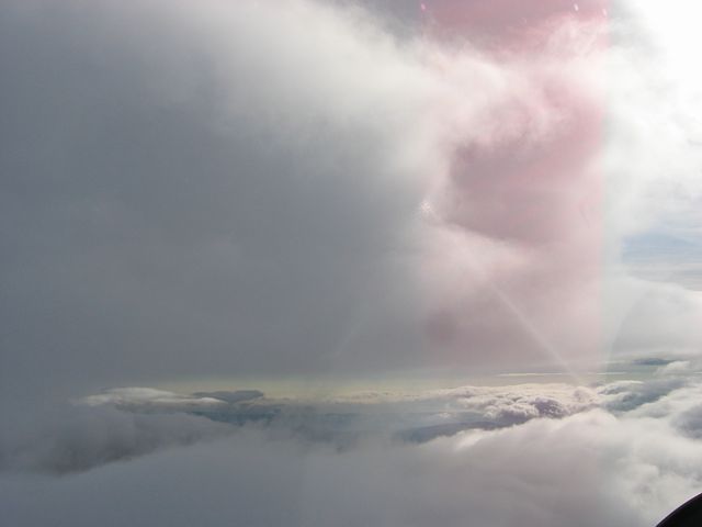
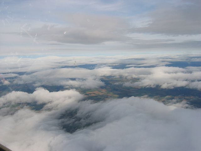
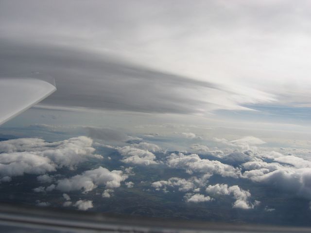
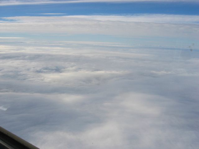
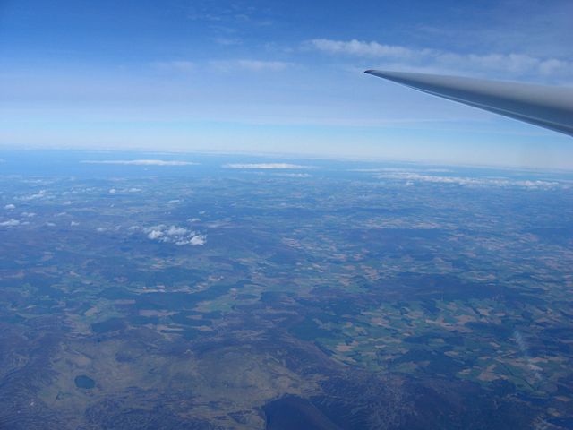
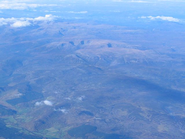
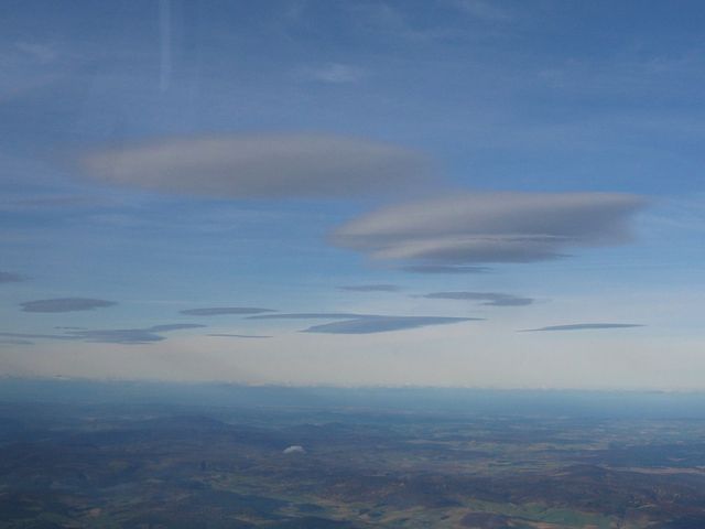
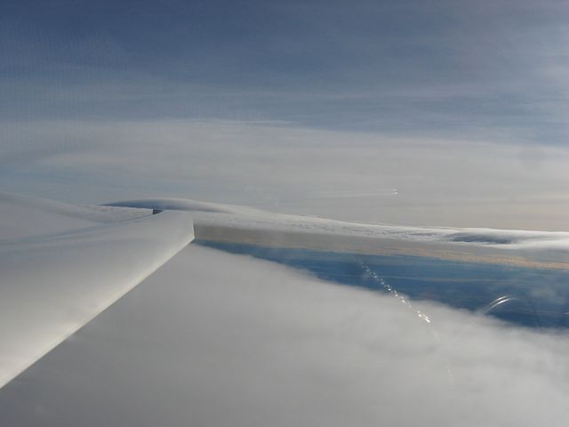
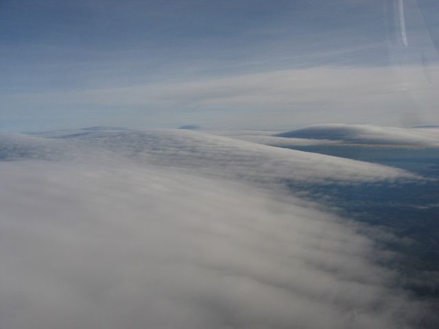
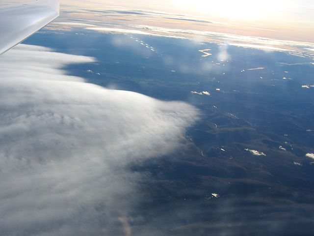
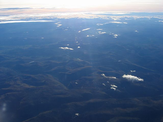
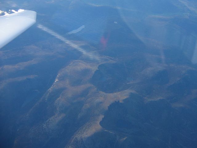
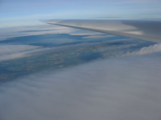
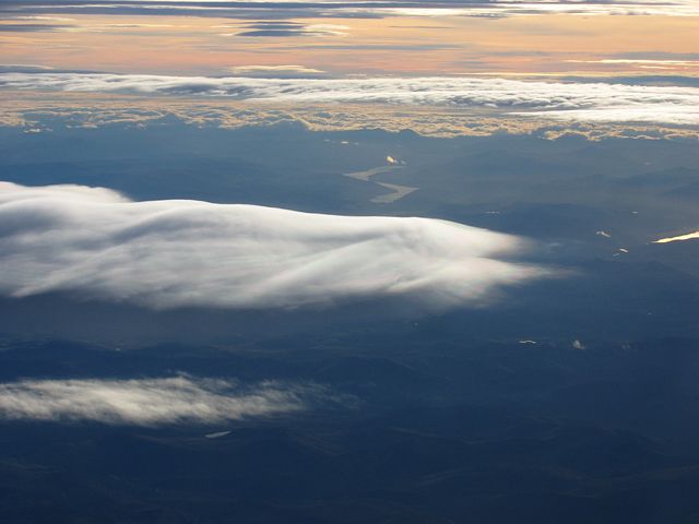
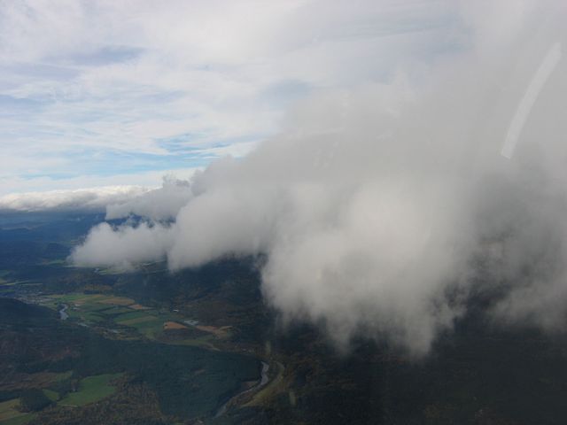
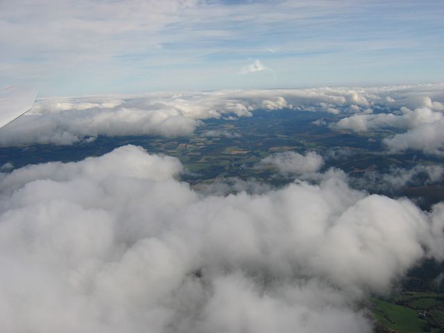
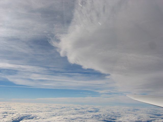
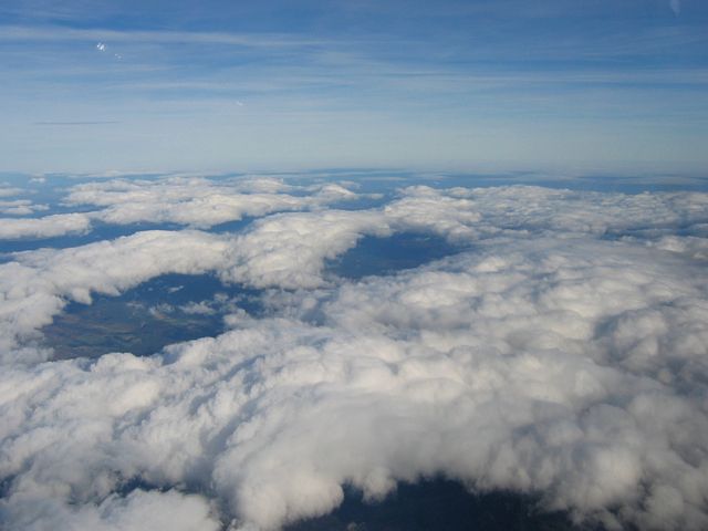
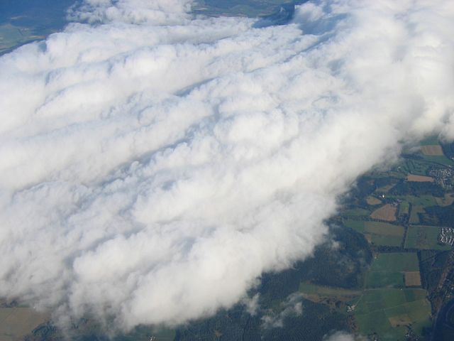
ClimbingPastClouds1.jpg
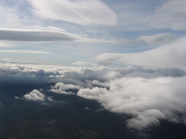
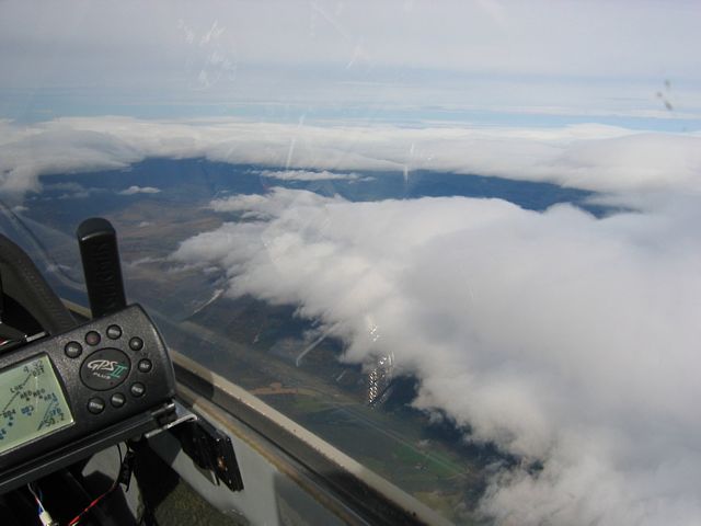
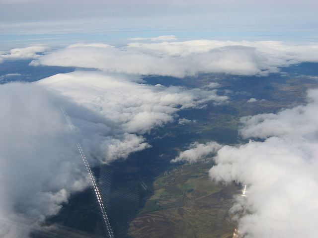
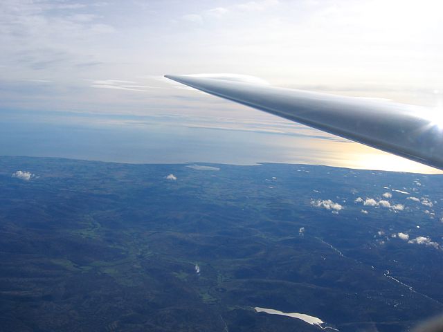
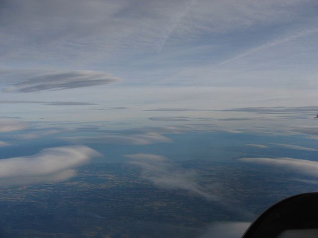
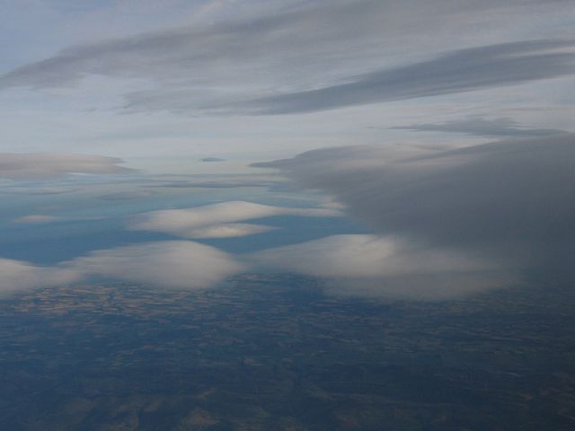
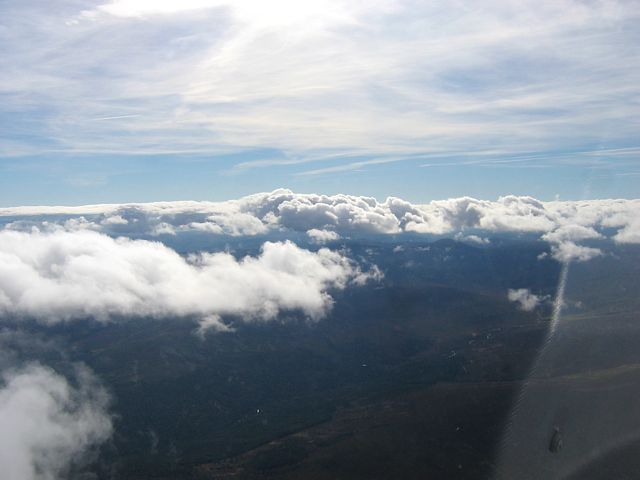
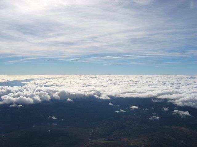
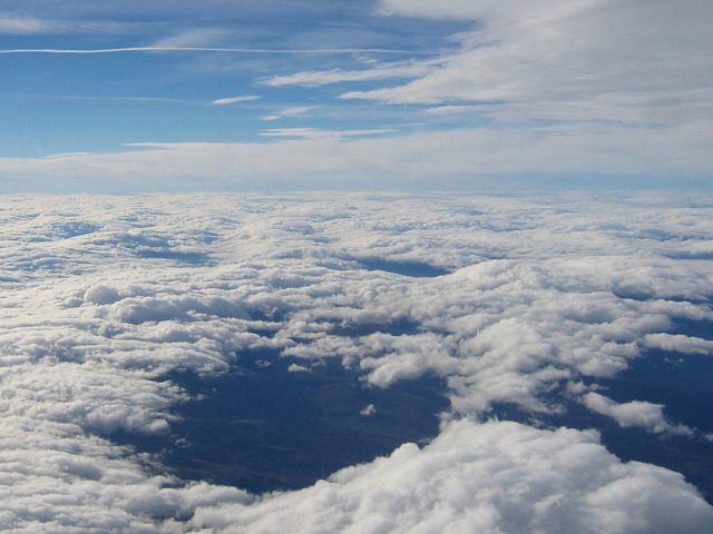
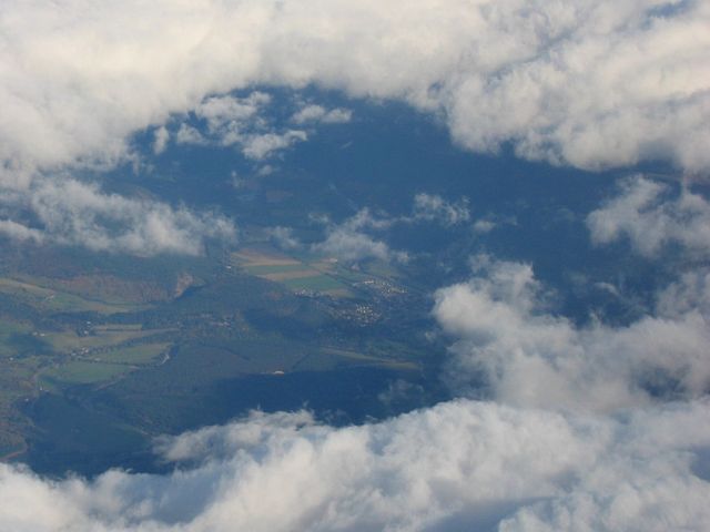
ClimbingPastClouds2.jpg
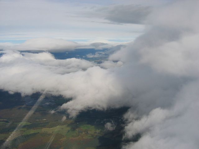
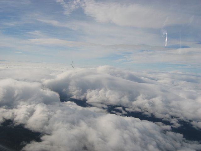
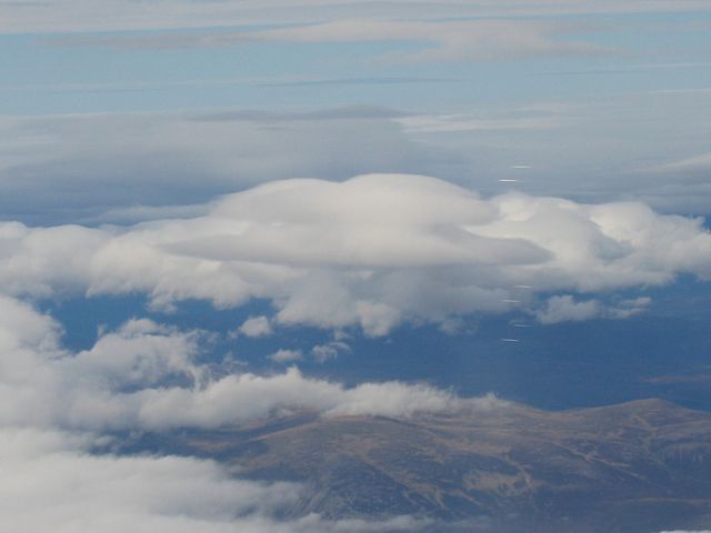
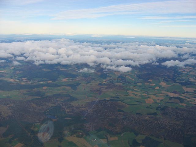
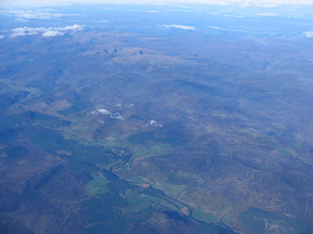
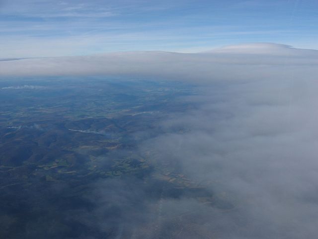
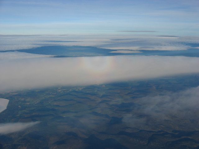
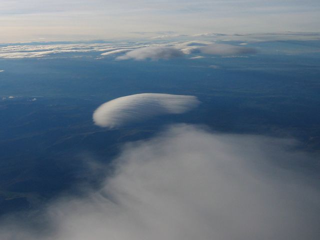
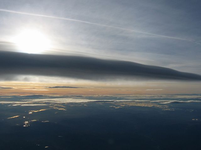
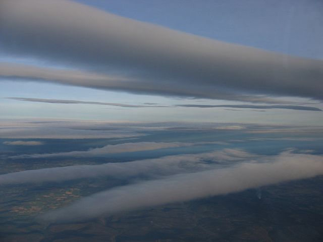
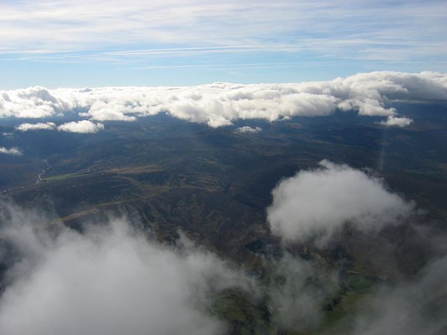
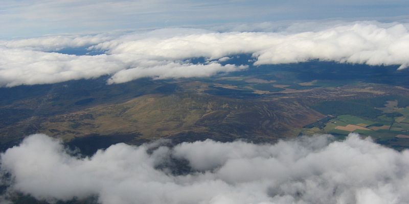
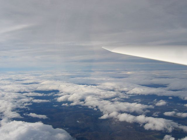
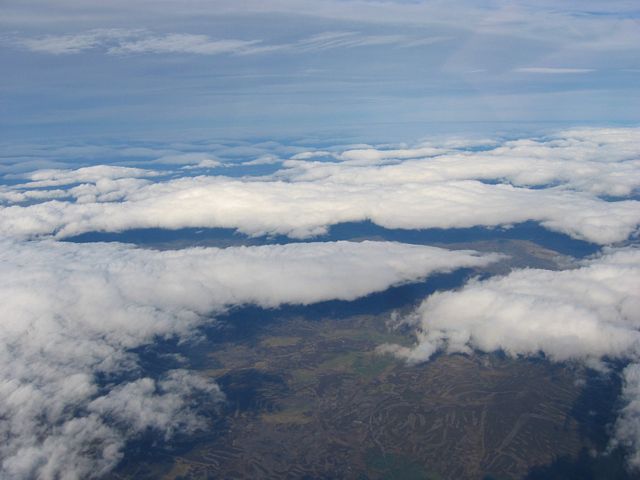
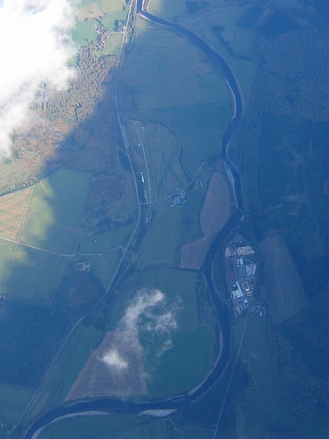
ClimbingPastClouds3.jpg
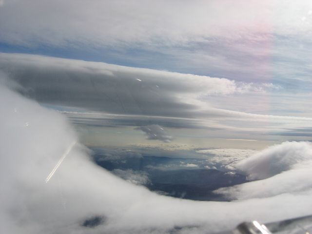
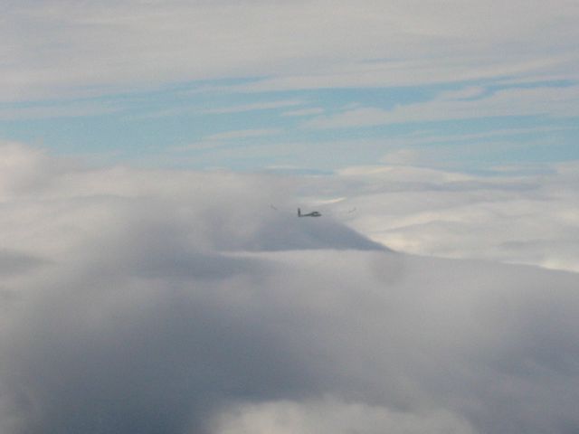
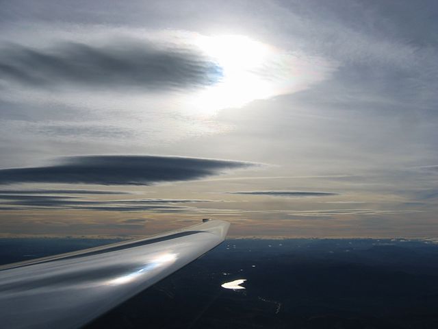
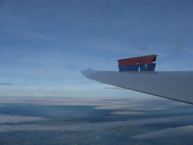
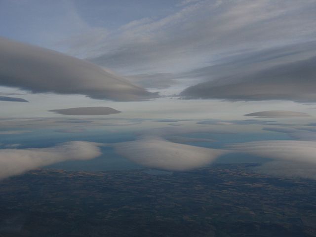
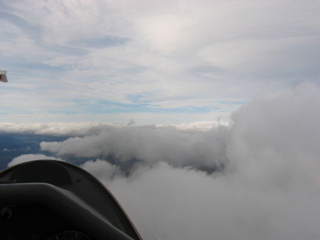
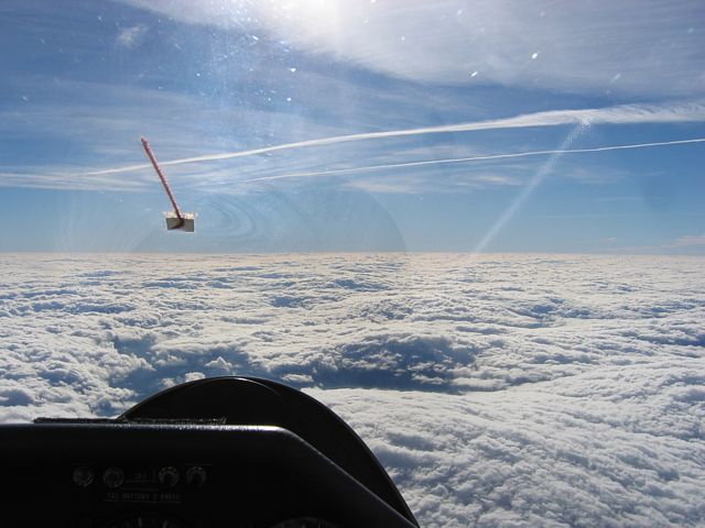
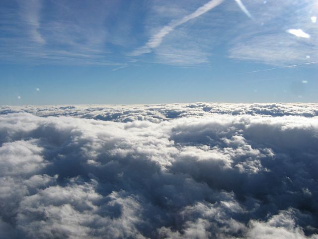
ClimbingPastClouds4.jpg
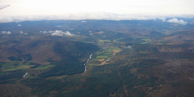
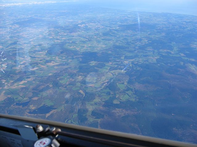
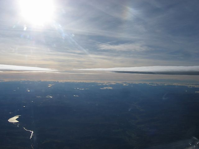
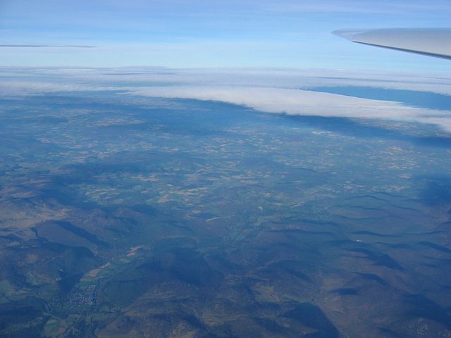
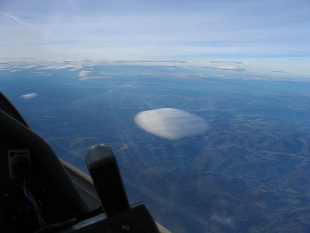
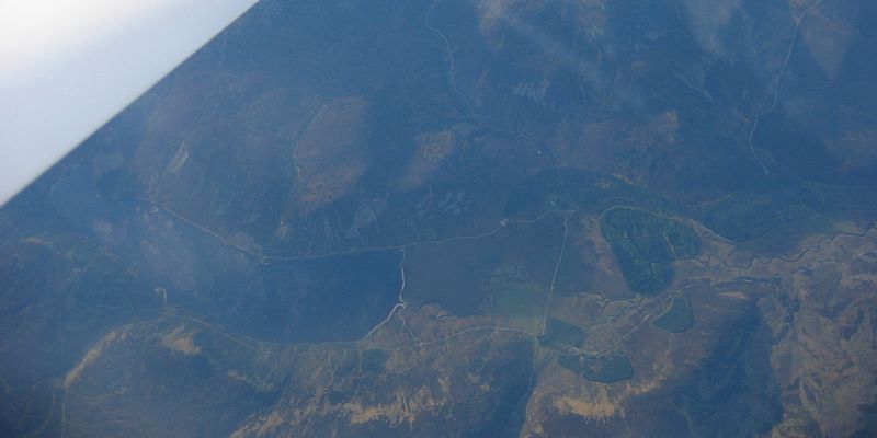
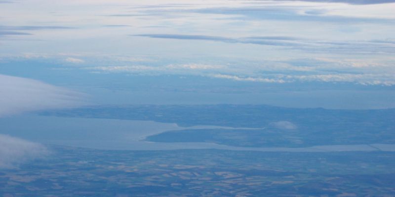
ViewNE.jpg
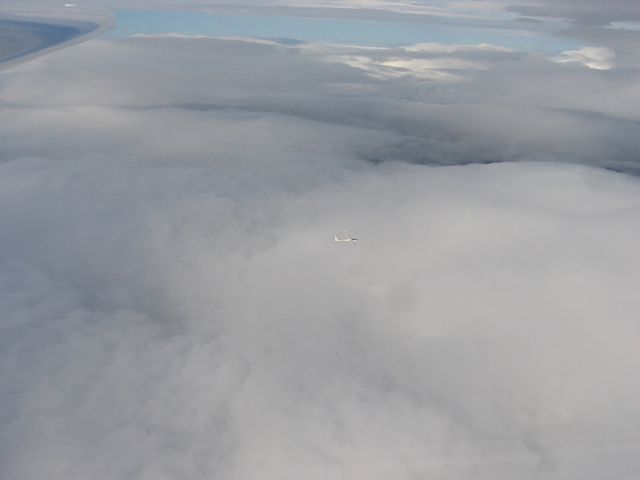
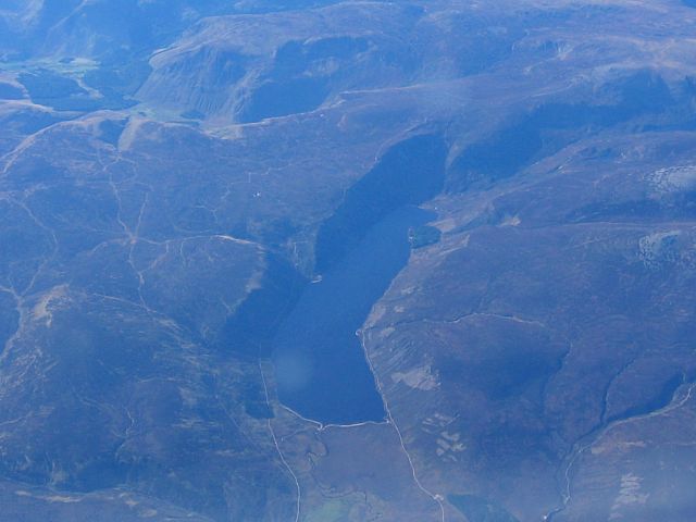
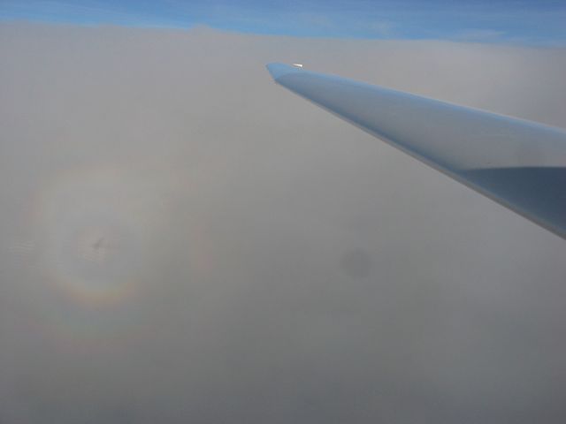
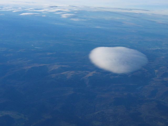
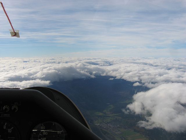
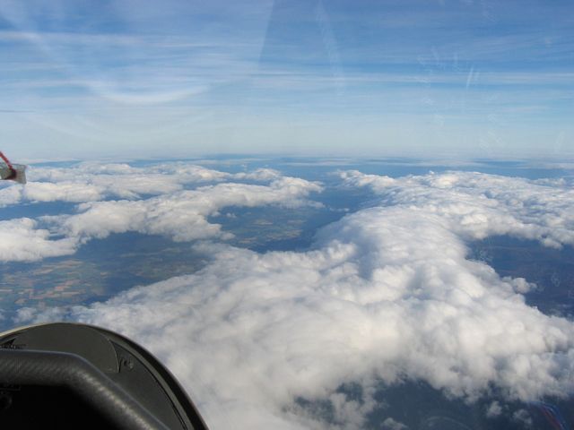
GliderAboveCloud.jpg
Click here to return to the Gliding 2007 Pictures page.
Click here to go directly to the Aboyne 2006 Pictures page.
Click here to go directly to the Aboyne 2004 Pictures page.
I was at Aboyne airfield (home of Deeside Gliding Club) for the second week of Lasham's annual expedition to this site. I arrived on the 6th and immediately got airborne in an S&H Discus (SH4) that was on site. That flight took me to 15,000 feet above site. The next few days were calm, and apart from a few weak thermals nothing much happening. So I stayed on the ground while others went circuit bashing and thermal soaring. On Tuesday cloudbase was too low so we walked around Loch Muick. As a result I didn't feel too good on Wednesday so almost glad I wasn't missing too much. On Thursday was the big day. Loch Muick suddenly looked rather tiny from the dizzy heights of 24,000 feet! Lots of diamonds today, and nice to finally break the 20,000 foot barrier! I flew twice this day. First time round in the K21 (778) I broke off at 19,200 feet as I was uncomfortable and very cold. Later in the day I went up again in SH4 and got up to height pretty quickly. One single climb over the local Lochs took me from 2900 to 22,300 feet! Then over Loch Muick I climbed the rest of the way to the top at 24,000 feet. On the 13th I had another bonus flight in the Discus before I left, climbing to 16,500 feet and then turning Corgarf and Braemar before coming back and descending.
Please click here for pictures taken prior to arrival at Aboyne.
Soon after I arrived at Aboyne and met up with Gordon and the week 1 people, I was handed S&H Discus SH4 and, since it was soarable, wasted no time getting into the air. Stuff lunch. I launched at about 11:58AM and stayed up for almost 4 and a half hours, topping out at 15,000 feet in the wave. Ahh it's so good to be back!
|
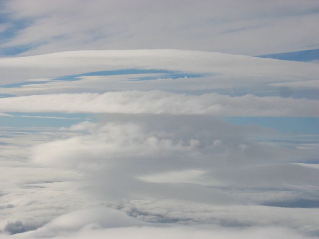
ClimbingPastClouds1.jpg |
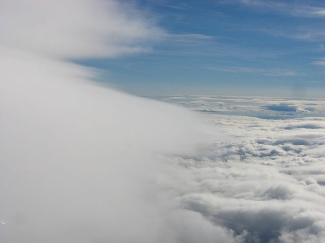
ClimbingPastClouds2.jpg |
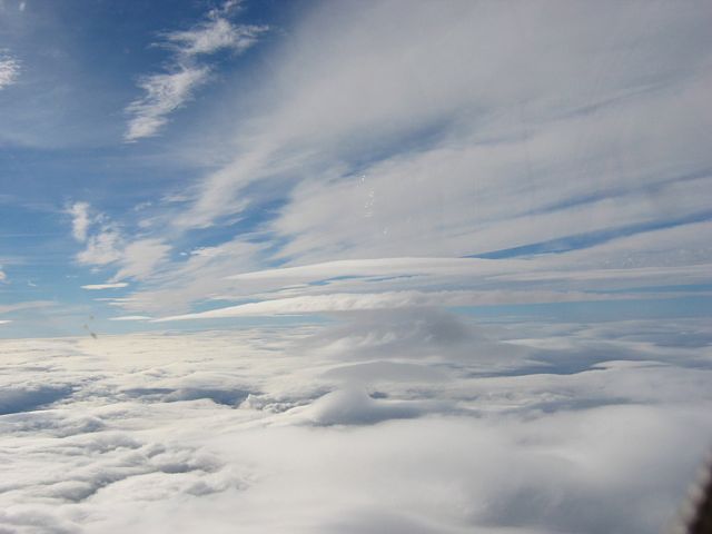
ClimbingPastClouds3.jpg |
ClimbingPastClouds4.jpg |
ViewNE.jpg |
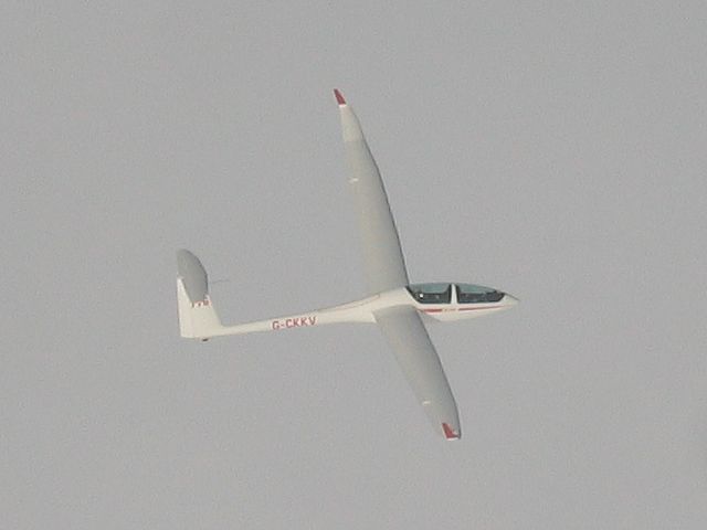
GliderAboveCloud.jpg |
| First pictures after launch. | Climbing up the side of a cloud in wave. | Looking NE. Tarland visible between clouds in centre of frame. | I had company up there. | ||
 MyLocalWaveBar.jpg |
 Clouds1.jpg |
 UpperLennie.jpg |
 Clouds2.jpg |
 MorvenLennie.jpg |
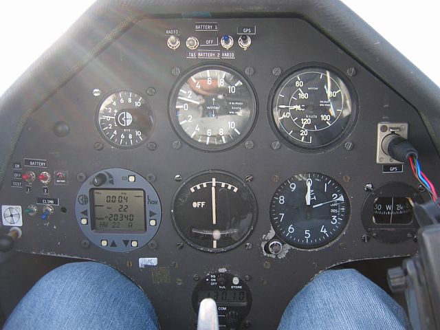
 776.jpg |
 776Zoom.jpg |
| This shot shows the wave well, lining up the cumulus below. | Clouds thickening up a bit. | Upper lenticulars appearing. | Looking back along my wave bar. | A lenticular to the north, and Morven below it. | I spotted 776 below me as we surfed above cloud. Al Nunn in the back. Not sure who was in the front. | |
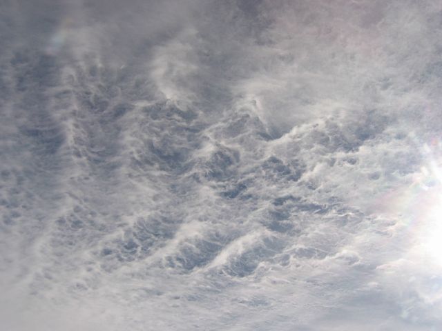
 Clouds3.jpg |
 Clouds4.jpg |
 Clouds5.jpg |
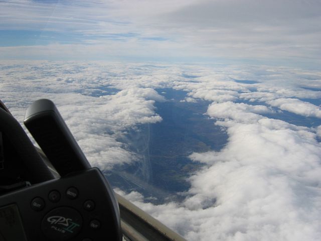
 15k.jpg |
| Some interesting clouds as I climbed up the side of a lenticular at about 9000 feet. | My last high shot looking west from 15,000 feet as the wave decayed and the holes closed. Shortly after this I had to descend before the hole below me closed. | ||
We got up early today as the forecast was good. By 8:30AM I was already airborne in the K21 778. Initially I struggled to stay up but soon found the wave and climbed away slowly but surely near the Lochs in the lee of Morven. Later on I joined others over in the lee of Lochnagar on the North side of Loch Muick and got to 19,200 feet before I broke off and descended due to discomfort and cold at the time.
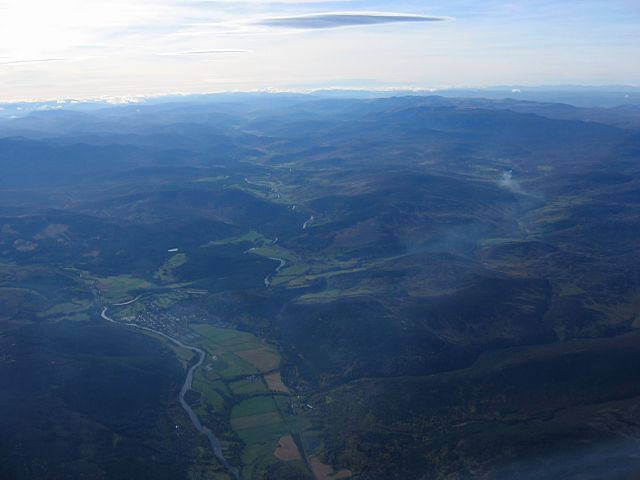
 DeeValley.jpg |
 ViewNE1.jpg |
 LochMuick.jpg |
 ViewNE2.jpg |
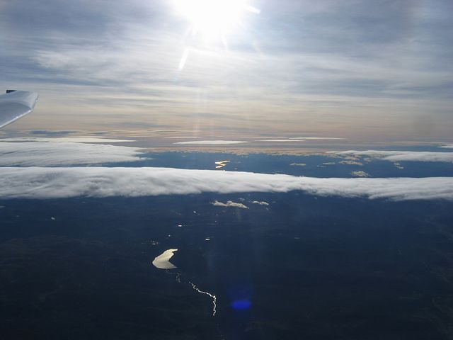
 ViewSE.jpg |
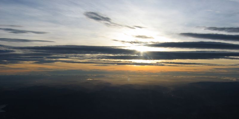
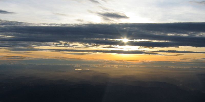
| First view up the Dee Valley (up right) and Glen Muick (up left). | Looking NE as I start to climb towards 10,000 feet. | Looking SW to Loch Muick. | Looking NE again as the lower cloud dissipates. | Looking SE towards Montrose from 19,000 feet above Loch Muick as the sun glints the distant sea. |
 DeeValleyCairngorms.jpg |
 ViewENE.jpg |
 Cairngorms.jpg |
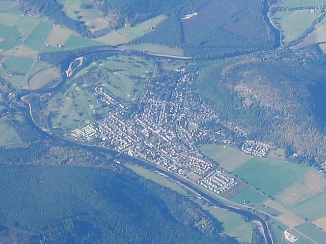 Ballater1.jpg |
 Ballater2.jpg |
| Looking up the Dee Valley to the Cairngorms from 19,000 feet. | Looking back towards Aboyne from 19,000 feet. | A closeup of the Cairngorms. | 2 shots of Ballater and surrounding valley from the SE and South as I descended. | |
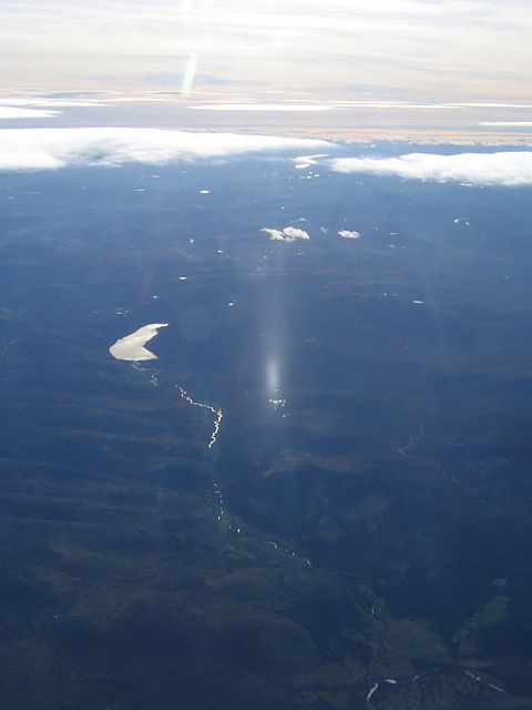
In the afternoon I managed to swipe the Discus SH4. I launched just before 3:30PM. This time I knew where to go and headed straight for the area just north of Loch Davan. I found strong lift so I dived to a low point of 2900 feet. Then in one single climb I went straight up to 22,300 feet, accidentally clipping a lennie on the way up. Good job the glider was still warm so no icing. But the optical effects as the tiny ice crystals 'snowed' past me were amazing. Vivid halos around the sun and a sun pillar too. Above the lennie I saw a bright glory with a shadow of the glider in the middle. Once topped out I headed straight over to Loch Muick and placed myself in front of the thickest part of a lennie there. From just under 20,000 feet I climbed all the way to the upper airspace limits at 24,000 feet. Then a slow descent through an increasingly beautiful sky with lennies above, below and all around me, and an pretty golden hour cloudscape to the west as the sun got low.
 DeeValleySmoke.jpg |
 Lennies1.jpg |
 Lennies2.jpg |
 Lennies3.jpg |
 Glory1.jpg |
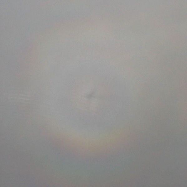 Glory1Closeup.jpg |
| Looking up the Dee Valley early in the flight from above the Lochs. Smoke a useful indicator of wind direction. | Looking up at those inviting lenticulars as I climb rapidly towards 10,000 feet. (1) Over Tarland and (2) towards Loch Muick with iridescence visible in the reflection on my wing. | Catching the lenticulars at about 16,000 feet. A sundog adds to the atmosphere. | As I climbed above the lenticular beside me I saw a vivid glory with a shadow of the glider in the middle. | ||
 Lennies4.jpg |
 Lennies5.jpg |
 SunPillar.jpg |
 Lennies6.jpg |
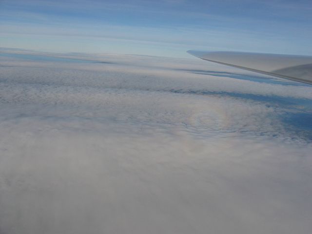
 20k.jpg |
 Lennies7.jpg |
 Lennies8.jpg |
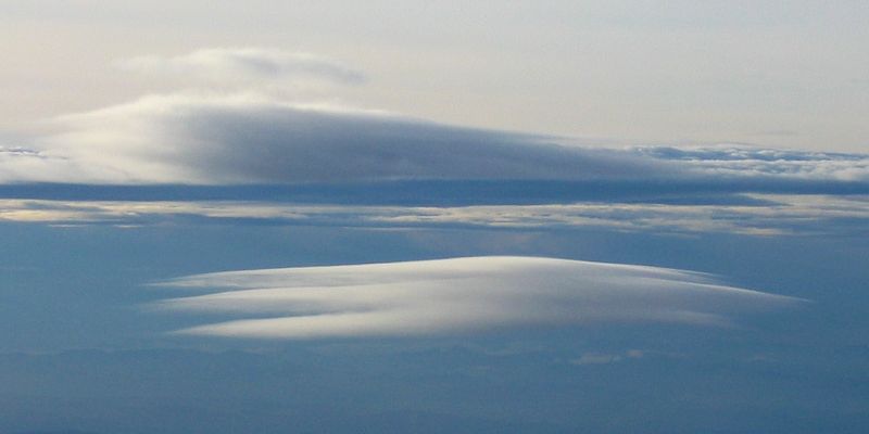
| Surfing above lenticulars at 17,000 feet. Smoke below again indicates wind direction nicely. By this height wind is strong enough to fly backwards! | Ice crystals in the air at this height created this sun pillar. This was definitely not a canopy reflection. | As I climb higher the lenticulars remind me of desert dunes with ripples on ripples everywhere. | At last! 20,000 feet (above Aboyne - L-Nav is set to QNH) for the first time! Shortly afterwards I pushed forward to find a bit more lift. | 2nd lennie on the left is the Loch Muick lennie that later took me to the top. | Heaven? The picture just can't do the view justice! | |
 22.3k.jpg |
 LochMuickLennie.jpg |
 Brr.jpg |
 24kViewE.jpg |
 24kViewSW.jpg |
 24kViewNW.jpg |
| The top of my climb. From 2900 to 22,300 feet in one climb in the lee of Morven. | I then transferred to the Loch Muick lenticular, arriving at just under 20k feet. Found 3-4kts in front of the forward-most part of the cloud. | Brr! Bit cold (under -20C) above 20k. Never mind the wonky canular. It kept me oxygenated in the thin air. Ice crystals visible on the inside of the canopy. | That's it! I've reached the airspace ceiling around 24,000 feet right above Loch Muick. Can't go any higher. Everything looks so tiny. Can see for miles and miles and miles. Had to break off from 2-3kts. I wonder how high the wave went? | ||
 Lennies9.jpg |
 CairngormsLennie.jpg |
 Lochnagar24k.jpg |
 Lennies10.jpg |
 Lennies11.jpg |
 GlenMuick24k.jpg |
| More views from the top before I started to descend. | Lochnagar - the source of my last wave climb. (Shame about the canopy reflections.) | Looking East towards Aberdeen as lennies get more numerous. | Looking below me at Loch Muick and Spittal of Glen Muick. The road and the river are just visible. | ||
 Lennies12.jpg |
 Lennies13.jpg |
 IceCrystals1.jpg |
 IceCrystals2.jpg |
 HighJet.jpg |
 Lennies14.jpg |
| More lennie shots as I start to descend. Look at those ripples in some of them! Some shots make the sky look like a giant climbing frame too. | Ice crystals on the inside of my canopy. Just like the window of a passenger jet. | Just one reason why I wasn't allowed above 24k (atleast without a transponder...). | Descending past the Loch Muick lennie at 21,000 feet in the down part of the wave. | ||
 RippledLennie.jpg |
 GoldenHour1.jpg |
 Descending.jpg |
 Lennies15.jpg |
 19kViewN.jpg |
| A beautiful rippled lennie hiding below the main Loch Muick lennie. | Sun starting to get low. Golden hour makes the cloudscapes even more stunning. | Descending below 20,000 feet taking yet more pics as I go. | This lennie has irridescence. I think that is Loch Tay in the far background. | Looking roughly northwards from 19k. Anyone got any idea where the water is? I can't ID it! |
 Lennies16.jpg |
 Lennies17.jpg |
 Lennies18.jpg |
 GoldenHour2.jpg |
 GoldenHour3.jpg |
 GoldenHour4.jpg |
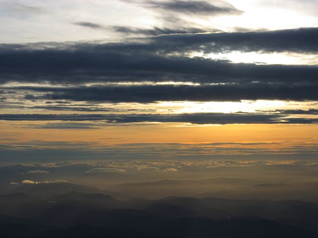
| Yet more lennie shots as I continue to descend. Some shots display pretty ripples while others make the sky look like a giant climbing frame. | Now below 10,000 feet, I soaked in the colours of the pre-sunset cloudscapes as I slowly descended back to earth. | ||||
I hung on when all the other week 2 people left. Thanks for some of them helping me rig SH4 first though. After lunch the holes opened up enough for it to be safe to go. South of the Lochs I quickly found 6 knots up after releasing from tow in the brisk SW'erly. I took that climb to 12-13,000 feet. Then went exploring. In the lee of Morven (NE side almost right overhead) I found 3-4kts at 10,000 feet and topped out at 16,500 feet. Then I went NW'wards along a wave bar to Corgarf (CGF) before pushing into a strong headwind to Braemar (BMR). Beyond here it was 8/8 cloudcover to the West and SW. I was now at 13,000 feet. But I decided head back as I had to leave soon. I pointed the glider downwind to Aboyne, put on a smooth 110 knots and the GPS showed more than 230kph! I only lost 1000 feet in 30km. I then stayed a few miles up-valley of the airfield and slowly but steadily descended from 12,000 feet to land just over 2 hours after launch. Then a mad scramble to put the glider away, pay up for the week, hit the Glenshee Pass before sunset and head home.
 Clouds1.jpg |
 Clouds2.jpg |
 Clouds3.jpg |
 Clouds4.jpg |
 Clouds5.jpg |
 Clouds6.jpg |
| Here we go one last time! Looking W, SW, SW, W, NE respectively as I climb past cumulus from about 3500 feet to 7000 feet above Aboyne. | It's already evident, looking SW, that without the wave punching holes in it, it would be 8/8 cloud here. | ||||
 Morven.jpg |
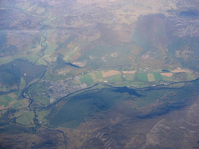
 BallaterThroughClouds1.jpg |
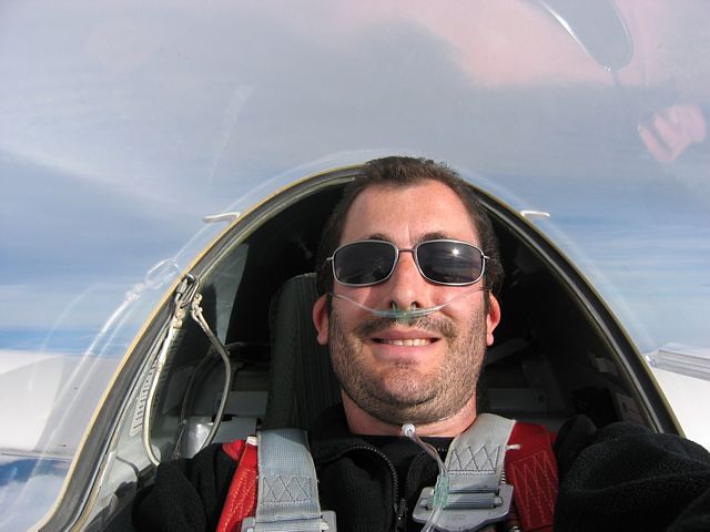 MeAt15k.jpg |
 CorgarfWaveBar1.jpg |
 TopCover1.jpg |
 TopCover2.jpg |
| Looking north from 8000 feet through a gap in the clouds to Morven. | To my west Ballater sits nicely under a wave gap. | Now in just NE (in the Lee) of Morven I climb past 15,000 feet. This time I got my canular straight. ;) Meanwhile I was eyeing the wave bar to the NW towards Corgarf. | Overhead and to the East this fantastic cloud web of filaments formed as I climbed slowly towards 16,000 feet. | ||
 TopCover3.jpg |
 Clouds7.jpg |
 Clouds8.jpg |
 Clouds9.jpg |
 Clouds10.jpg |
 BallaterThroughClouds2.jpg |
| Close by and to the west the top cover looked kinda like an upper wave system but it was drifting away to the north and I couldn't find any way in. | After reaching 16,500 feet I went to Corgarf. Further West the wave holes were fairly closed while to the North it looked quite murky under the top cover. | My view approaching Braemar at 13,000 feet. I pushed SW into a strong headwind to get there. Just beyond Braemar was a small hole. Otherwise 8/8 cloudcover in this direction. | Looking back to Aboyne from Braemar. | Looking down at Ballater again as I head back towards base. | |
 CorgarfWaveBar2.jpg |
 Clouds11.jpg |
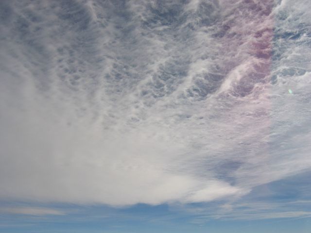
 CloudRipples.jpg |
 DGC.jpg |
 Clouds12.jpg |
| Looking back to the Corgarf wave bar from the south. | Looking further East the wave holes formed an almost cellular structure. | As I descended I noticed lots of ripples on this cloud near Ballater. | Looking down at the airfield and surrounding area from the West. | About to descend below cloud top height. At this level they look like 2 huge mountain ridges side on to me with the 'valley' hidden from view. |
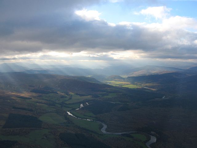
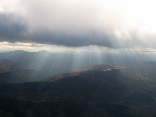 Crepuscular.jpg |
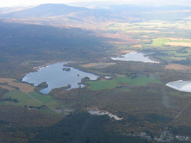 Lochs.jpg |
 DeeValley.jpg |
| When I got below cloudbase I was treated to a dazzling display of crepuscular rays. | One last look at the Lochs (with Morven behind) and up the Dee Valley towards Ballater and Braemar before landing. | |
Please click here for pictures taken from the ground.