IMG_7754.jpg
IMG_7758.jpg
IMG_7759.jpg
IMG_7760.jpg
IMG_7761.jpg
Click here to return to the main Pictures index.
Click here to return to the General 2010 Piccies Page, or click on one of the links below:
Page 1: 15th August 2010 - Kilimanjaro Approach (7)
Page 2: 16th August 2010 - Karama Lodge and Safari (77)
Page 3: 17th August 2010 - Trek Day 1: Start to Machame Camp (51)
Page 4 (This Page): 18th August 2010 - Trek Day 2: Machame Camp to Barranco Camp (72)
Page 5: 19th August 2010 - Trek Day 3: Barranco Camp to Karanga Camp (110)
Page 6: 20th and 21st August 2010 - Trek Days 4 and 5: Karanga Camp to Barafu Camp and Shabbat (91)
Page 7: 22nd August 2010 - Trek Day 6: Summit Day (53)
Page 8: 23rd August 2010 - Trek Day 7: Barafu Camp to Mweka Camp (58)
Page 9: 24th August 2010 - Trek Day 8: Mweka Camp to Exit (33)
Page 10: 25th August 2010 - Kilimanjaro Exit (10)
Total: 562 Pictures
| Location | Altitude (m / ft) | Distance | Altitude Gained / Lost |
|---|---|---|---|
| Machame Huts | 3,021m / 9,911ft | ||
| Shira Caves Campsite | 3,839m / 12,595ft | 5.3km | 818m / 2,684ft Gained |
| Lava Tower Campsite | 4,627m / 15,180ft | 7km | 788m / 2,585ft Gained |
| Barranco Huts | 3,986m / 13,077ft | 3.75km | 641m / 2,103ft Lost |
| Total | 16.05km - ~1km for 'Prohibited Trail' Shortcut around Shira Caves = ~15km | 1,606m / 5,269ft Gained + 641m / 2,103ft Lost = 965m / 3,166ft Total Gained |
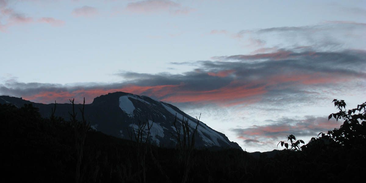
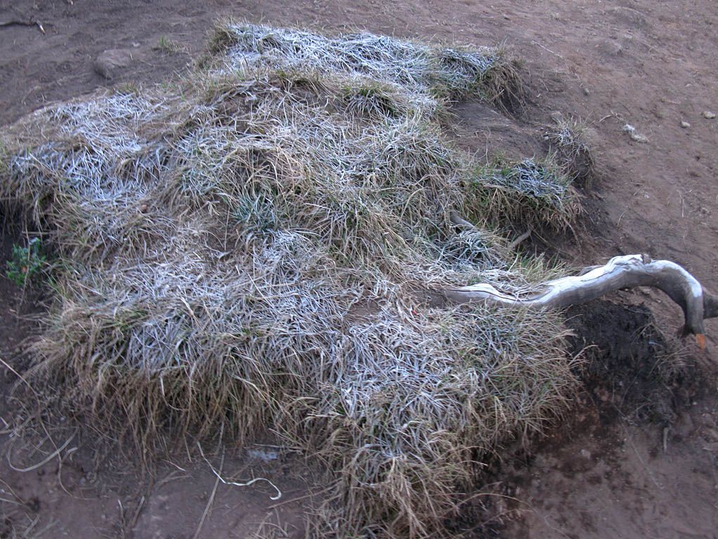
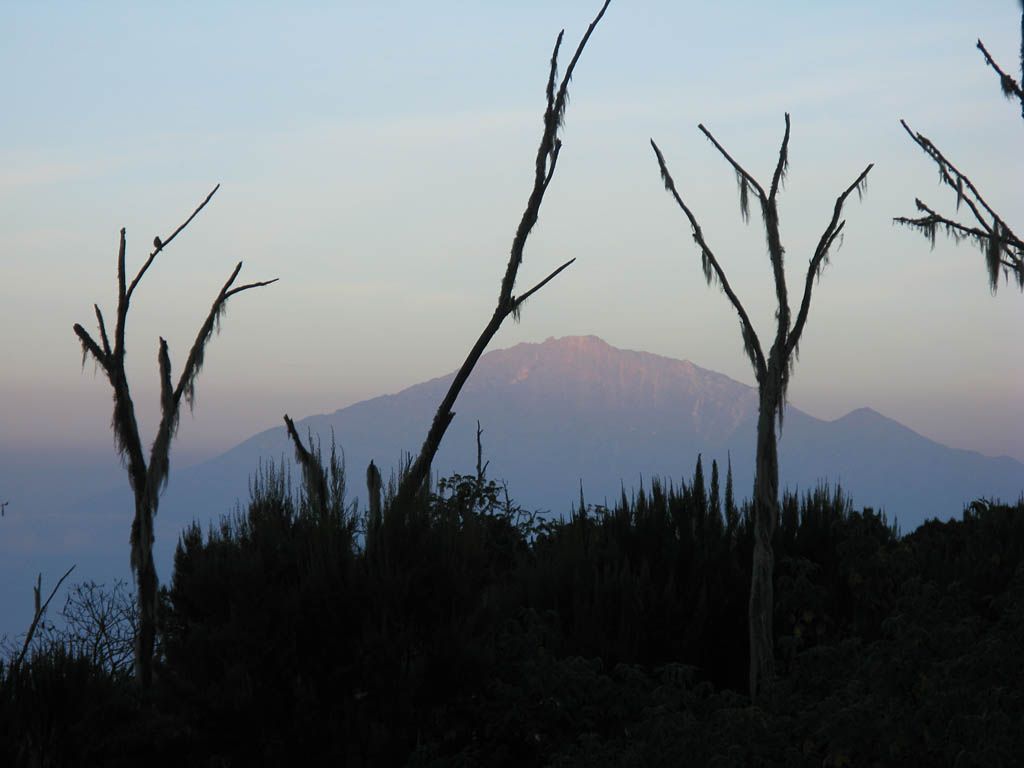
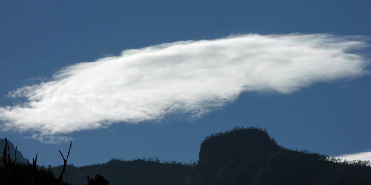
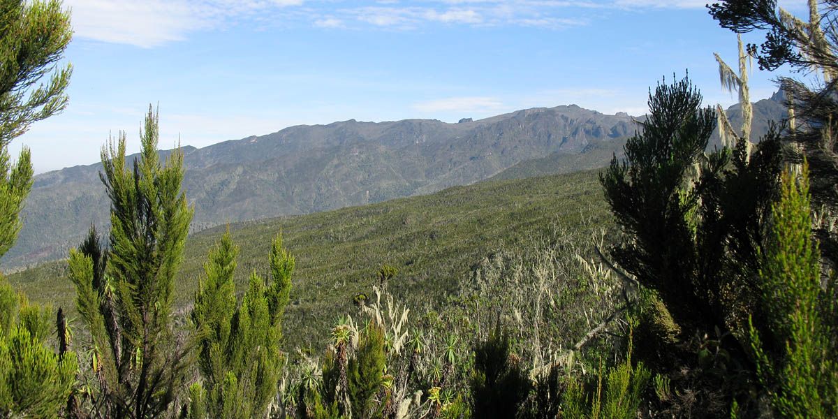
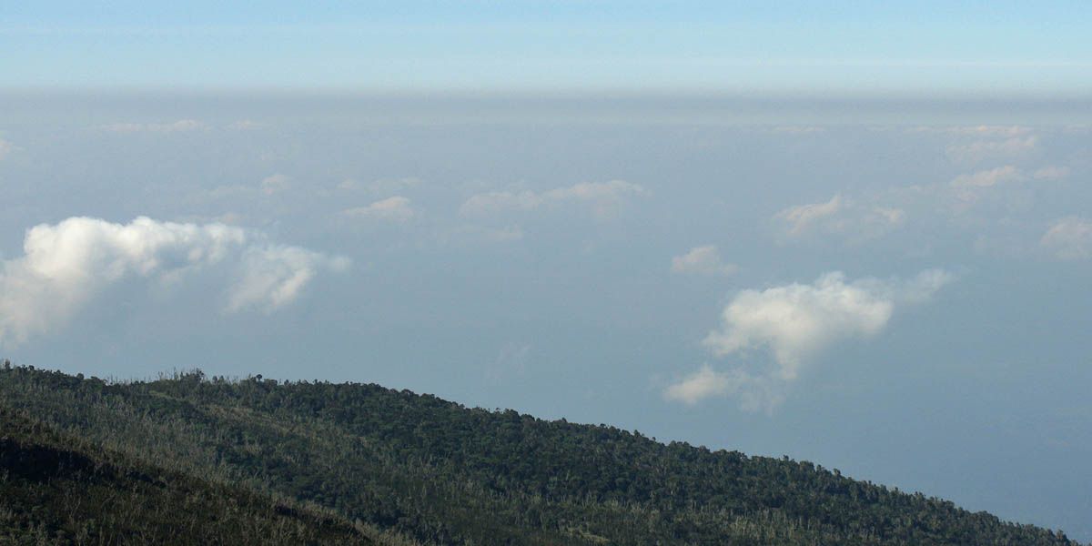
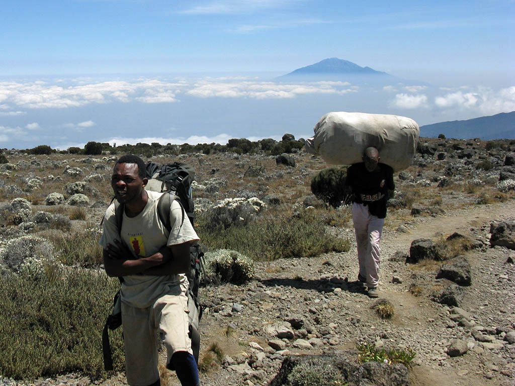
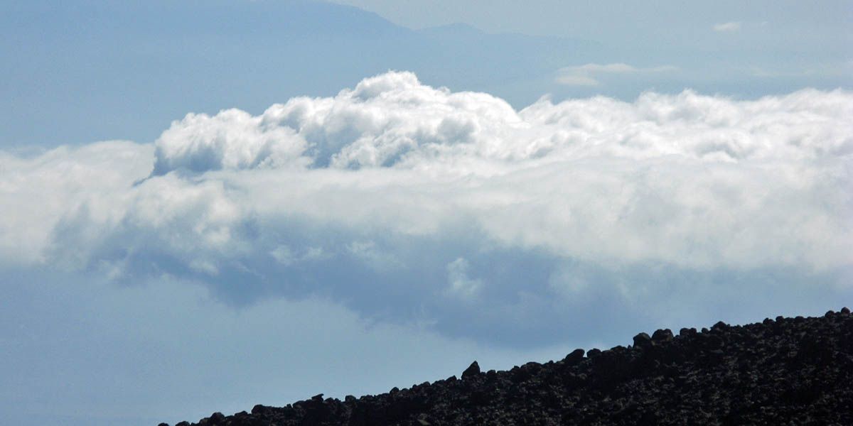
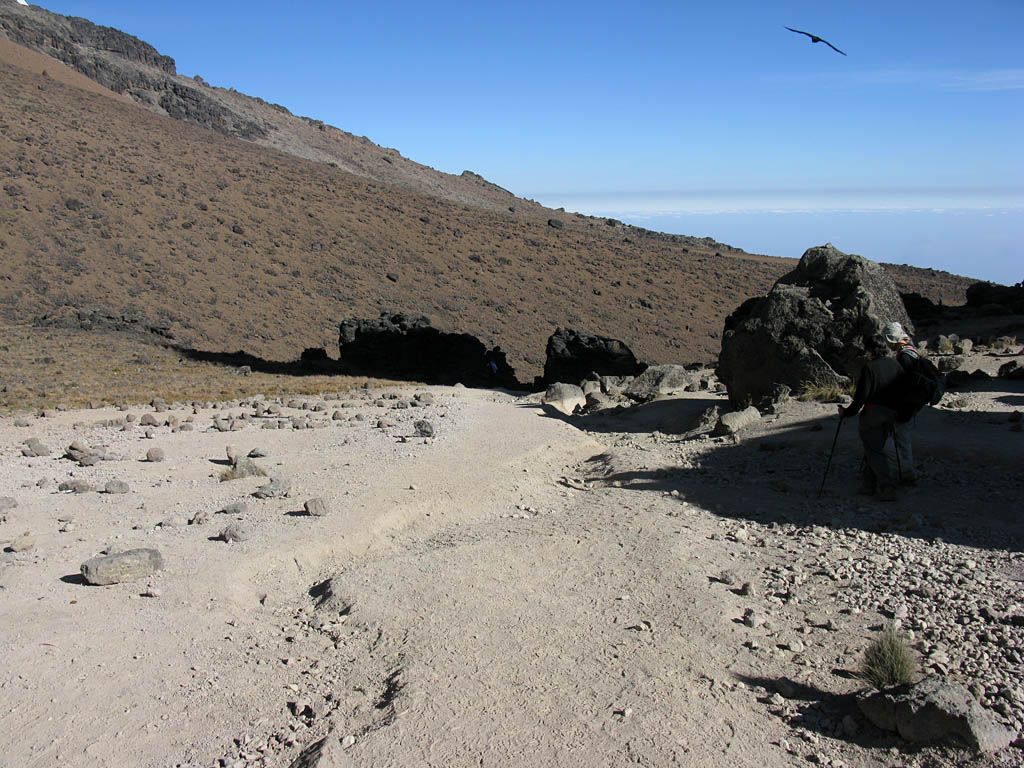
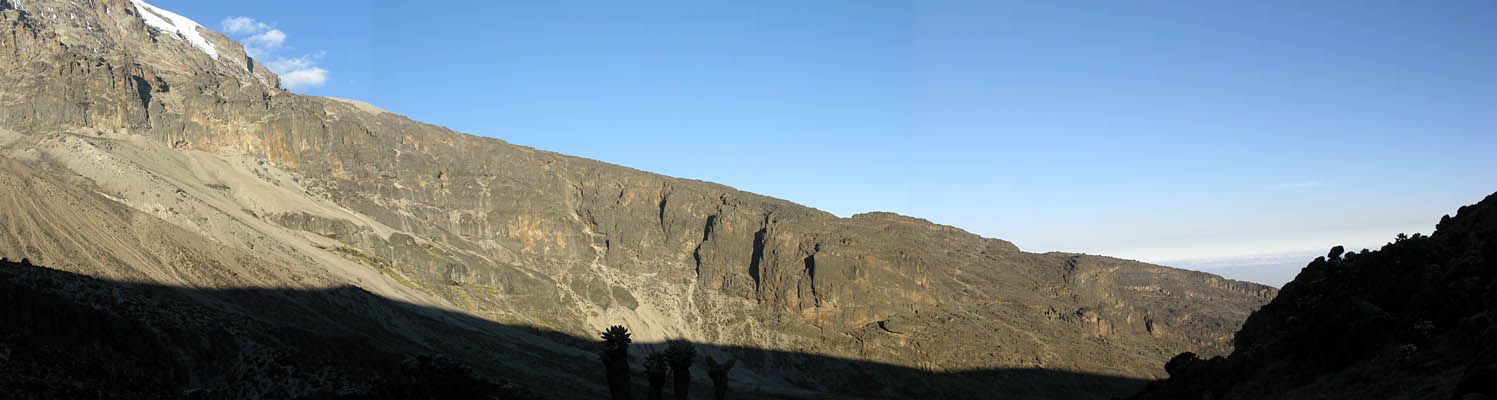
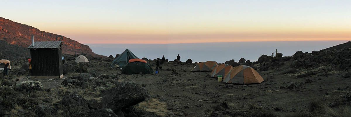
I didn't sleep that well last night but felt good nonetheless. It was a cold and frosty start. Frost at 3 degrees south! I spent some time admiring the sunrise as well as Mount Meru seemingly floating on the haze, before we had a nice breakfast.
|
IMG_7754.jpg |
IMG_7758.jpg |
IMG_7759.jpg |
IMG_7760.jpg |
IMG_7761.jpg |
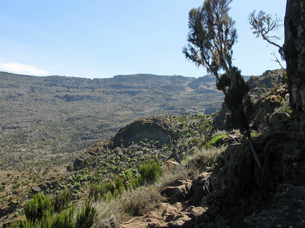
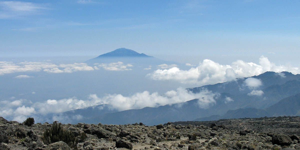
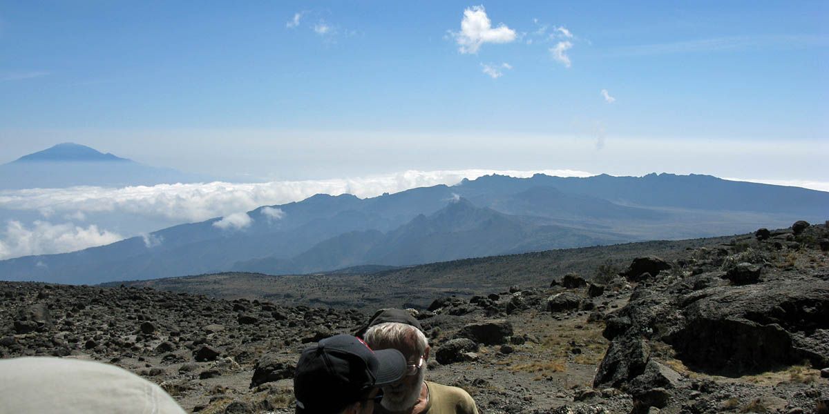
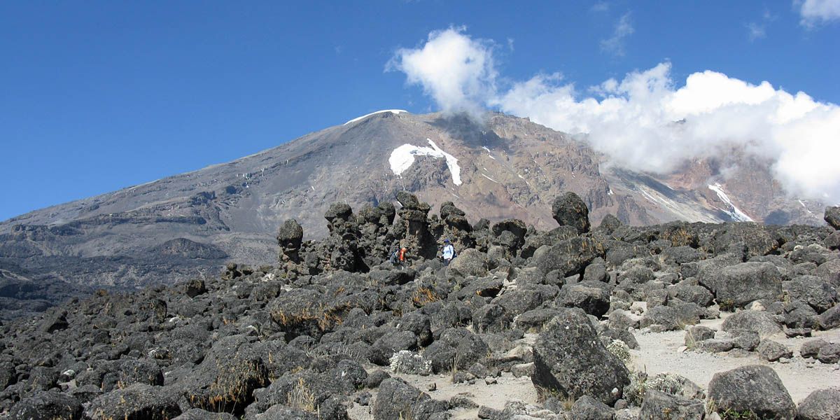
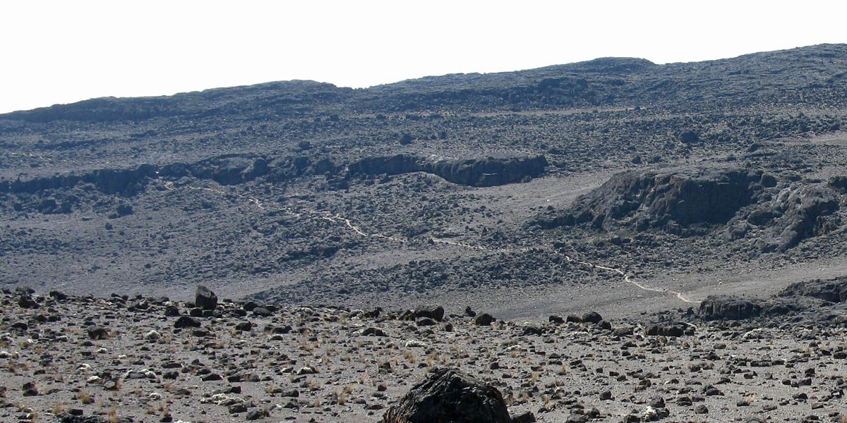
| Sunrise at Kilimanjaro. | Despite being at only 3 degrees south, being at almost 10,000 feet (Machame Hut is at 3021m/9911ft) already it is cold enough at night for a ground frost to form. | Mount Meru floating on the haze again at sunrise. | Lenticular clouds forming in the lee of the summit. I guess it's breezy up there. | |
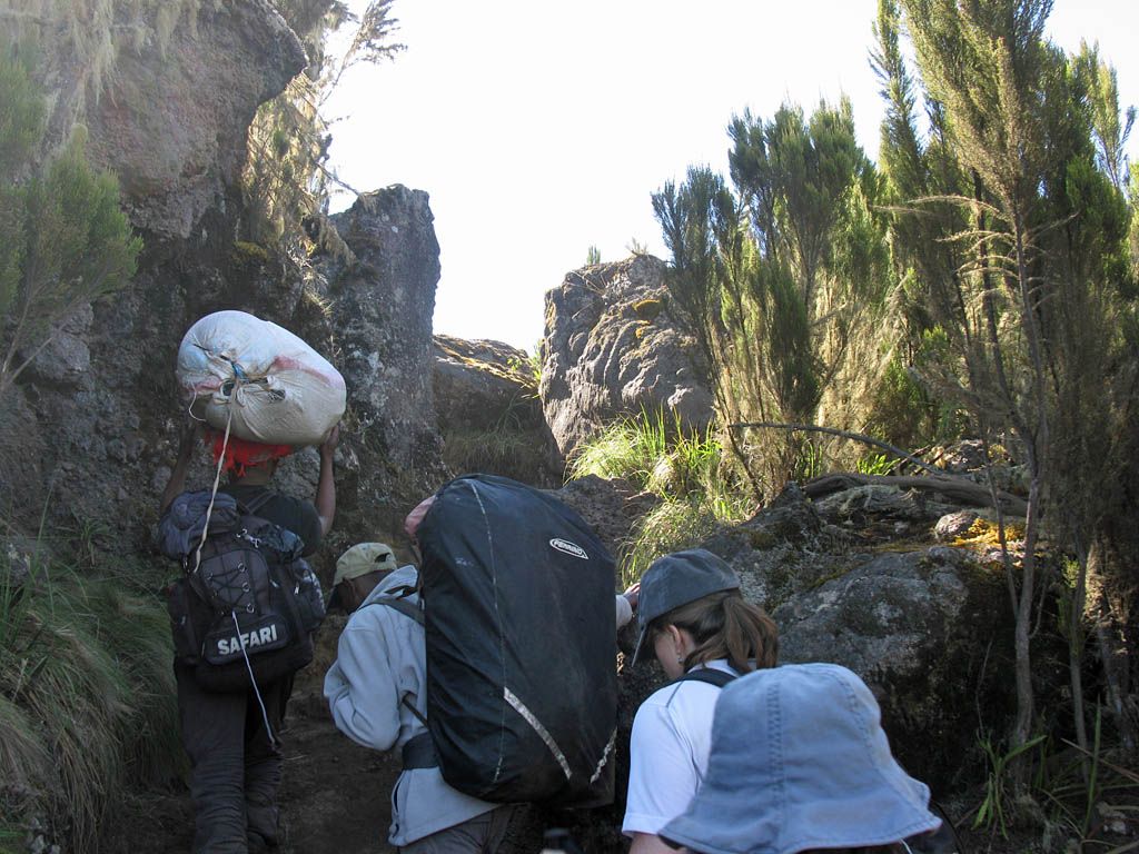
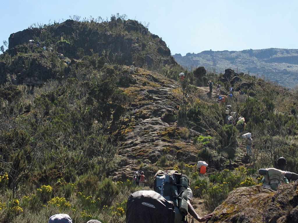
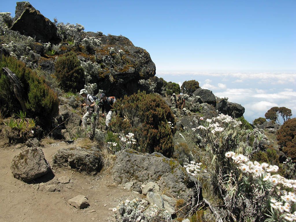
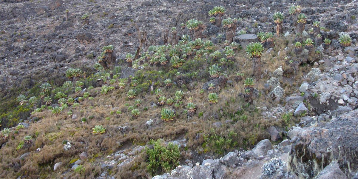
There had been extensive discussion over the best plan for today. In the end it was decided that in order to have an easy day on Friday to allow for plenty of time to prepare for Shabbat, we would have an extra long day today. The porters weren't too keen on going all the way from Machame to Barranco in one day (the normal process is to stop at Shira Caves for the night before continuing on) but a promise of an extra tip was enough to persuade them. So a long punishing day ahead, but that would leave us two easy days and a rest at high altitude to leave us in good shape for the summit.
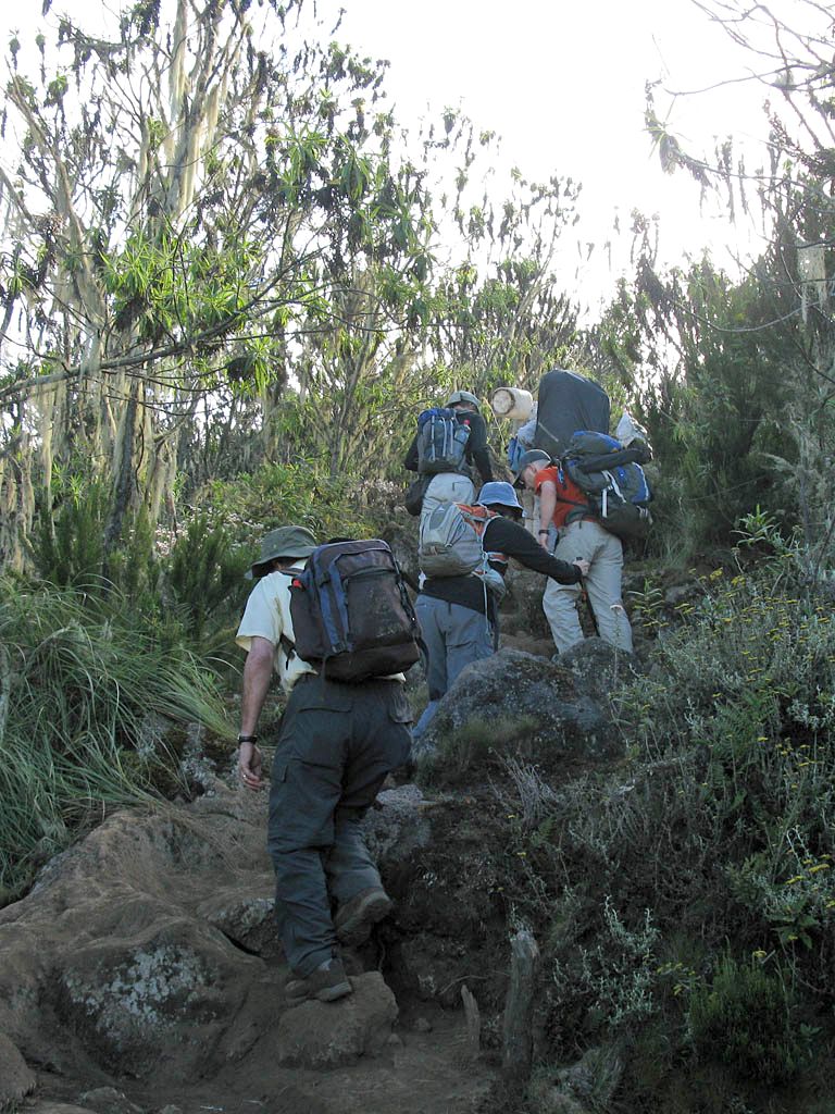
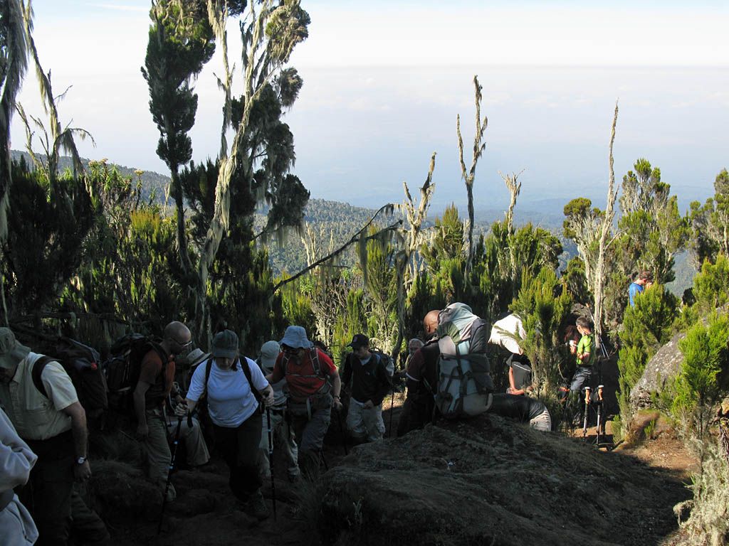
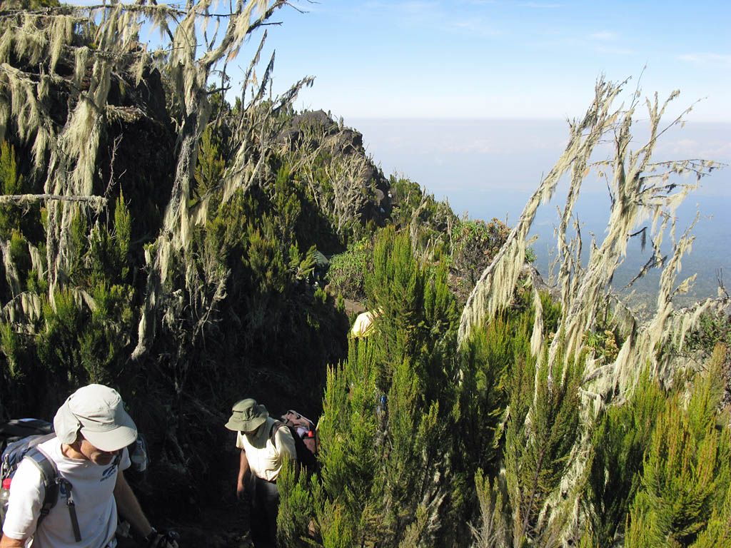
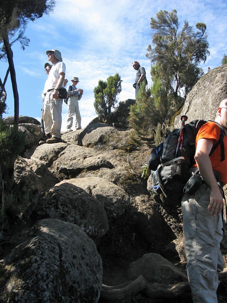
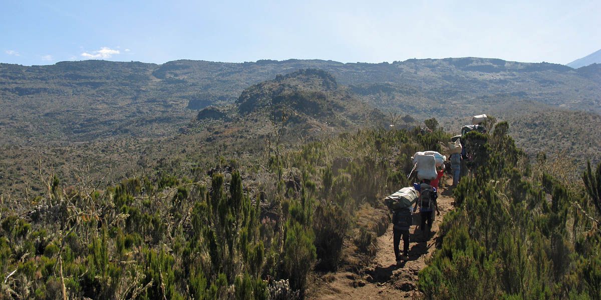
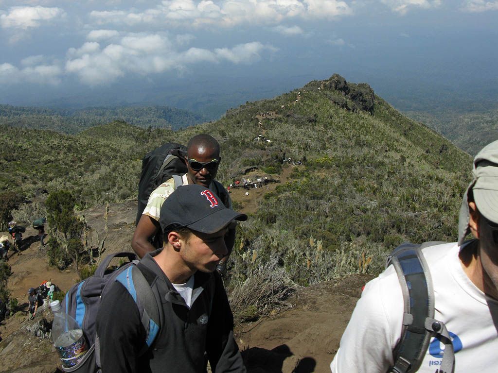
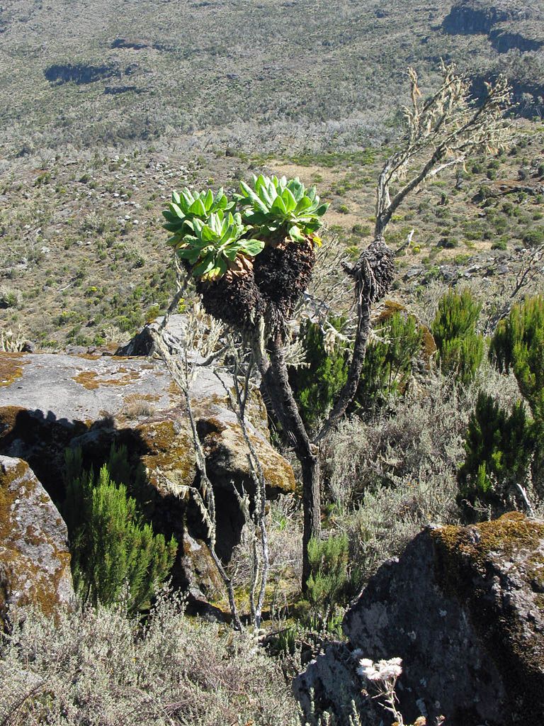
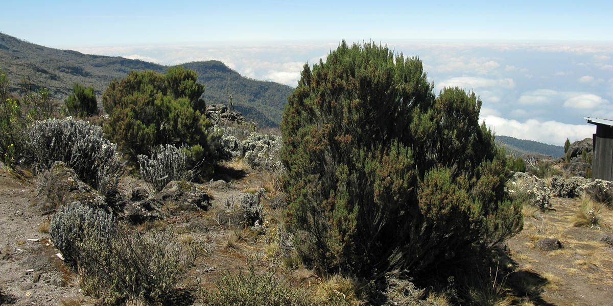
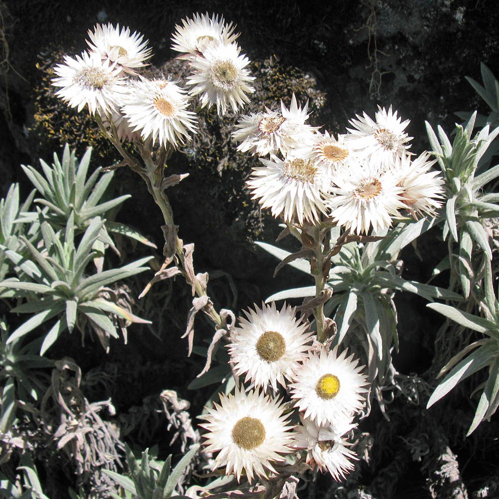
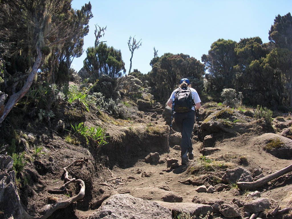
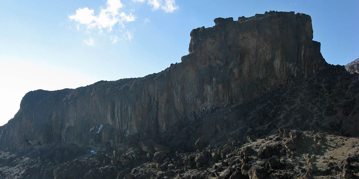
We set off from Machame Camp at 8:30AM. From the outset it was a steep relentless climb uphill through the giant heathers. The higher we got the better the panoramic vista behind us got, especially as cumulus clouds started to bubble up below us across the plain. A fair way up we passed a big pile of boulders that served well as a breathtaking lookout point. Higher up we found our first Tree Groundsel plants. Then not far short of Shira Caves we had a respite from the climb as we reached a small plateau where we had a rest stop. Around here the first Everlastings appeared too - some small flowers that, after dying, remain intact as a dried dessicated ghost of a flower. All the while the imposing Shira Plateau, a big wall of rock above us, got ever closer.
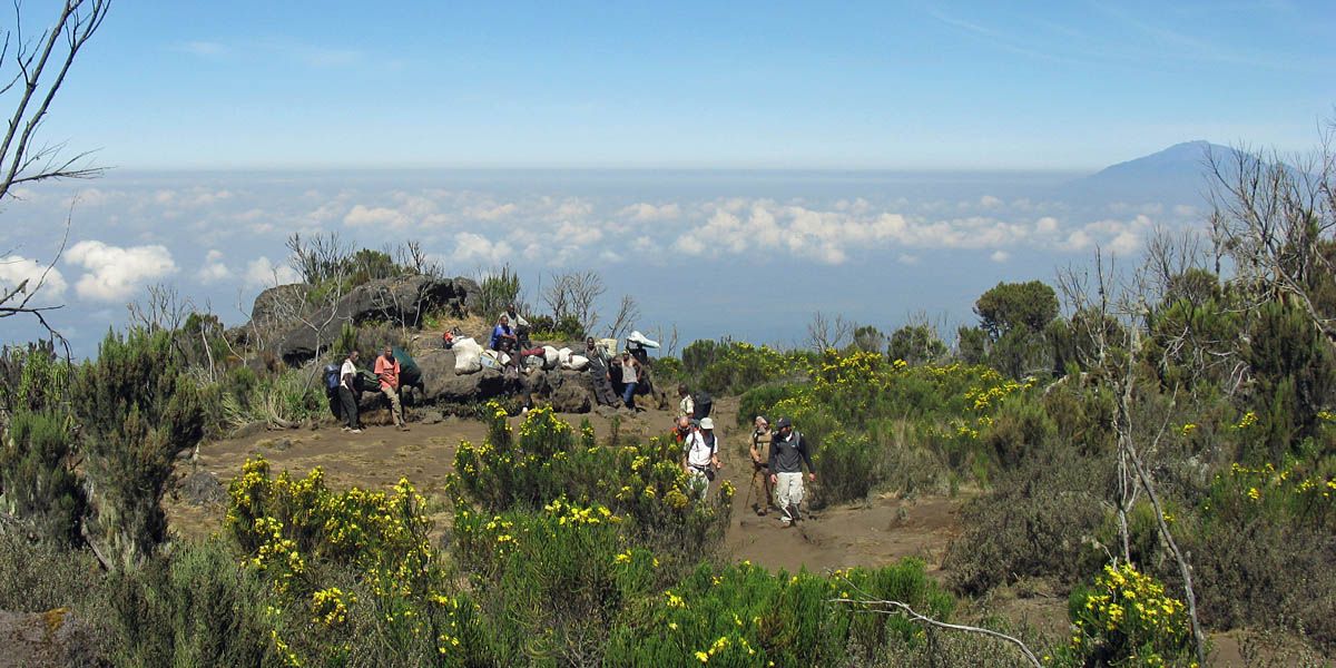
Eventually we reached our lunch stop, a nice spot on the rocks in around some now not so giant heathers just above the Shira Caves. That was a long hard slog! Up here it is starting to feel nippy in the shade. By now I was starting to suffer from the altitude a bit with a throbbing headache, slight queasiness and a slight shortness of breath but the rest from the strain of the long steep climb helped. I took it easy over lunch, forcing myself to eat and drink as much as possible, which helped a fair bit. Especially as we'd been made such nice lunchboxes. Needless to say the spectacular view below us over the clouds more than made it worth while.
 IMG_7762.jpg |
 IMG_7764.jpg |
 IMG_7765.jpg |
 IMG_7768.jpg |
 IMG_7771.jpg |
| Climbing up a steep slope away from Machame camp through the giant heathers, enjoying the ever more awe inspiring views as we get higher. | Looking up at the Shira Plateau still towering above us. | Machame camp is now a long way below us and getting ever smaller. | ||
 IMG_7779.jpg |
 IMG_7780.jpg |
 IMG_7781.jpg |
 IMG_7783_7789_Panorama.jpg |
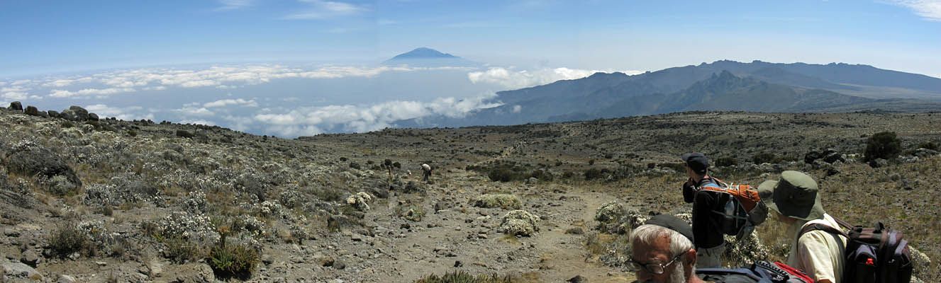
| Onwards and upwards we go! | A spectacular panorama from summit (left) to Shira Plateau (right) looking down the way we came. Taken from a lookout point. | ||
 IMG_7790.jpg |
 IMG_7791.jpg |
 IMG_7792.jpg |
 IMG_7793.jpg |
 IMG_7796.jpg |
 IMG_7797.jpg |
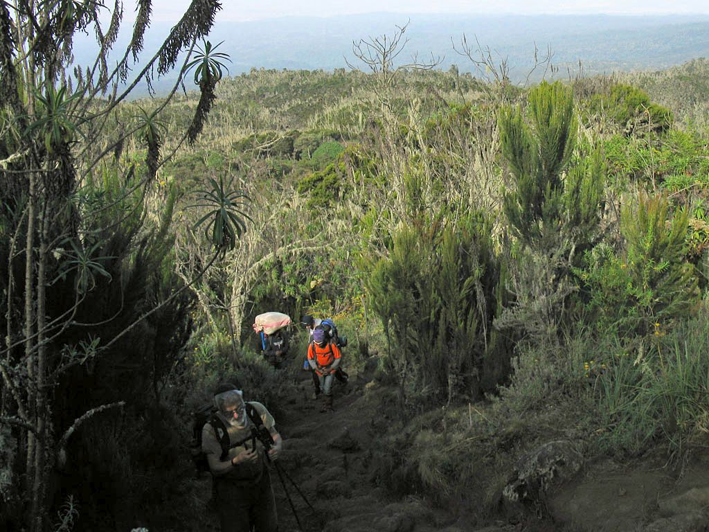
| Pictures taken from the lookout point, a pile of boulders allowing us to get above the giant heathers. Looking down the way we came, to the summit, down to the bottom of the boulders and across to cumulus clouds forming below us. | Looking up at the lookout point from the path below. | Continuing on as the path gradient levels out as we get close to the height of the Shira Plateau. | |||
 IMG_7799.jpg |
 IMG_7800.jpg |
 IMG_7801.jpg |
 IMG_7805.jpg |
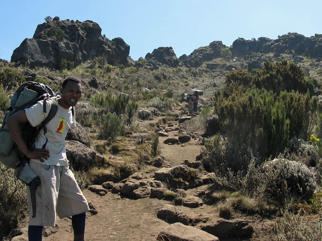
 IMG_7807.jpg |
 IMG_7808.jpg |
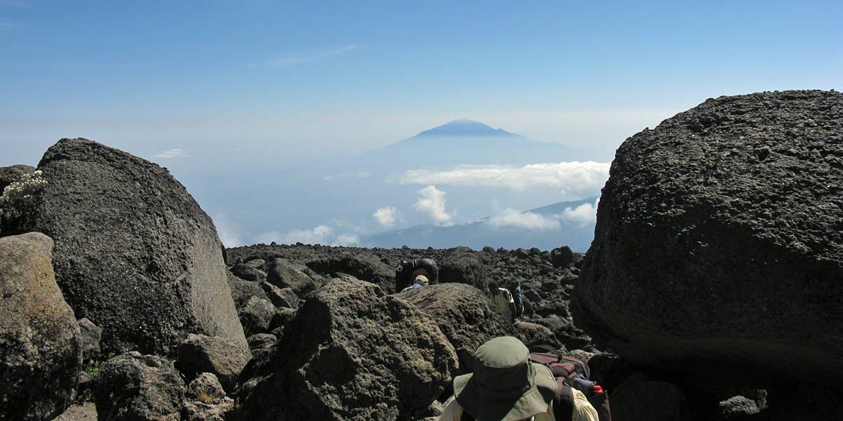
| Every time I look back the view gets more and more stunning. Especially with Mount Meru 'floating' on the haze. | Going up and around some huge boulders. | Passing some resting porters. | This shows the ridge that we have been climbing up well. | The first Tree Groundsel plants as we get to the height at which they grow. | |
 IMG_7811.jpg |
 IMG_7817_7818_Panorama.jpg |
 IMG_7823_7826_Panorama.jpg |
 IMG_7827.jpg |
 IMG_7829.jpg |
| The path ahead marked by porters. Our guide leading the way. | The panoramic views continue to get ever more breathtaking as we take a break not far now from the lunch stop above Shira Caves. | The first everlastings. These flowers are only found at high altitude. | ||
 IMG_7830.jpg |
 IMG_7831.jpg |
 IMG_7833.jpg |
 IMG_7835.jpg |
 IMG_7838.jpg |
| Looking back at the rest stop as we carry on up to the lunch stop. | Onwards and upwards. The everlastings getting more and more common as we get higher. | Here is where we stopped for lunch, just above the Shira Caves. How's that for a spectacular lunch view? | ||
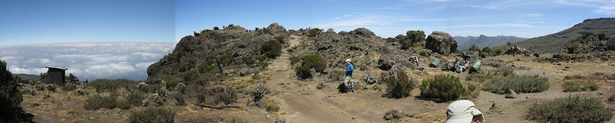
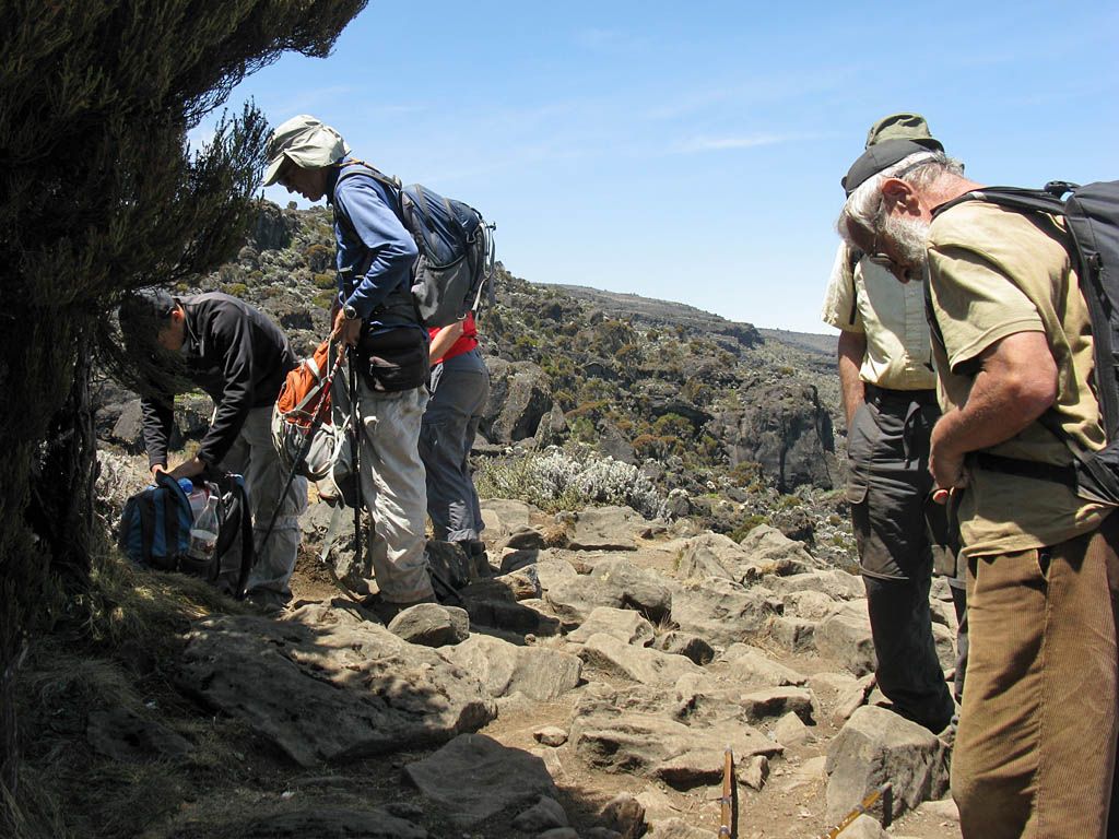
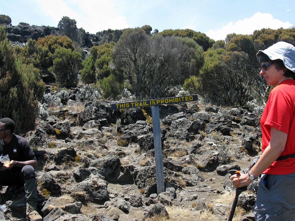
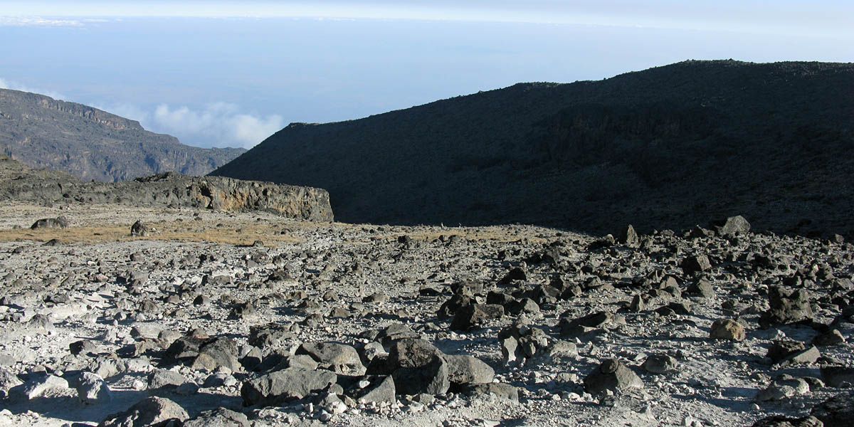
I felt a little better after the lunch rest thankfully. I was put at the front of the group to set the pace. From the lunch stop was a sign stating that 'This Trail is Prohibited'! It was actually a path that cut a corner. So instead of a 15 minute trek down to Shira Caves and then back up again we cut across above Shira Huts and reached the path to Lava Tower much more quickly. This was a gently inclining path thankfully as I was feeling a bit rough. We took it slowly and steadily uphill, leaving behind the giant heathers and eventually many of the Everlastings too, as we climbed high up into the field of large lava boulders that were strewn everywhere. On the way I experimented with my breathing, and discovered that slower deeper breathing helped a lot and the headache all but disappeared. (I guess the deeper breath puts higher pressure in the lungs allowing more oxygen to be absorbed. Great!) The only downside was that heavy breathing the cold high air altitude air chilled my lungs a bit, and they felt funny for the rest of the day with a slight chesty cough developing too. (Fortunately after a good night's sleep they returned to normal so not to worry.)
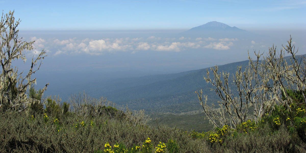
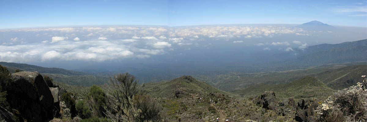
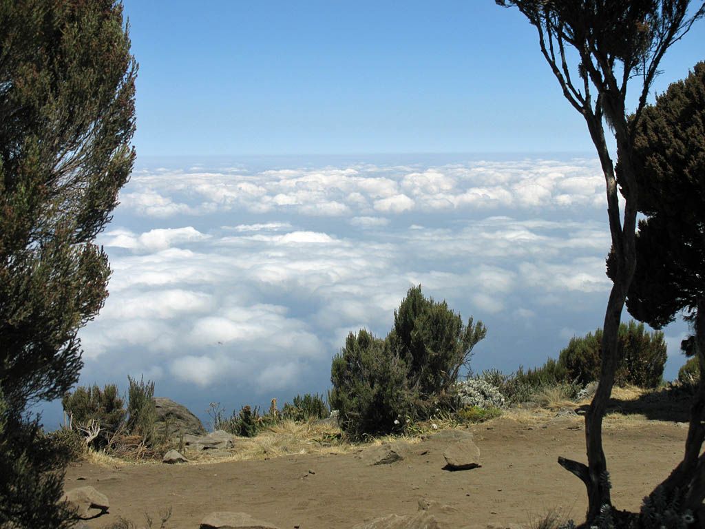
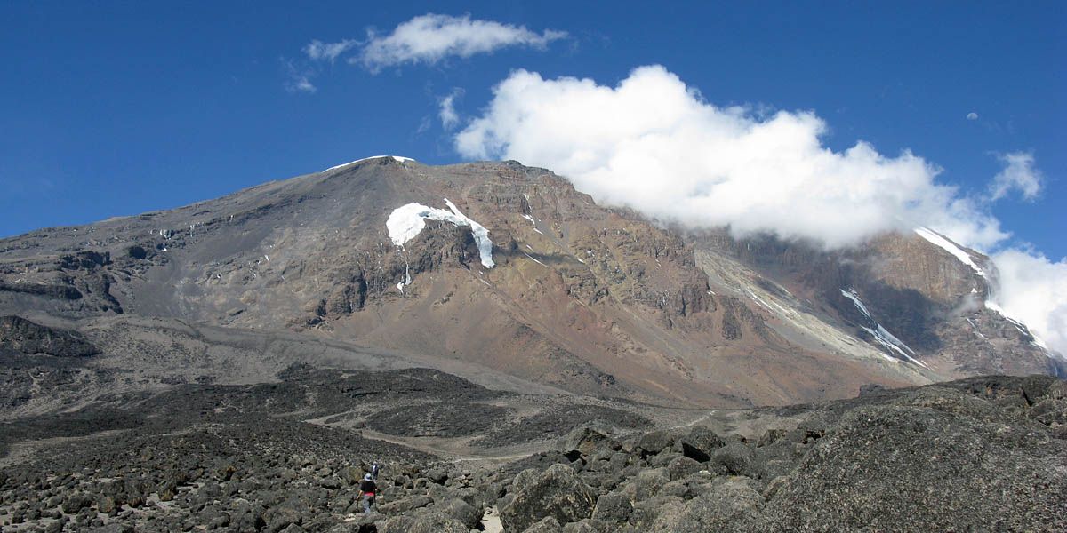
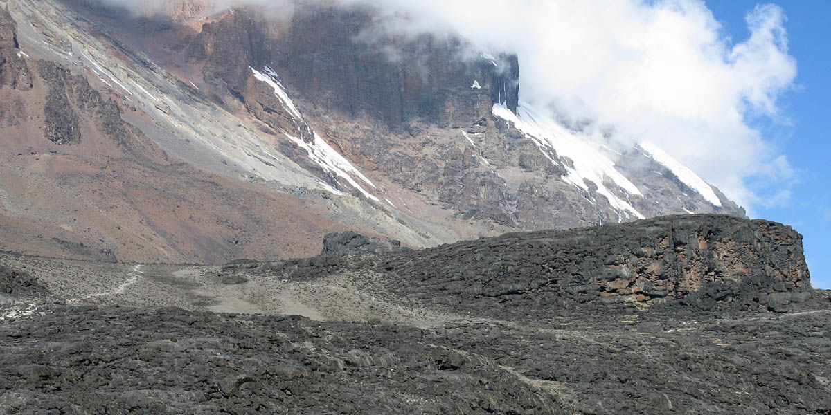
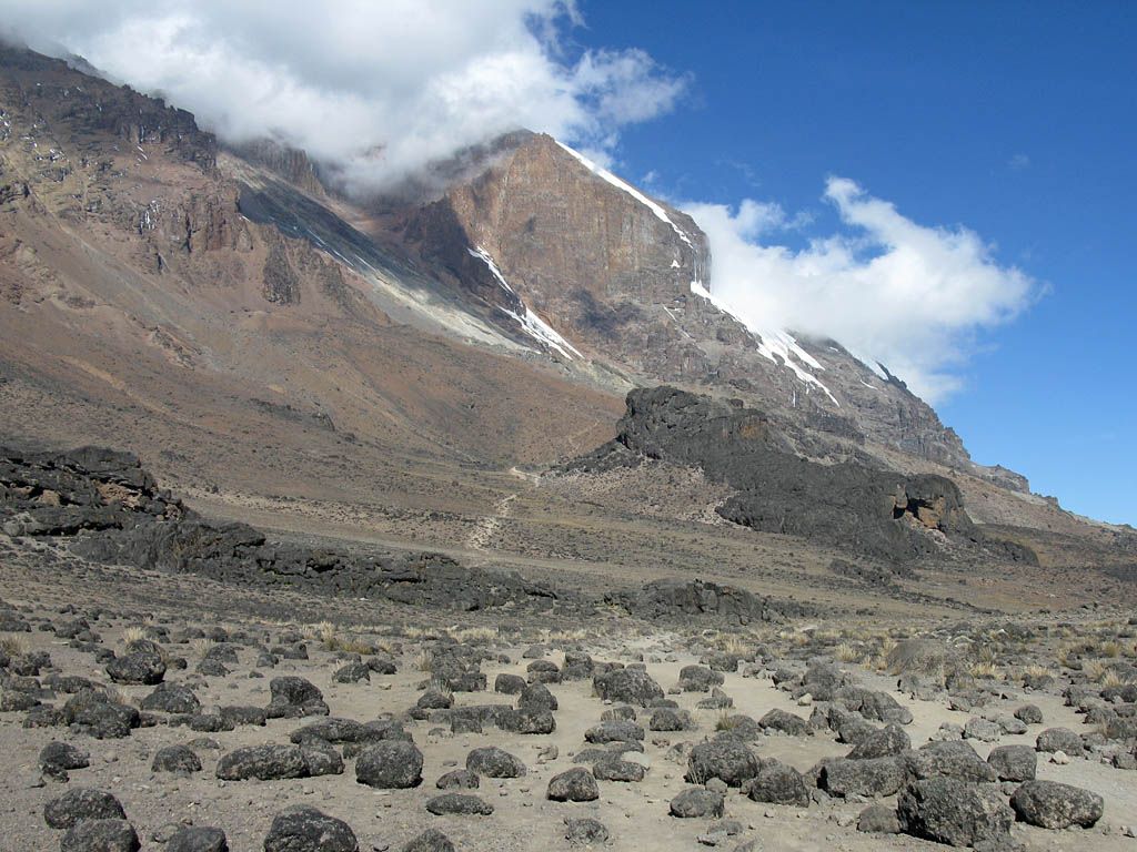
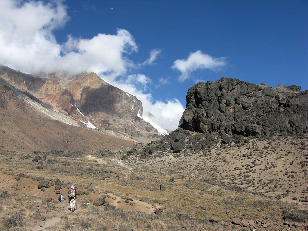
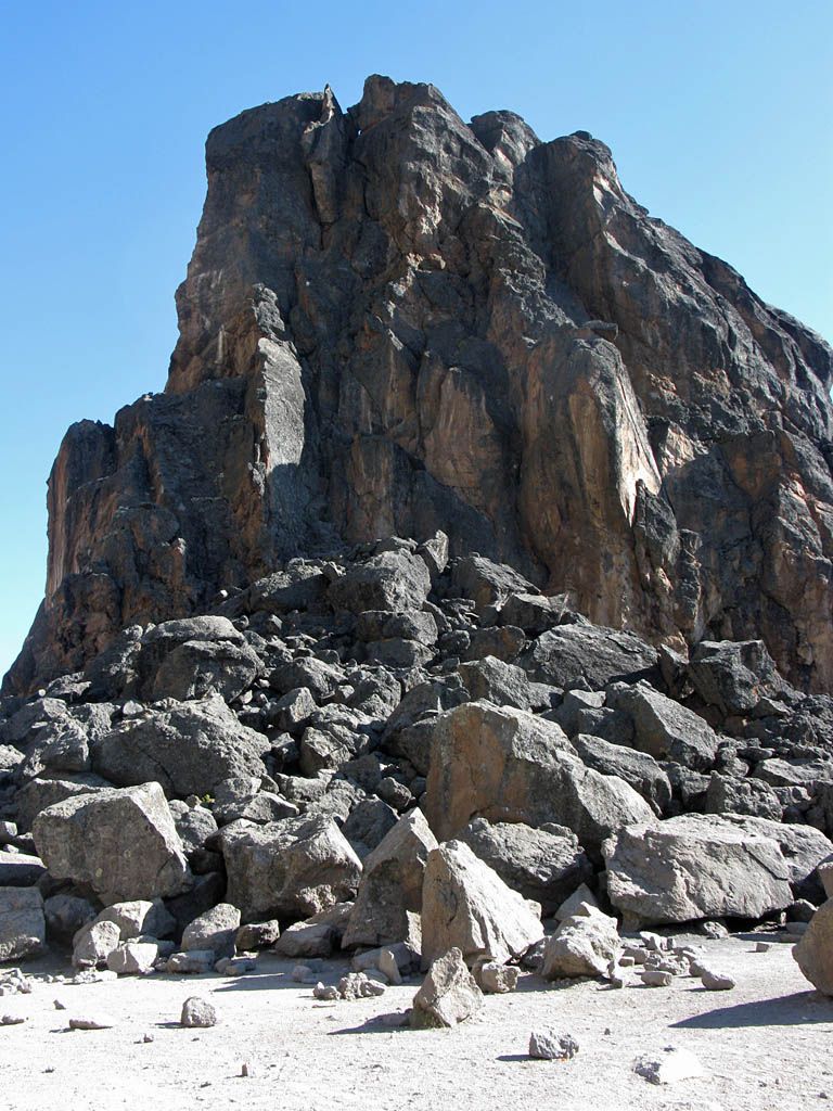
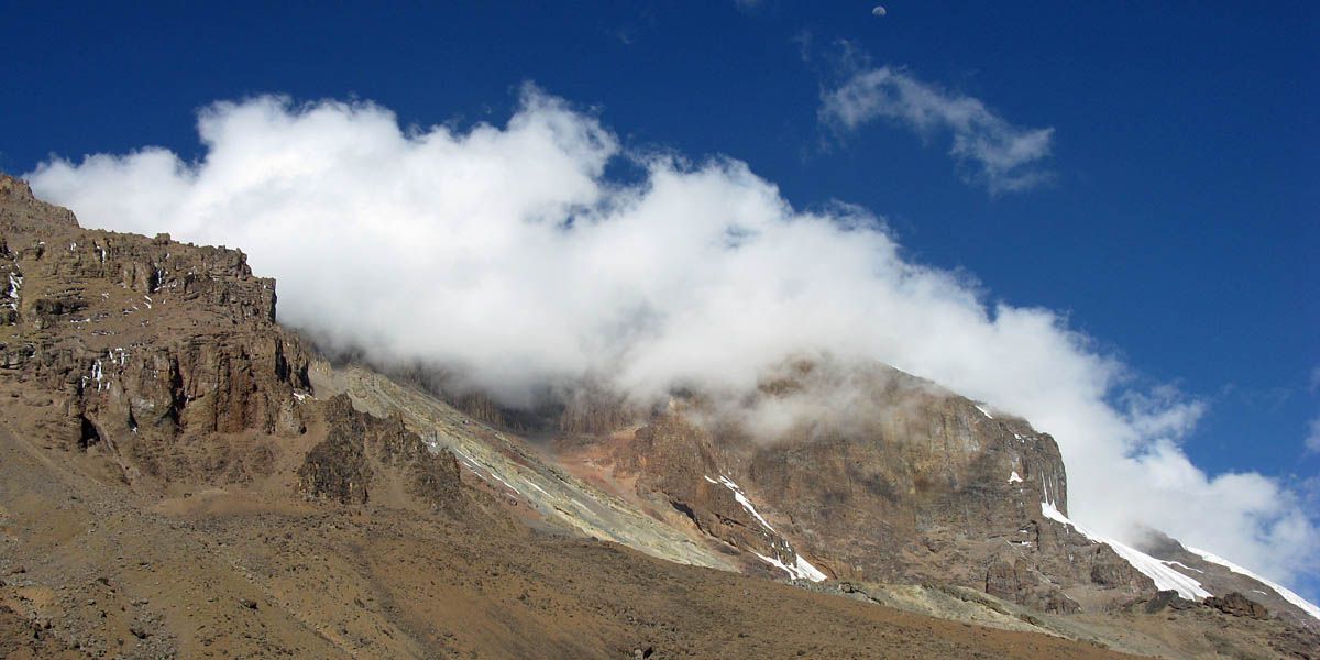
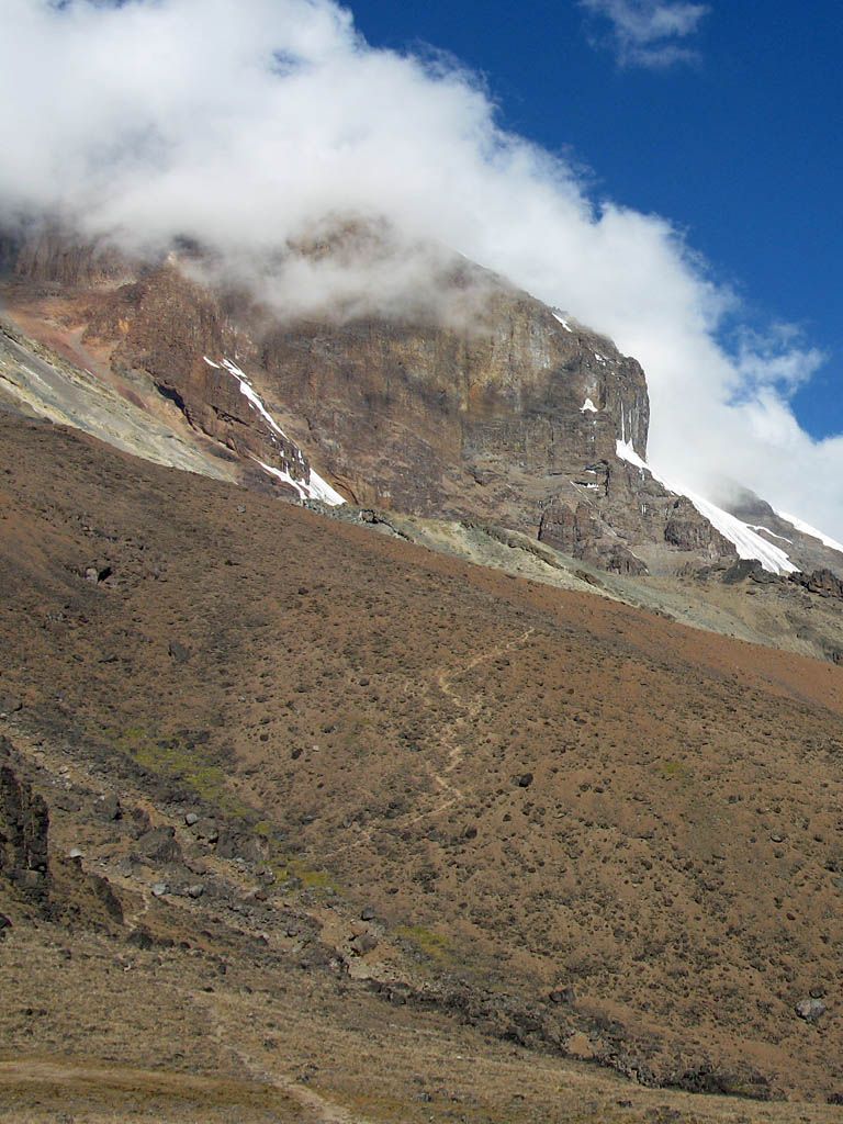
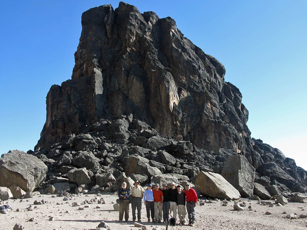
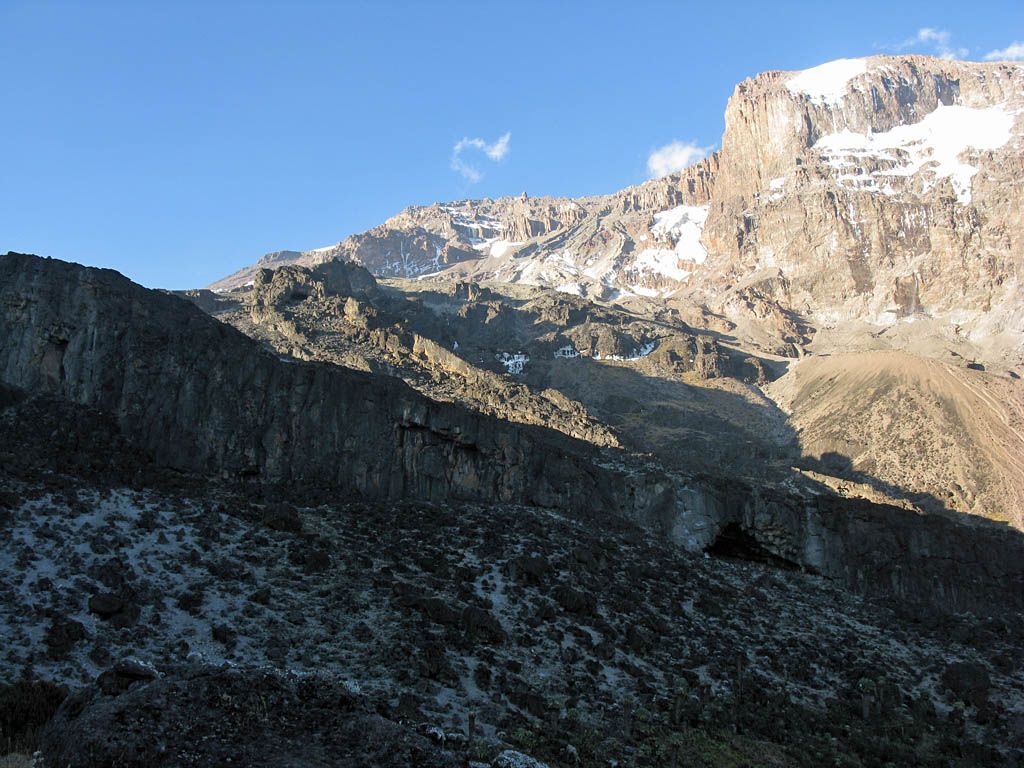
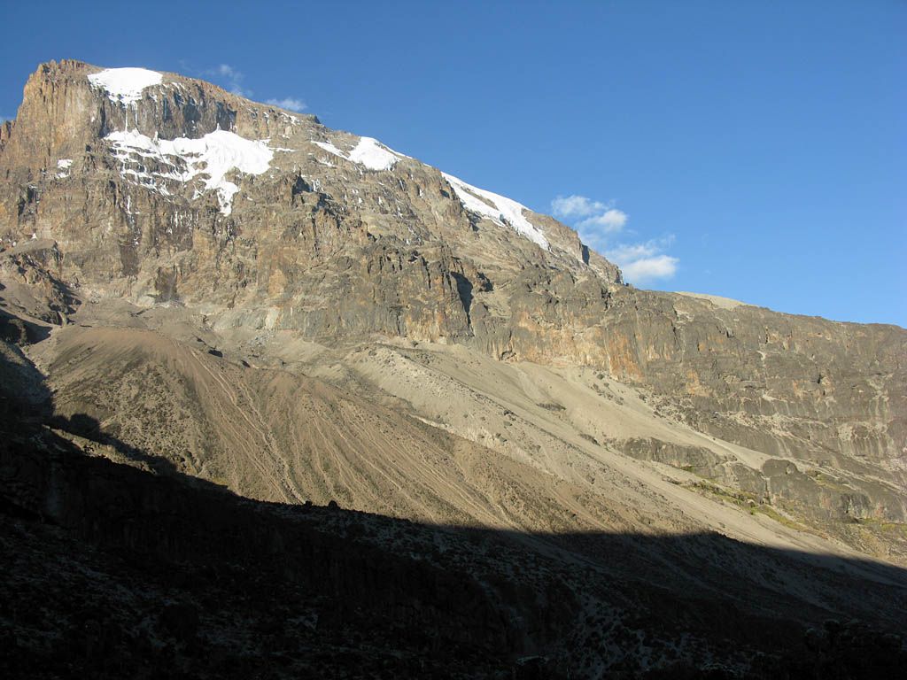
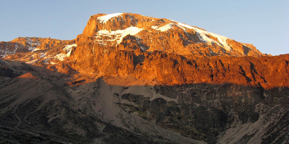
The views of course were outstanding as ever, with Kibo and its glaciers and own cloud formations ever closer and now looking down over the Shira Plateau, the views over the clouds were just ever more breathtaking. Eventually we joined up with a path from the Shira Plateau / Lemosho Route and then traversed up and across as the path levelled off. Soon enough we reached Lava Tower Campsite after one more ascent despite a problem with one of my sticks when I tried to adjust them. Thanks to Yedidya for managing to free and fix it. We had a rest at Lava Tower, during which we took a group shot of us in front of the tower of rock. Unlike some other tourists nearby, none of us felt the urge to climb to the top of the tower as we were all a bit tired and quite happy to conserve our energy at this high altitude (now at 4627m / 15,180ft).
 IMG_7839.jpg |
 IMG_7841.jpg |
 IMG_7842_7844_Panorama.jpg |
 IMG_7845.jpg |
 IMG_7850.jpg |
 IMG_7851.jpg |
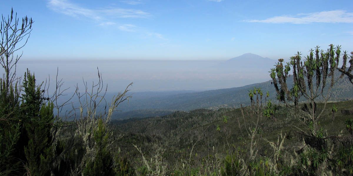
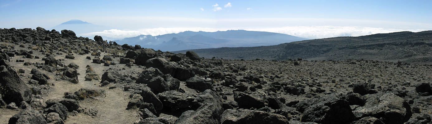
| From the lunch stop there was a 'prohibited path'. Yep we went that way. A shortcut bypassing Shira Caves and saving time and distance. | Now above the Shira plateau and getting high up, the gradient is now more gentle, the vegetation more sparse, the air much thinner, and the views ever more spectacular again as the Shira Plateau joins Meru floating on the haze and cumulus clouds below. | Looking ahead past spectacular towers of lava boulders towards the glacier and cloud shod summit. | |||
 IMG_7852.jpg |
 IMG_7855_7856_Panorama.jpg |
 IMG_7857.jpg |
 IMG_7858.jpg |
 IMG_7859.jpg |
| Higher and higher... Mount Meru and the Shira Plateau still appearing to float on the haze and lower clouds. | Nearly at the base of Kibo itself, which is sporting a nice cloud hat. | Converging with the path from the Shira Plateau / Lemosho route as we get close to Lava Tower. | Walking close to the base of Kibo. | |
 IMG_7862.jpg |
 IMG_7865.jpg |
 IMG_7871.jpg |
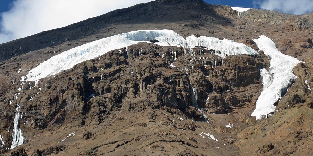
 IMG_7872.jpg |
 IMG_7874.jpg |
 IMG_7875.jpg |
| Taking a break. The air is thin up here! The guides posing for the camera. | Long range shot of cloud formation below us near the Shira Plateau. | The Western Breach route snaking its way up the side of Kibo from Lava Tower towards Arrow Glacier. | Ice not so far above us on the side of Kibo. | Approaching Lava Tower. | |
 IMG_7876.jpg |
 IMG_7879.jpg |
 IMG_7880.jpg |
 IMG_7885.jpg |
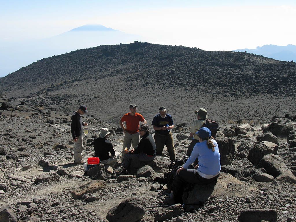
| Lava Tower from the base, also known as Lava Tower camp. We are now at 4627m/15,180ft. | Kibo's cloud hat evolving above us. | Looking up the Western Breach route from its start point. | Group shot at the base of Lava Tower. From left to right: David, Bob, Anne, Misha, Susan, Yedidya, Boaz, Mike |
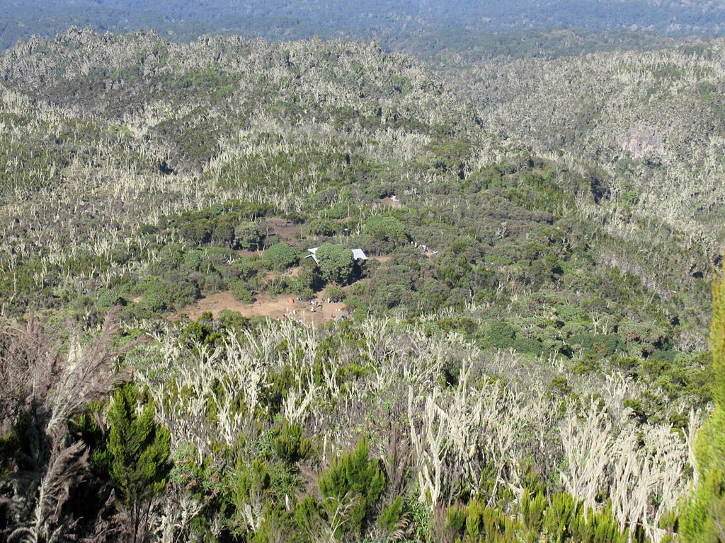
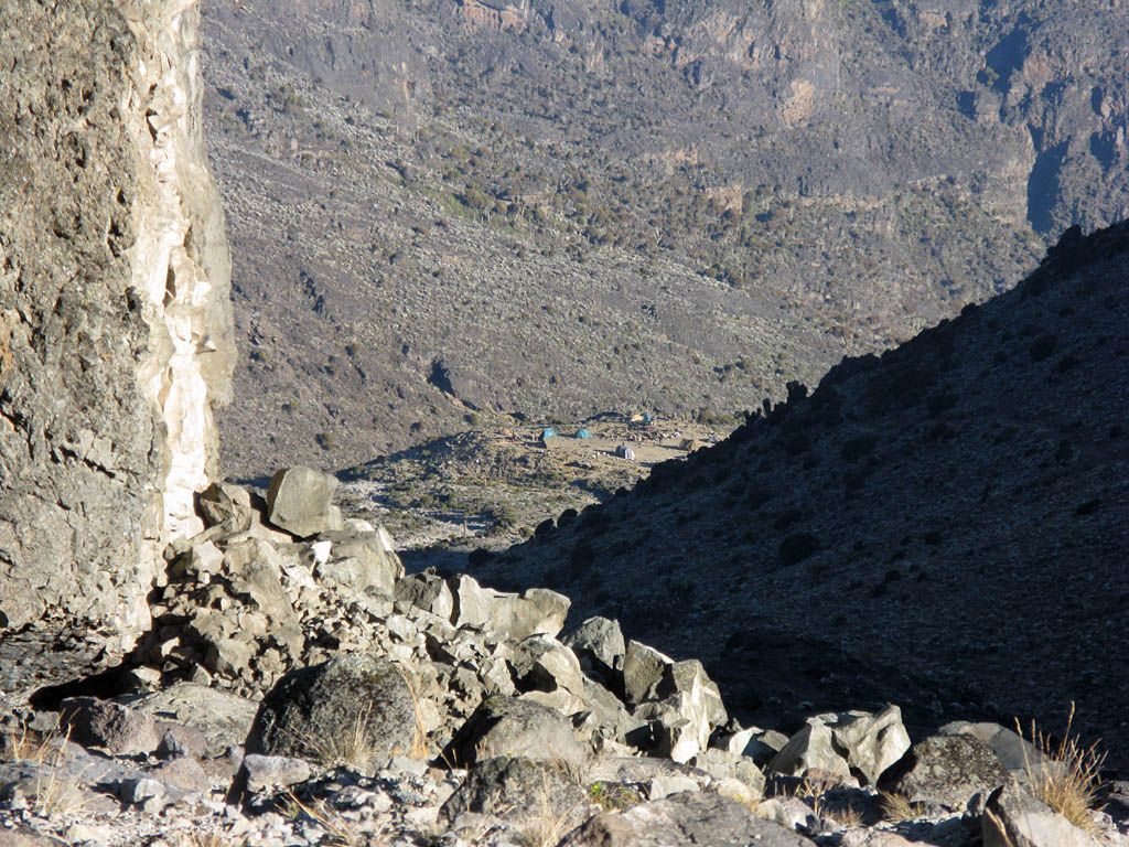
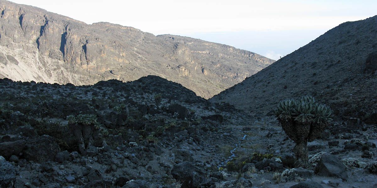
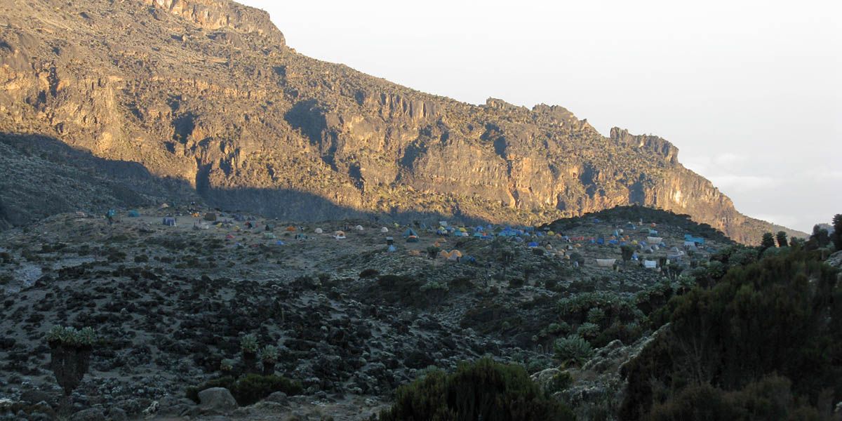
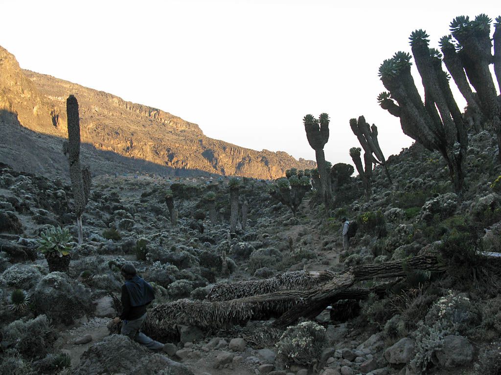
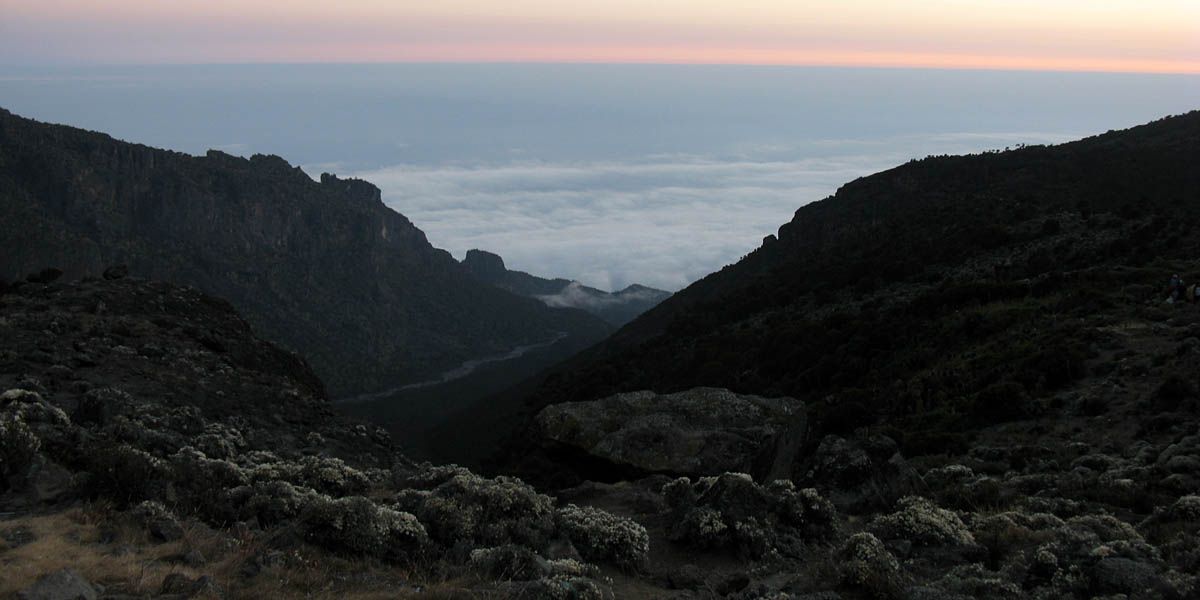
After our stop at the Lava Tower Campsite, we started to descend to Barranco. However this descent was rocky and tough, and my lungs had started to feel a bit funny from the cold. Some of my toes were starting to hurt from all the jarring of the rocky descent too. Despite this I was still enjoying the spectacular scenery. However after having walked many miles over many hours at high altitude, I was just itching to get to Barranco Camp and collapse in a heap somewhere. We descended into the Barranco Valley, which was grand and spectacular, now right below Kibo. We passed lots of strange and wonderful Tree Groundsel plants, a sure sign that we were lower now. Meanwhile up ahead we could start to see the camp site in the distance in the valley. On the way down we were in shadow, but the golden hour sun lit up Kibo in the most wonderful light as the day got late. After an age of descending slowly and painfully over tortuous rocks, I finally hobbled my way into Barranco Camp just as the sun set! How's that for timing!
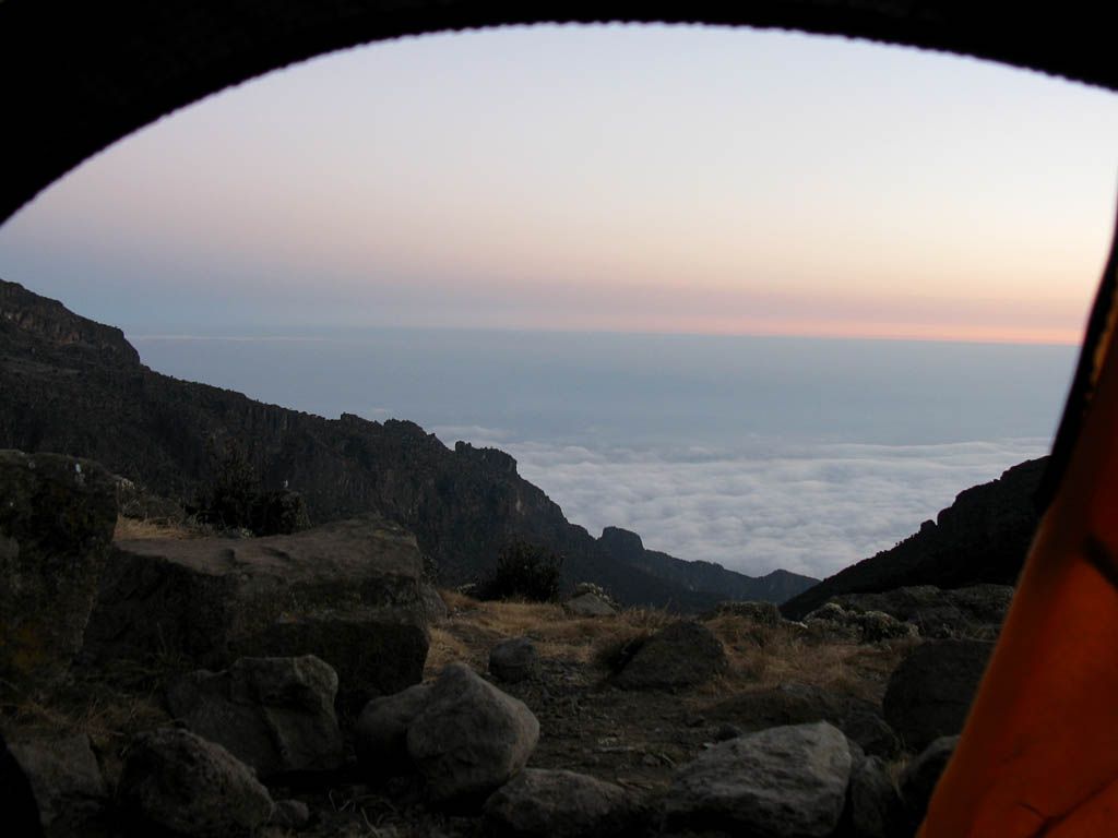
Now in the campI was shown to my tent with a view down to the plains maybe 10,000 feet below. I rested for a while feeling rather worn out, now well wrapped up against the increasing cold. A migraine kicked in from the stress of such a long and strenuous day. But that was soon squashed with some tablets I had for just such an occasion. I managed to get some nice twilight photos from my tent before it got too dark. Looking down the valley onto the clouds below was pretty epic. Supper was served after a while which was vegetable soup and spaghetti with vegetable sauce, and was delicious. After supper and the briefing for the next day I went straight back to the tent for a much needed sleep, and was out like a light!
 IMG_7886.jpg |
 IMG_7887.jpg |
 IMG_7888.jpg |
 IMG_7889.jpg |
 IMG_7890.jpg |
 IMG_7892.jpg |
| The way down from Lava Tower ahead. | Looking back at Lava Tower as we descend. | Descending into the Barranco valley and first view of Barranco camp site. | Tree groundsel plants. | Continuing the descent as the sun gets low. | |
 IMG_7893.jpg |
 IMG_7894.jpg |
 IMG_7894_7896_Panorama.jpg |
 IMG_7897.jpg |
 IMG_7898.jpg |
| Looking up at Kibo and its glaciers as we continue to descend. | Almost at Barranco campsite now. | |||
 IMG_7899.jpg |
 IMG_7900_7901_Panorama.jpg |
 IMG_7902.jpg |
 IMG_7904.jpg |
| Sun set as we arrive at Barranco. | Looking down the valley towards the clouds below in the deepening twilight. | My view from the tent before I sleep off an exhausting day. | |
So a really tough day completed successfully. Even the super fit porters found it hard, and the next day we heard that one porter went the wrong way and ended up at Shira Huts. He eventually made it to Barranco in the dark at about 11pm I understand. But as a result of this day, we now have several easy days ahead which will allow us to acclimitise and build up our energy reserves for the all important assault on the summit in four days time.
Click here to return to the main Pictures index.
Click here to return to the General 2010 Piccies Page, or click on one of the links below:
Page 1: 15th August 2010 - Kilimanjaro Approach (7)
Page 2: 16th August 2010 - Karama Lodge and Safari (77)
Page 3: 17th August 2010 - Trek Day 1: Start to Machame Camp (51)
Page 4 (This Page): 18th August 2010 - Trek Day 2: Machame Camp to Barranco Camp (72)
Page 5: 19th August 2010 - Trek Day 3: Barranco Camp to Karanga Camp (110)
Page 6: 20th and 21st August 2010 - Trek Days 4 and 5: Karanga Camp to Barafu Camp and Shabbat (91)
Page 7: 22nd August 2010 - Trek Day 6: Summit Day (53)
Page 8: 23rd August 2010 - Trek Day 7: Barafu Camp to Mweka Camp (58)
Page 9: 24th August 2010 - Trek Day 8: Mweka Camp to Exit (33)
Page 10: 25th August 2010 - Kilimanjaro Exit (10)
Total: 562 Pictures