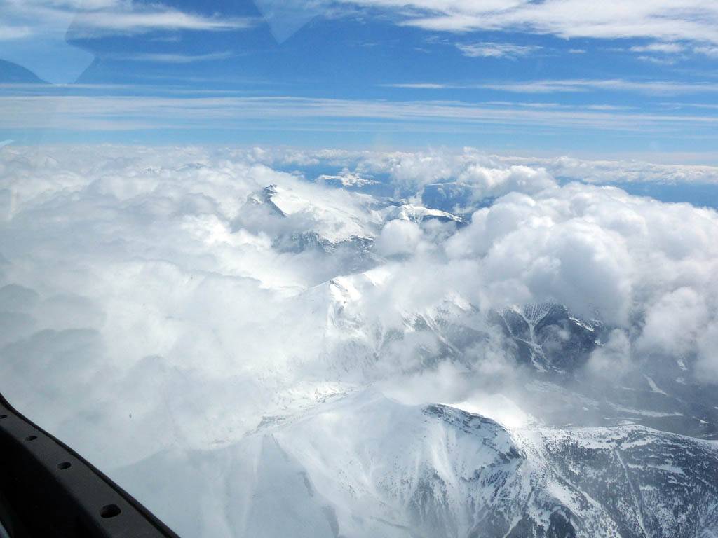
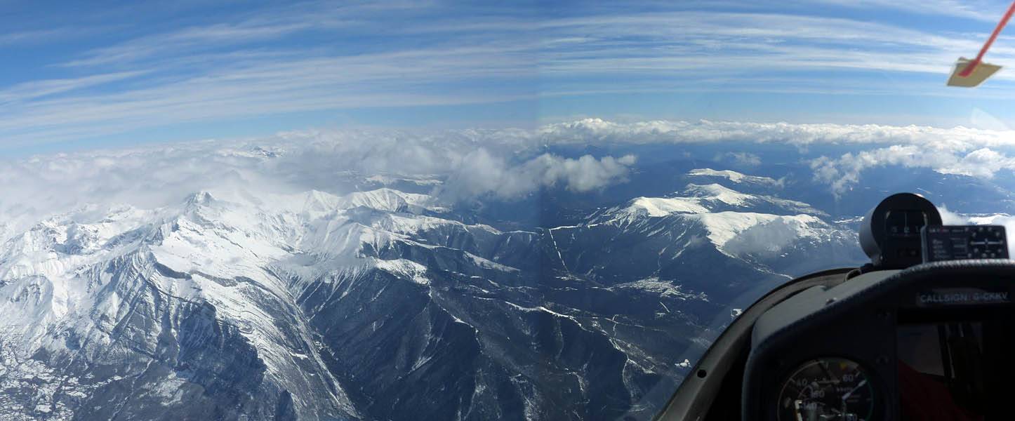
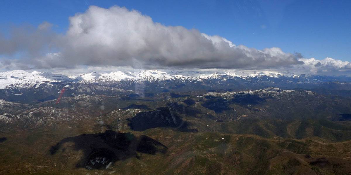
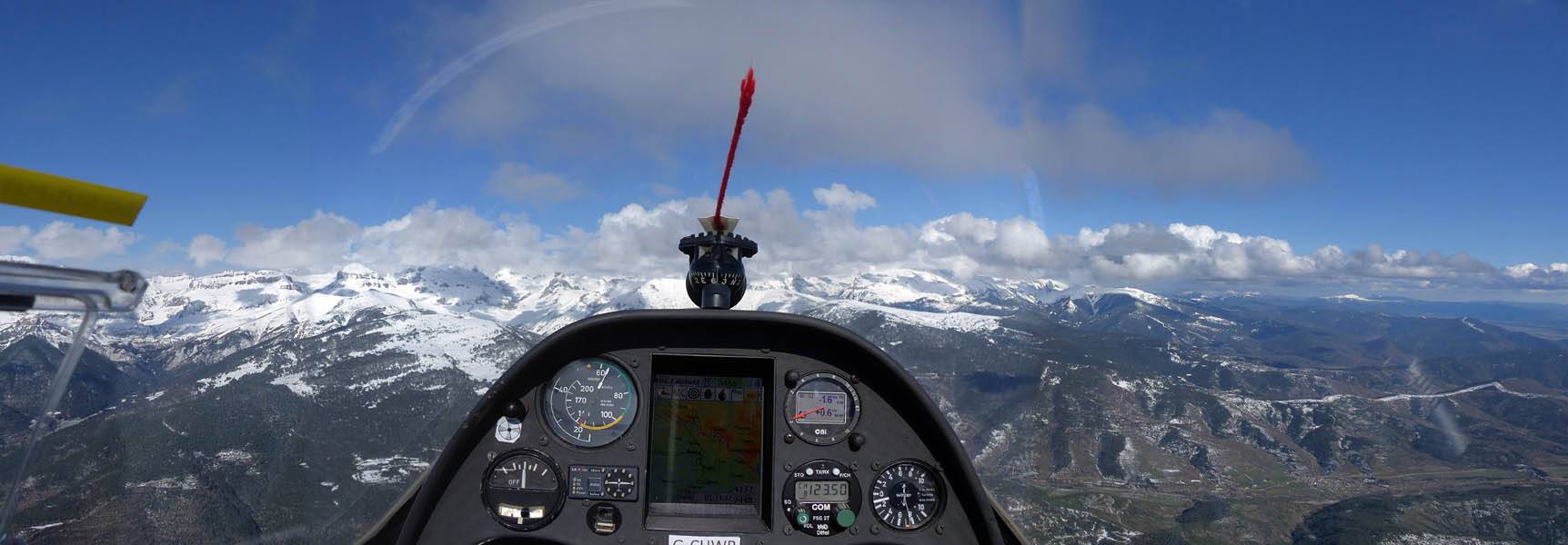
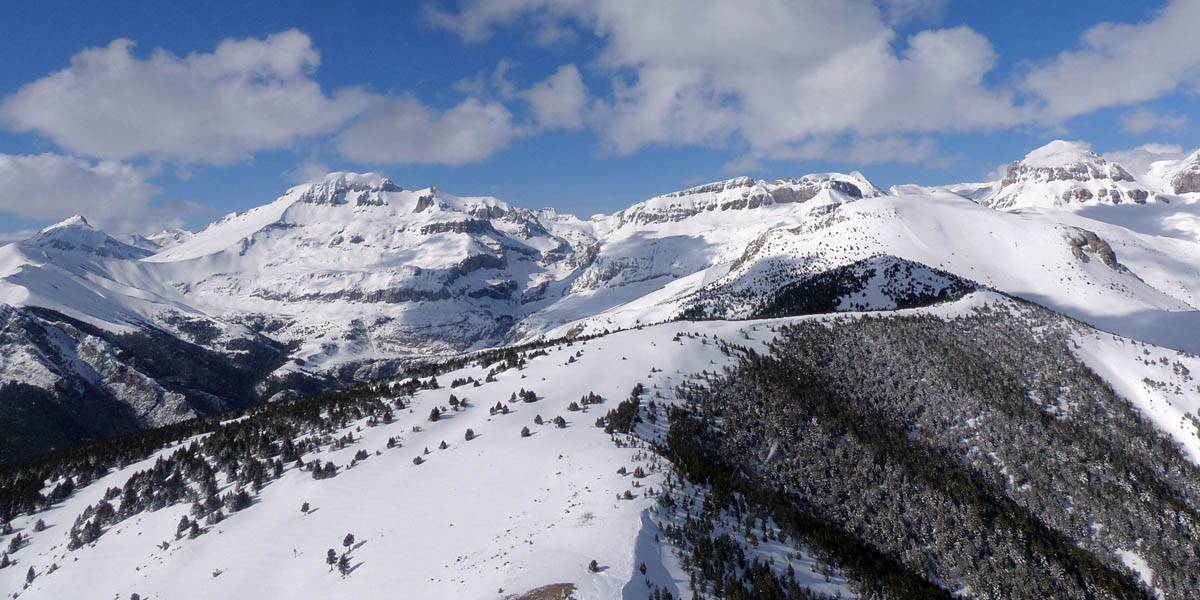
P1010527_529_Panorama.jpg
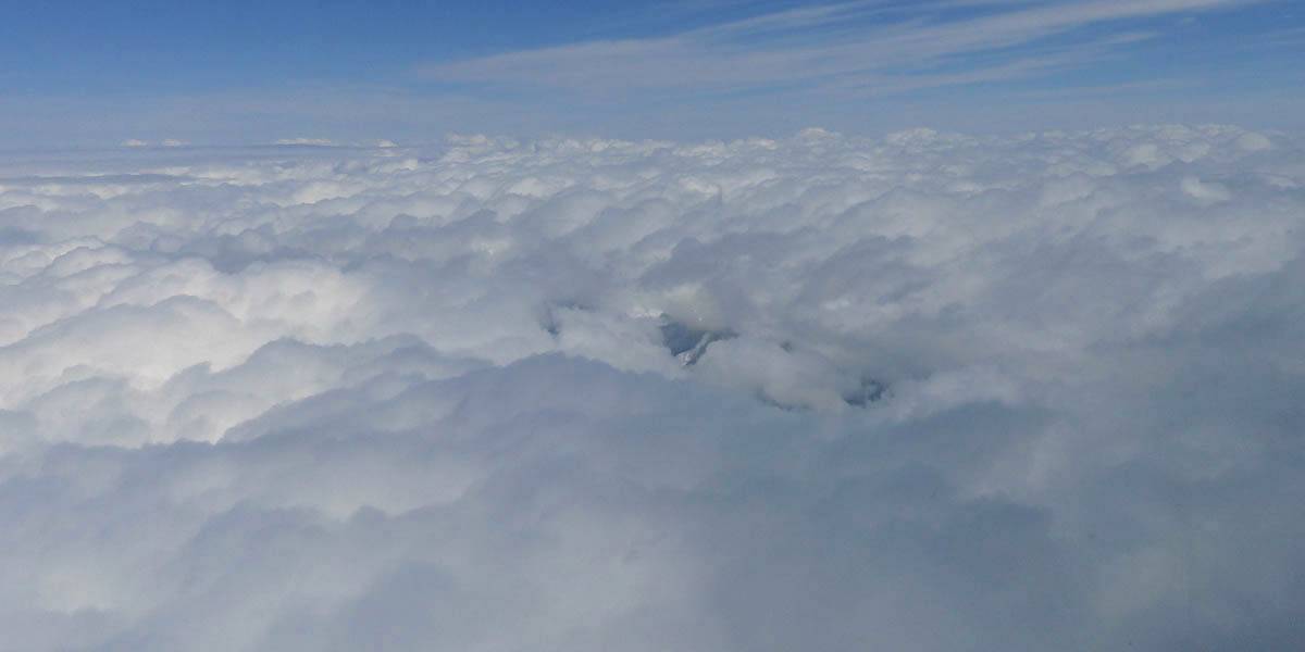
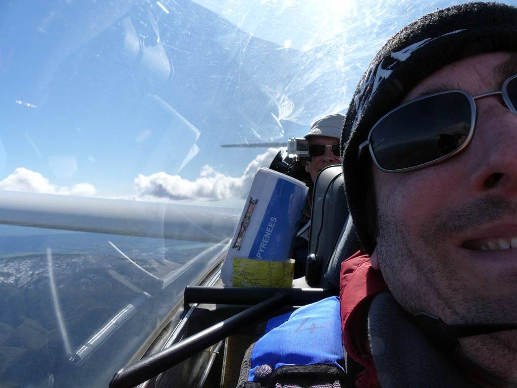
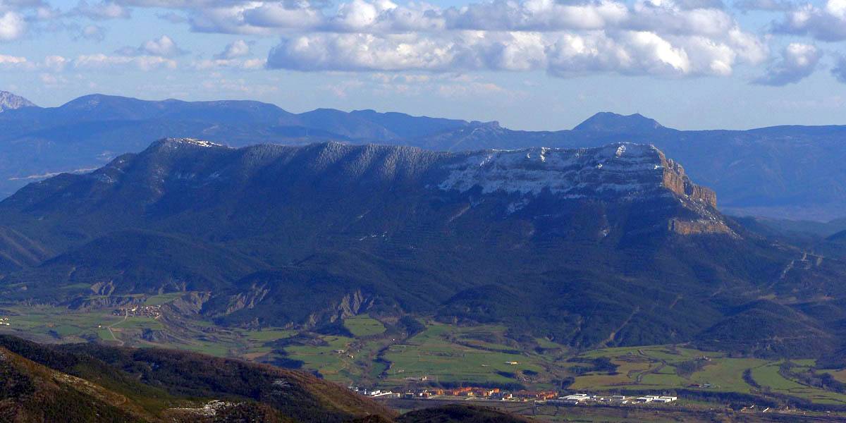
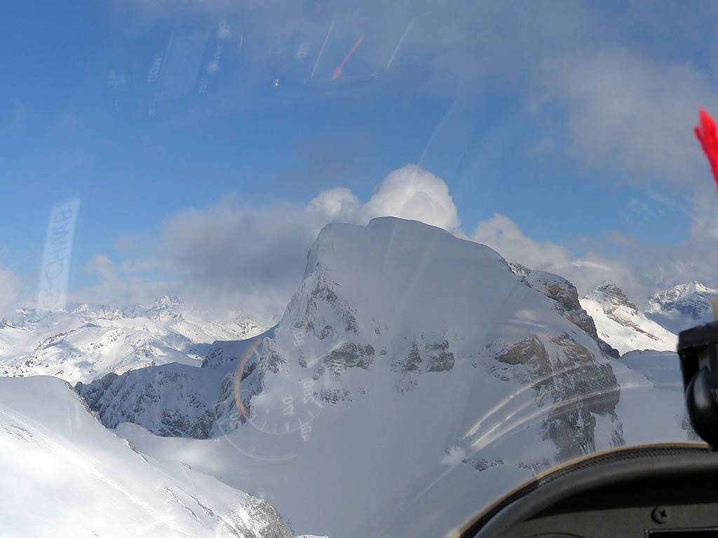
P1010537.jpg
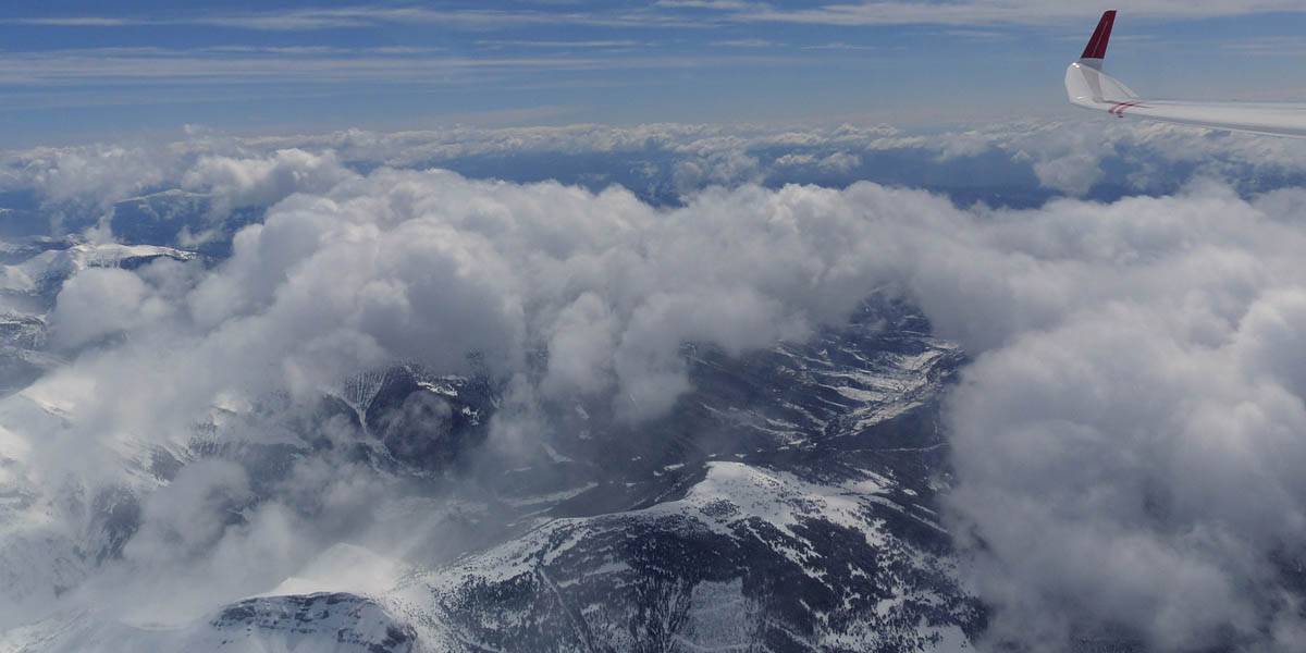
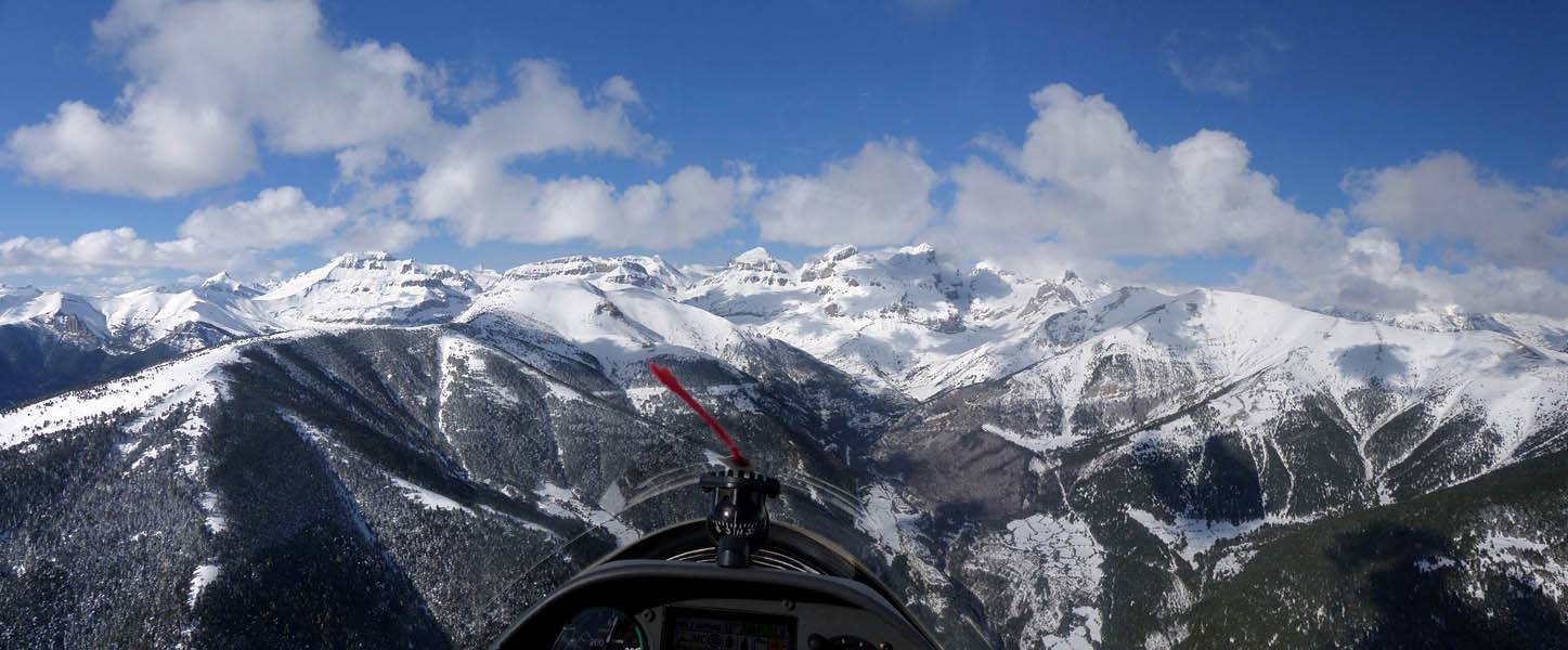
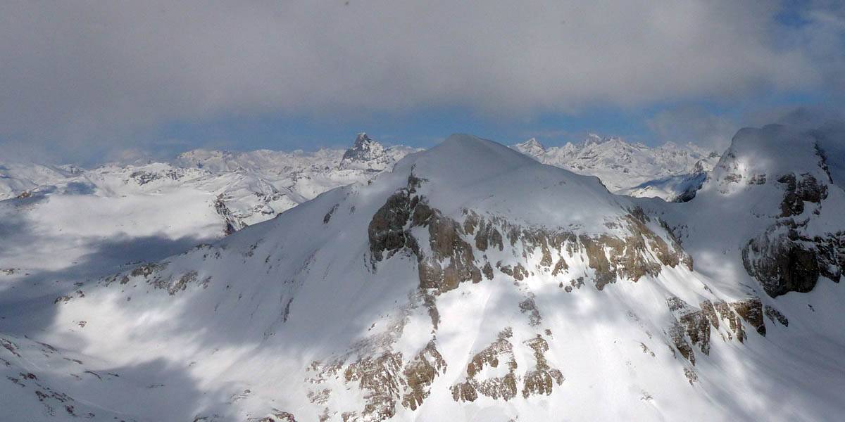
P1010547.jpg
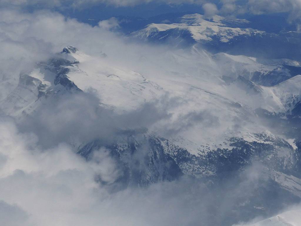
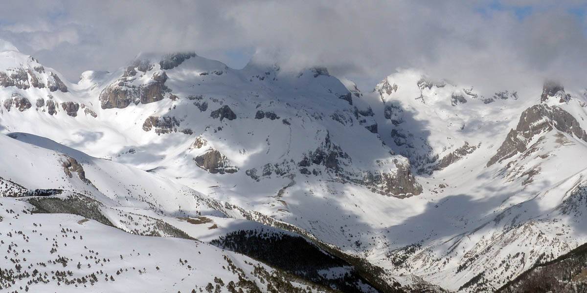
P1010550.jpg
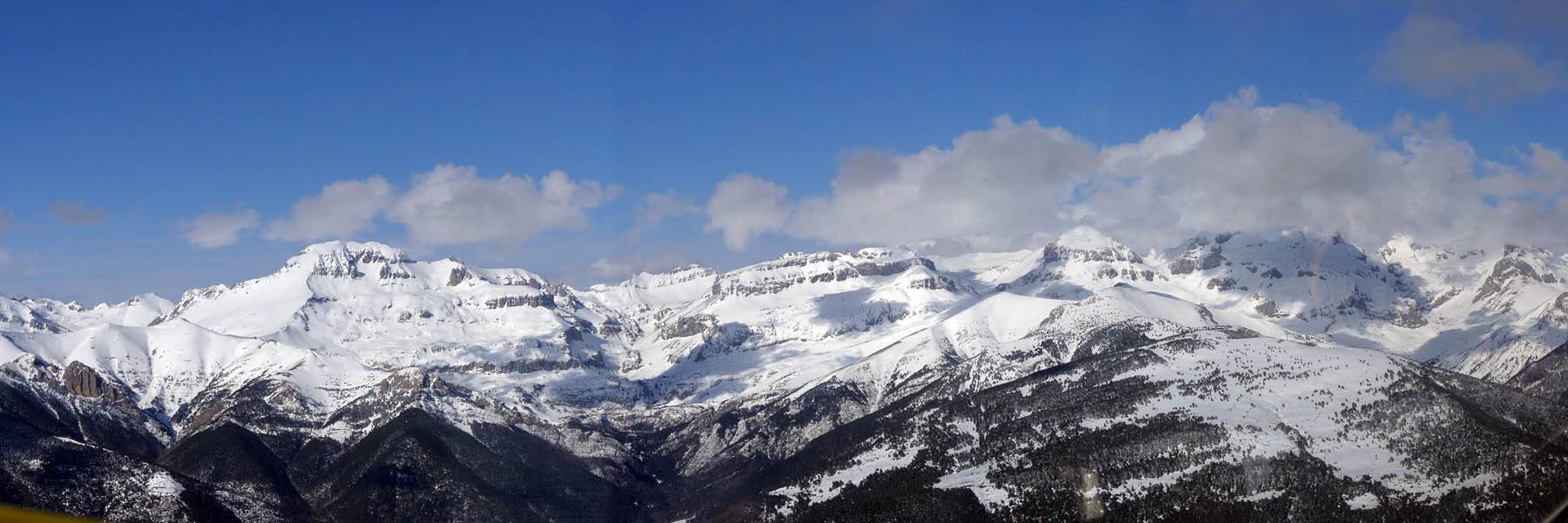
P1010551.jpg
Click here to return to the Gliding 2014 Pictures page.
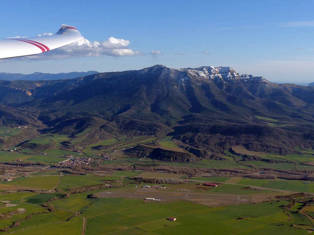
After many years watching people on the Jaca expedition have great fun in the Pyrenees mountains I decided that it was time for me to visit. I've been to Aboyne four times but never to Jaca. I flew out on Ryanair from Stansted to Zaragoza on Sunday 23rd over some spectacular showery cloudscapes after taking off in a hail storm. At Zaragoza it took just 15 minutes from plane to car hire desk where I grabbed a nice Fiat 500 hire car. After a fun drive over the hills northwards I soon passed through Jaca and found Santa Cilia. A borrowed Tom Tom proved invaluable escaping from the confusing road system around Zaragoza and again when I approached Santa Cilia. It meant I could focus more on getting used to the car and enjoy the scenery more. After a cosy night in Santa Cilia the first flight on Monday was a short non soaring flight as rain arrived. Alas the weather was closing in after last week's good and warm weather. Tuesday was a washout so we visited a farm in Santa Cruz and had a lovely non flying day. On the way back we drove up to the monastery (it was snowing up there) before returning back to base. The flying began in earnest on Tuesday. The forecast was a little uncertain with a cold unstable Northwesterly wind. Monday's rain had turned to snow overnight. After an early snowball fight we launched and got into wave, topping out at 13,000 feet, above the mountain tops. The views were breathtaking. The French side was 8/8 cloud cover but we were able to follow a wave bar along the ridge before exiting to the valley to return for the next person. The best flight was on Thursday. I was up in the afternoon and had fun in thermals. After a low save near the area known as stage 2 we followed a street out to the Yesa reservoir before returning to the high mountains. Later in the day the cloud amounts reduced and cloudbase rose to 8500 feet allowing us to reach the mountain tops. With so much fresh snow it was dazzling up there. I didn't want to go back down. On Friday a shorter less exciting flight late in the day was still fun with a weak decaying thermal street from the Southeast, followed by some bowl bashing near the mouth of the Hecho valley and some formation flying. That was all the flying alas as on Saturday the wind was too strong from the Southeast to handle the gliders on the ground safely. By then I was exhausted anyway and already happy so no problem. The day consisted of derigging some gliders, resting, preparing to go home and some more mountain appreciation. On Sunday 30th I took a scenic route to the airport, hitting some glorious twisties to Riglos before carrying on to the airport for a smooth journey home.
Please click here for pictures taken on Sunday to Tuesday (113).
Please click here for pictures taken from the ground on Wednesday and Thursday (54).
Please click here for pictures taken on Friday to Sunday (87).
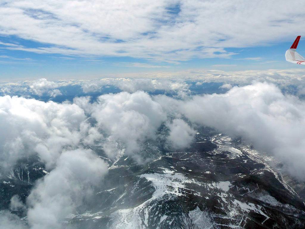
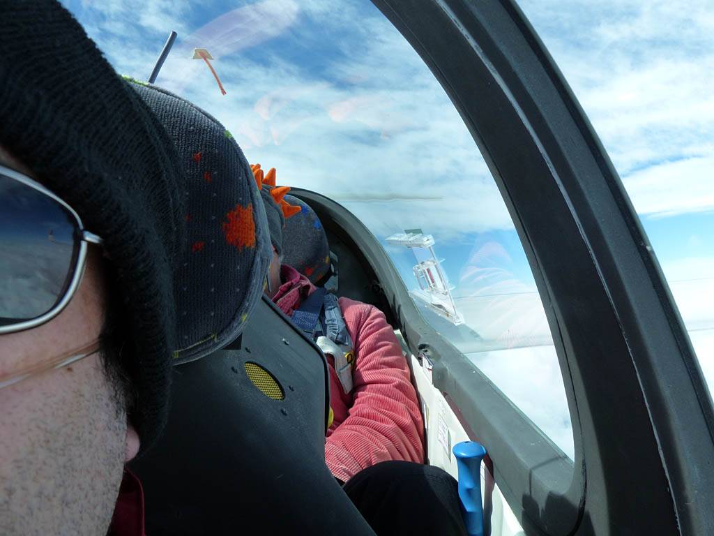
Bob and I launched around 11:47AM with me in control and took a high tow to around 6000 feet above the stage 2 area. The last 1000 feet were impressively rough as we got thrown about by the rotor. It took full control deflections to stay with the tug! We were tossed all over the place. The wave was tricky at times but the hotspots were 6-10kts up at times. We had a good tour of the local mountains. We headed upwind northwestwards to Anso valley, jumping from wave bar to wave bar. At one point after reaching 10,000 feet we dropped down in heavy sink to 8000 feet in the lee of Pena Forca in the high mountains before escaping again as we found wave above the upper Hecho valley, and topped out at just over 13,000 feet. I Let bob fly a fair bit as I was keen to take lots of pictures. After pushing East past Bisaurin and Canfranc, and past Pena Collarada and Pena Retona we looped south down the Tena valley to Sabinanigo at still over 10,000 feet. Then after losing some height we headed along the South side of the Jaca valley back to base, getting a good view of the top of Oroel as we passed still at about 7500 feet. I was in control for the landing. It was a steep approach as there was heavy sink at the dropoff beyond the runway. I had a smooth landing and stopped nicely in the gravel area which Bob seemed impressed with. I was down at 1:24PM after about 1h37m in the air.
|
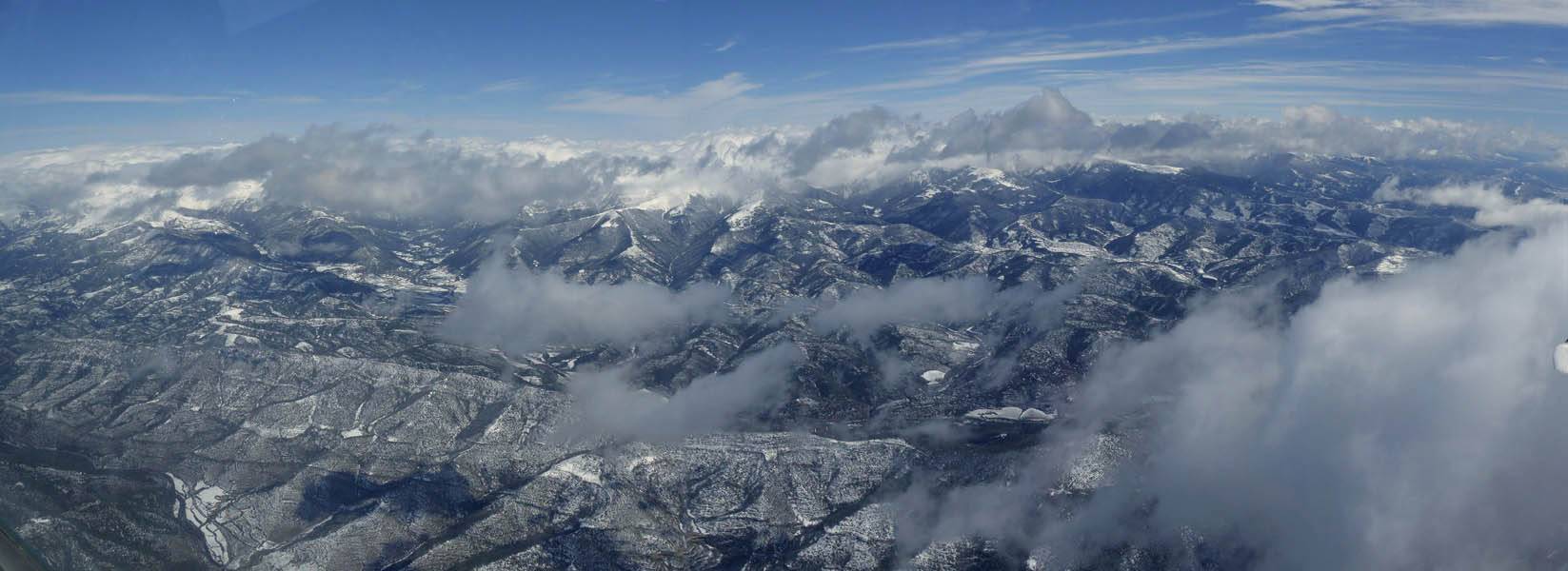
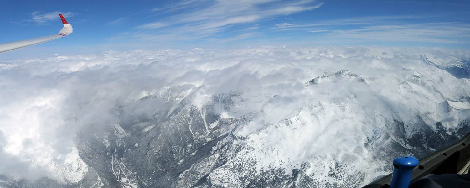
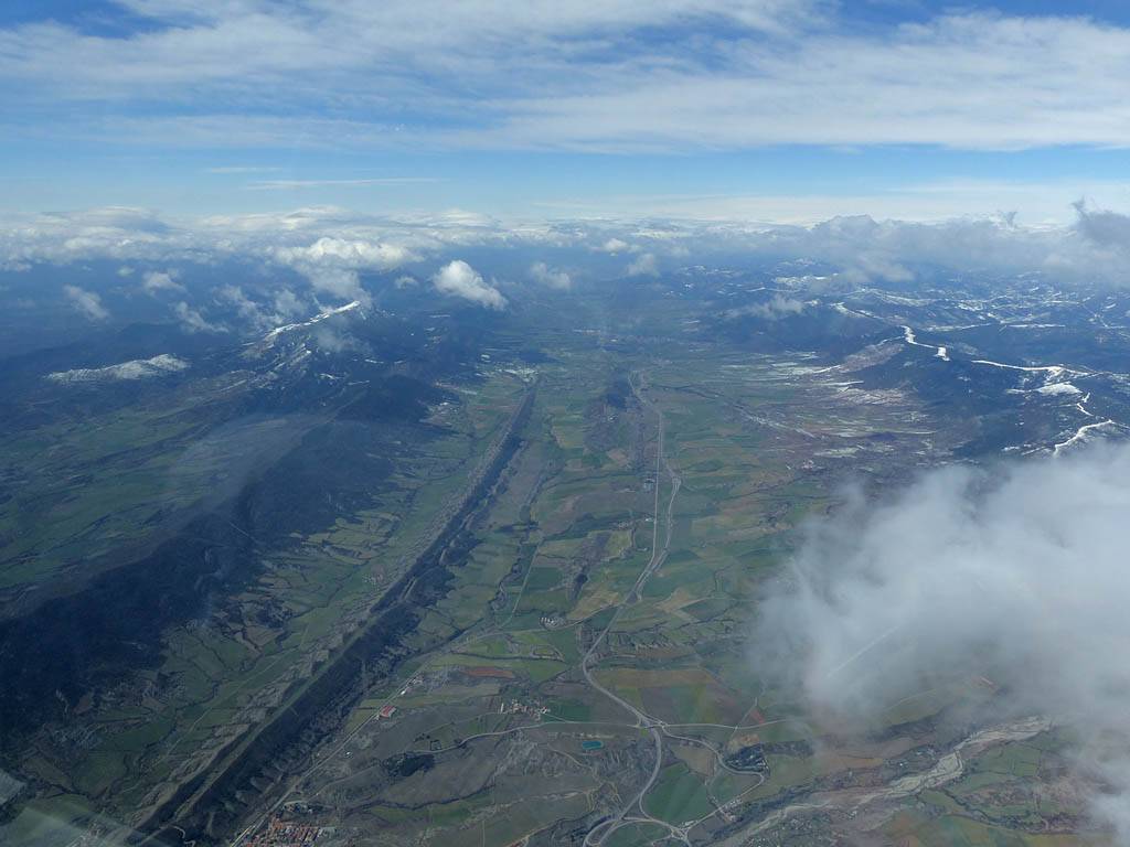
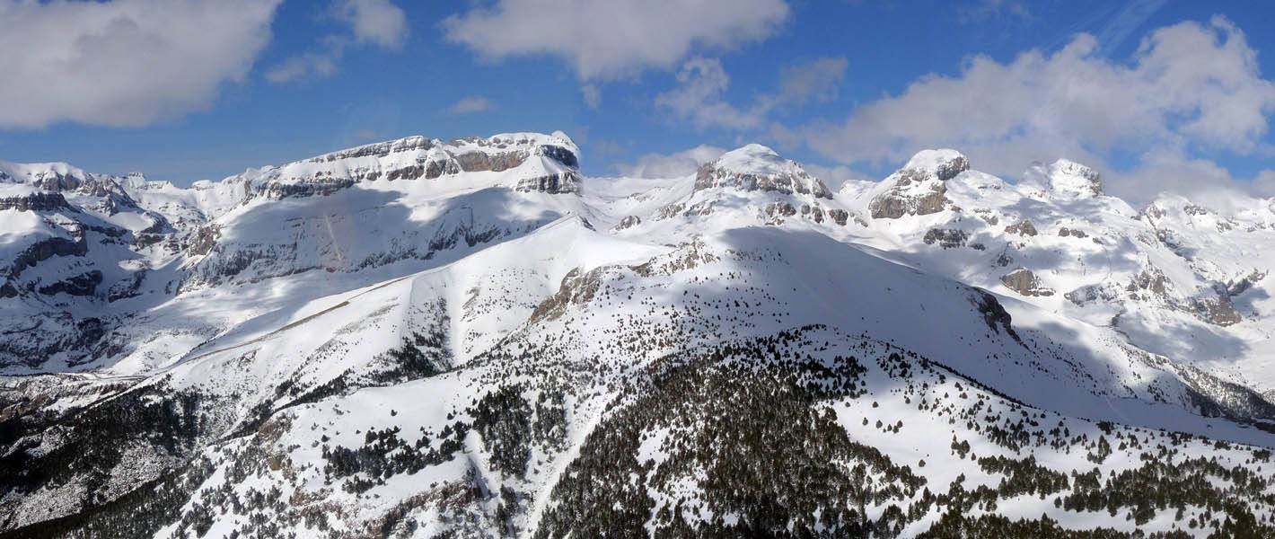
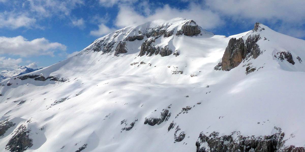
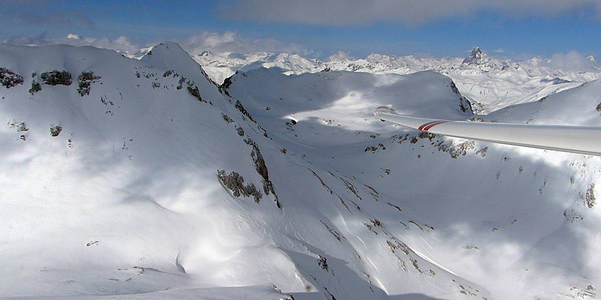
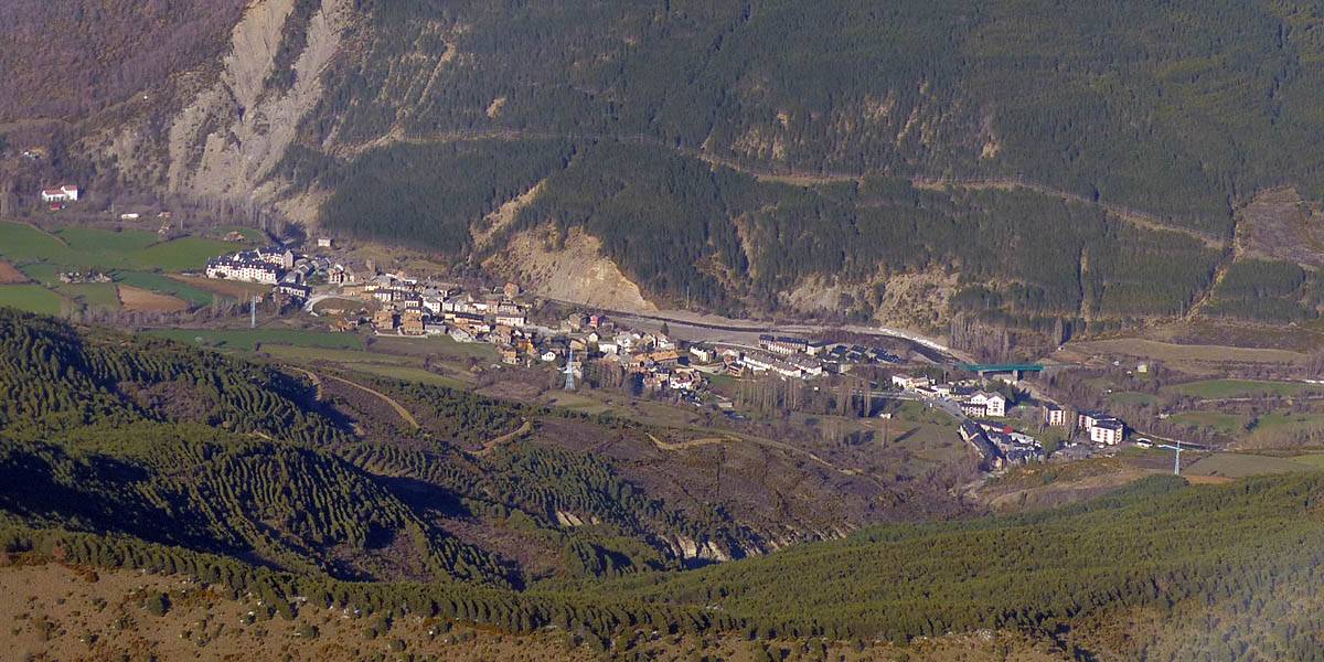
P1010527_529_Panorama.jpg |
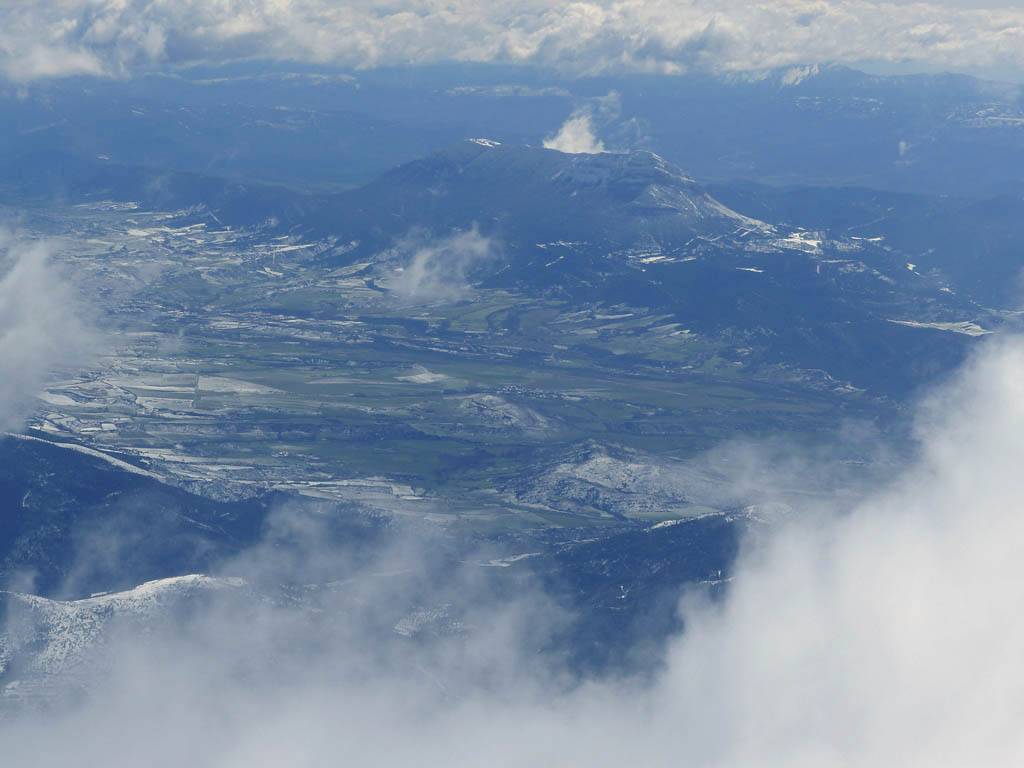
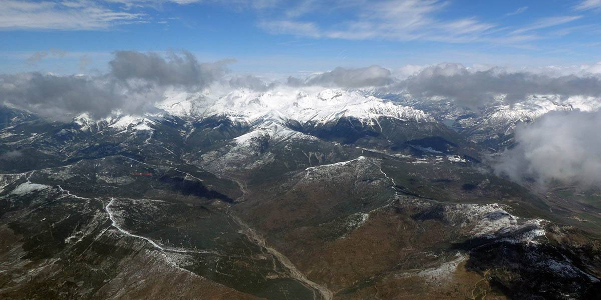
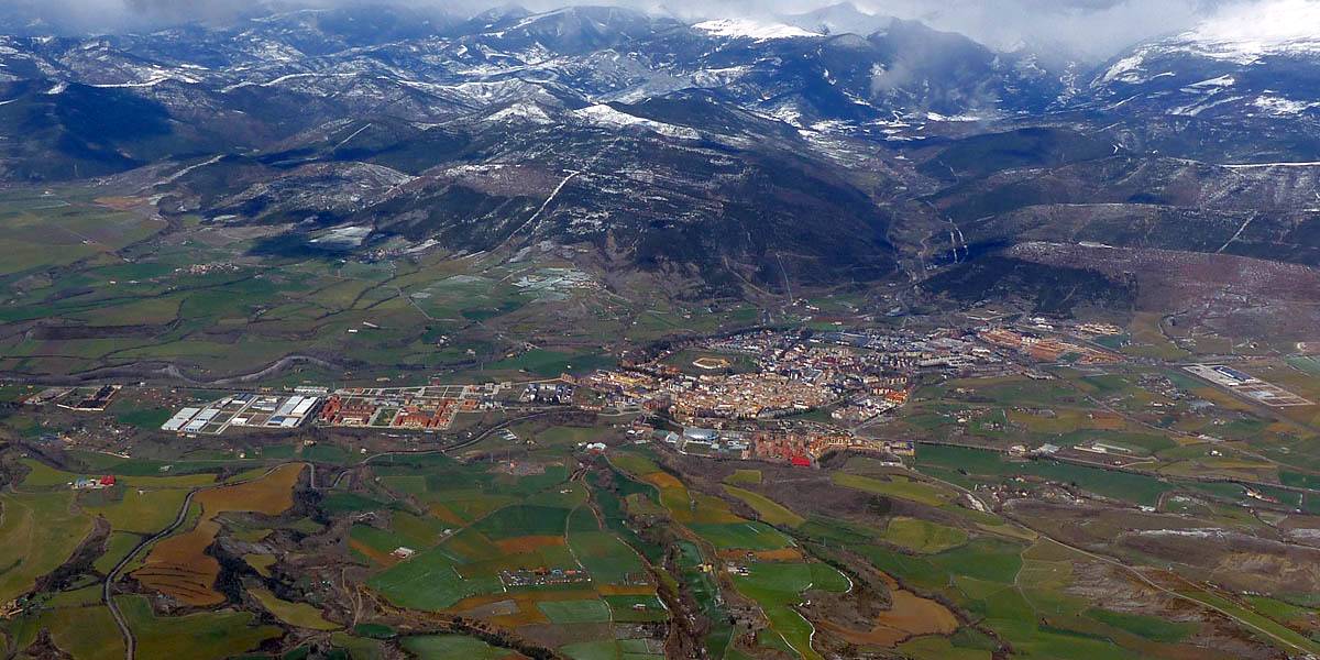
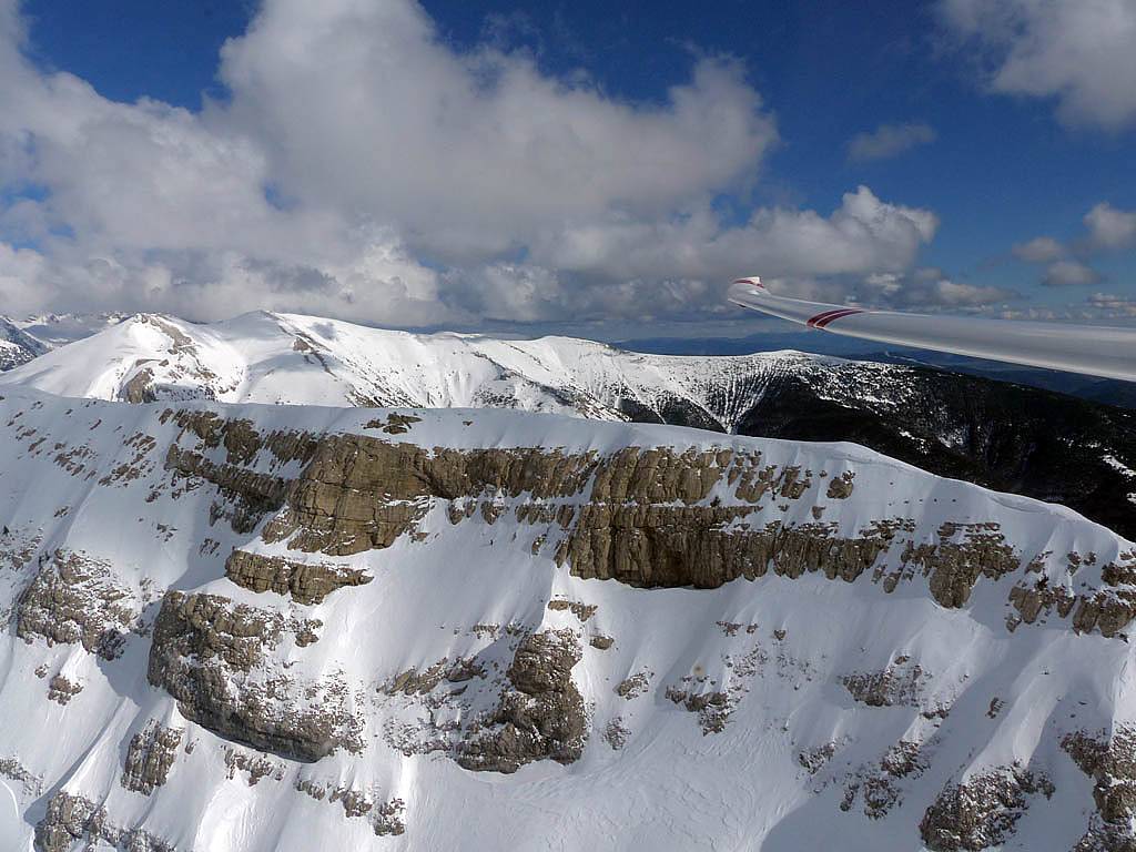
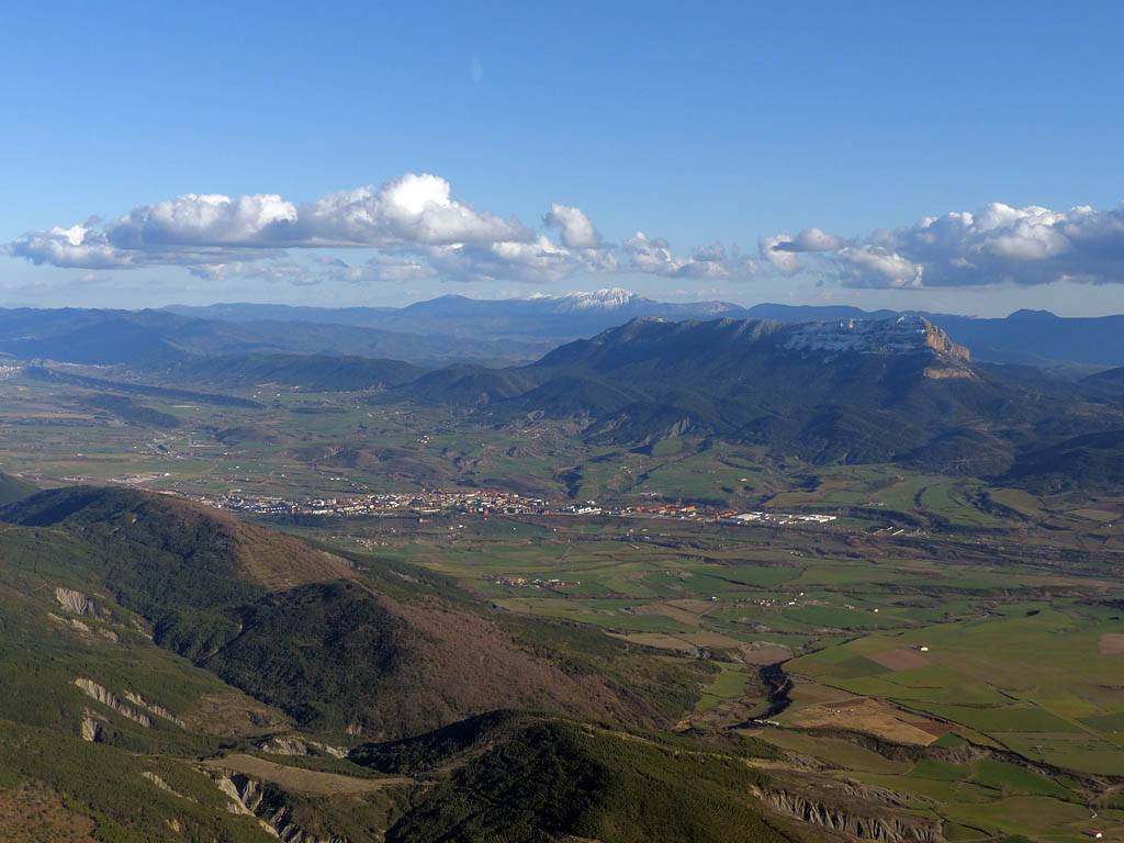
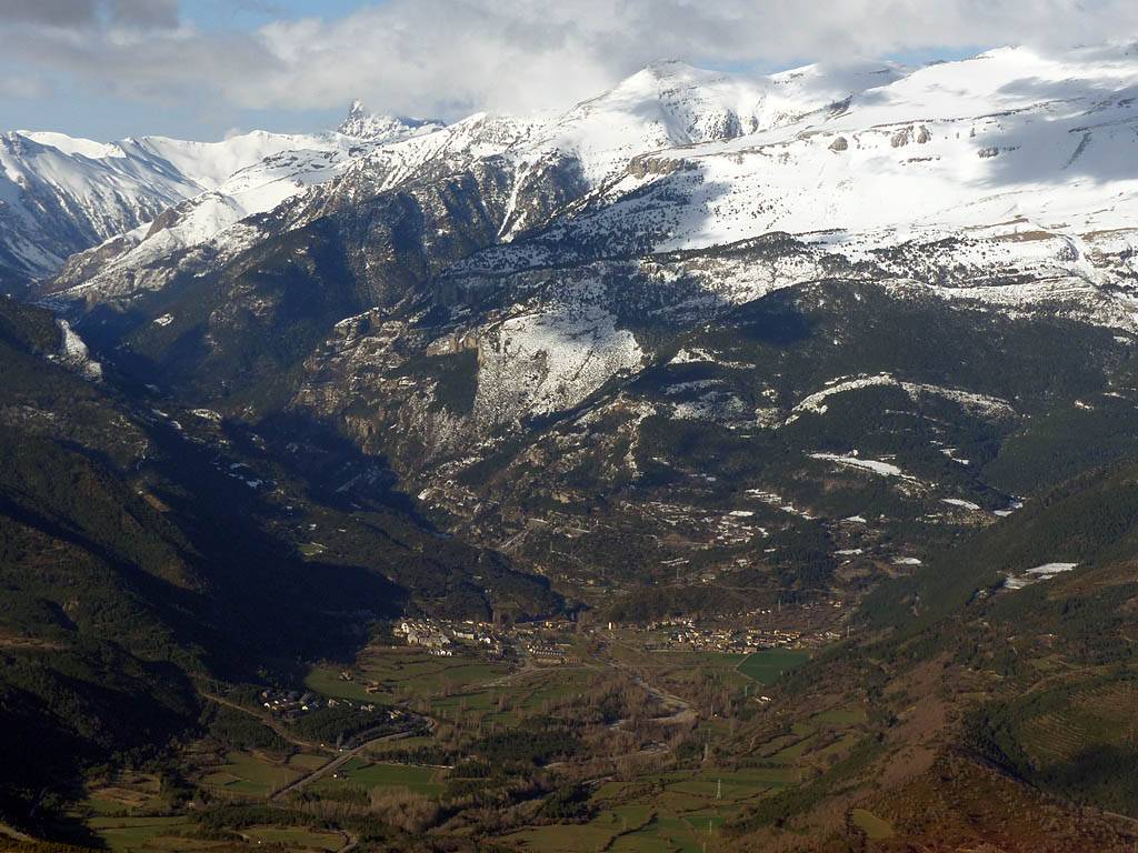
P1010537.jpg |
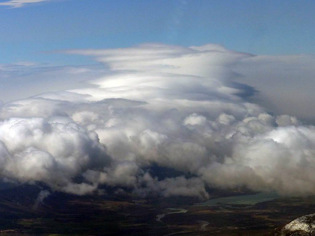
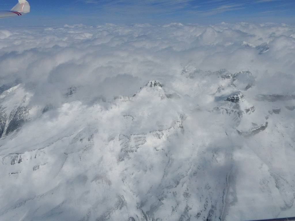
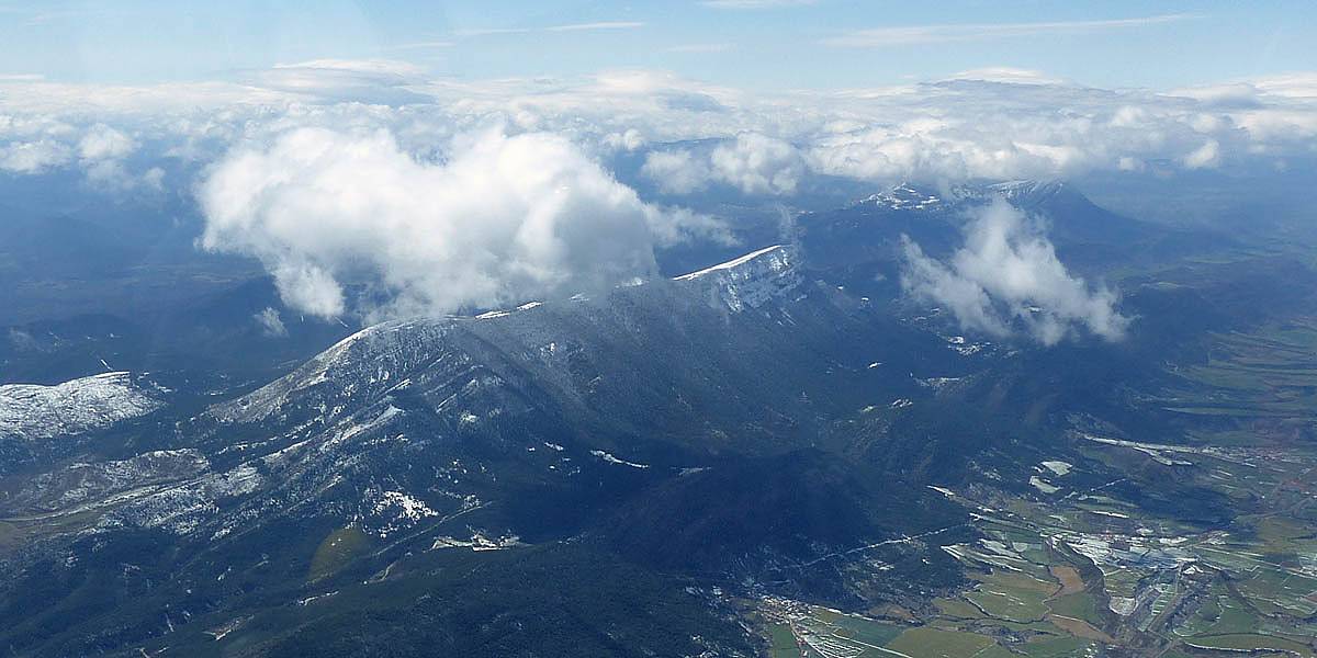
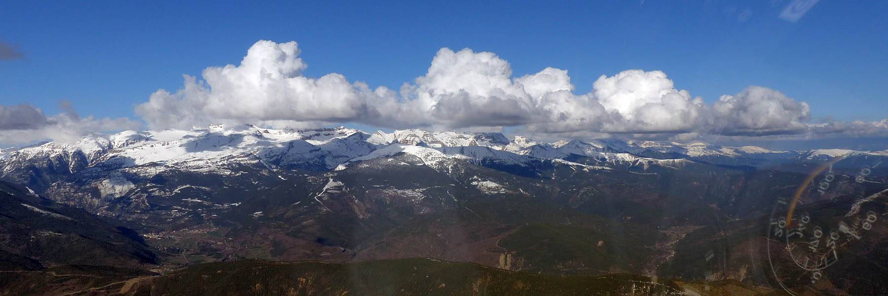
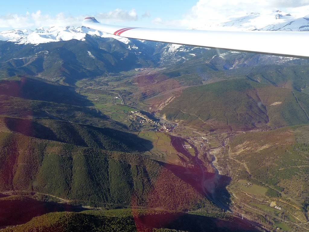
P1010547.jpg |
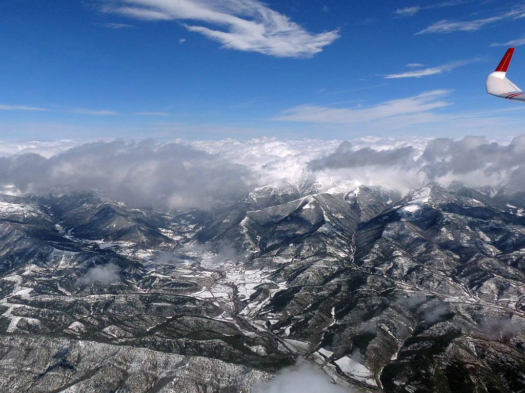
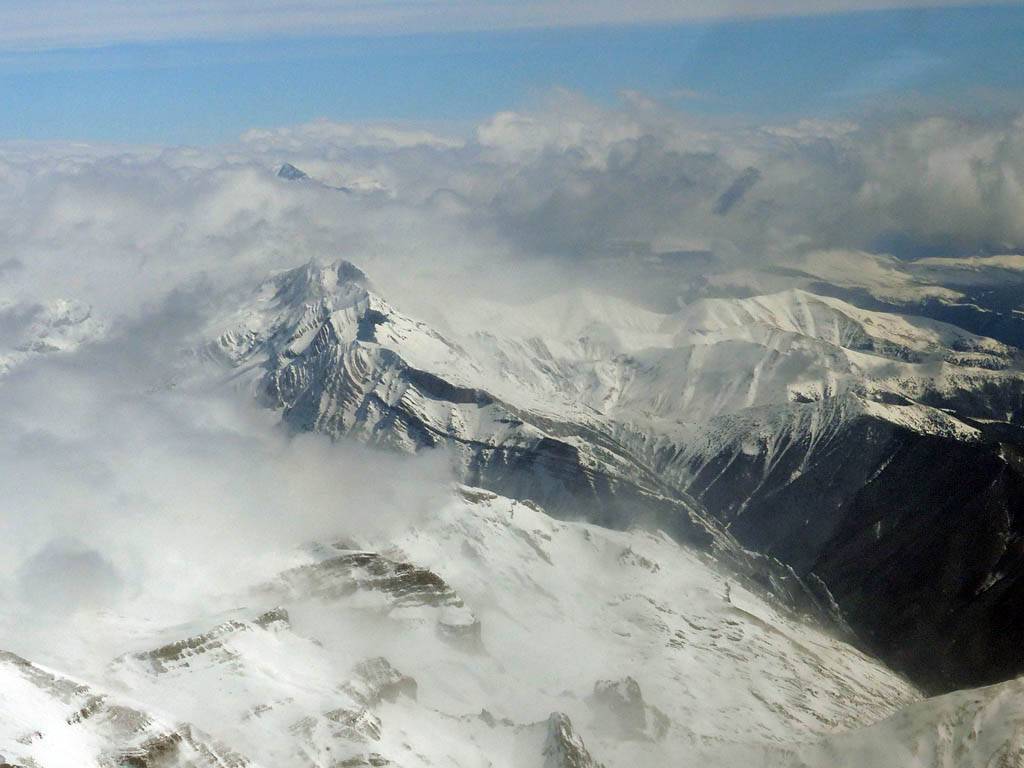
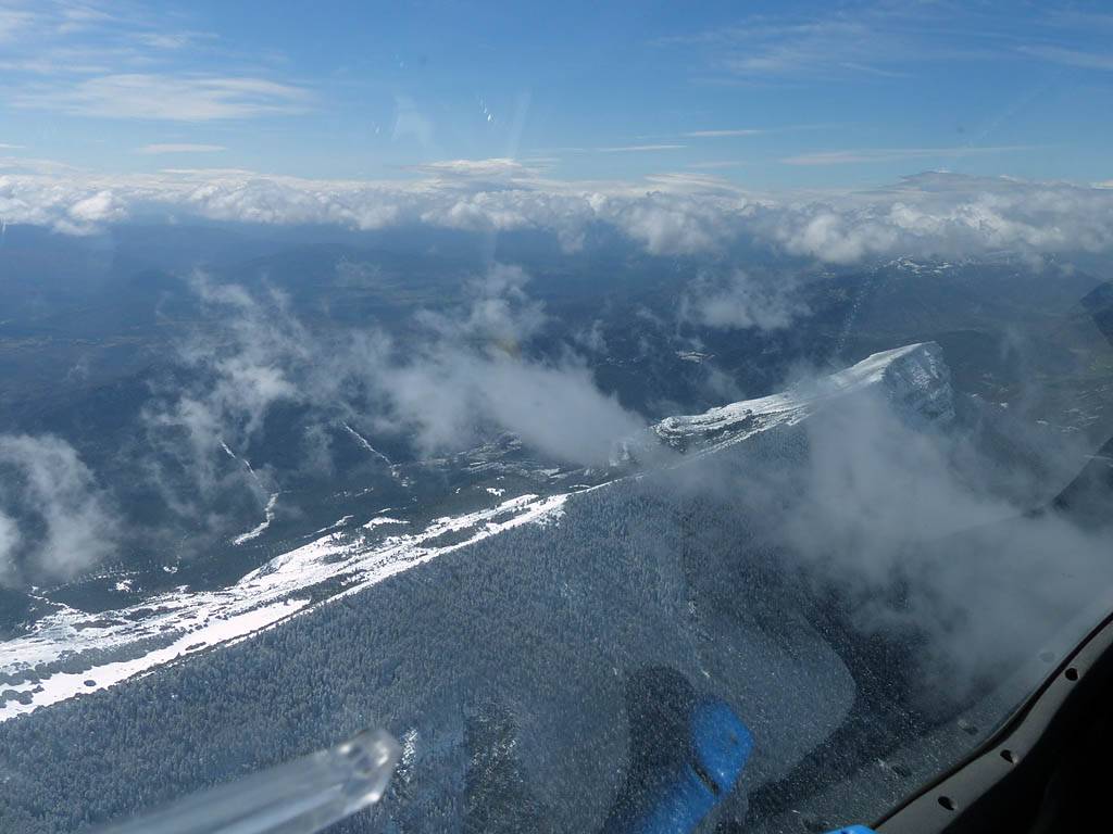
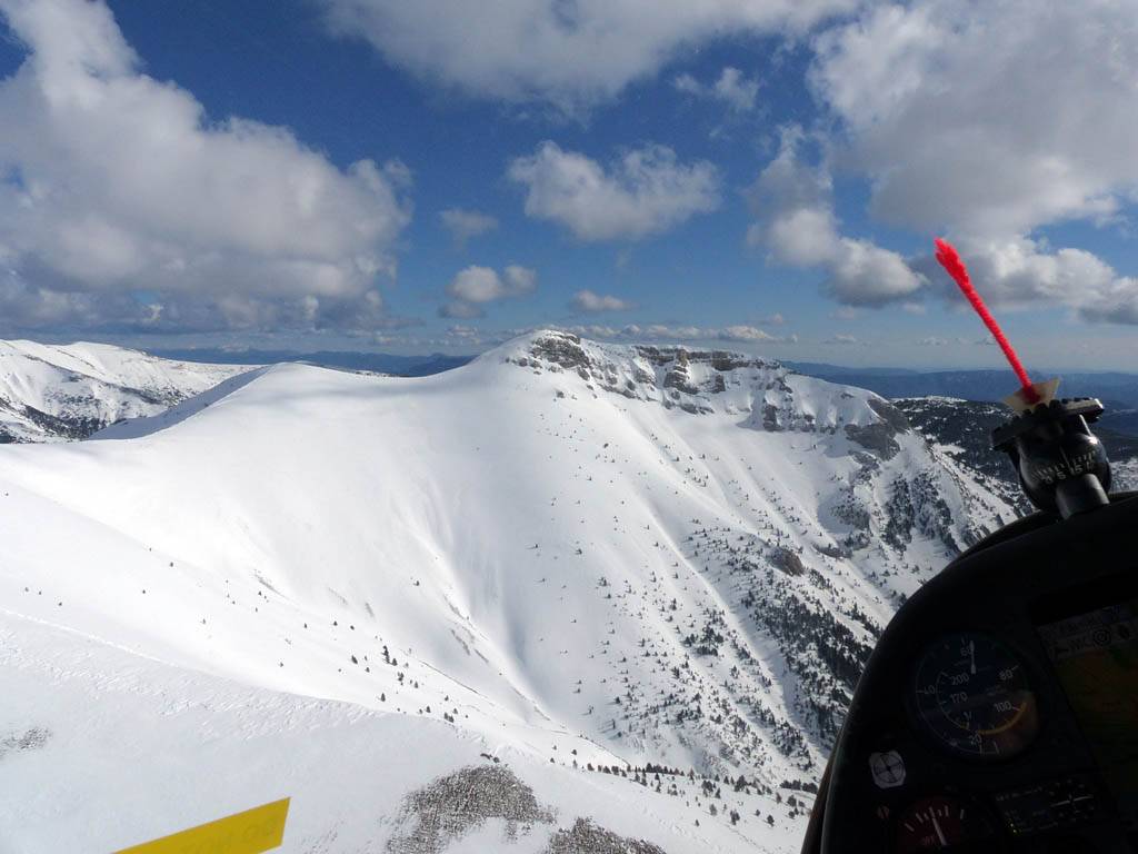
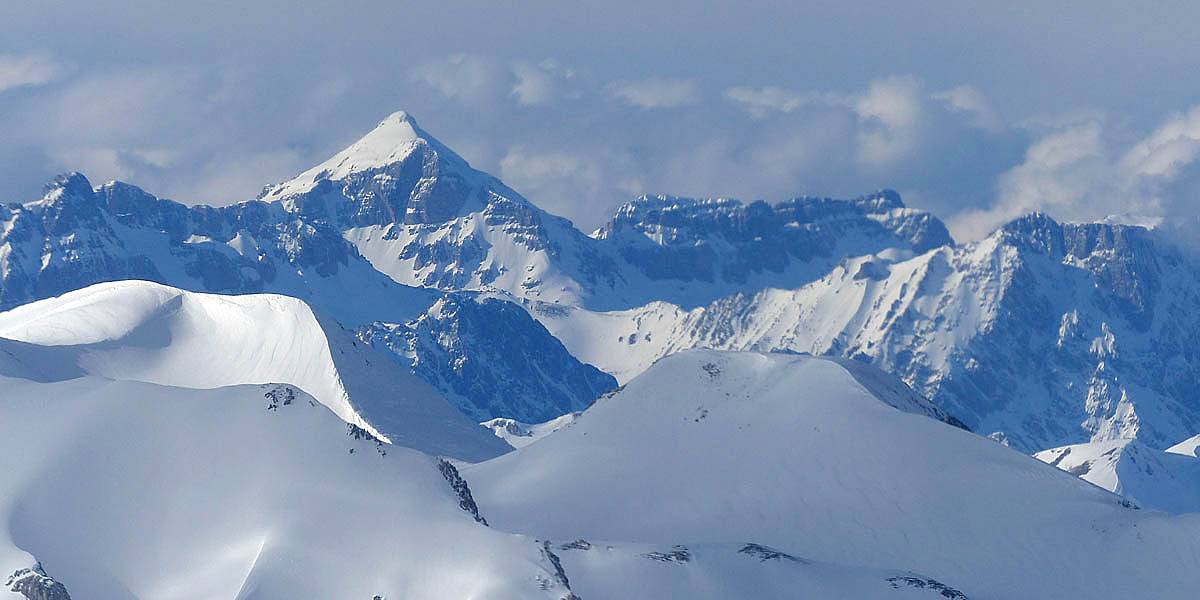
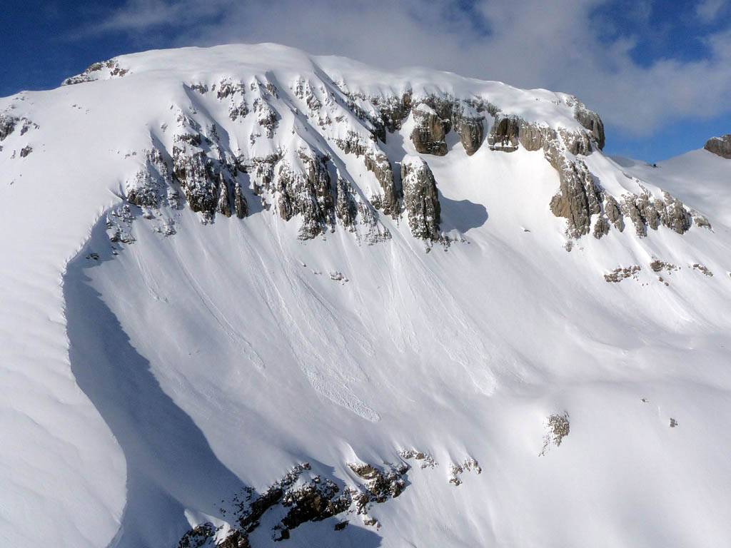
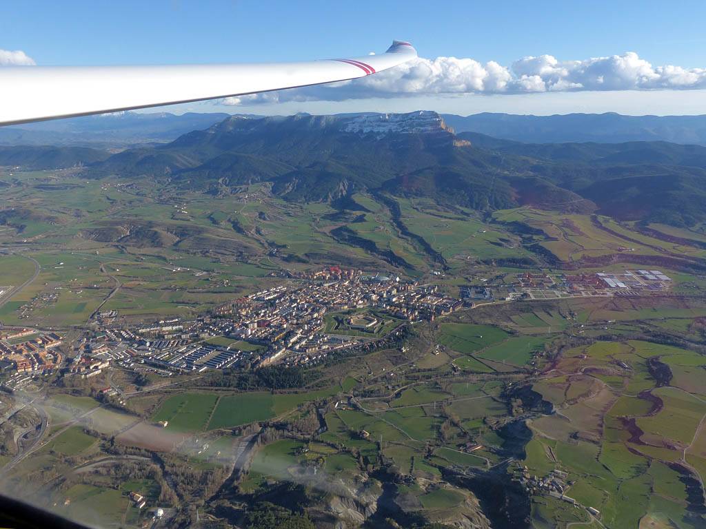
P1010550.jpg |
P1010551.jpg |
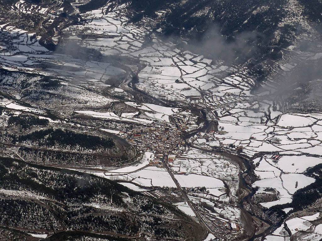
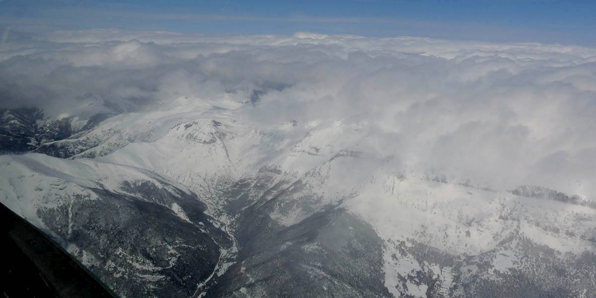
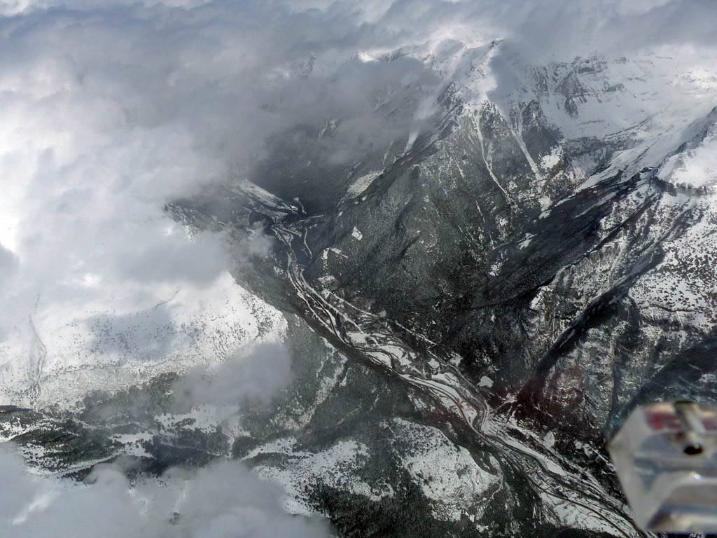
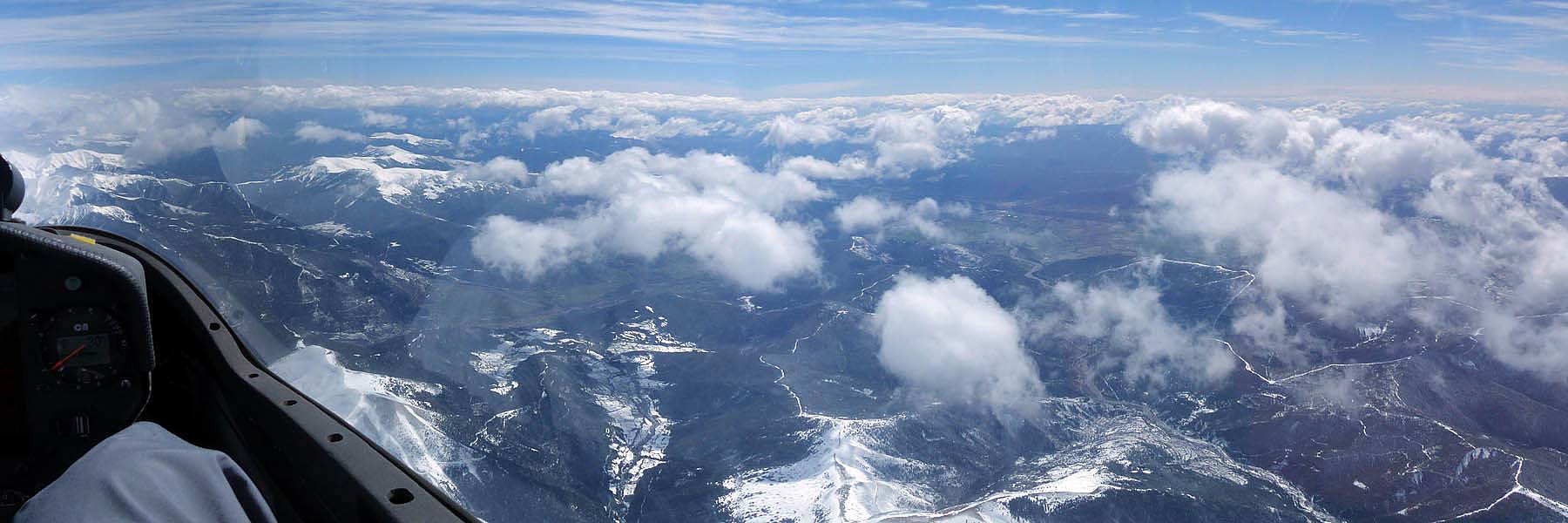
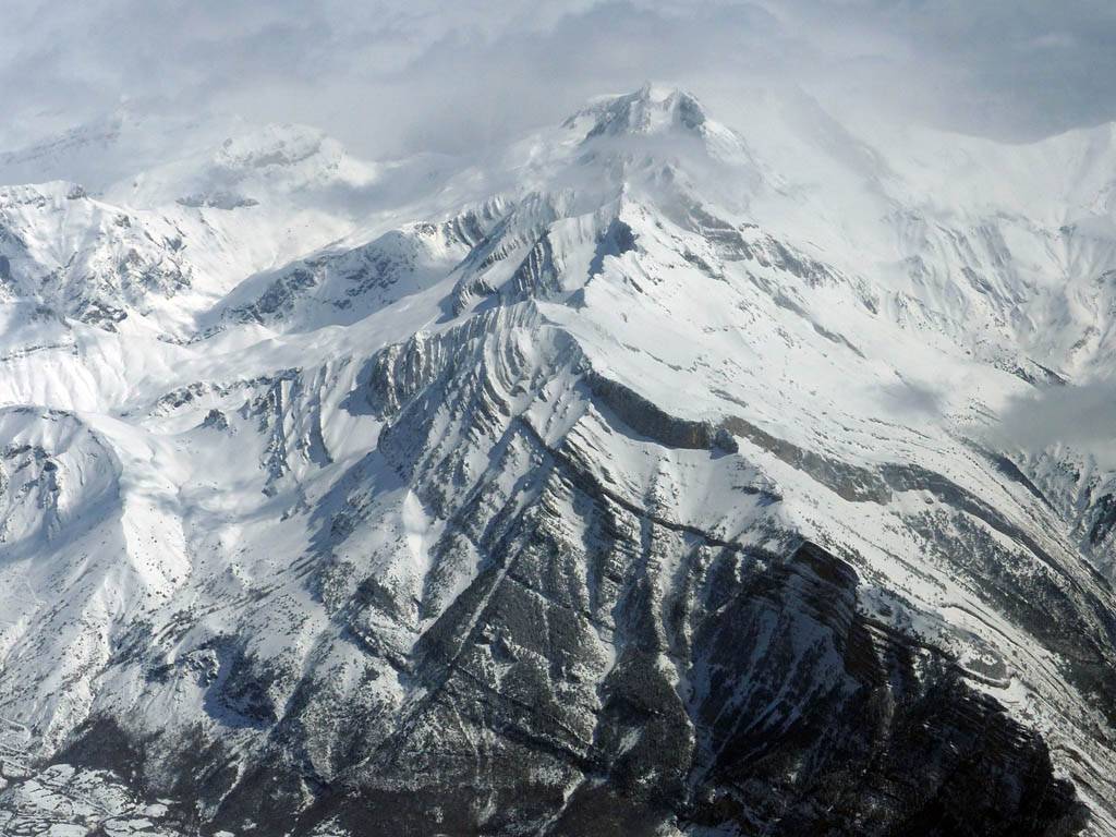
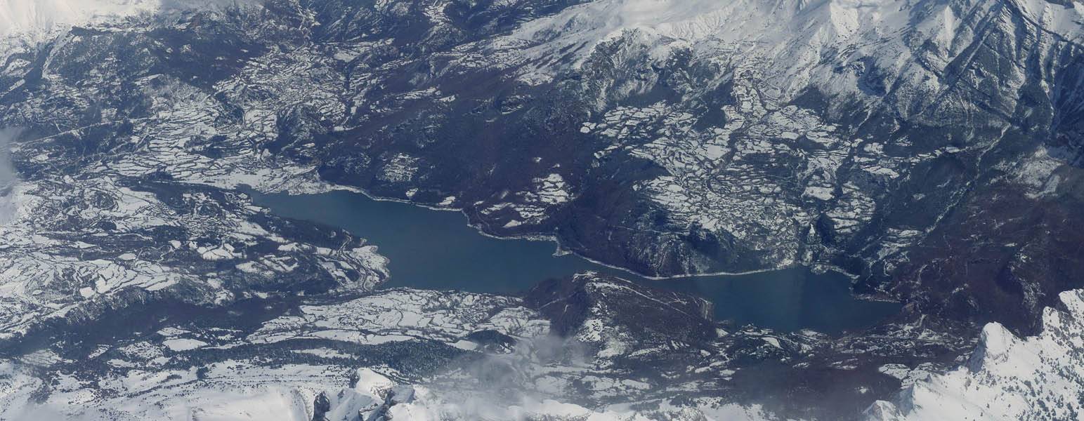
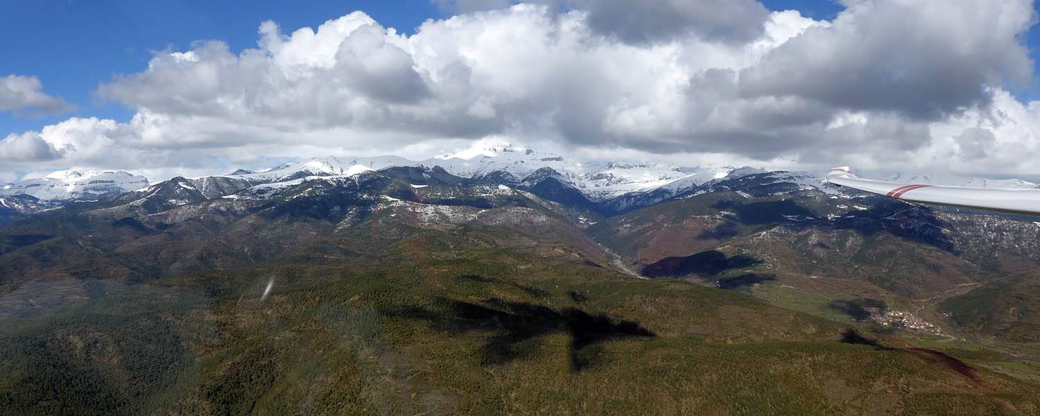
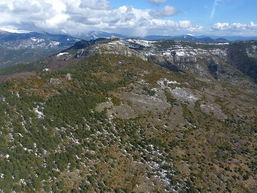
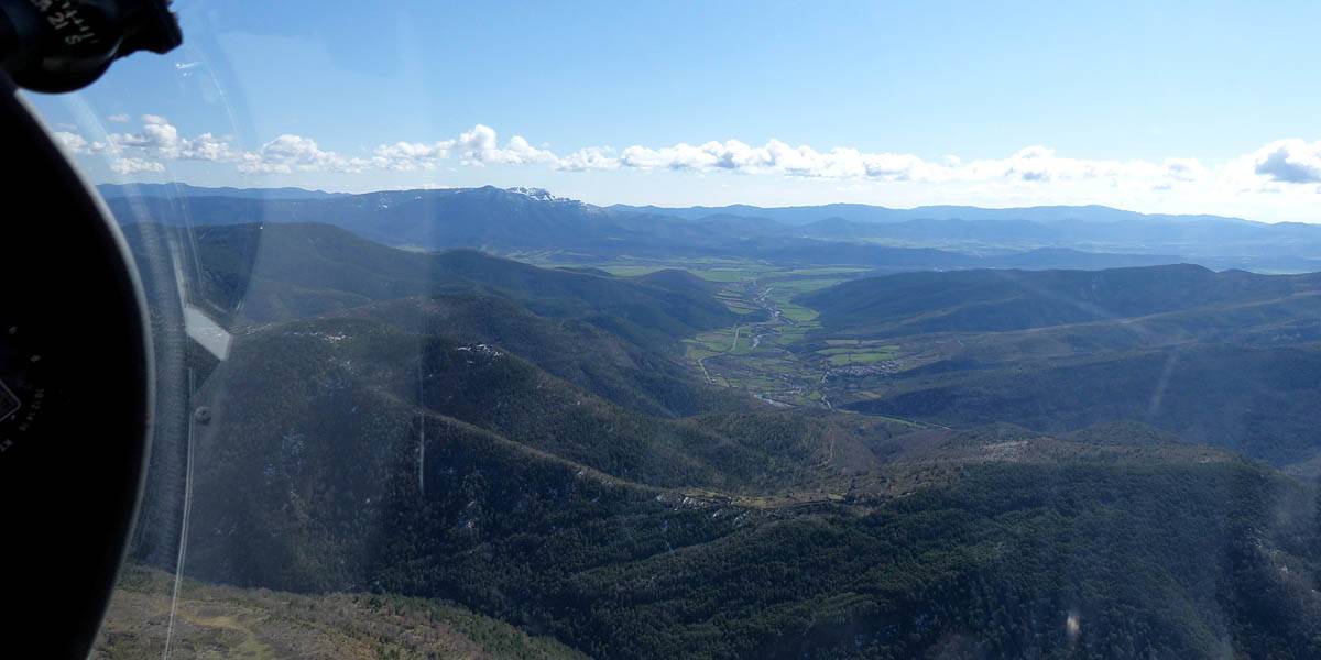
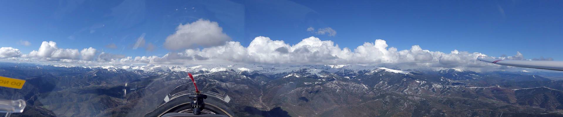
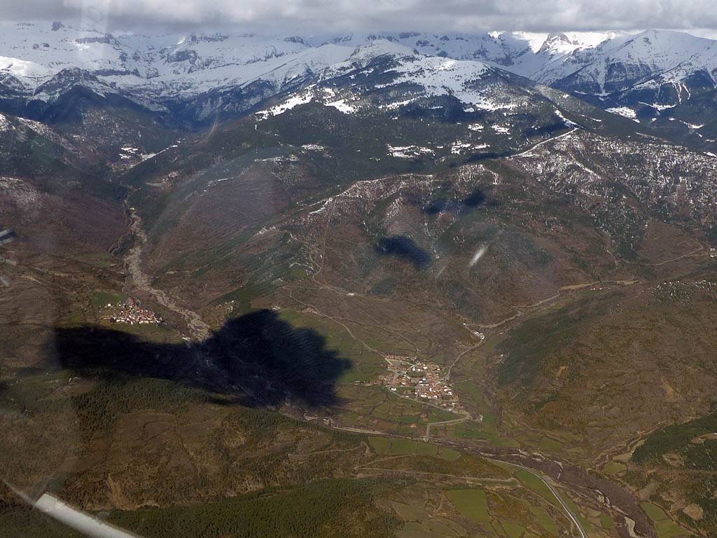
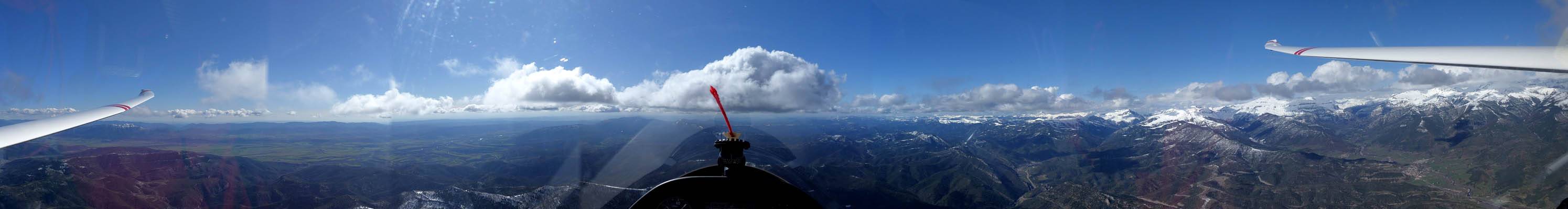
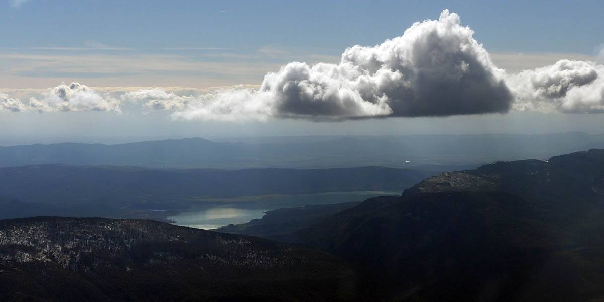
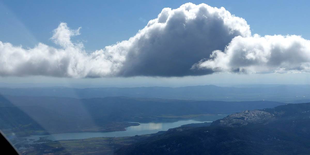
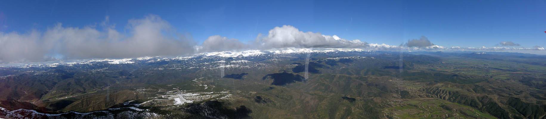
| The first panoramic view somewhere above the Hecho / Anso valley area as wave takes us above 10,000 feet. | The view to Jaca and the mountain Oroel beyond. | Wave bars to the Southwest, Yesa reservoir visible. | Views of a snow covered Hecho valley and Hecho itself. | |
 P1010559.jpg |
 P1010563.jpg |
 P1010563_565_Panorama.jpg |
 P1010577.jpg |
 P1010578.jpg |
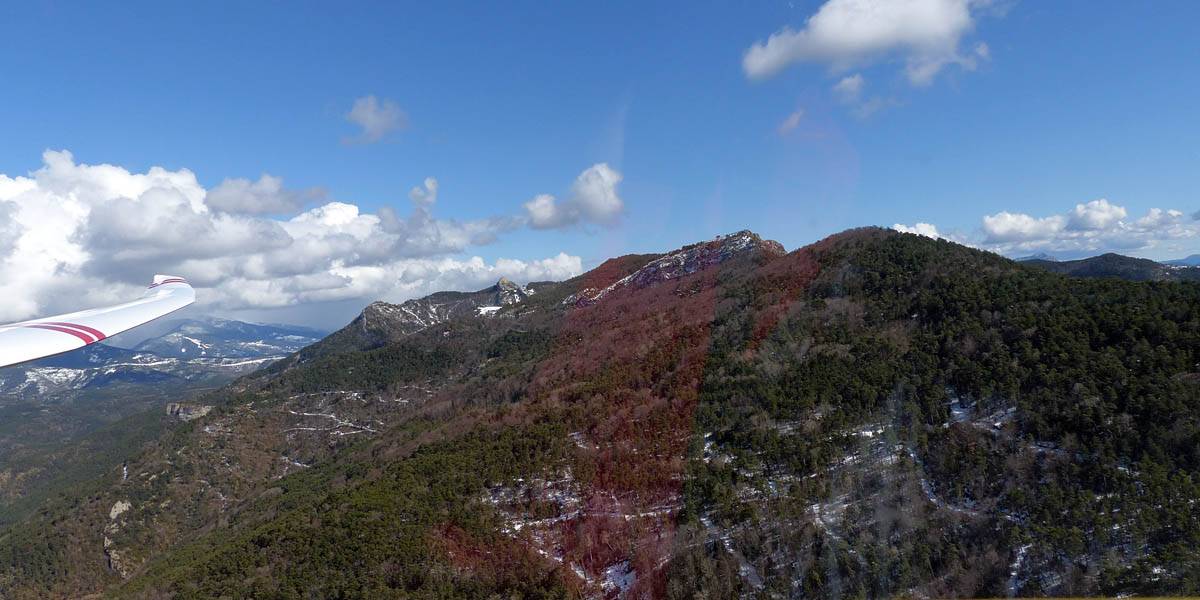
| Looking past (I think) Bisaurin into a cloud covered France. | Looking North into a cloud covered France. | Looking Southeastwards along the main ridge. Cloud cover on the North side. Clearer on the South (Spanish) side. | Other high peaks poking out of the cloud cover as we fly along a wave bar Southeastwards. | |
 P1010579.jpg |
 P1010581.jpg |
 P1010583.jpg |
 P1010591.jpg |
 P1010592_595_Panorama.jpg |
| Looking South from somewhere West of Canfranc. | I think this is Pena Collarada looming up ahead from the Canfranc area | More spectacular views to the South. | Canfranc valley from the Southwest, and the road from Jaca to France.. | 120 degree panorama taken somewhere near Canfranc, nose pointing Southeast. The firebreak on a ridge visible below the wing. |
 P1010597_598_VPanorama.jpg |
 P1010600_602_Panorama.jpg |
 P1010607.jpg |
 P1010613.jpg |
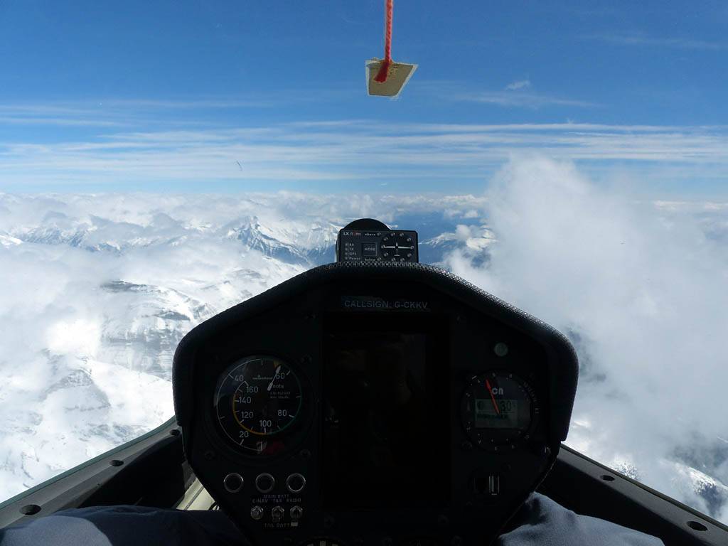 P1010614.jpg |
| Looking South from over Canfranc to Jaca, and Oroel beyond. | The view up Canfranc and surrounding mountains. | Looking ahead towards the Tena valley and Tendenera beyond. | I think this is the top of Pena Collarada shrouded in cloud. | Cockpit view towards the Tena valley and Tendenera |
 P1010616.jpg |
 P1010619_620_Panorama.jpg |
 P1010621.jpg |
 P1010630_631_Panorama.jpg |
| In cockpit shot of me (on oxygen at 13,000 feet) and Bob in the back. | Somewhere near the Tena valley. Over the nose is Tendenera with Ordessa beyond the gullies. To the South is the Jaca valley. The views don't cease to amaze. | A closeup view of the exsquisite rock formation of Tendenera from the West. | Embalse de Bubal, a reservoir in the Tena Valley. |
 P1010634_635_Panorama.jpg |
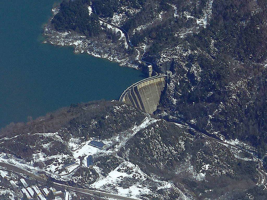 P1010637.jpg |
 P1010649.jpg |
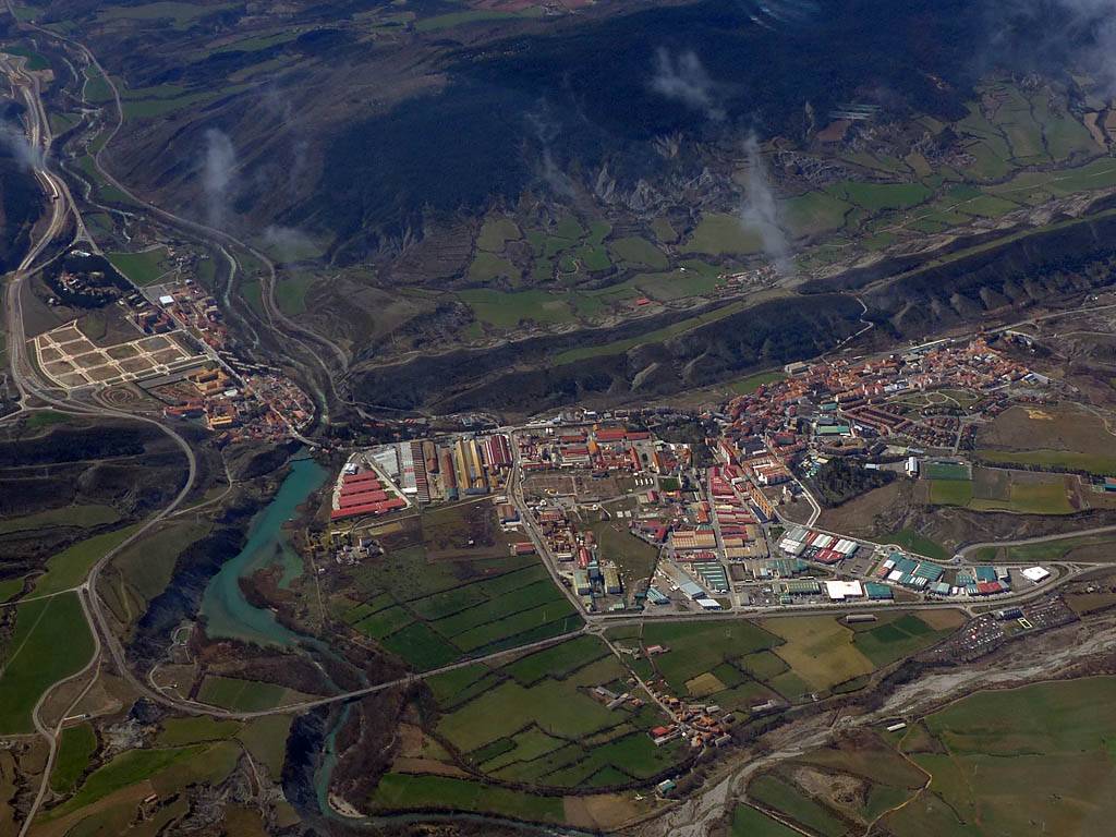 P1010654.jpg |
 P1010661.jpg |
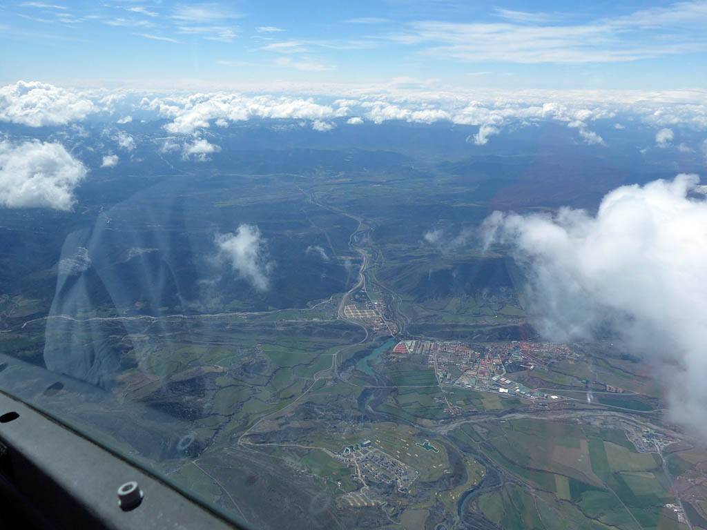
| Another panoramic view Eastwards to Tendenera. | Embalse de Bubal, a reservoir in the Tena Valley. Dam closeup. | Sabinanigo from the North as we exit the mountains down the Tena valley. | Looking West-Northwest along the Jaca valley from Sabinanigo. | |
 P1010670.jpg |
 P1010701.jpg |
 P1010716.jpg |
 P1010721.jpg |
 P1010729.jpg |
|
| Looking back North to Pena Collarada (Embalse de Bubel visible to its right). | Oroel from the Northeast as we head back towards the airfield along the Jaca valley. | Oroel closeups as we fly past still at around 8000 feet. | Jaca from the South. | ||
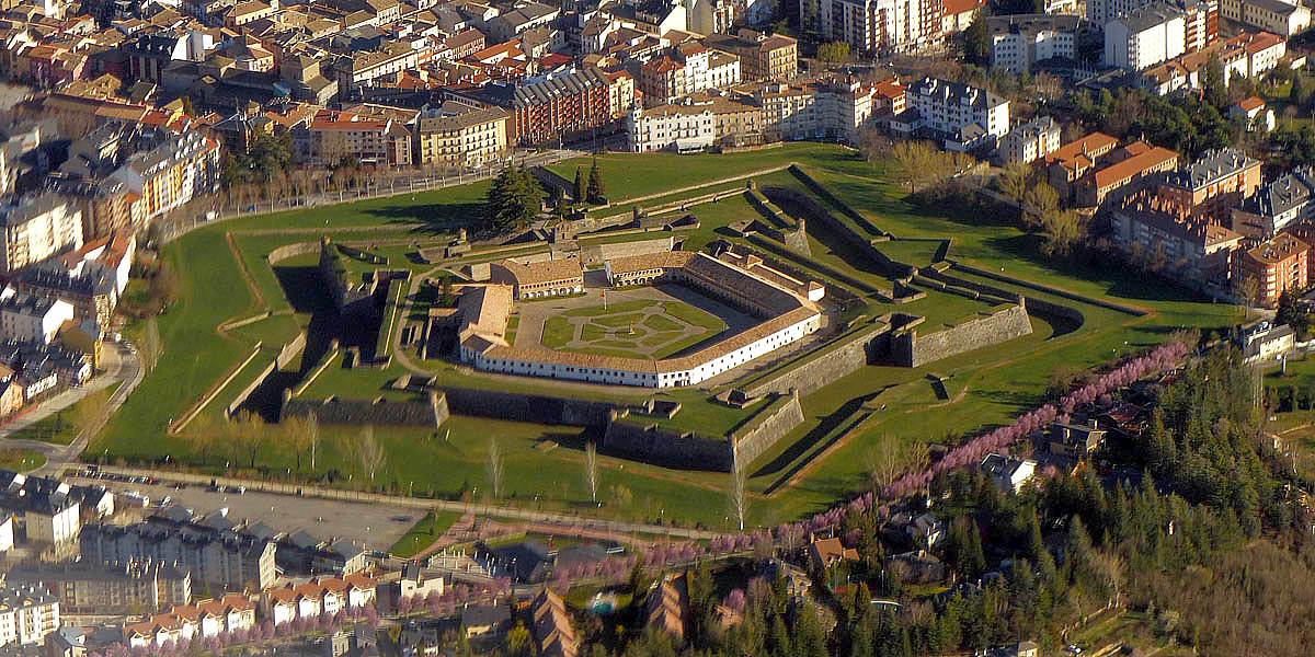
 P1010734.jpg |
 P1010745.jpg |
 P1010751.jpg |
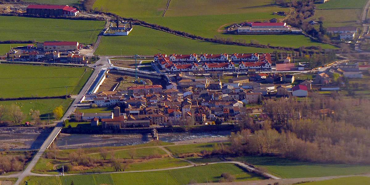
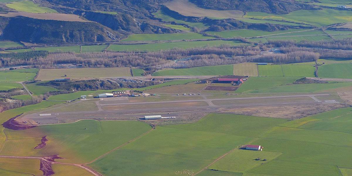
 P1010759.jpg |
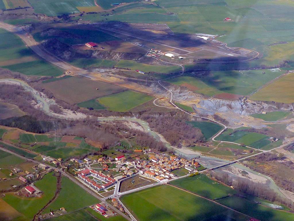
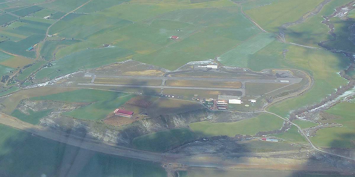
| Jaca fort from the South. | Santa Cruz from the North, on the slopes of Cuculo. | Santa Cilia in the foreground from the Southeast, with the airfield beyond. | Aerodromo de Santa Cilia from the South. |
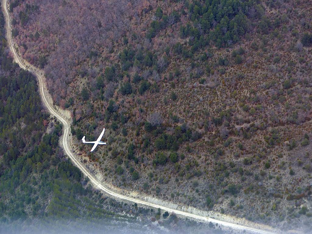
John and I launched about 3:13PM. We towed to stage 2 as stage 1 wasn't working too well as evidenced by the low strugglers. However we struggled for a while too and got below the ridge top where the lammergayer nest was. But John used his local experience to slowly but surely save us and get high enough to pass over the nest safely and to better lift. We had tried pushing towards stage 3 but promptly found heavy sink and retreated around stage 2 to the south slope where the lift saved us. We then had fun along a street westwards towards Yesa reservoir, getting up to 7000 feet. Further along though cloudbase was lower and the street ended. After looking at the view of the reservoir we returned along the street and carried on to the stage 3 peaks. Cloudbase was at first too low to safely reach the mountain tops but then cloudbase rose as the air dried out and we made it to the high mountain tops in the end. The views were stunning! We spent a fair while floating around up there, ridge soaring the ridge between the Aragues and Aisa valleys, and then below Bisaurin as we got to the highest peaks. I took so many pictures as John flew close to the ridges. We could see over into France and the view was improving all the time as the clouds got shallower. I also tried a couple of video clips. We had also been told not to rush down as there was nobody else to fly afterwards. So after more time up there during which John let me have a go soaring the mountain tops we eventually followed the firebreak ridge down towards Jaca and slowly lost height, flying over the home hill from the East on the way down. We landed at about 5:50PM. I did muck up the landing slightly but a small input from John ensured we still stopped short at the gravel beyond the hangar. We were up for 2 and 36 minutes.
 P1010870_871_Panorama.jpg |
 P1010873.jpg |
 P1010878.jpg |
 P1010880.jpg |
| Looking towards the mountains just after releasing from tow near stage 2. | Getting rather low at stage 2. Those slopes soon to save us with weak lift. | The escape route down the slopes of the Hecho valley back to the airfield if we don't get away. | |
 P1010882_886_Panorama.jpg |
 P1010887.jpg |
 P1010890_896_Panorama.jpg |
| Panorama as we head towards stage 3 after getting away from a low save at stage 2. | A view of the Aragu�s valley with Aragu�s Del Puerto and Jasa visible. | West facing 180 degree panorama taken somewhere South of Aragu�s Del Puerto and Jasa (visible under the starboard wing). |
 P1010904.jpg |
 P1010913.jpg |
 P1010916_920_Panorama.jpg |
 P1010921.jpg |
| Lovely views of the Yesa Reservoir to the Southwest after following a cloud street in it's direction. | The cloud street that took us from stage 2 towards Yesa. You can see a lower ridge highlighted by thin snow that helped trigger it. | ||
 P1010924.jpg |
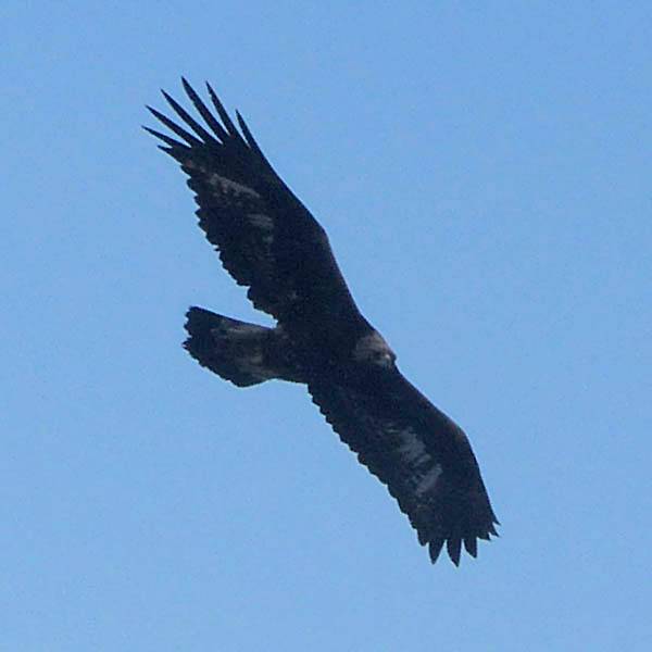 P1010929.jpg |
 P1010930_932_Panorama.jpg |
 P1010933_935_Panorama.jpg |
 P1010940.jpg |
| John and I having fun. | Sharing a thermal with a vulture. | Heading towards the high peaks after returning back along the Yesa cloud street. | Another view of Oroel. Much less snow on it than yesterday! | |
 P1010942.jpg |
 P1010949_951_Panorama.jpg |
 P1010954.jpg |
 P1010967.jpg |
| Heading for the higher mountains as cloudbase rises past 8000 feet. | Spectacular views close to the ground above 7000 feet. | ||
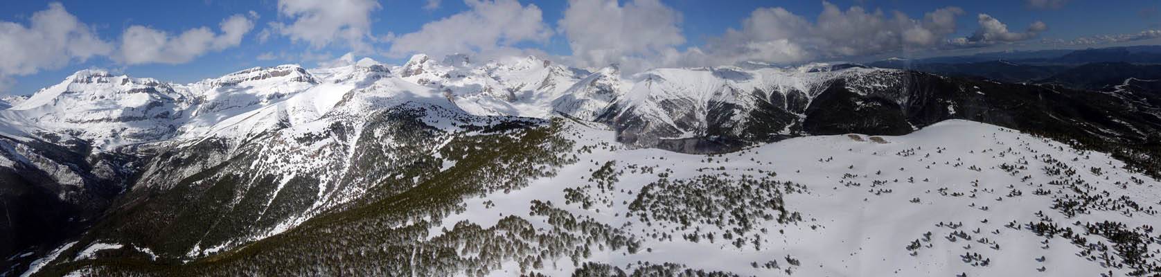 P1010971_975_Panorama.jpg |
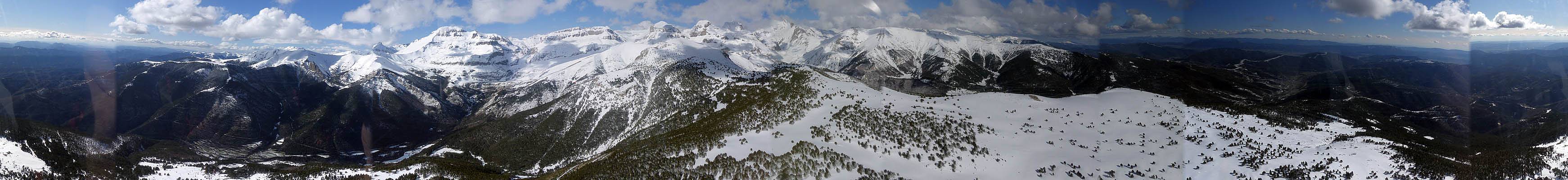 P1010982_990_360Panorama.jpg |
 P1020004_005_Panorama.jpg |
| 180 degree panorama from the high peaks between the Hecho and Canfranc valleys, to the Jaca valley below. | An attempt at a 360 degree panorama in the same place approaching stage 3. | Looking up to the high peaks just East of Bisaurin. |
 P1020011.jpg |
 P1020022.jpg |
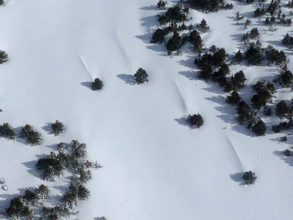 P1020032.jpg |
 P1020046.jpg |
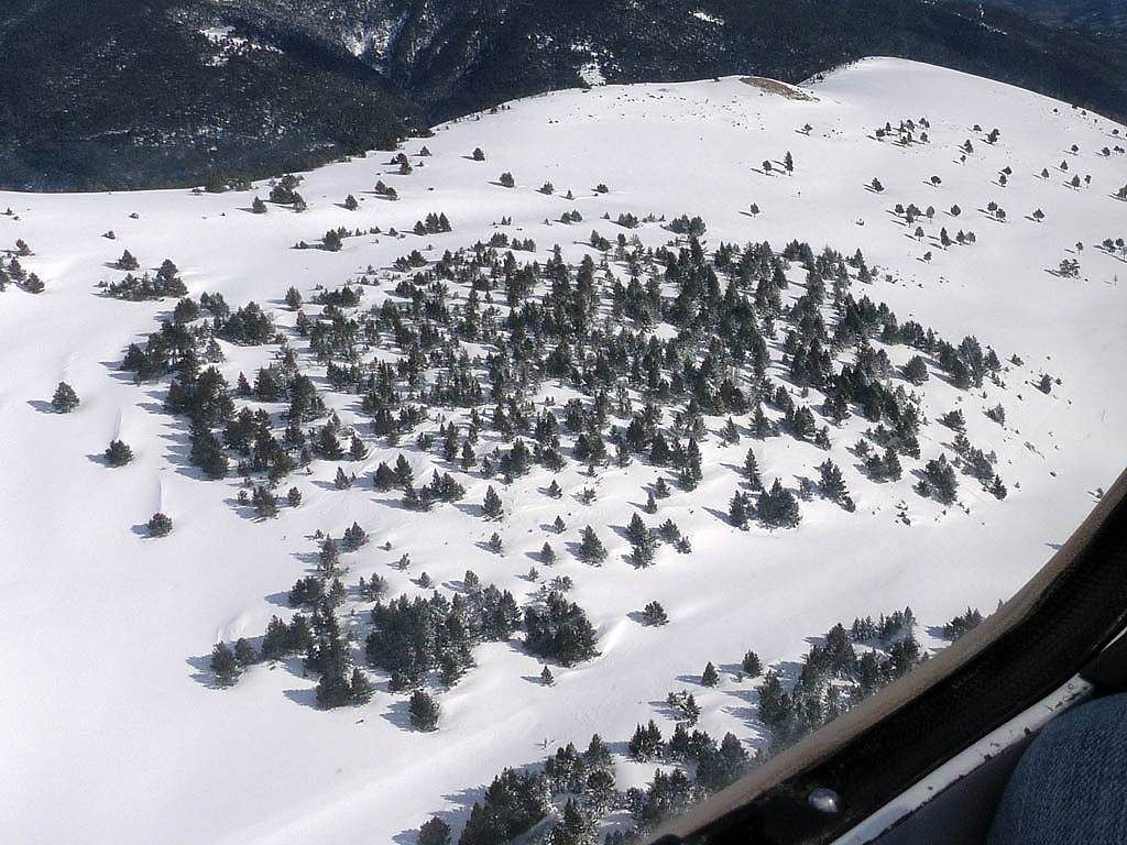
| Looking around as we ridge soar the top end of the ridge above the Aragues valley. | Below us on the ridge snow has been sculpted by hardy trees into drifts. | Bisaurin! We are now up to 8000 feet. Cloudbase rising to 8500 feet and cloud amounts reducing. | |
 P1020104.jpg |
 P1020108.jpg |
 P1020115.jpg |
 P1020127.jpg |
| We are now high enough to see over the Bisaurin ridge into France (the border just down the other side of the peaks). We ridge soar the Bisaurin high ridge towards 8500 feet. Ossau and other French peaks visible in the distance. | |||
 P1020131.jpg |
 P1020133.jpg |
Video clips taken at the mountain tops: Clip 1 Clip 2 |
| A closeup look at the Southern side of Bisaurin. Avalanches evident on its flank. | ||
 P1020140.jpg |
 P1020146.jpg |
 P1020150.jpg |
 P1020153.jpg |
 P1020158.jpg |
| Looking down to Jaca and Oroel as we head back down along the ridge between the Asia and Canfranc valleys (the Firebreak ridge). | Looking back is a spectacular view of the high peaks as we retreat to the Jaca valley. | Canfranc. | Looking up the Canfranc valley where Canfranc Estacion where the roads North from Jaca tunnels under or crosses over the mountain pass into France. | |
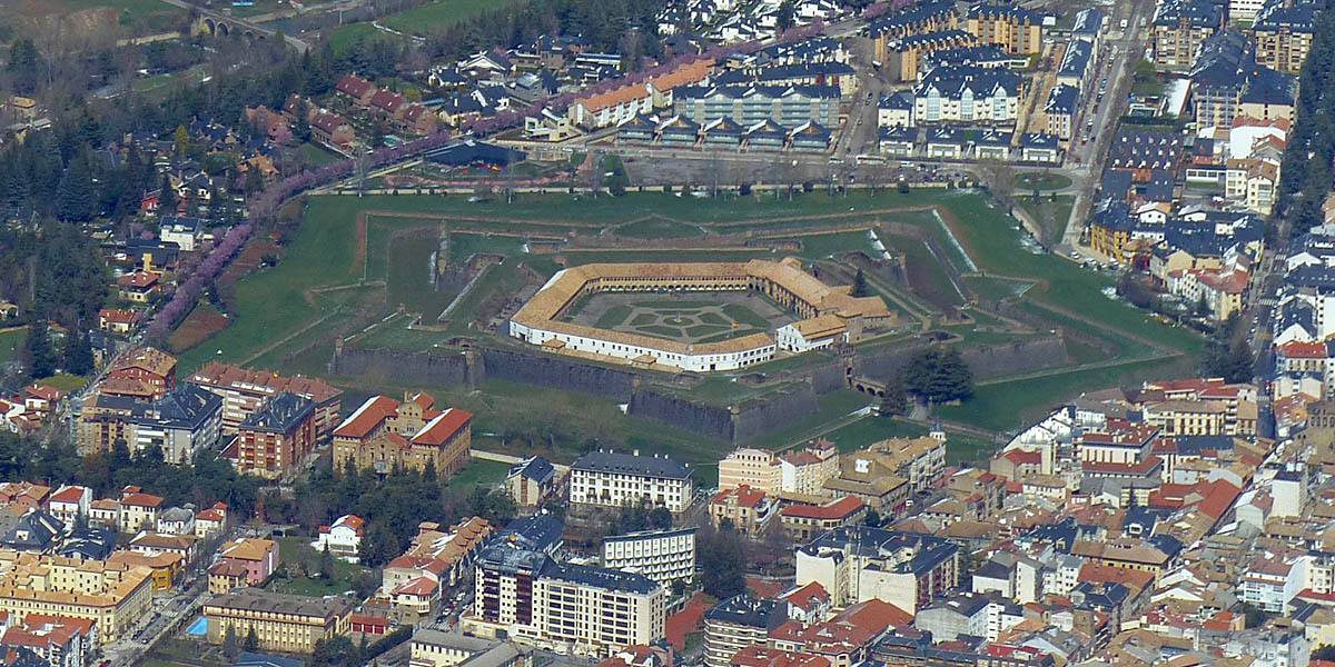
 P1020159.jpg |
 P1020160.jpg |
 P1020167.jpg |
 P1020169.jpg |
 P1020170.jpg |
| Jaca and its star shaped fort from the Northern side. | Santa Cilia and Aerodromo Santa Cilia from the North. | Cuculo towering above Santa Cilia. | ||
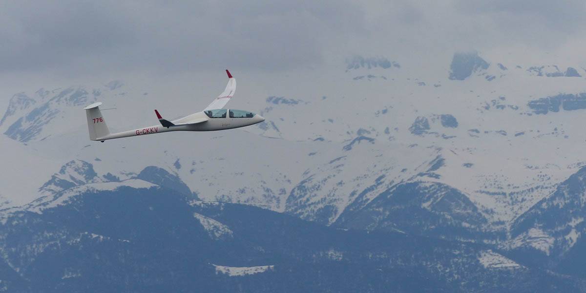
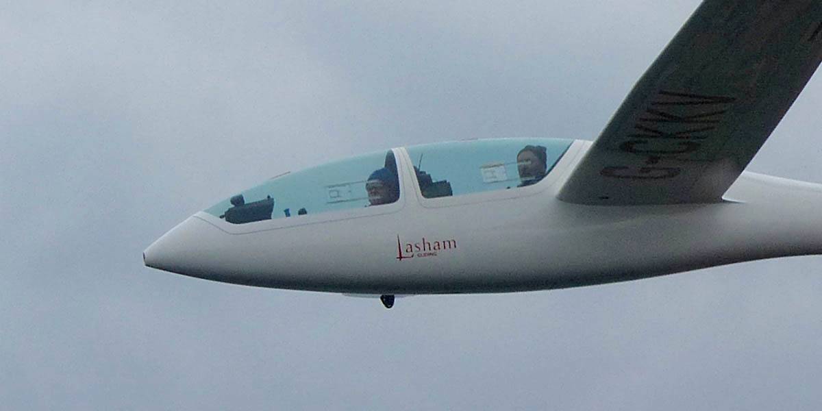
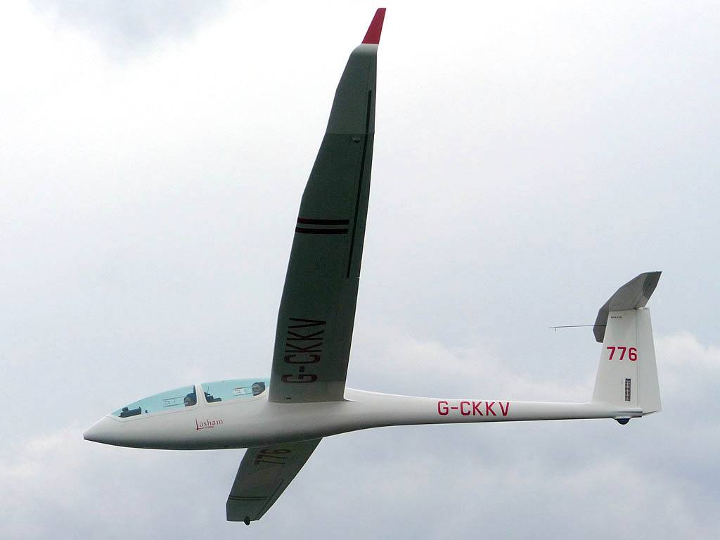
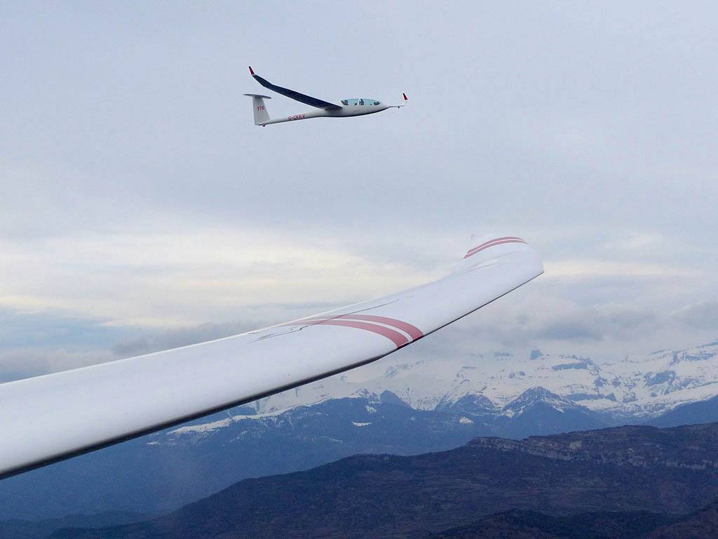
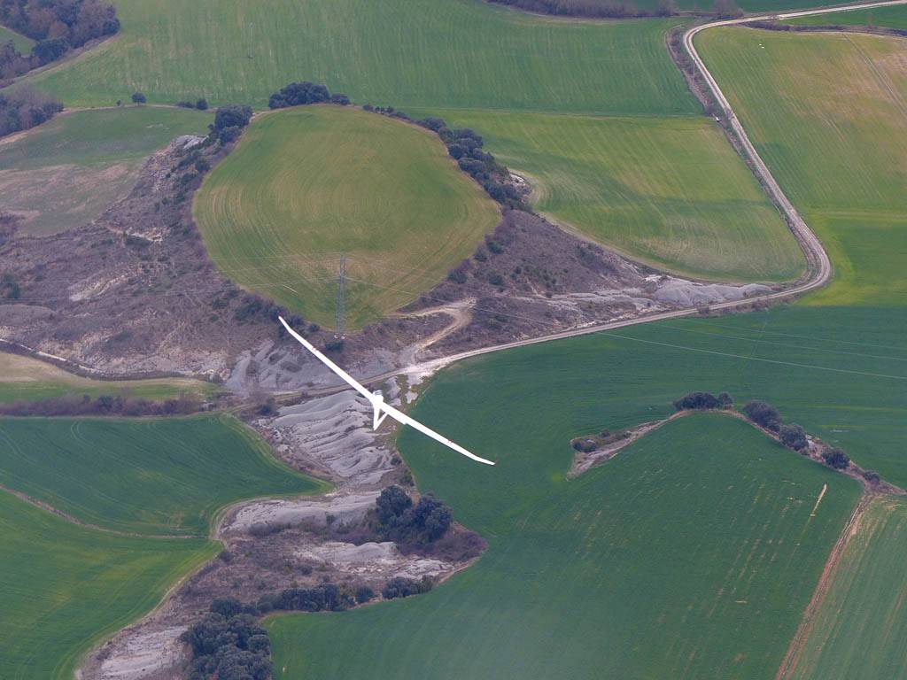
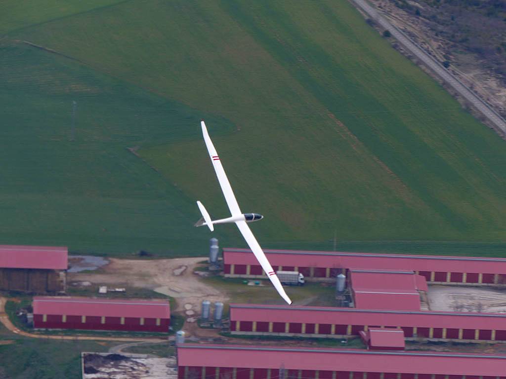
John ans I launched at 4:40PM in 775. Thick top cover was present but still a street of thermals persisted from the southeast. We scratched our way up in weak lift and pushed upwind, maxing out at almost 6000 feet (still well below cloudbase which was 8000 or 9000 feet) somewhere Southwest of Oroel. The thermals then started to decay and so we pushed back downwind past the airfield to the hills on the west side of the Hecho valley. There we surfed the ridges for a bit and found bubbles of strong lift coming out of bowls pointed into wind. 776 with Bob and Mike Truelove joined us and after some more bowl bashing Bob called for a photo op. I got my camera out as we flew side by side and I took some pictures. Then we went in to land. 776 went first (as Mike T was bursting for a pee) followed by us. We landed at 6:15PM after 1 hour 35 minutes in the air.
 P1020279.jpg |
 P1020297.jpg |
 P1020298.jpg |
 P1020299.jpg |
 P1020323.jpg |
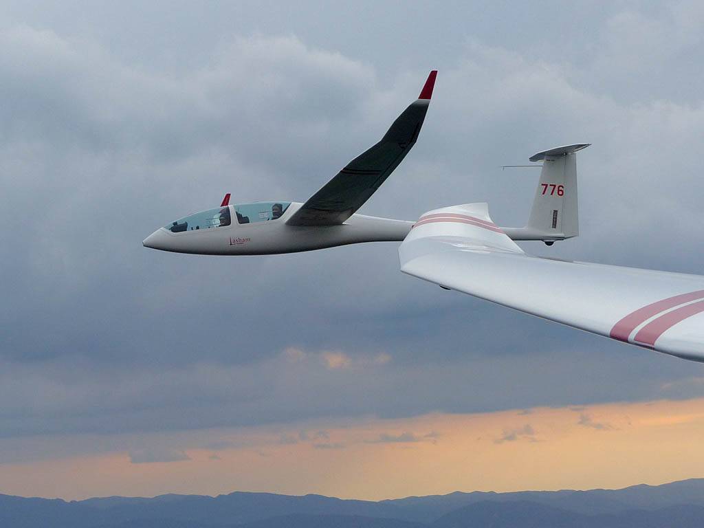
| Flying along with 776 near the mouth of the Hecho Valley, Northwest of the airfield. John Simmonds in 775 flying while I took pictures, Bob Johnson and Mike Truelove in 776. | ||||
 P1020334.jpg |
 P1020339.jpg |
 P1020341.jpg |
| 776 returning to the airfield while we held back for a bit to land a short while later once the runway was clear. | ||
Please click here for pictures taken on Sunday to Tuesday (113).
Please click here for pictures taken from the ground on Wednesday and Thursday (54).
Please click here for pictures taken on Friday to Sunday (87).