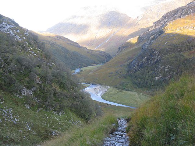
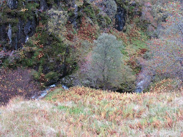
img_2668.jpg
img_2670_2673_panorama.jpg
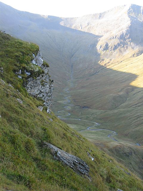
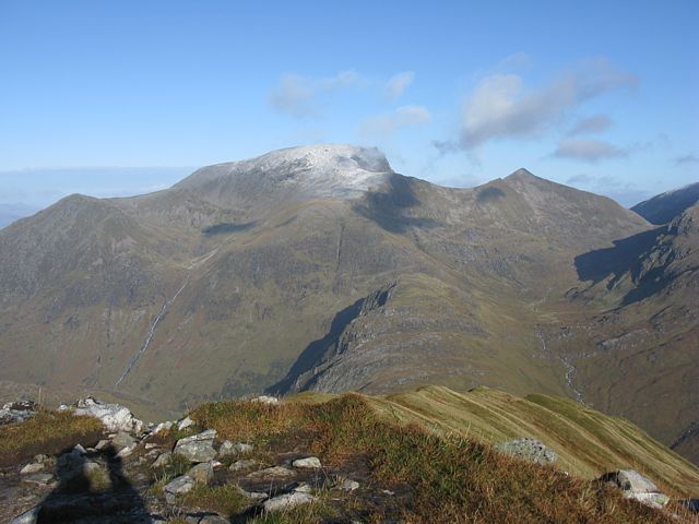
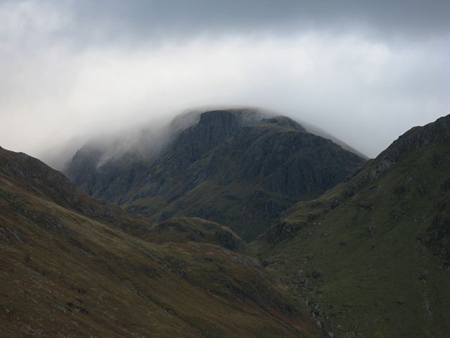
img_2674.jpg
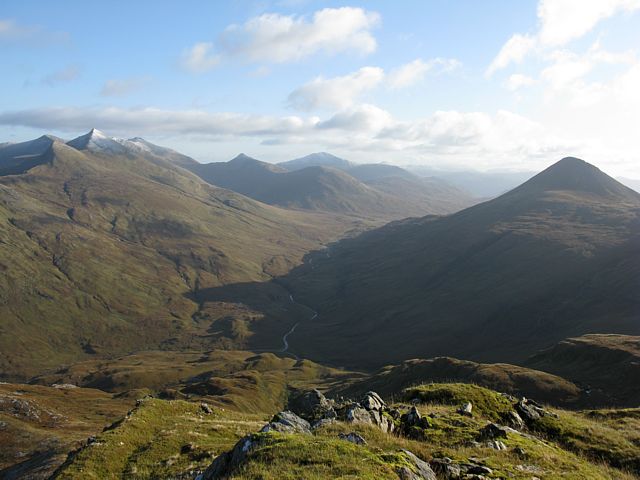
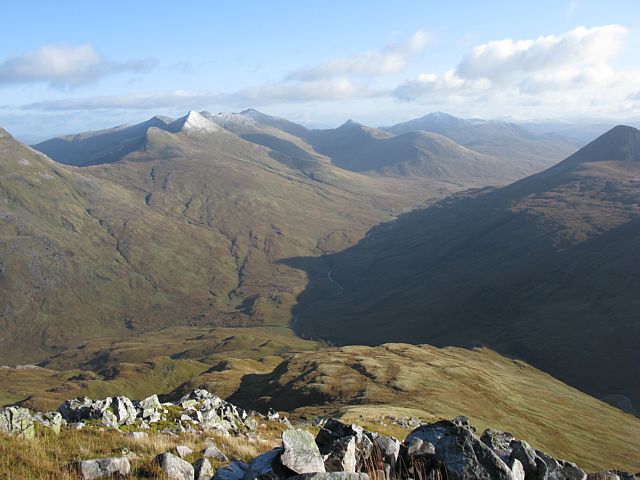
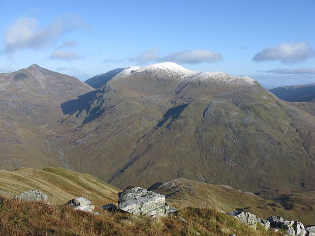
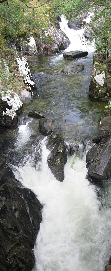
img_2675.jpg
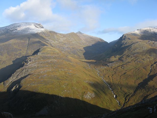
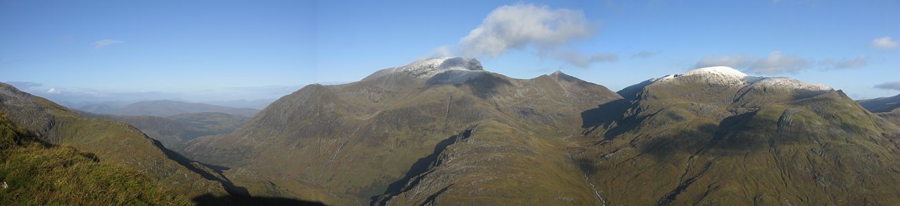
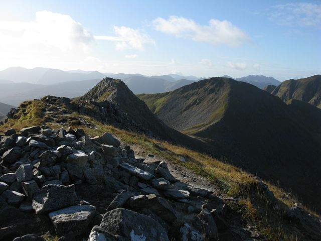
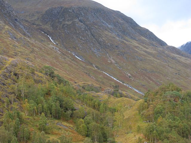
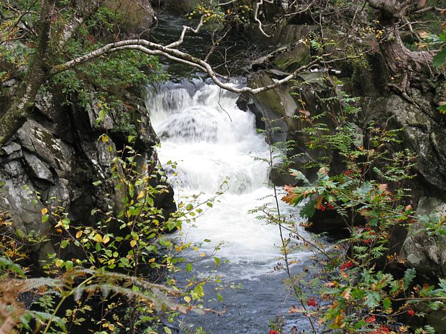
img_2676.jpg
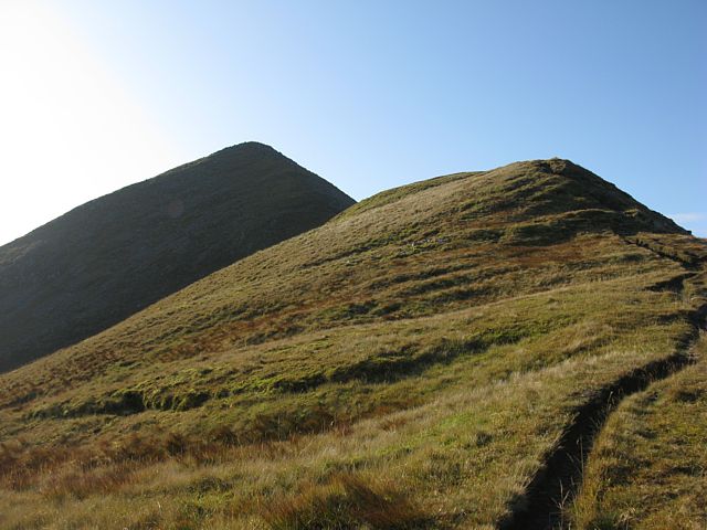
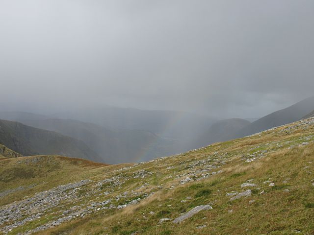
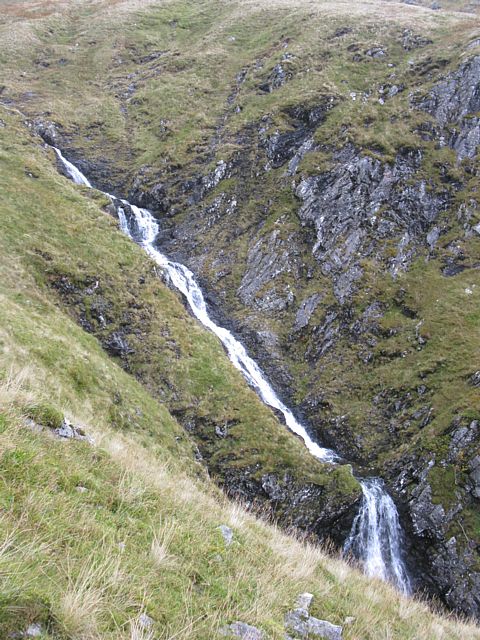
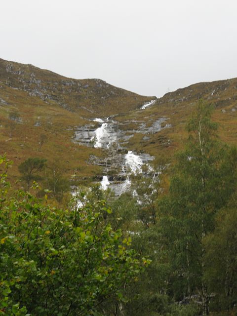
img_2677.jpg
Click here to return to the main Pictures index.
Click here to return to the main 2009 General Piccies Page.
Click here to go to Scotland 2009 Page 2.
Click here to go to Scotland 2009 Page 3.
Click here to go to the Aboyne 2009 page.
I returned to Aboyne in October 2009. Like in 2007 I decided to make a holiday of it. I left after work on 1st October, stayed in Carlisle, and then over to Fort William via Oban on the 2nd. On Saturday 3rd a storm blew through but I still managed to do a very soggy 7 mile walk in the hills above Kinlochleven. Then on Sunday 4th it was calm and sunny. I attempted the Ring of Steall walk and although I didn't quite complete it I did walk atleast 10 miles and had a great, albeit exhausting, day. On Monday 5th I transferred to Aviemore and walked to the summit of Cairngorm while it had a snow cap. Good view from the top. On Tuesday 6th I went to Glenmore and walked to Ryvoan Bothy and then back via the summit of Meall a' Bhuchaille. Then after a rest back at Aviemore I explored Craigellachie nature reserve and ended up walking up to a lookout point above Aviemore. After all that walking I was fairly wasted, so on Wednesday 7th I took the steam train to Boat of Garten and then walked the 5 miles back to Aviemore. Then I rested for the rest of the day. Then Thursday 8th was transfer day to Ballater. I made a driving trip out of it, exploring as far as Braemar and Linn of Dee before an early finish at Ballater. On Friday 9th I did a 7 mile walk above Ballater in windy and damp conditions. Then on Saturday 10th I transferred to Deeside Gliding Club.
On Sunday 11th I did have a good wave flight to 20,000 feet. But on Monday 12th it was calm and I had an awesome walk up to the summit of Lochnagar. Tuesday 13th was damp and unfliable. 14th was also not soarable but the gliders did fly. Thursday started off damp and low cloud, but a gap opened up mid afternoon and I soared to 7000 feet before the gaps in the cloud closed on me. I did managed to descend through a closing hole though and land safely before rain arrived. Then Friday 16th I flew a single seater. I fell down onto a ridge at 1500 feet before thermalling up and connecting with wave and peaking at 19,500 feet. Very satisfying that was. I came down mid afternoon as the clouds reduced as high pressure dug in. Pressure was almost 1040Mb today so FL195 was higher than usual too. Then on Saturday 17th I started my journey home.
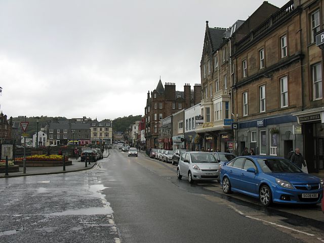
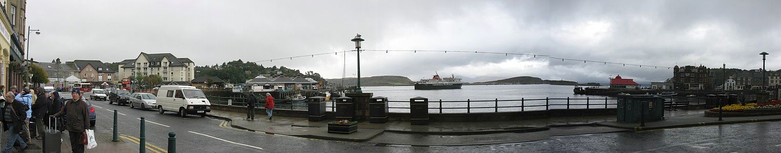
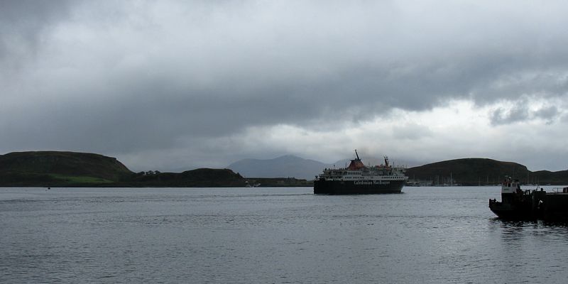
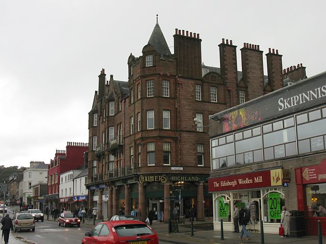
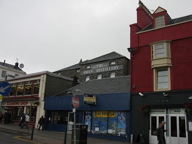
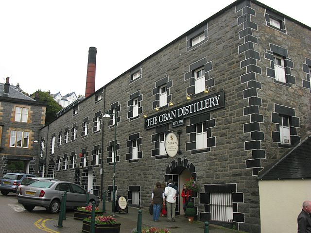
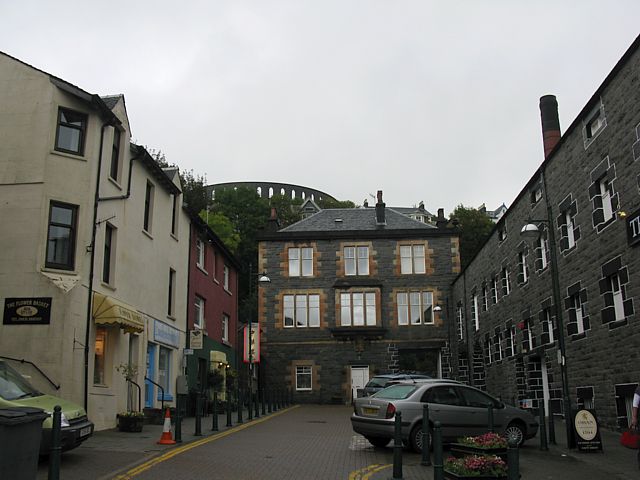
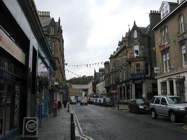
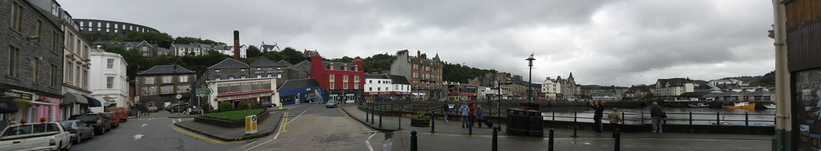
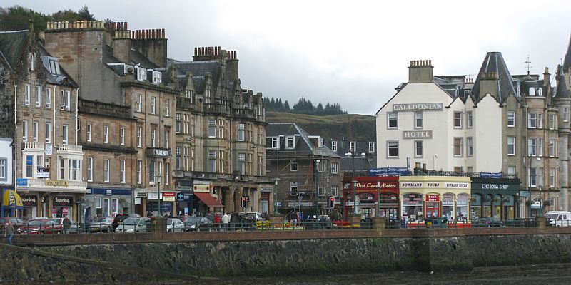
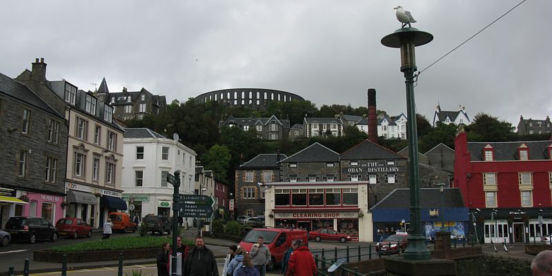
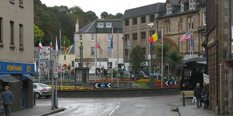
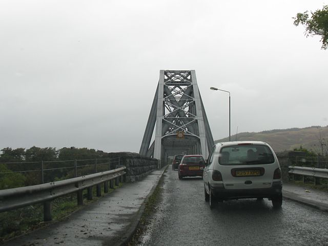
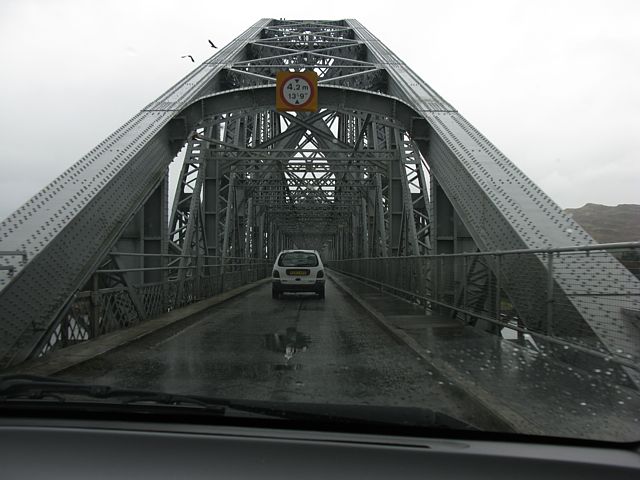
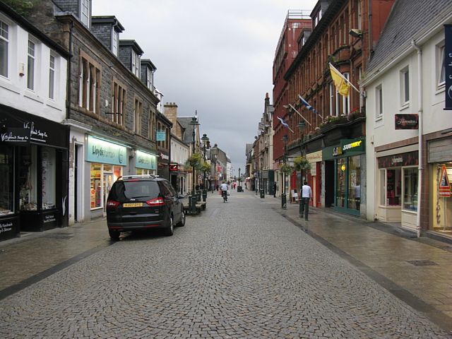
Today I went from Carlisle to Fort William via Oban. After visiting Oban I crossed to Fort William on the gorgeous A828.
|
img_2668.jpg |
img_2670_2673_panorama.jpg |
img_2674.jpg |
img_2675.jpg |
img_2676.jpg |
img_2677.jpg |
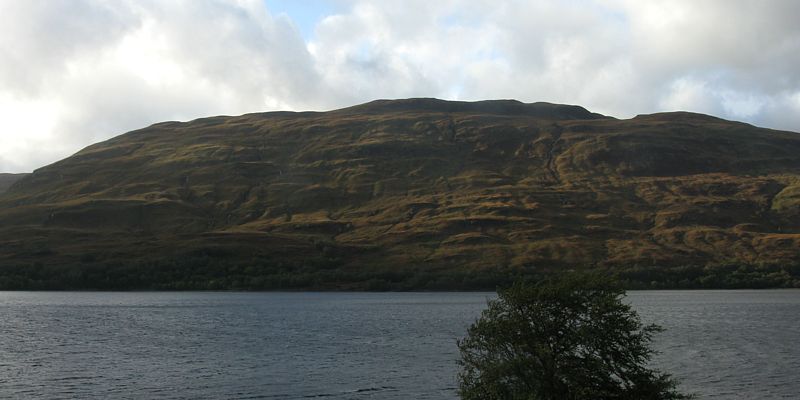
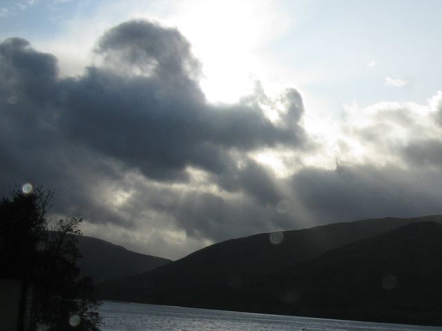
| Views around Oban. | The distillery. | ||||
 img_2678.jpg |
 img_2679.jpg |
 img_2685_2689_panorama.jpg |
 img_2690.jpg |
 img_2691.jpg |
 img_2693.jpg |
| More views around Oban. | |||||
 img_2694.jpg |
 img_2695.jpg |
 img_2698_2702_panorama.jpg |
 img_2705.jpg |
 img_2709.jpg |
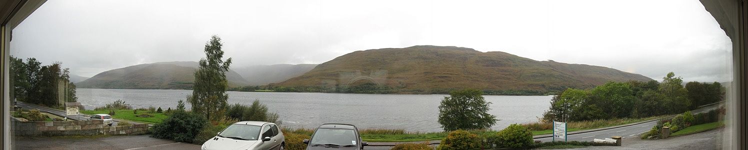
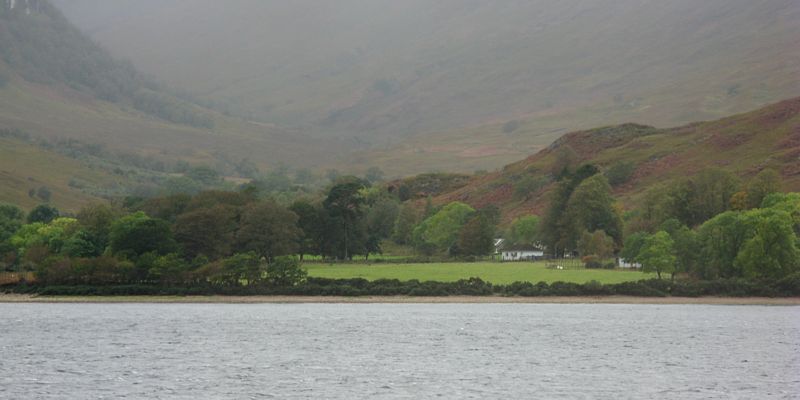
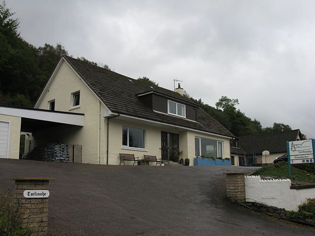
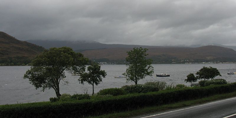
| Crossing the A828 bridge at Connell on the way to Fort William. | The view from the front room of Tor Linnhe BnB. | Looking across Loch Linnhe. | Tor Linnhe BnB. | |
 img_2711.jpg |
 img_2712.jpg |
 img_2713.jpg |
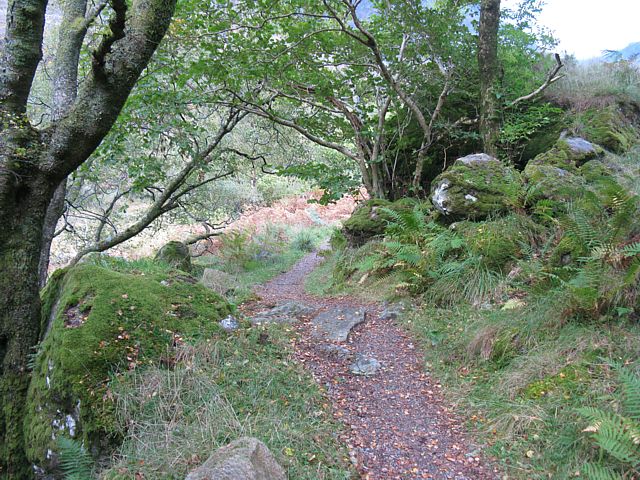
 img_2716.jpg |
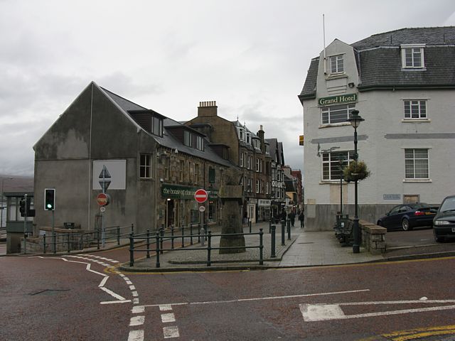
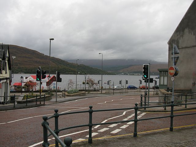
| Views as I walked into Fort William town centre for supper. | |||
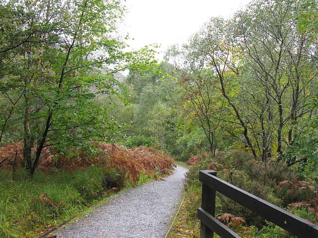
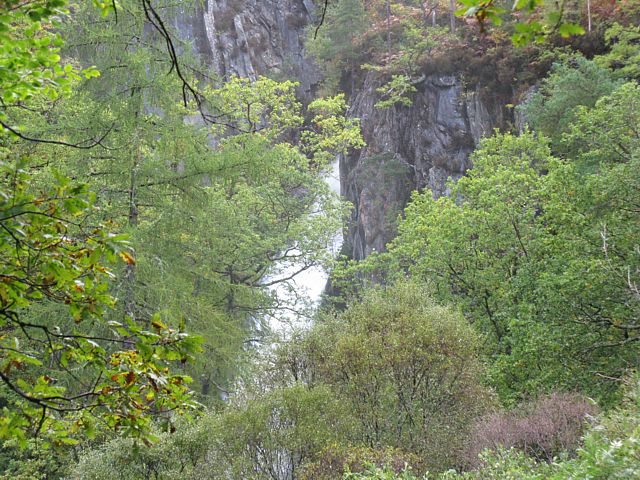
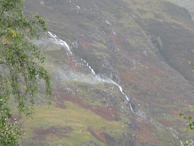
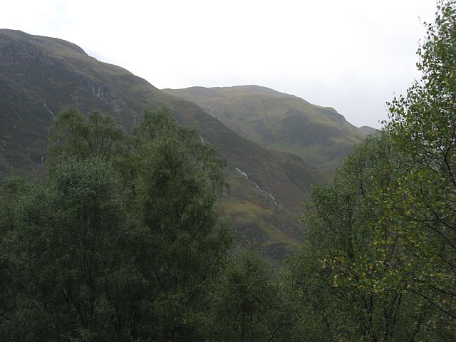
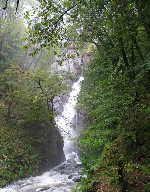
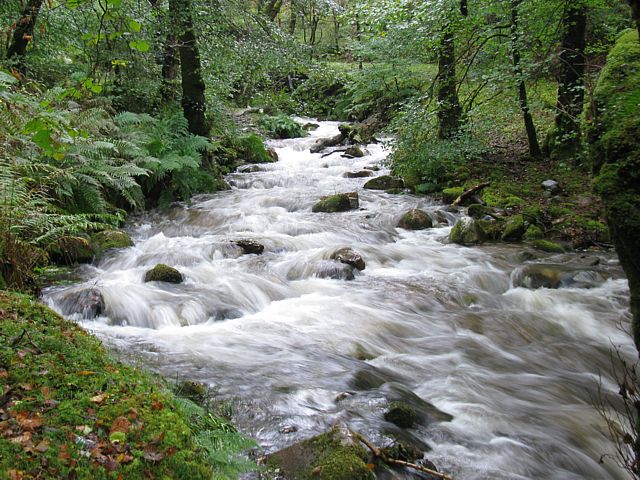
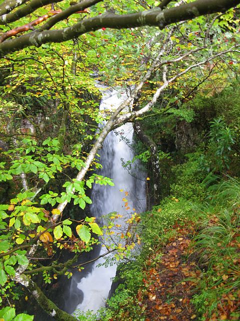
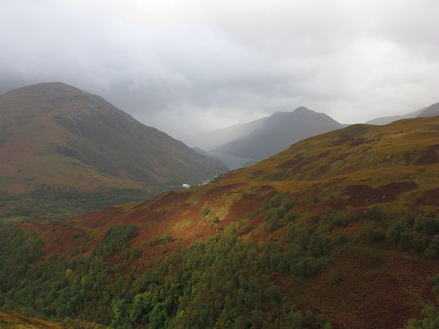
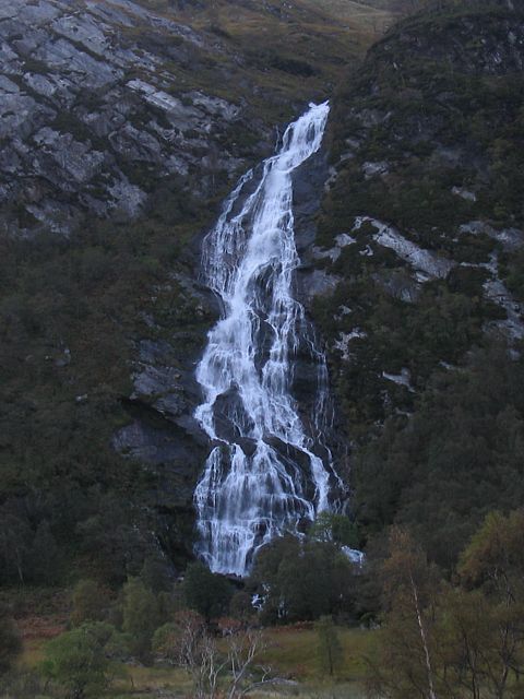
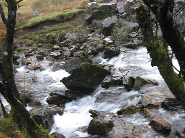
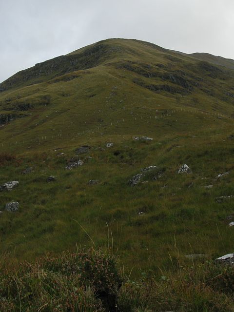
I drove to Kinlochleven and visited the Mare's Tail waterfall. Then I carried on up into the hills and followed the pipeline back round. I only went to 400 metres but that was enough in these stormy conditions. Frequent heavy showers ensured a soaking too, as well as some moody pictures.
 img_2718.jpg |
 img_2720.jpg |
 img_2723.jpg |
 img_2724.jpg |
 img_2730_2732_panorama.jpg |
 img_2733.jpg |
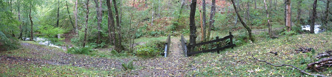
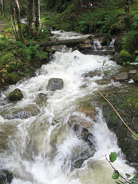
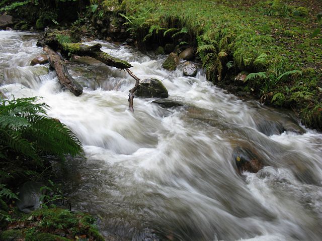
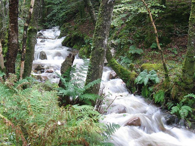
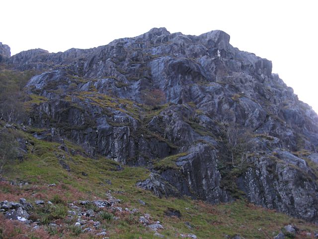
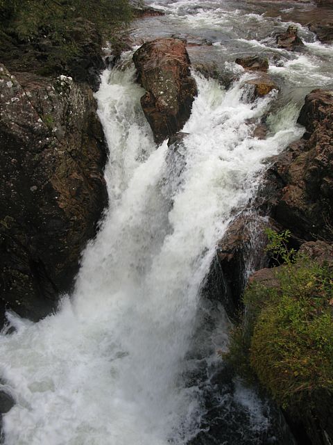
| Setting off along the Mare's Tail path the views were already nice. | High above me streams were being whipped up by the very strong wind. | A wider angle view of the mountains above Kinlochleven to the South of the Loch. | A 3 shot woodland panorama as the path crosses over a bridge. | Waterfall. | |
 img_2738_2739_panorama.jpg |
 img_2744.jpg |
 img_2746.jpg |
 img_2747.jpg |
 img_2751.jpg |
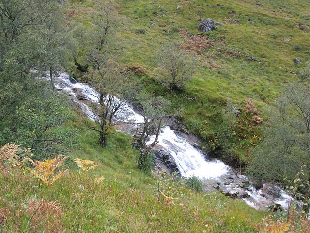
 img_2758.jpg |
| The Mare's Tail waterfall itself. | More waterfalls and rapids along the path. | Climbing up above Kinlochleven. | Another view of the Mare's Tail from above. | ||
 img_2761.jpg |
 img_2766.jpg |
 img_2767.jpg |
 img_2785.jpg |
 img_2793.jpg |
 img_2809.jpg |
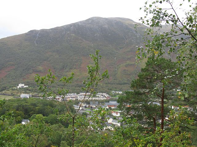
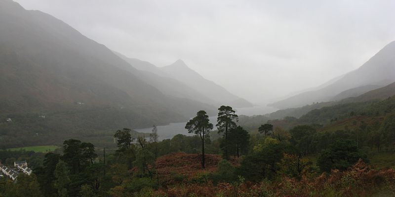
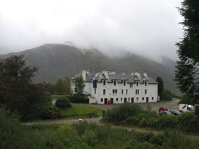
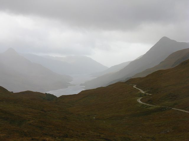
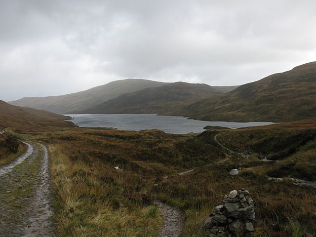
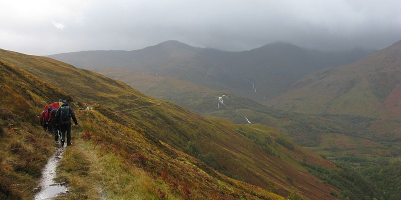
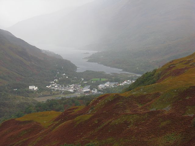
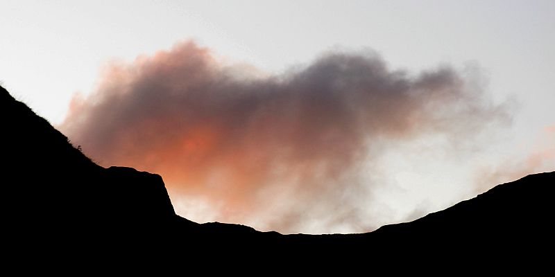
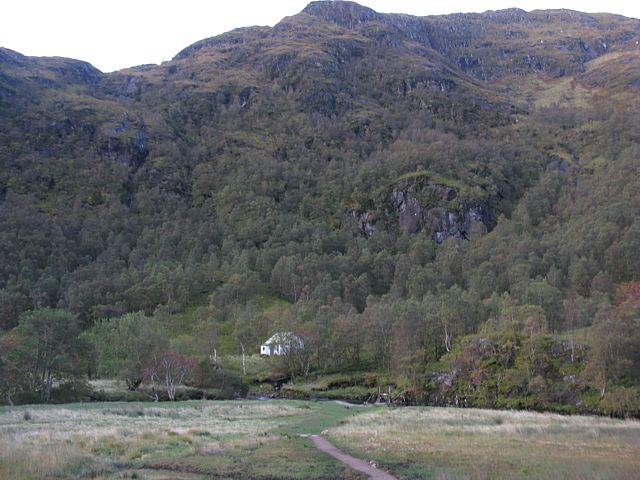
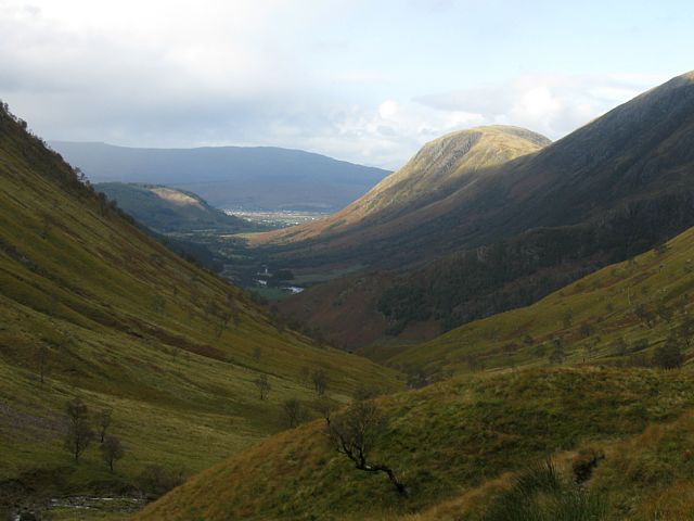
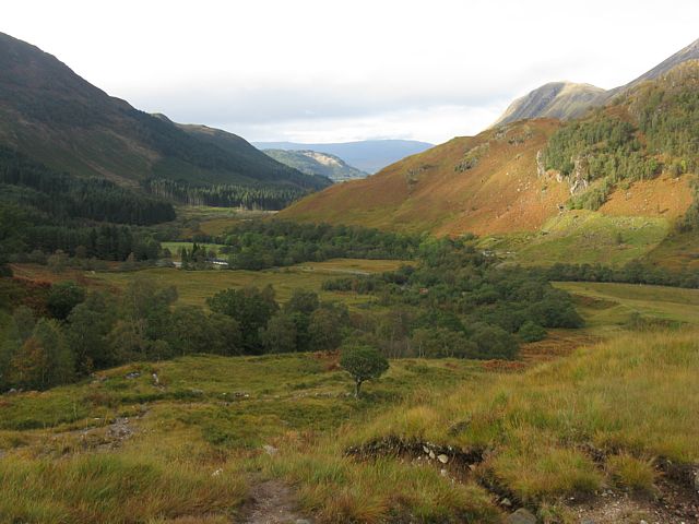
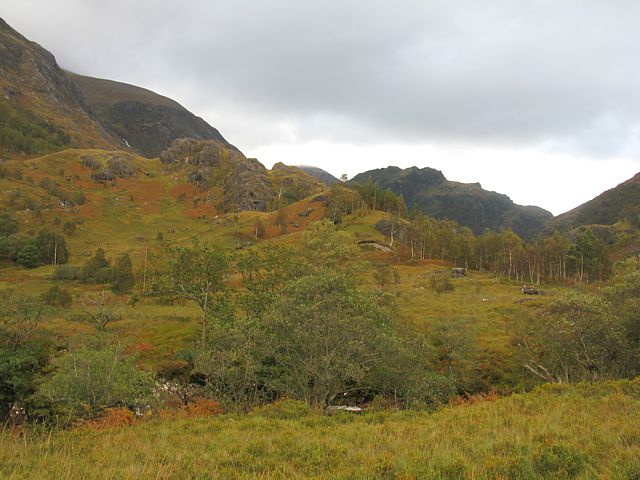
| As I break out of the woodland a moody damp hazy view West across Loch Leven is revealed. The Pap of Glencoe is prominent near the centre of the picture. | Approaching Mamore Lodge. | Mamore Lodge with a background view of clouds capping Garbh Bheinn and surrounding peaks. | Another view acros Loch Leven, now from 350 metres up East of Mamore Lodge. | Approaching Loch Eilde Mor from the West. | |
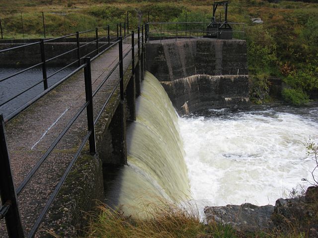 img_2810.jpg |
 img_2815.jpg |
 img_2816.jpg |
 img_2819.jpg |
 img_2823.jpg |
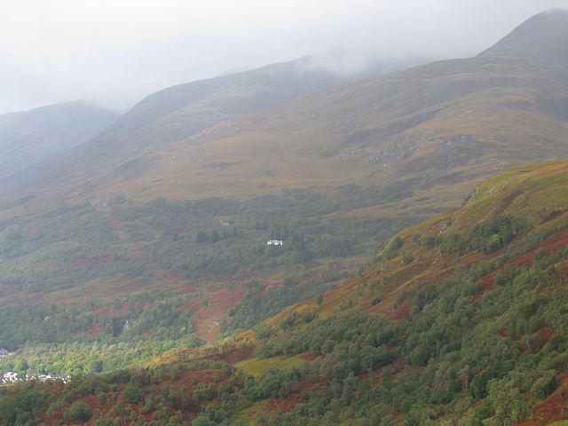
| Crossing the dam at the Southwest corner of Loch Eilde Mor. | Kinlochleven from the East as I walk south along a very boggy pipeline path. | Walking along the pipeline path. Another group doing the same walk joined me at this leg. | Another view of Kinlochleven, now from the Southeast. | Looking Northwest back to Mamore Lodge as we are about to descend to the river Leven from the pipeline. |
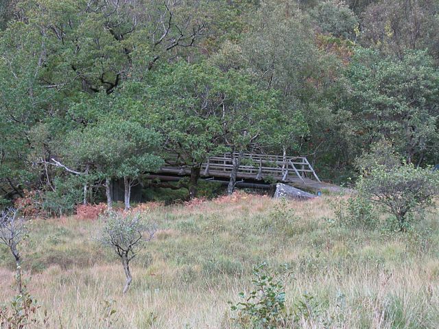
 img_2827.jpg |
 img_2829.jpg |
| Views from Tor Linnhe BnB late in the day after I returned to dry off and rest. | |
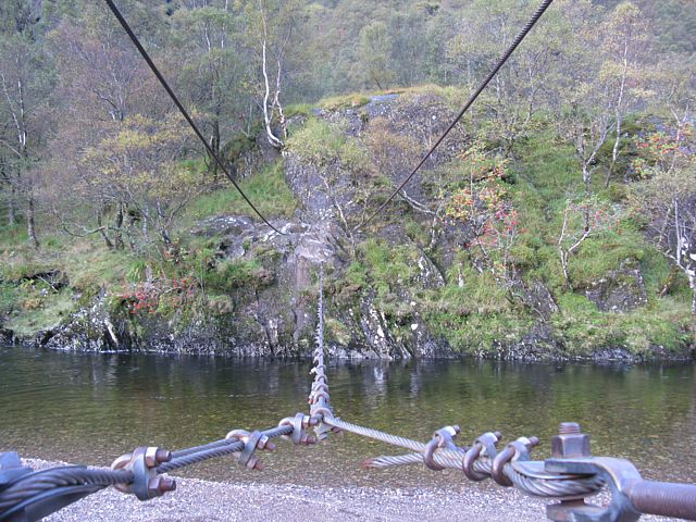
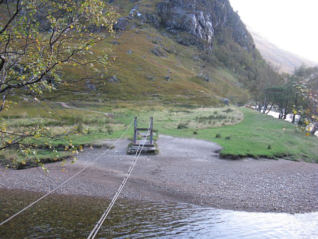
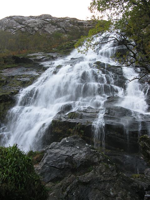
With the storm out the way and near perfect weather forecast I decided today was the day to try the Ring of Steall walk. I got to Glen Nevis just as it was getting light. After a walk to the Steall Falls I first had to cross a wire bridge, and then the Steall river. I failed to get across by the falls as it was a raging torrent but managed to ford across further downstream. Then after crossing a bog it was a straight forward long slog up to the first munro, An Garbanach. Then after scrambling over rocks and traversing the ridge tops I scared myself getting round Am Bodach after losing the path. Then after that I was getting tired and took an escape route down a glen West of the final munros to the lower falls at Polldubh in Glen Nevis. Then as the day got late it was a straight forward albeit very tired walk back to the upper car park where I started.
 img_2831.jpg |
 img_2835.jpg |
 img_2837.jpg |
 img_2838.jpg |
 img_2841.jpg |
 img_2842.jpg |
| Early morning in Glen Nevis. | Steall falls. | Steall hut nestles in the glen. | Golden hour on the snow capped summit of Ben Nevis above. | ||
 img_2845.jpg |
 img_2846.jpg |
 img_2853.jpg |
 img_2855.jpg |
 img_2861.jpg |
 img_2878.jpg |
| They call this a bridge??? I can't believe I made it across. | Underneath the Steall falls. After all the rain it was too rapid to safely cross. I forded it across further down stream. | Views back down Glen Nevis and across to Ben Nevis as I find and start to climb the path to An Garbanach. | |||
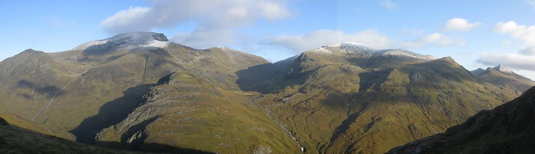 img_2889_2891_panorama.jpg |
 img_2894.jpg |
 img_2905.jpg |
 img_2908.jpg |
 img_2910_2912_panorama.jpg |
| Panorama of Ben Nevis and Aonach Beag. | Looking across to the Glen that feeds the Steall falls. | Looking up Glen Nevis as I rest on a grassy knoll high up the mountain. | Another panorama of Ben Nevis and Aonach Beag. | |
 img_2915.jpg |
 img_2920.jpg |
 img_2921.jpg |
 img_2922.jpg |
 img_2925.jpg |
 img_2930.jpg |
| My first clear view of the summit of An Garbanach. Nearly there! | Looking around at the summit of An Garbanach at 982 metres. | There was a dusting of snow at the summit. | |||
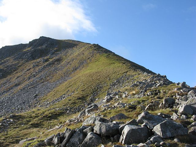
 img_2932.jpg |
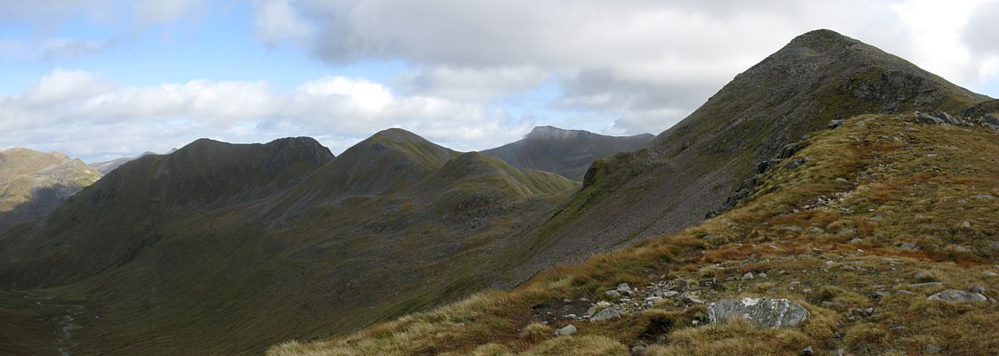
 img_2934.jpg |
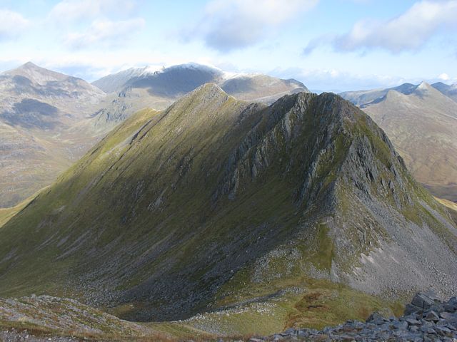
 img_2935.jpg |
 img_2936.jpg |
 img_2940.jpg |
 img_2941.jpg |
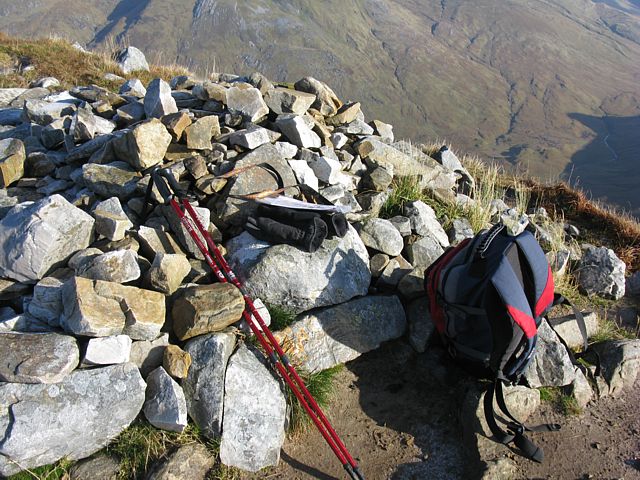
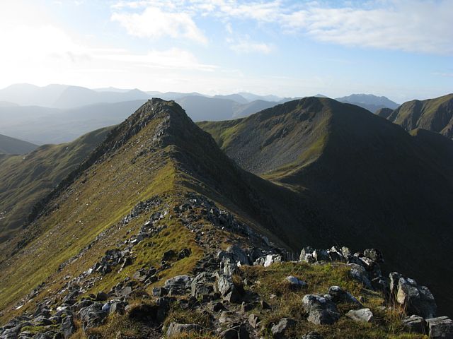
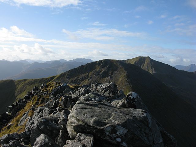
| Me and my gear resting at the summit of An Garbanach. | Looking at the ridge ahead, and Stob Coire a' Chairn. | Scrambling over Stob Coire a' Chairn, looking back to An Garbanach. Ben Nevis and Aonach Beag in the background, and forward to the next peak. | Descending from Stob Coire a' Chairn. | Looking back to Ben Nevis from a Baleach below Stob Coire a' Chairn's Southwest slope. | |
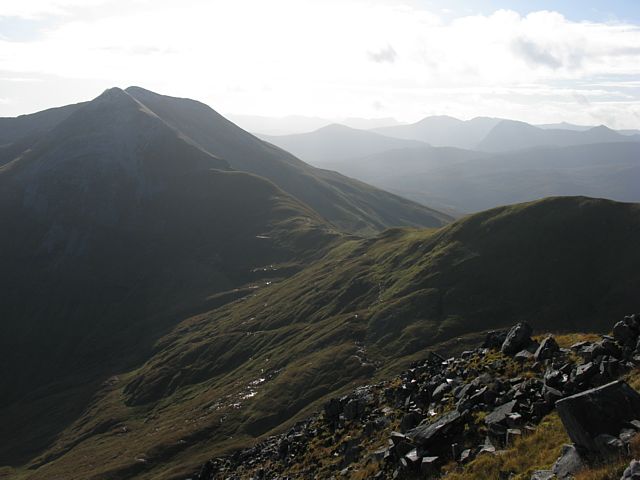
 img_2942.jpg |
 img_2943.jpg |
 img_2944.jpg |
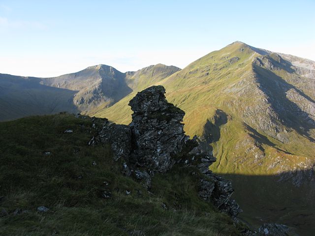
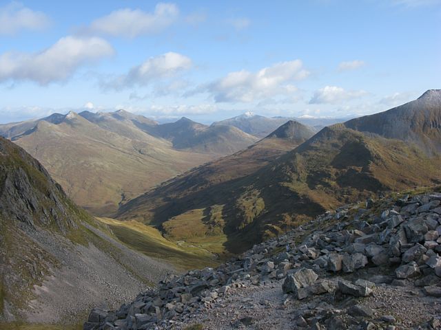 img_2946.jpg |
 img_2949.jpg |
 img_2954_2956_panorama.jpg |
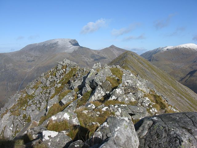
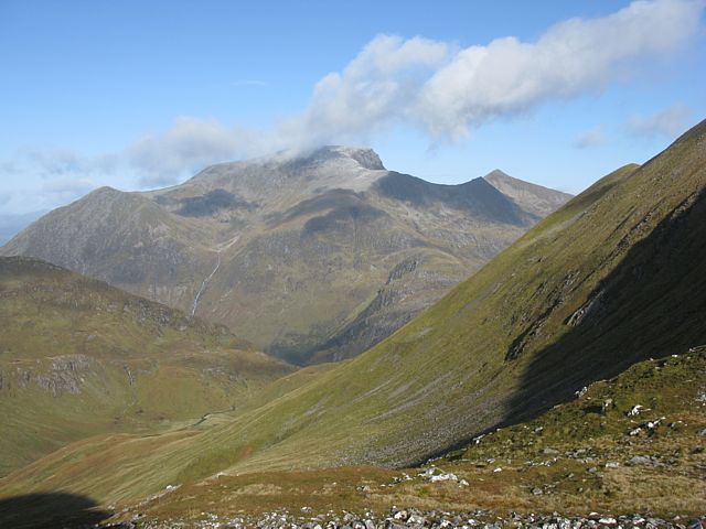
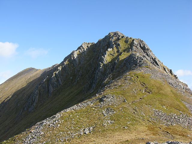
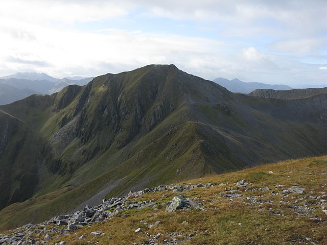
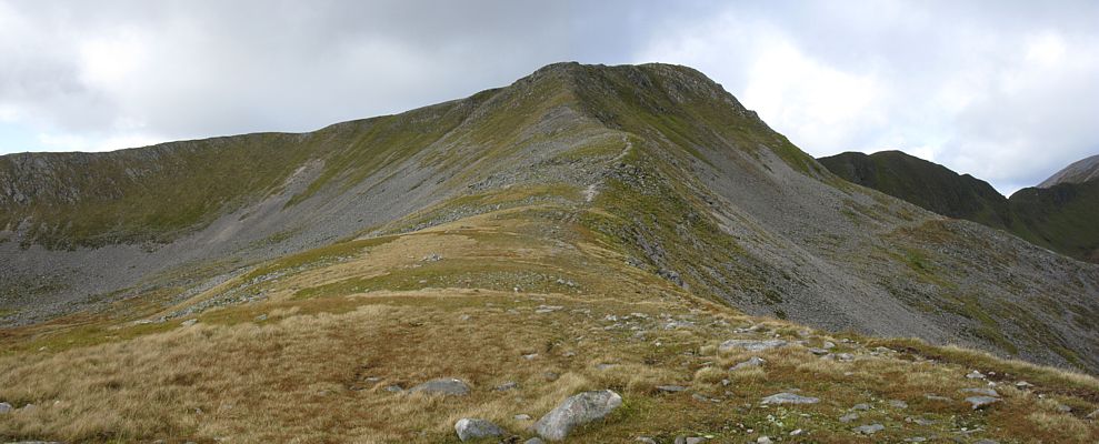
| Did I really just climb down that steep Southwest slope of Stob Coire a' Chairn? | Looking up the Northeast slope of a 'mini' peak between Stob Coire a' Chairn and Am Bodach. | Looking back at Stob Coire a' Chairn and An Garbanach from the 'mini' peak to its Southwest. | Looking across the mountain range from the 'mini' peak. | Am Bodach lies ahead to the Southwest. | Am Bodach from the ridge below its steep Northeast slope, and the ridge beyond it to the West. |
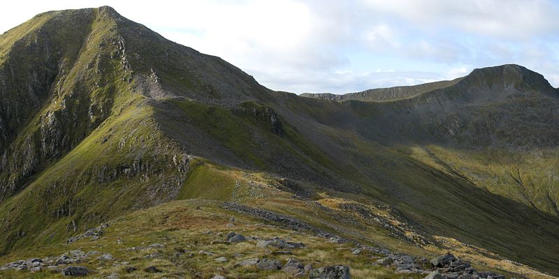
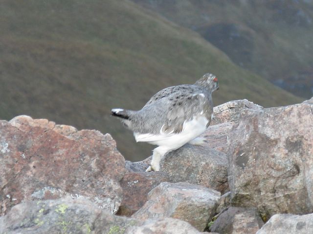
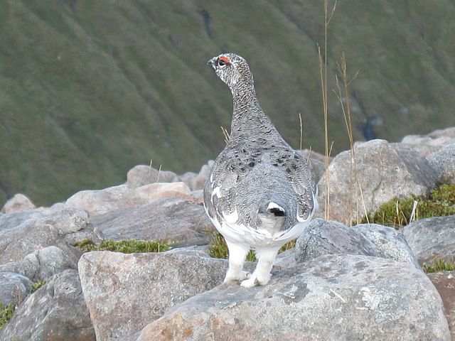 img_2960.jpg |
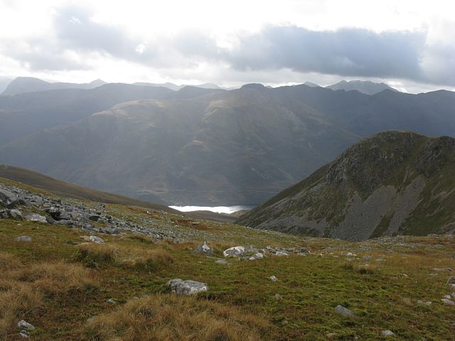
 img_2962.jpg |
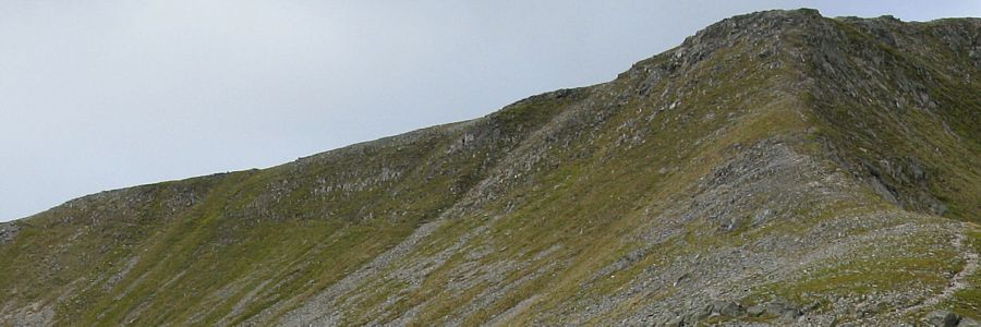
 img_2964.jpg |
 img_2965_2966_panorama.jpg |
 img_2967_2968_panorama.jpg |
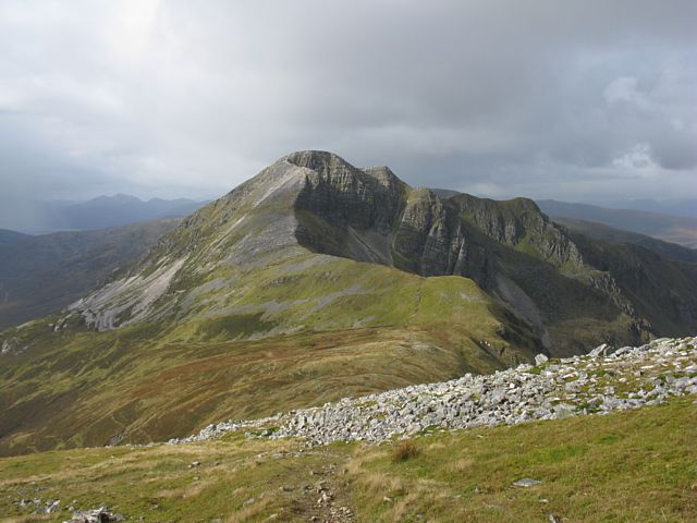
| A ptarmigan on the ridge to the Northeast of Am Bodach. | Looking south from the ridge Northeast of Am Bodach I can see Loch Leven. | After escaping the slopes of Am Bodach and making it to the ridge beyond, the view of the western slope looks much gentler. | Looking West from the ridge between Am Bodach and Sgurr an Lubhair. There is a path going up and left along the South slope of Sgurr an Lubhair. It is this route I took to escape down a glen between Stob Ban and Sgurr a' Mhaim. | |
 img_2967_2968_panorama_zoom.jpg |
 img_2969.jpg |
 img_2972.jpg |
 img_2973.jpg |
 img_2974.jpg |
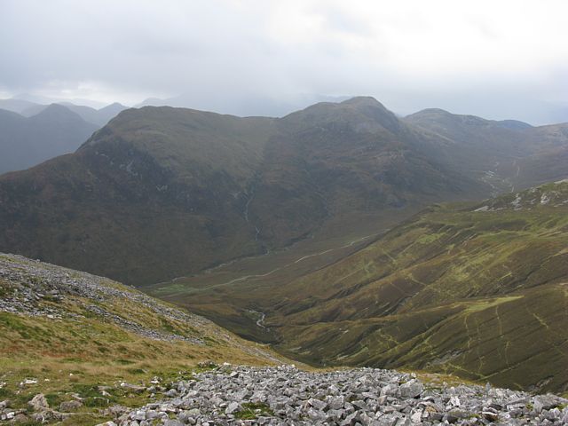
| A closer look at my escape path on the south slope of Sgurr an Lubhair. | Stob Ban from the Western slopes of Sgurr an Lubhair. | The first shower of the day fell as snow at ab out 850 metres. | Looking Northwest I can now see the path that descends into Coire a' Mhusgain. | Coire nam Miseach, at the top of the glen below Sgurr an Lubhair's Western slopes. |
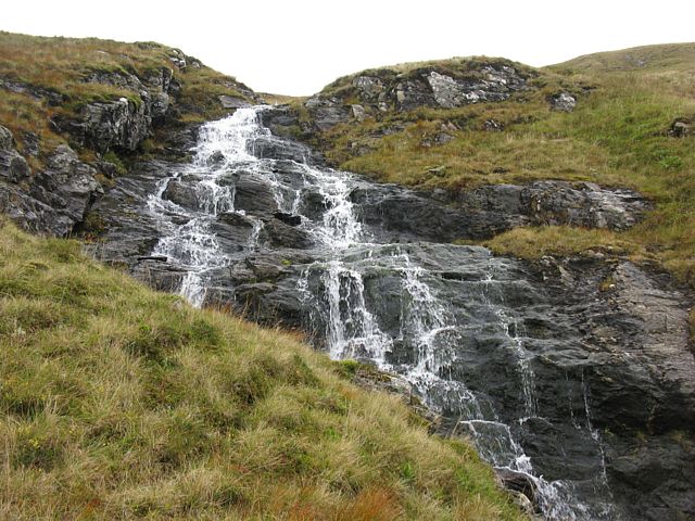
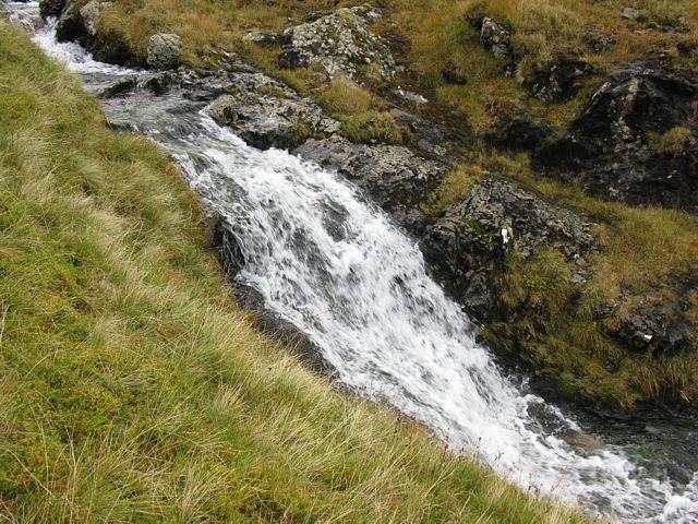
 img_2981.jpg |
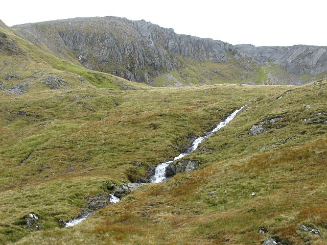 img_2982.jpg |
 img_2985.jpg |
 img_2990.jpg |
 img_2992.jpg |
 img_2997.jpg |
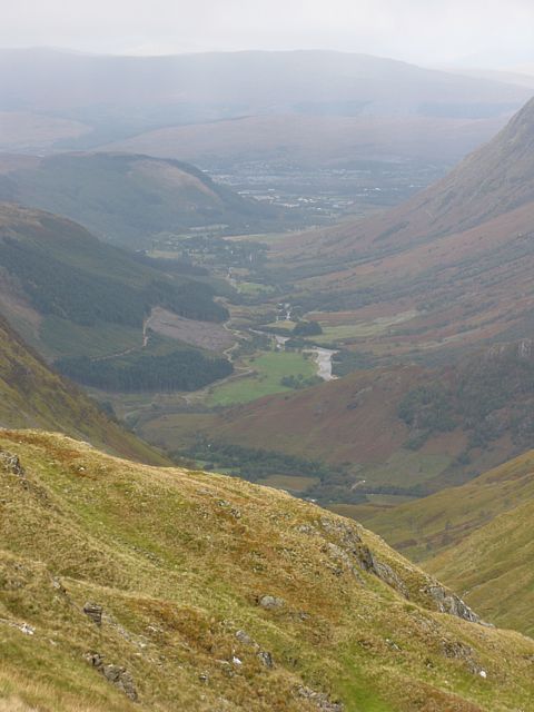
| Looking down the glen I can see all the way back to Glen Nevis and beyond to Fort William. | All the way down the glen, Allt Coire a' Mhusgain bristles with waterfalls and the views up and down the glen are beautiful. | ||||
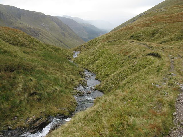
 img_3007.jpg |
 img_3009.jpg |
 img_3010.jpg |
 img_3011.jpg |
 img_3014.jpg |
 img_3017.jpg |
| A 3rd of the way down the glen the path zig-zags down a steep slope into a gorge that reminds me of a swiss scene. | A lower view of Glen Nevis and Fort William. | Just short of the bottom of the glen I rested by this lovely waterfall. | Looking up the Northwest slope of Sgurr a' Mhaim, I can see the route description wasn't kidding when it said the descent is steep! | Entering Glen Nevis as I approach the lower falls. | The lower falls at Polldubh in Glen Nevis. |
 img_3021.jpg |
 img_3027.jpg |
 img_3028.jpg |
 img_3031.jpg |
 img_3034.jpg |
| Walking back up Glen Nevis to the upper car park along a path on the south side of the river, I notice how vivid the autumn colours are. | Meanwhile the weather deteriorates and the upper peaks are no longer visible as cloudbase lowers. | The cascade waterfall, Allt Coire Eoghainn, that falls from Ben Nevis near the upper car park. Nearly there! | Completing the south side path and crossing a bridge over the Water of Nevis to complete the walk along the road. | |
 img_3035_3036_vpanorama.jpg |
 img_3042.jpg |
 img_3043.jpg |
 img_3045.jpg |
| More waterfalls on the left side of the road as I walk back to the upper car park. | Allt Coire Eoghainn from underneath. | At last! the car park and start point! And I can now collapse after a long and very hard walk. A great day in the mountains is completed. | |
For more pictures please click here to go to Scotland 2009 Page 2.