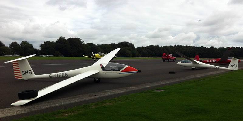
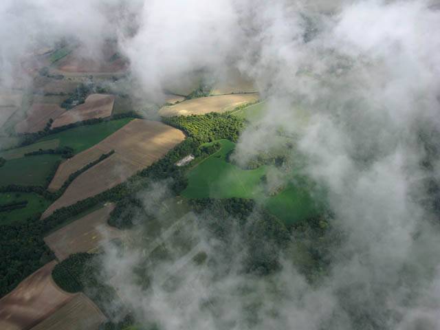
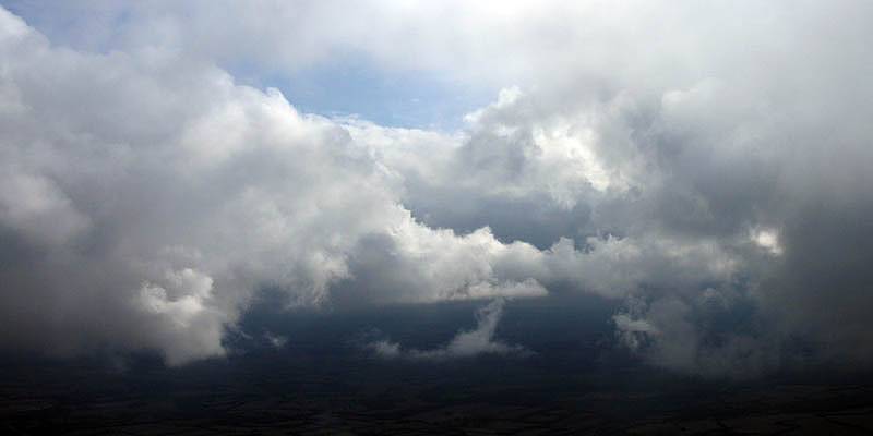
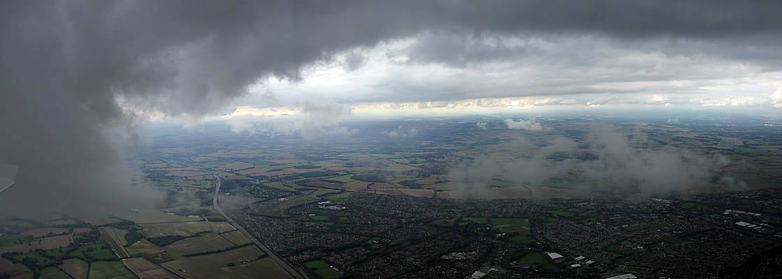
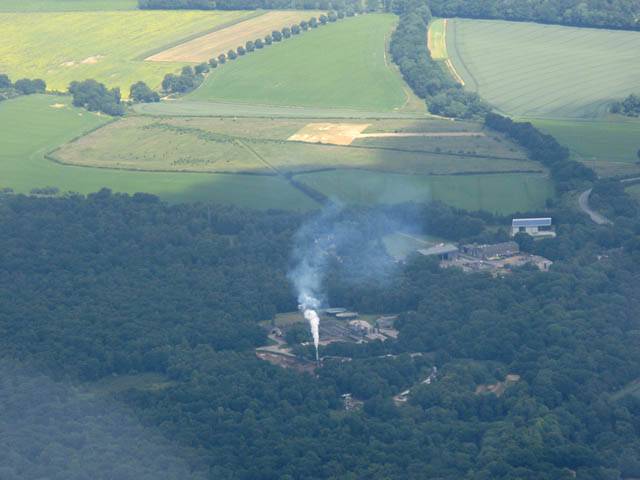
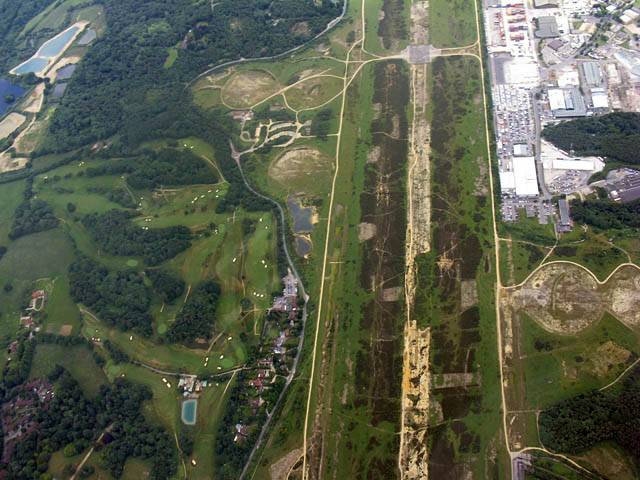
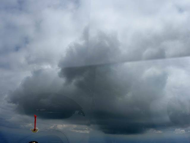
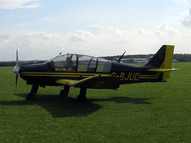
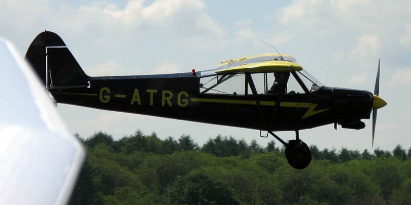
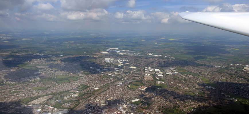
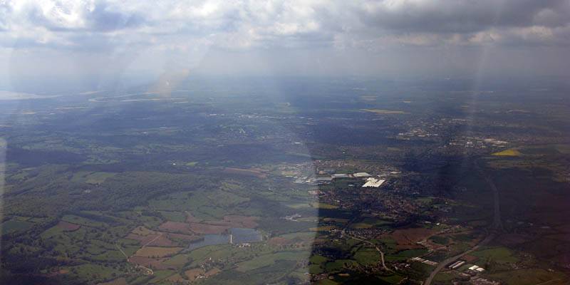
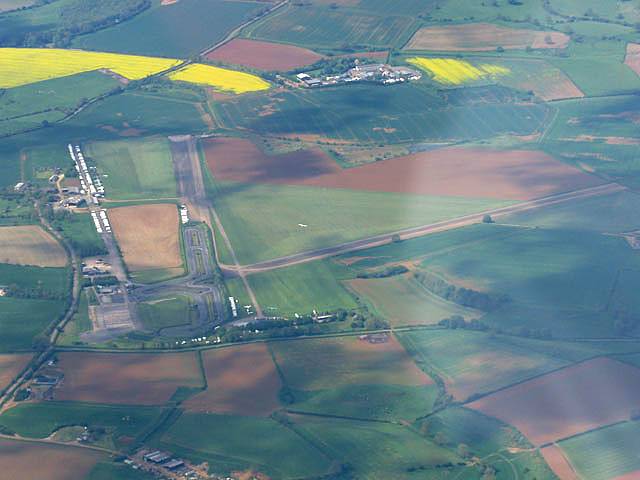
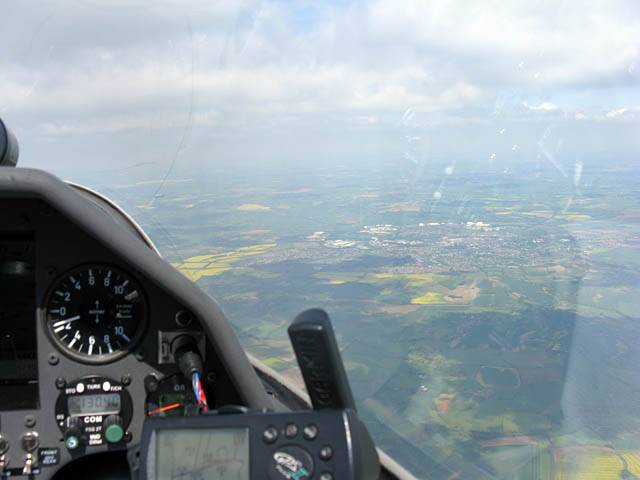
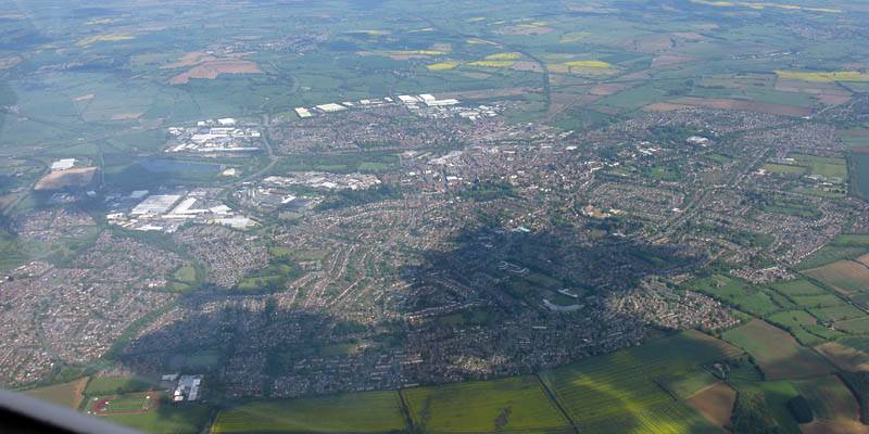
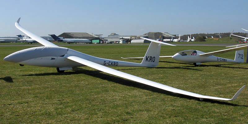
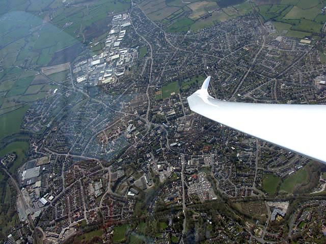
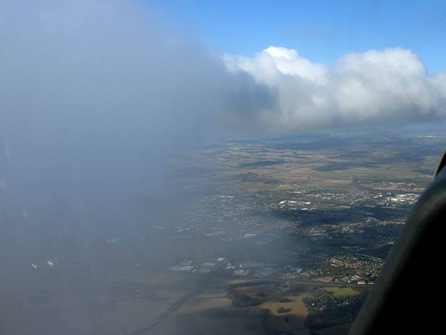
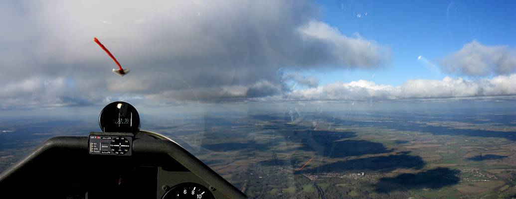
IMG_3319.jpg
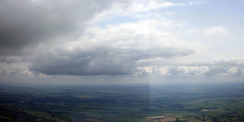
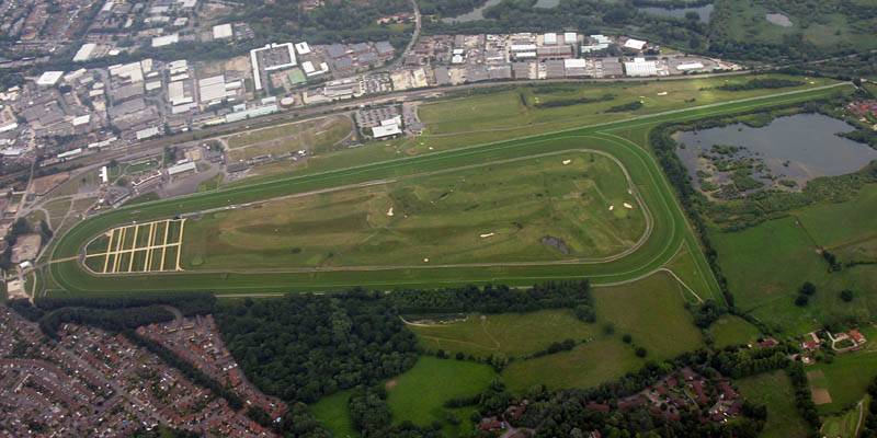
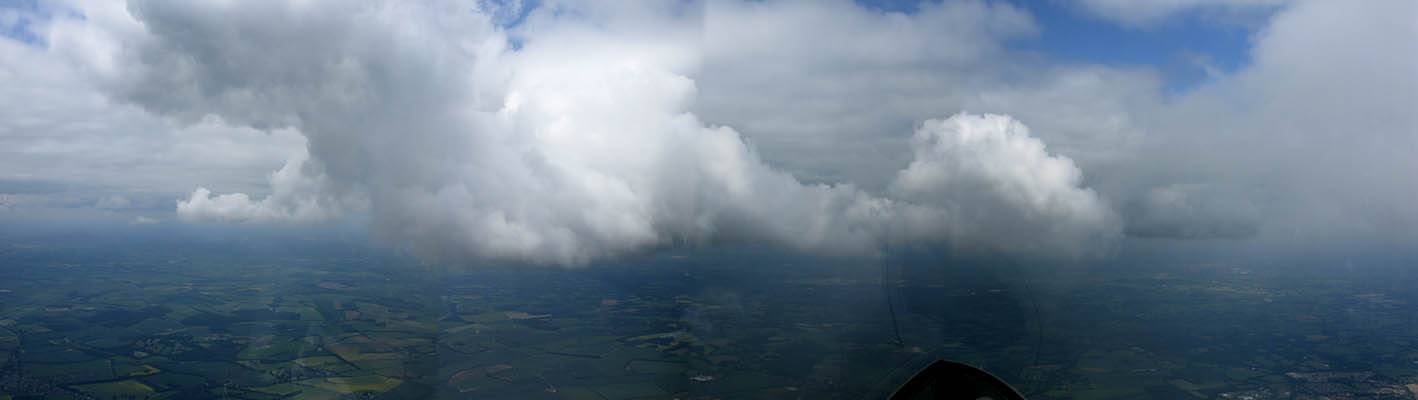
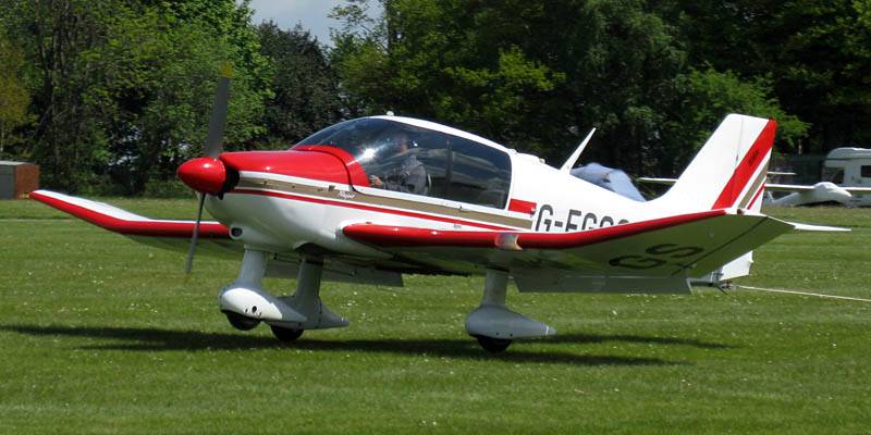
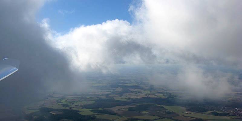
IMG_3328.jpg
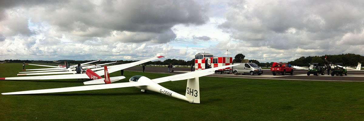
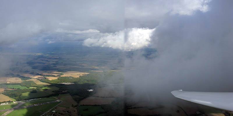
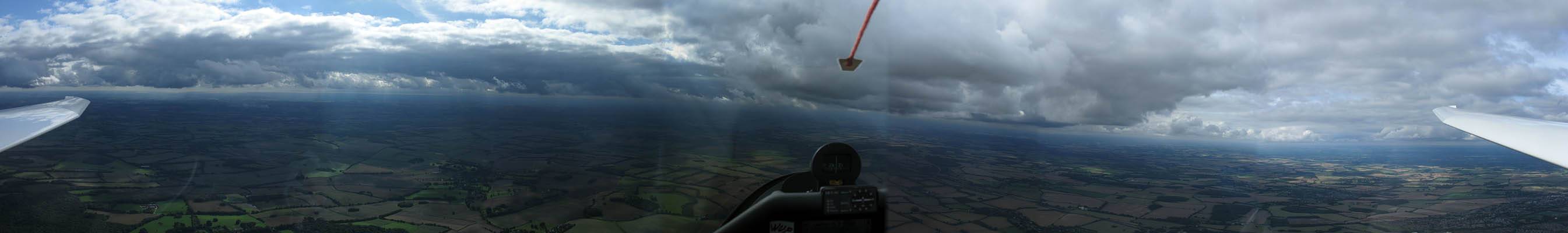
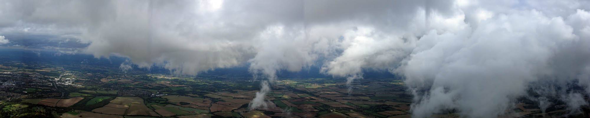
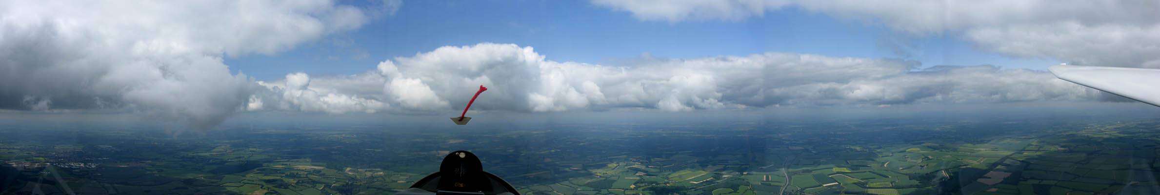
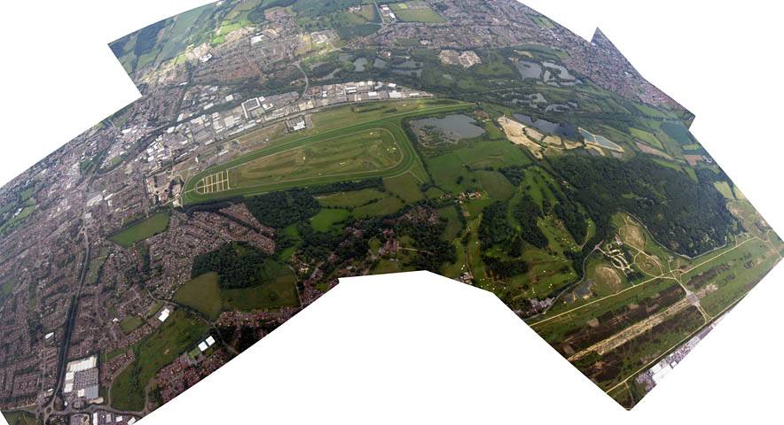
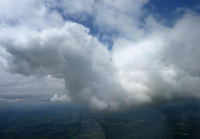
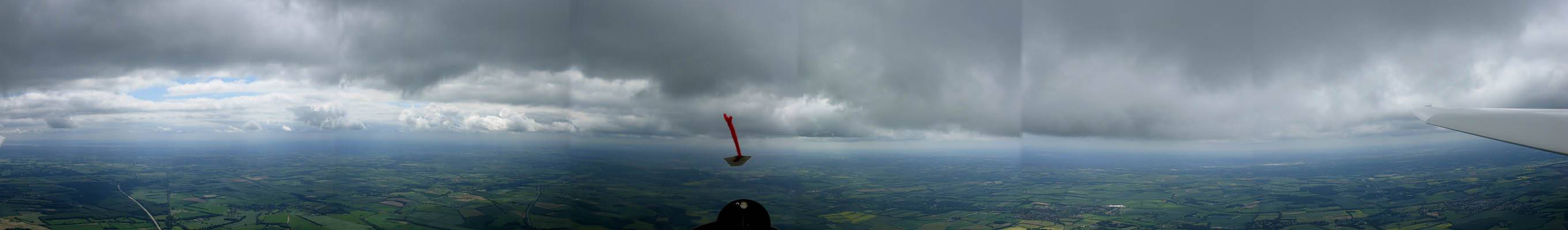
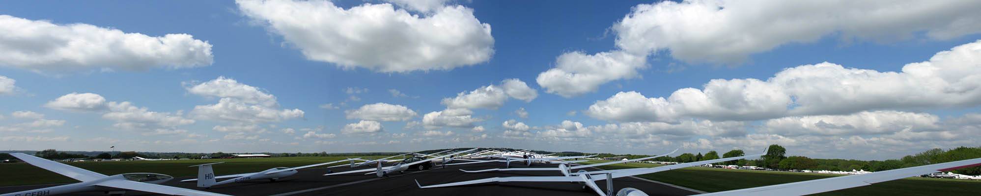
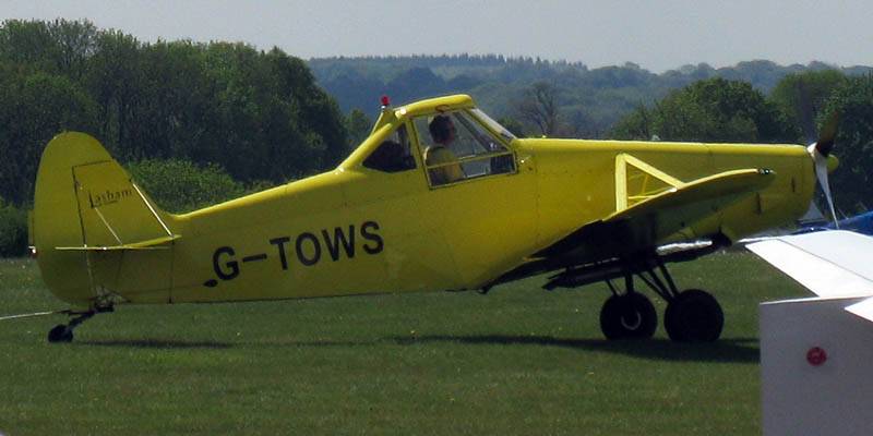
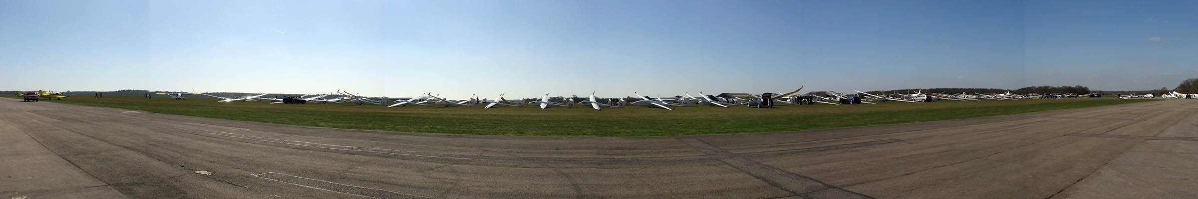
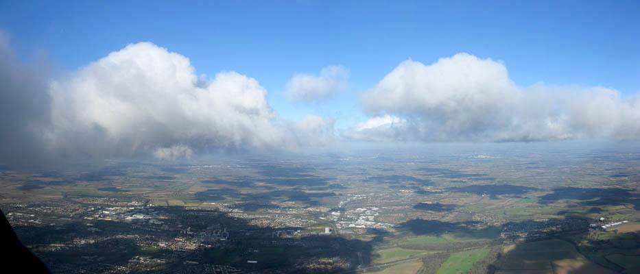
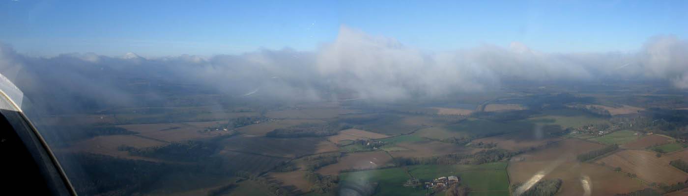
IMG_3330_3331_Panorama.jpg
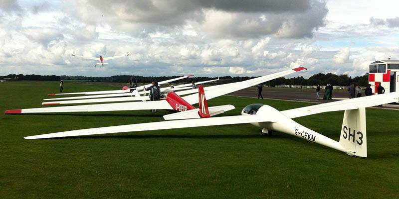
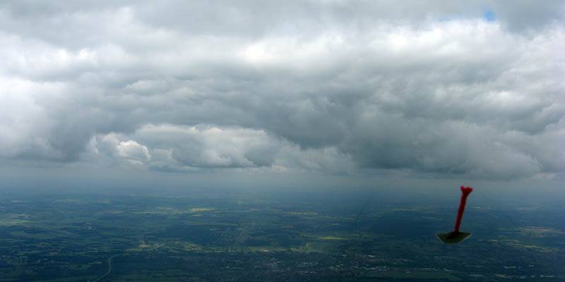
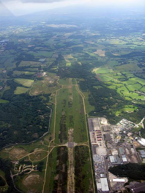
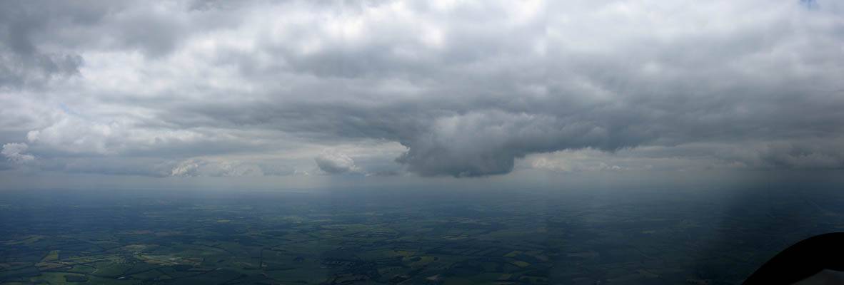
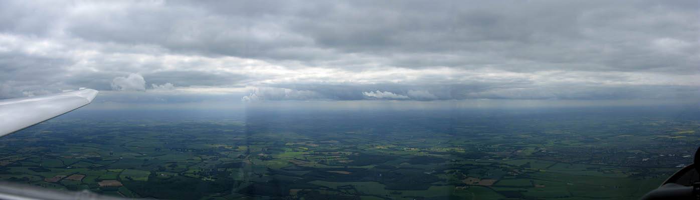
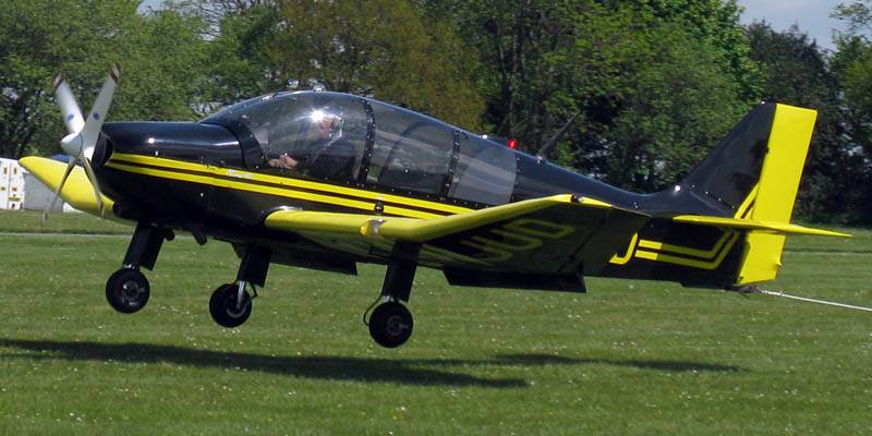
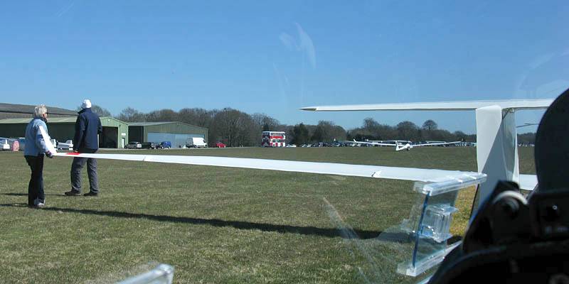
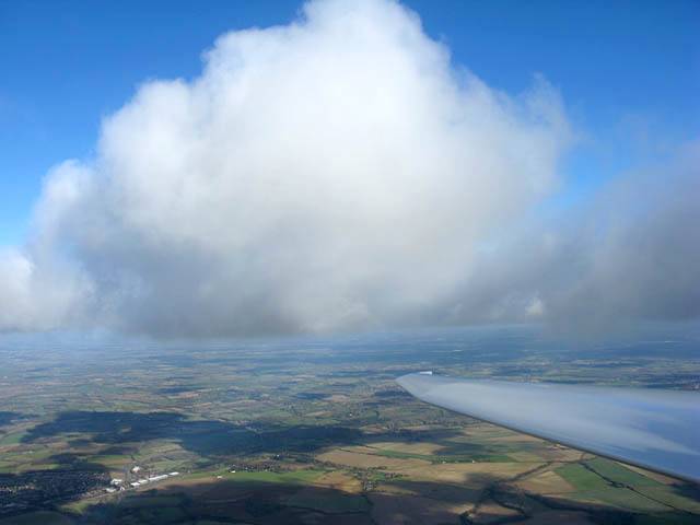
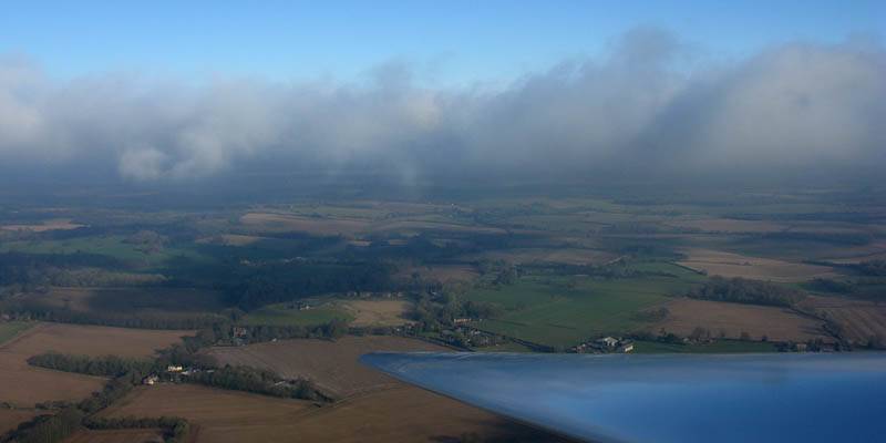
IMG_3336.jpg
Click here to return to the main Pictures index.
Click here to go to my 2013 diary.
Click here to go to the 2014 images.
Click here to go to the 2012 images.
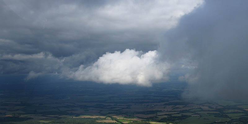
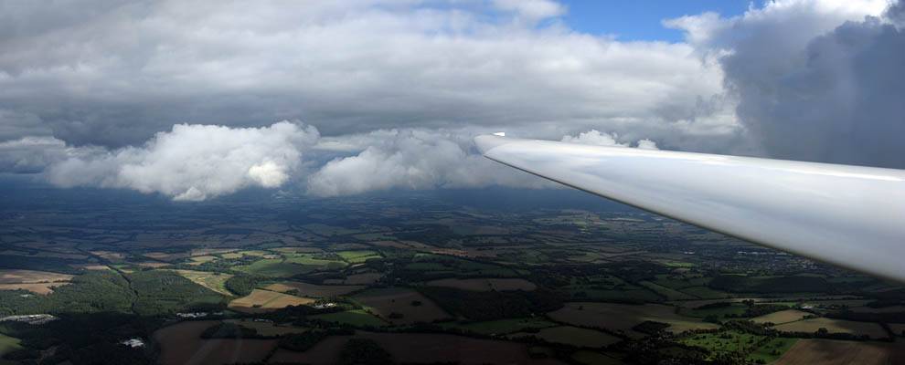
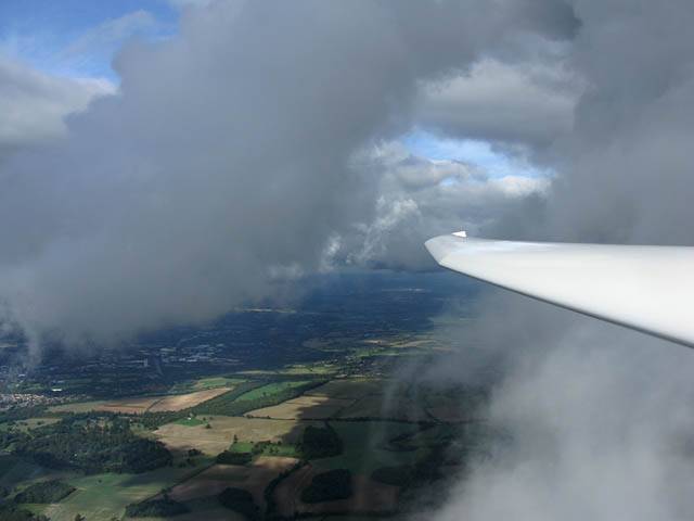
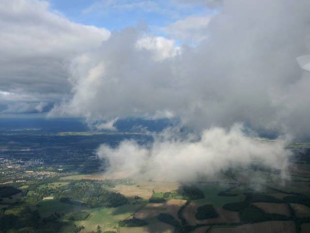
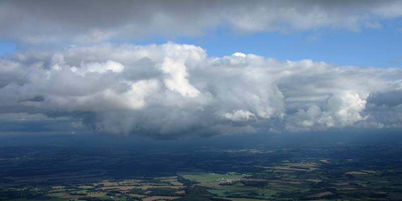
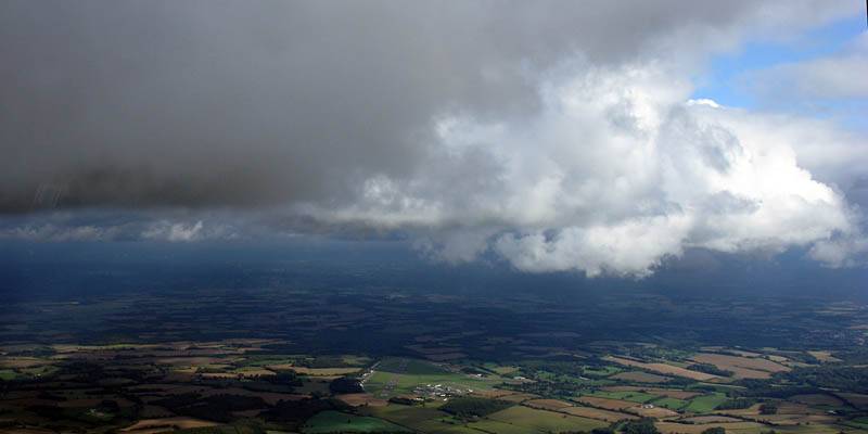
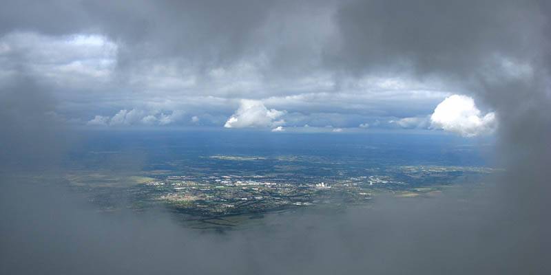
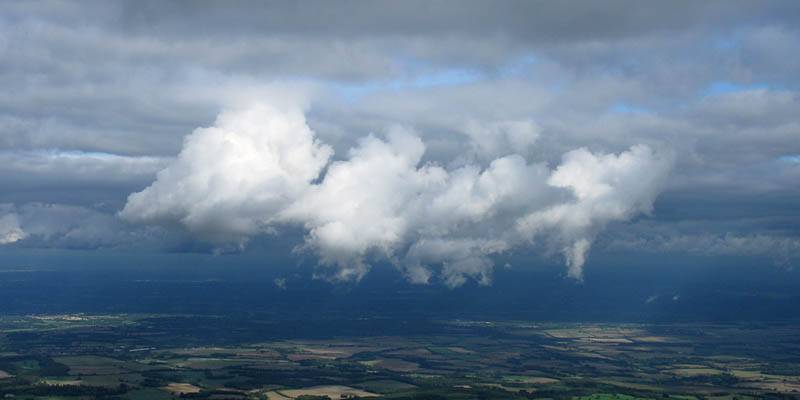
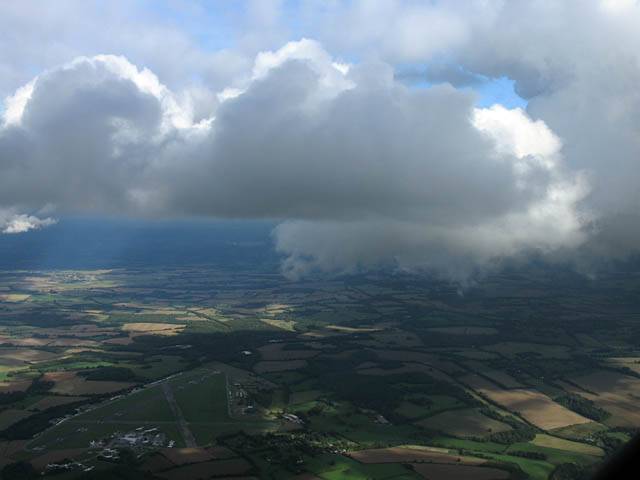
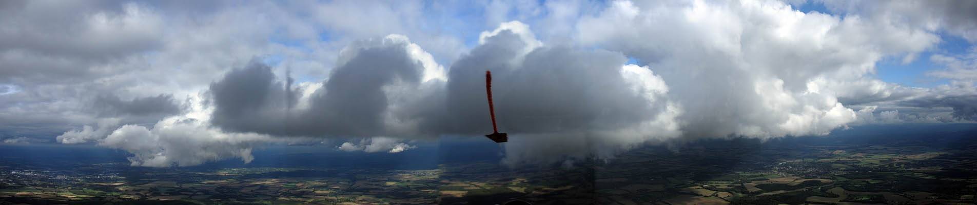
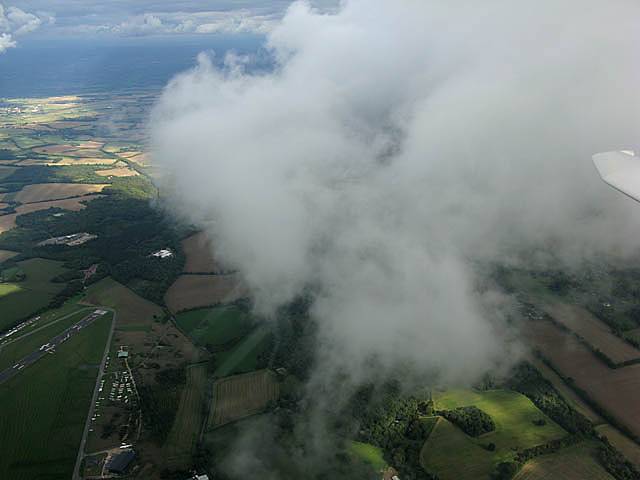
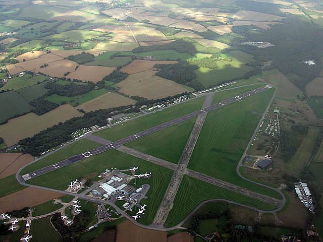
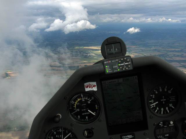
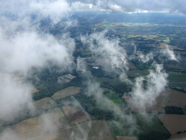
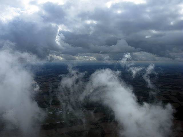
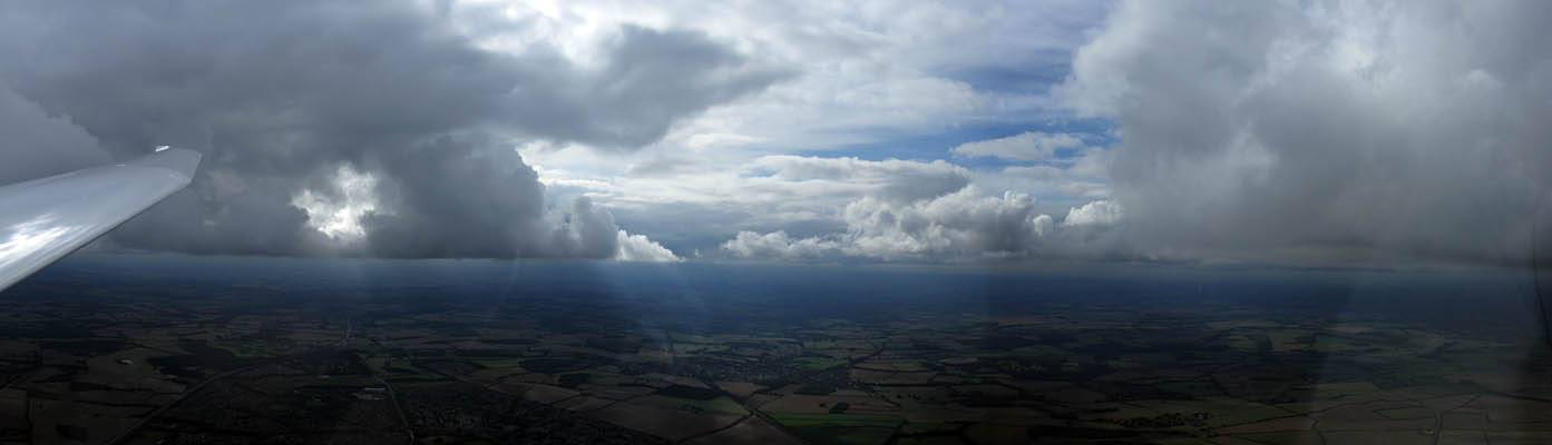
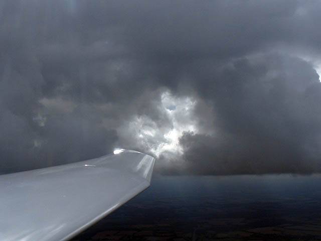
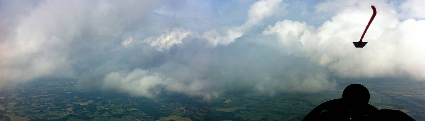
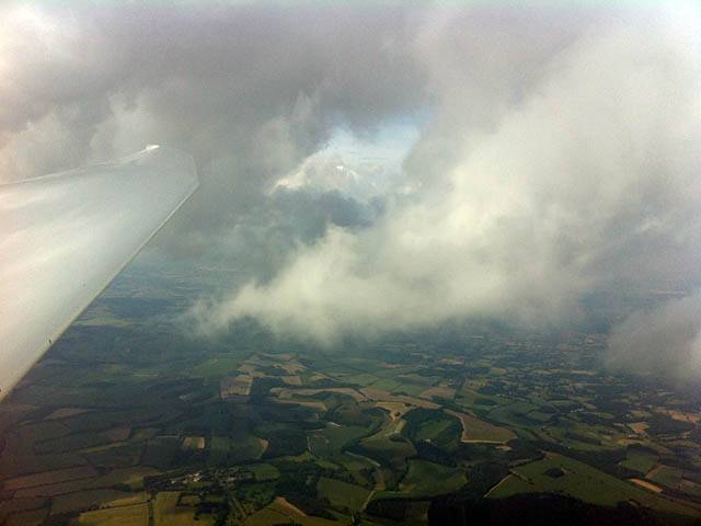
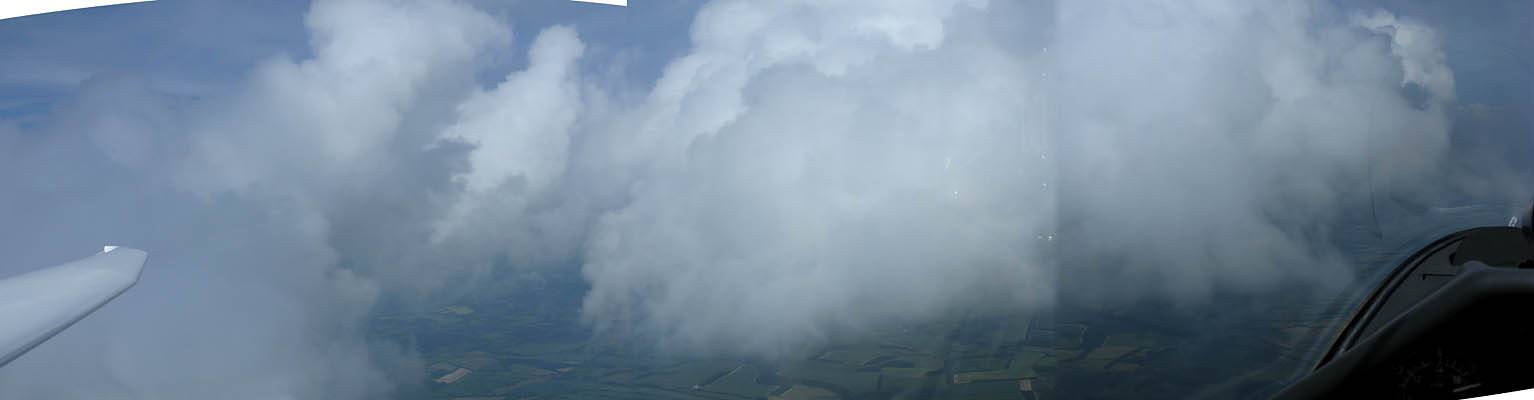
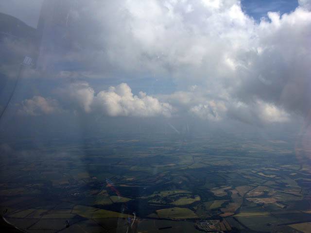
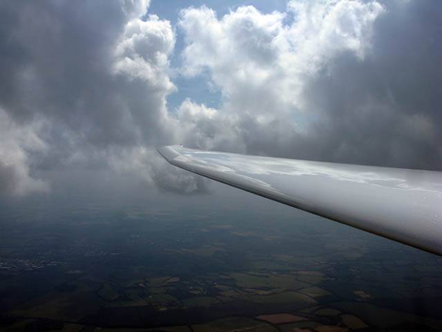
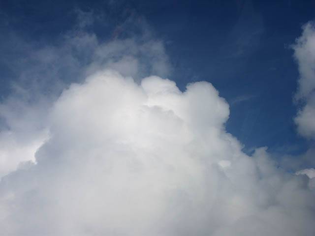
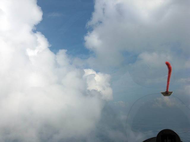
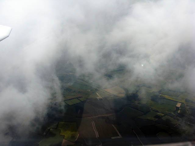
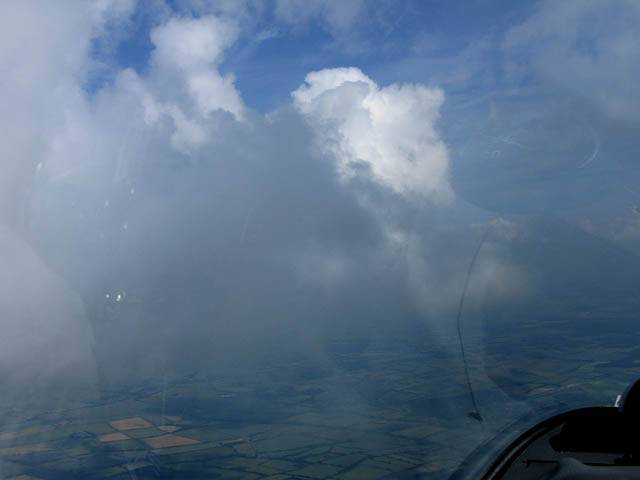
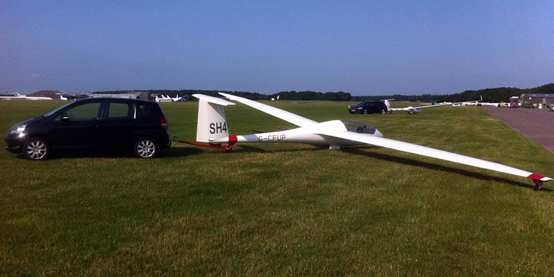
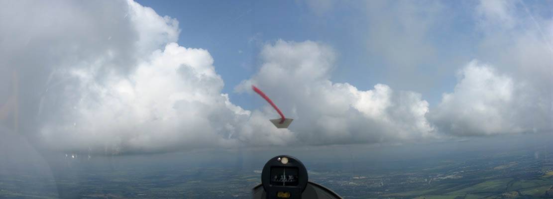
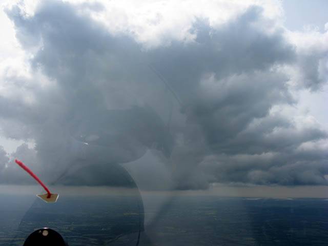
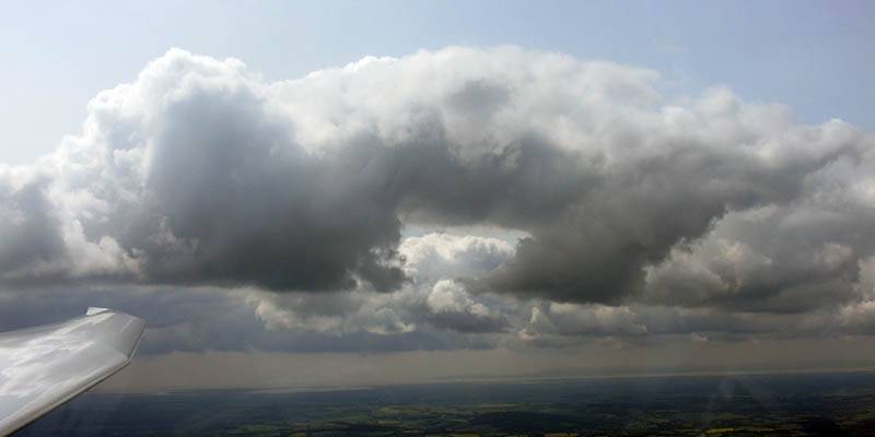
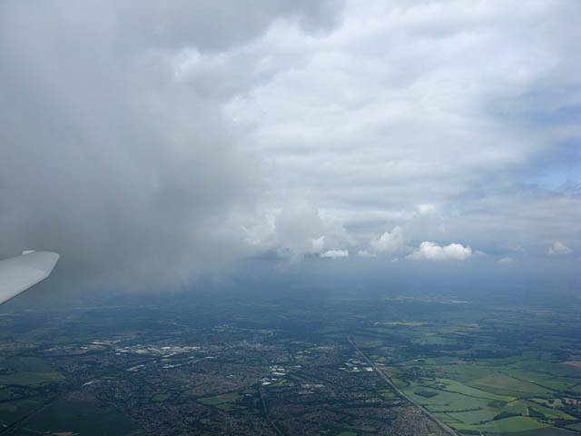
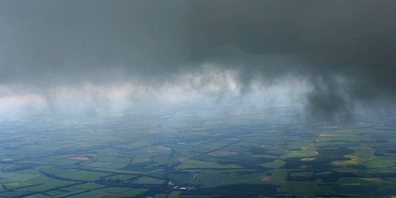
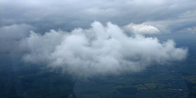
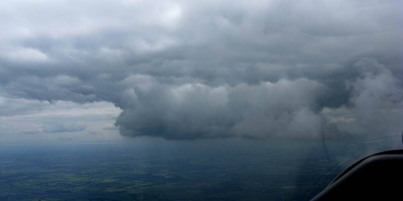
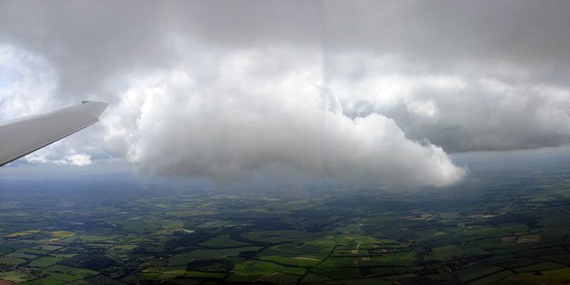
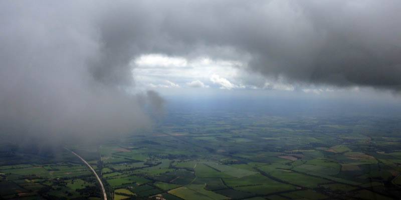
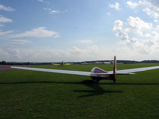
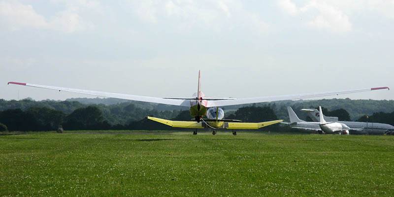
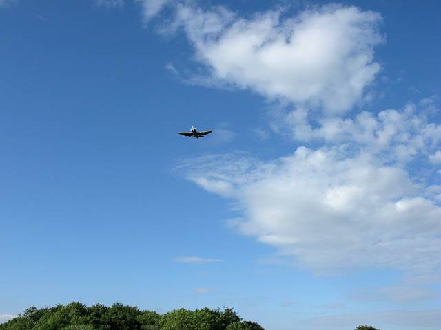
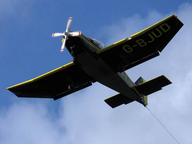
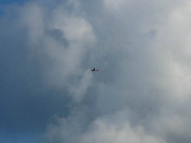
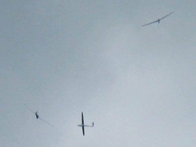
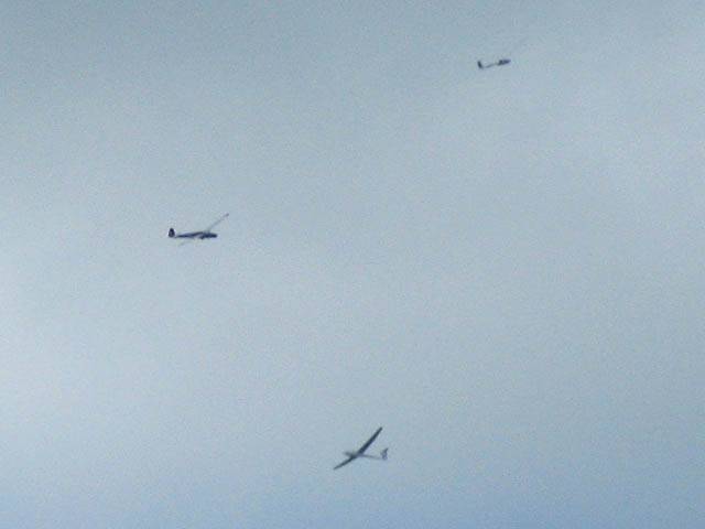
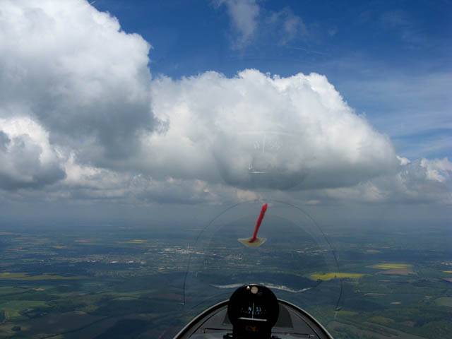
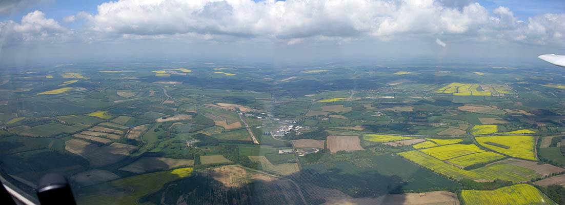
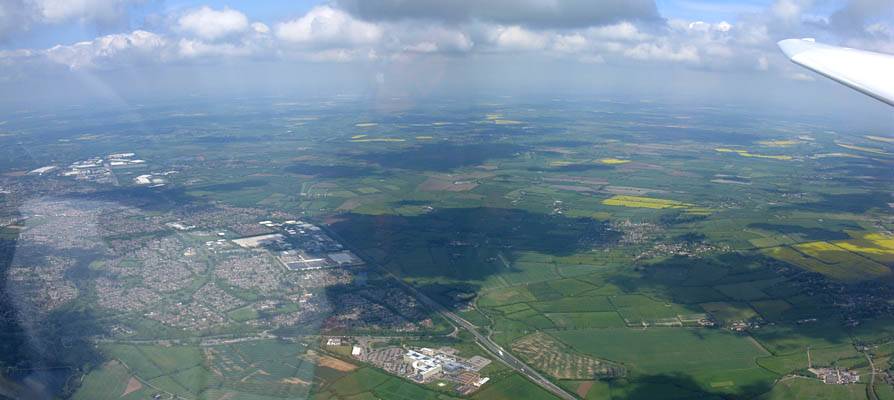
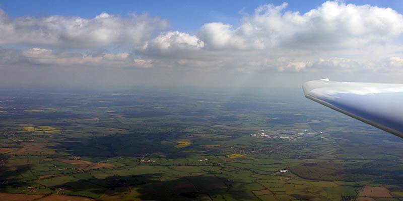
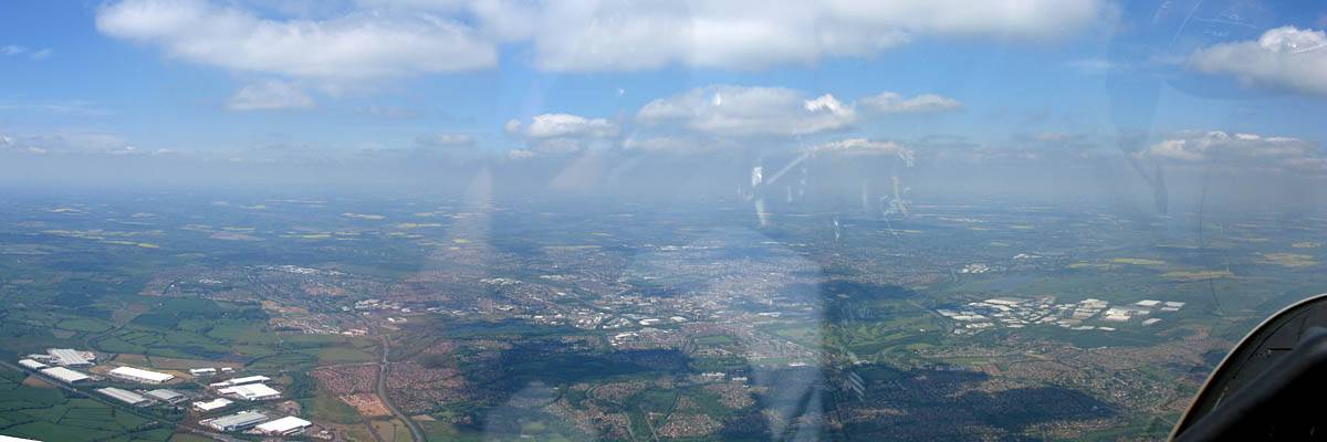
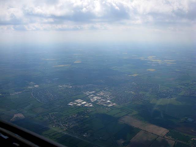
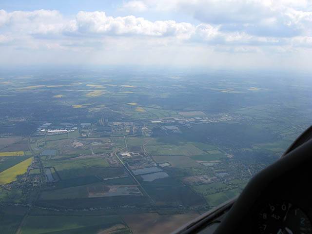
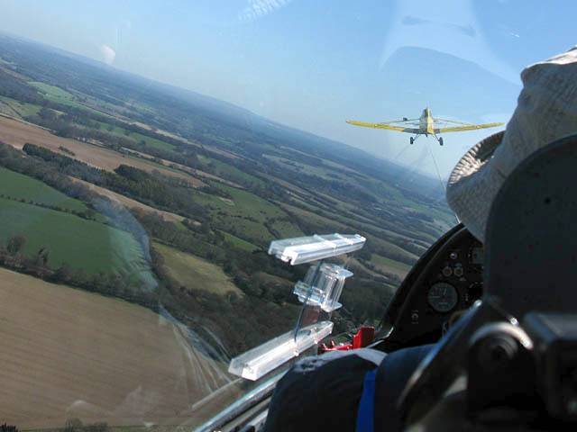
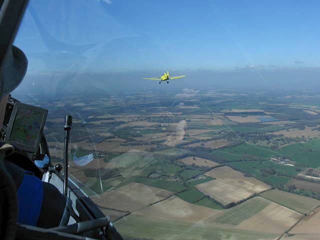
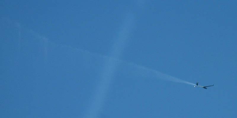
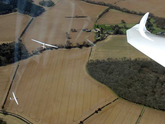
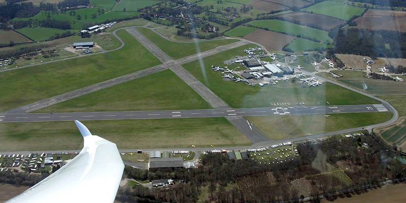
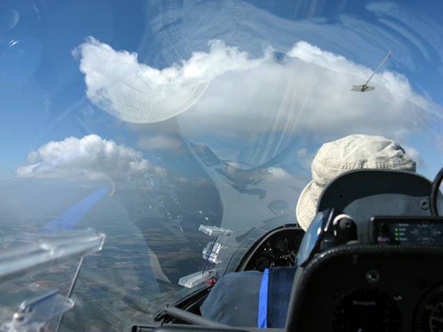
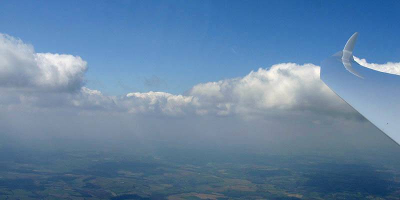
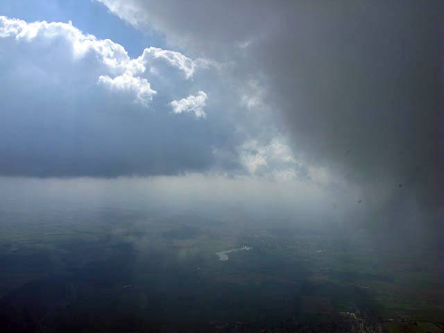
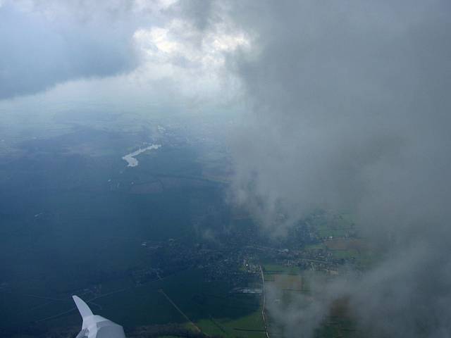
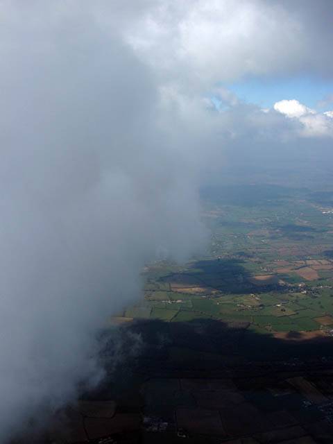
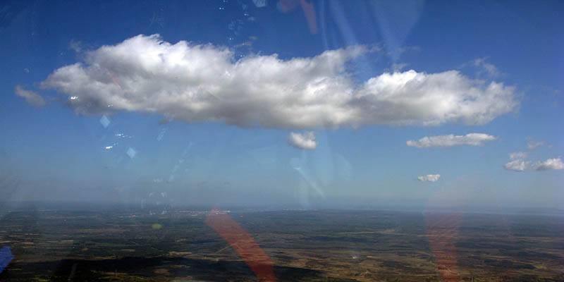
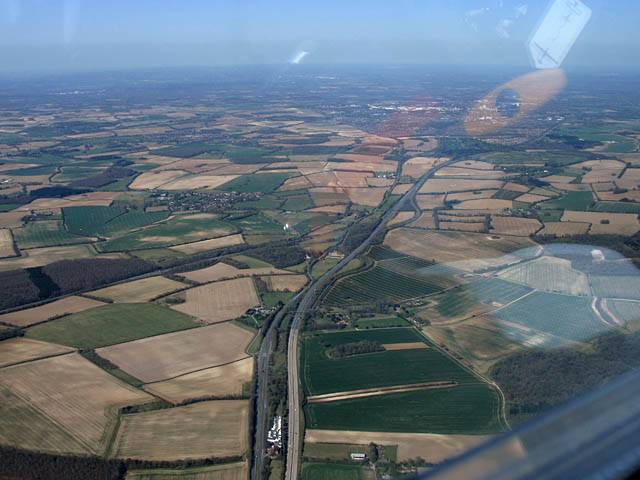
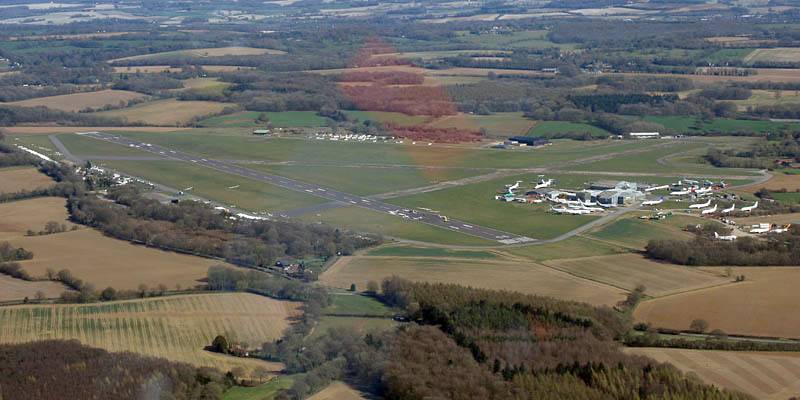
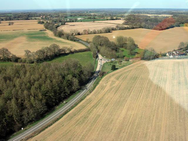
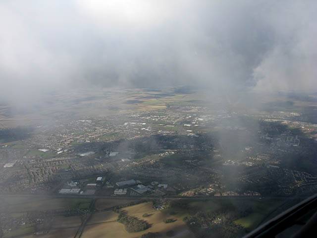
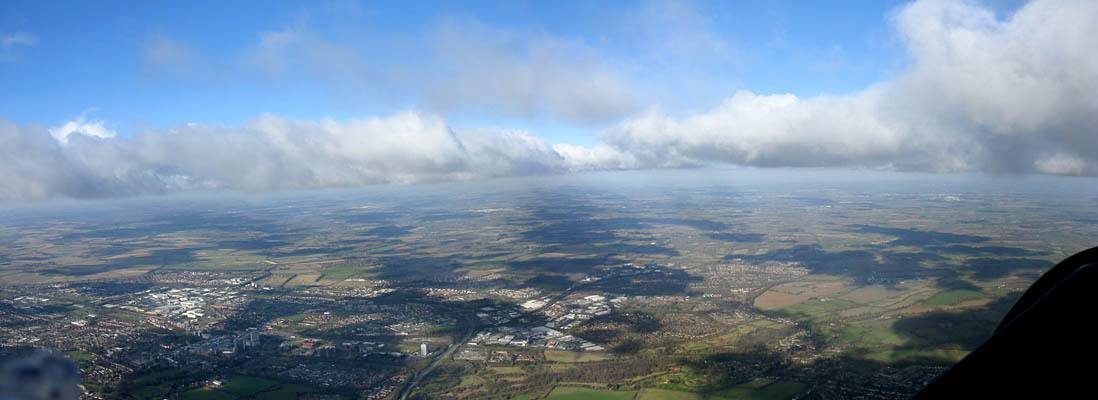
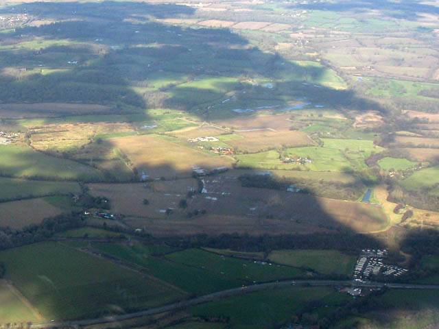
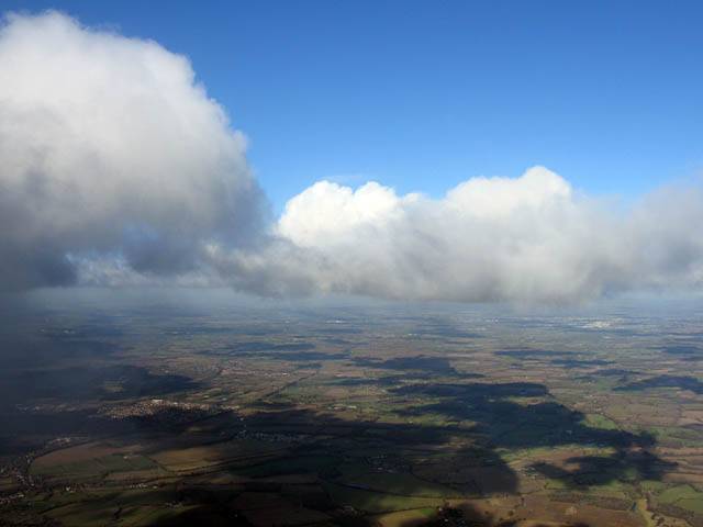
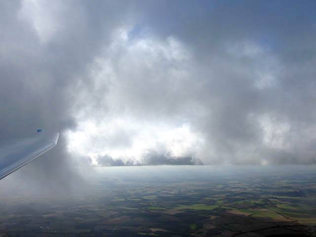
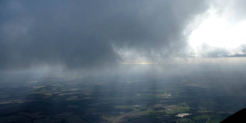
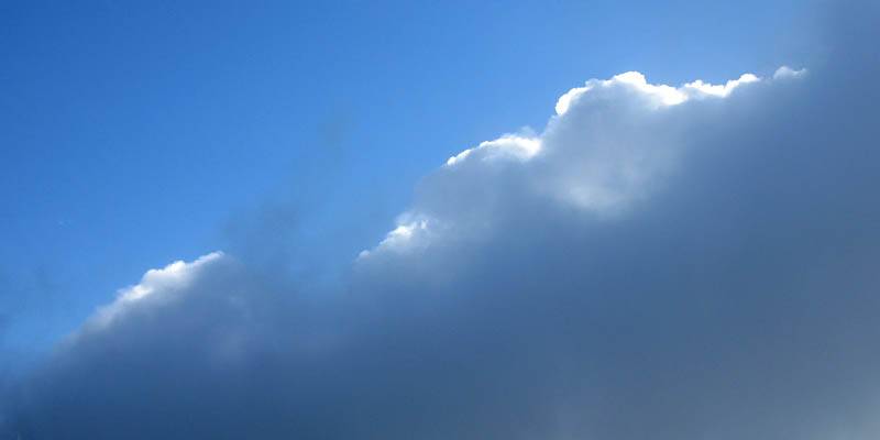
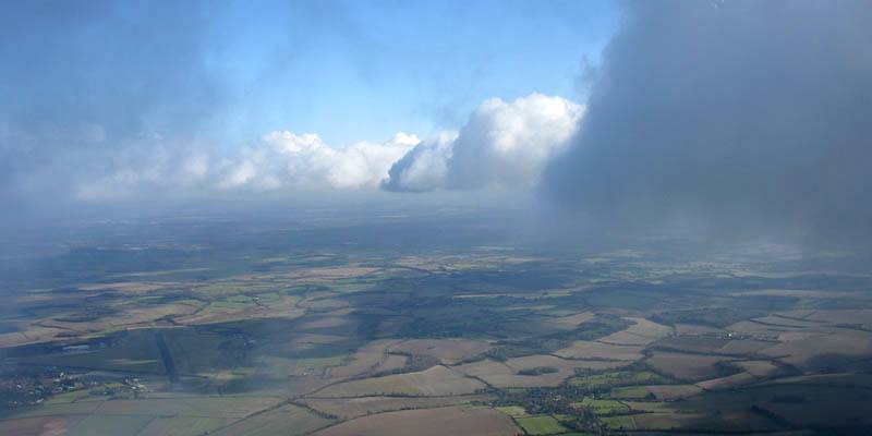
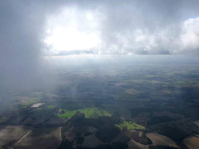
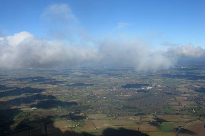
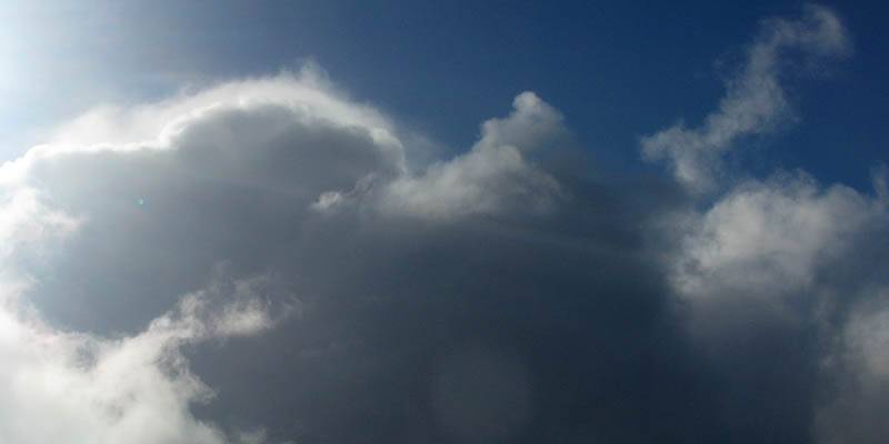
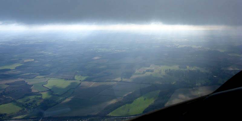
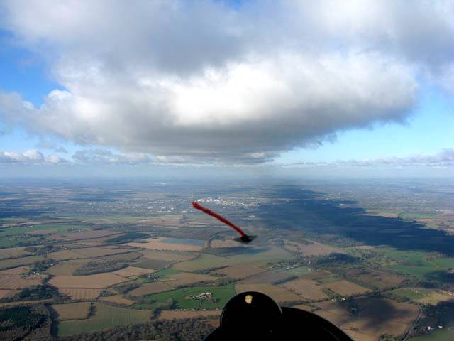
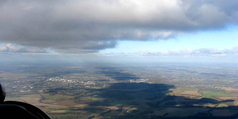
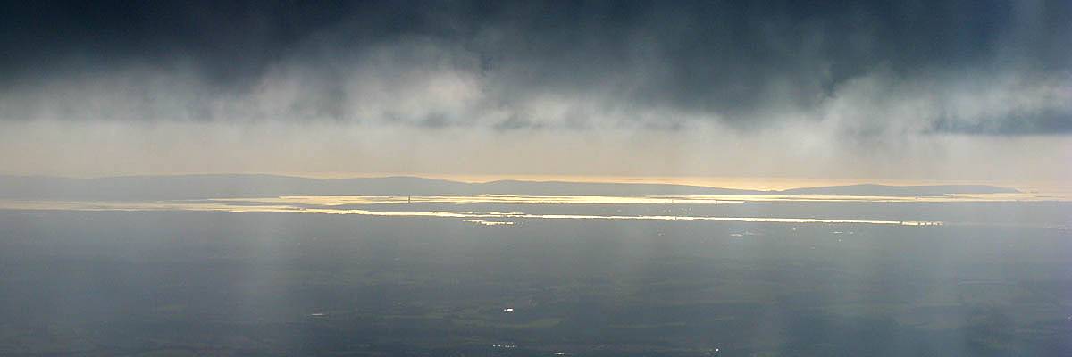
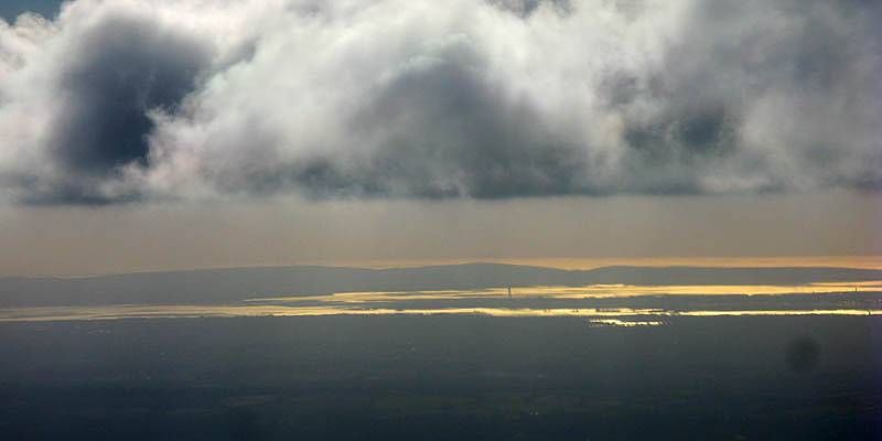
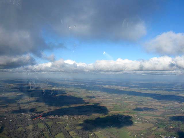
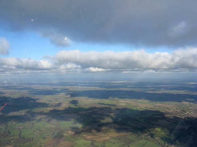
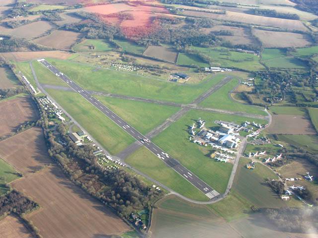
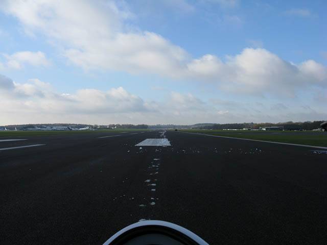
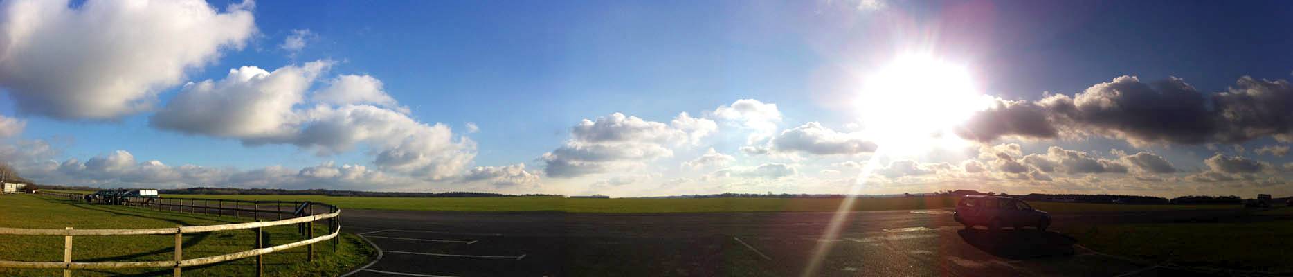
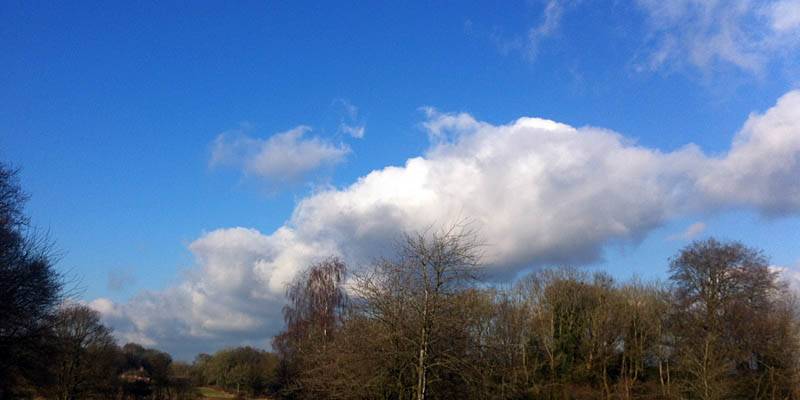
A bonus October soaring day with some crazy clouds. There was a lot of top cover and spreadout, but some sort of convergeance led to some very strange clouds. Some clouds had 'frilly skirts' down to 2500 feet, while others had smooth bases at 3000 to 3500 feet. Cloudbase was highly variable and generally dropped during the flight. The frilly skirts could be climbed up and made for lots of fun and eye candy. I was never able to go far from the airfield without encountering huge dead gaps under top cover. In the end severe spreadout (8/8's for miles) drifted in and killed off the thermals and I fell down after 2 hours 45 minutes. Good fun local soaring.
|
IMG_3319.jpg |
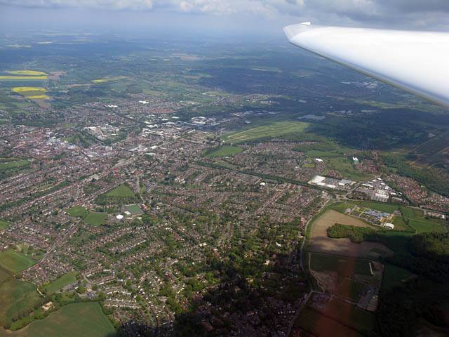
IMG_3328.jpg |
IMG_3330_3331_Panorama.jpg |
IMG_3336.jpg |
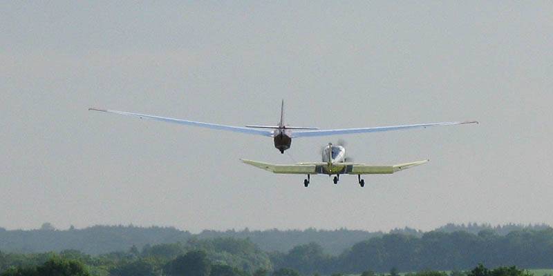
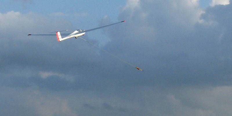
| iPhone shots taken while parked up and while in the winch queue as it starts to get soarable. | |||
 IMG_1898.jpg |
 IMG_1904.jpg |
 IMG_1907.jpg |
 IMG_1911.jpg |
 IMG_1921_1922_Panorama.jpg |
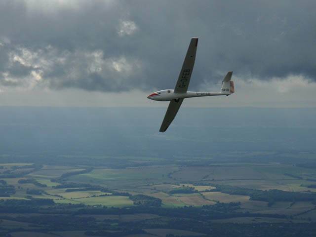
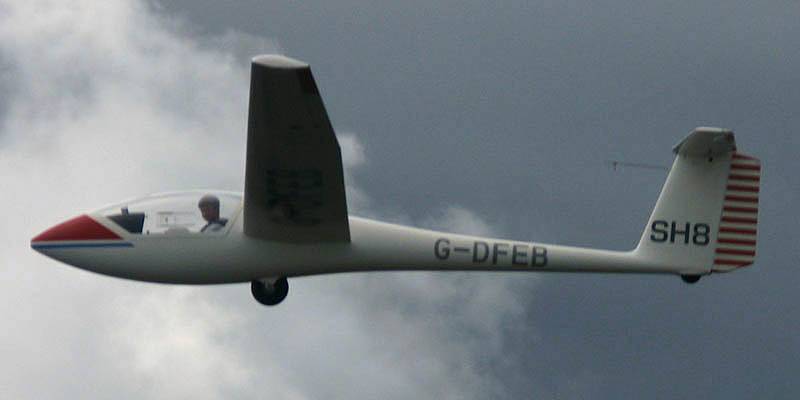
| Soon after launch and playing with the clouds. | Formation flying alongside Grob 102 SH8. | An above cloudbase panorama with Lasham below. | ||
 IMG_1923_1924_Panorama.jpg |
 IMG_1928.jpg |
 IMG_1931.jpg |
 IMG_1936_1942_Panorama.jpg |
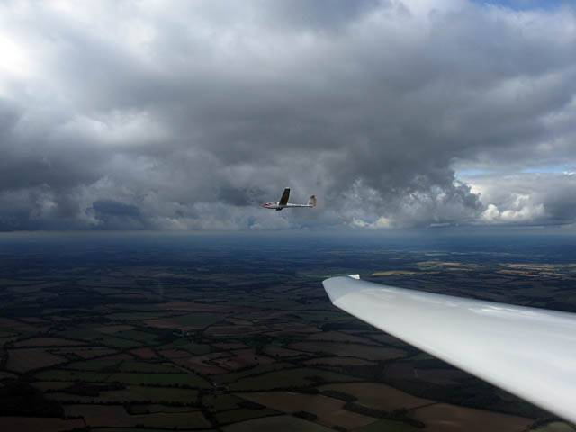
| Another panorama showing how much top cover there is. | Having fun zooming past wisps and filaments of cloud that dangle below the upper cloudbases. | This 180 degree panorama makes it look like 2 gliders are converging on me. But those wings are all part of my glider. | |
 IMG_1944.jpg |
 IMG_1956.jpg |
 IMG_1959.jpg |
 IMG_1962.jpg |
 IMG_1966.jpg |
| Looking back at the crazy clouds over Lasham Airfield from a higher smoother cloud further West. | Looking through a gap in the clouds towards Basingstoke from the South. | More crazy cloud art, to the North of Lasham and back near the airfield. | ||
 IMG_1967_1971_Panorama.jpg |
 IMG_1975.jpg |
 IMG_1983.jpg |
 IMG_1994.jpg |
 IMG_1998.jpg |
| A panorama showing more of the crazy cloudstreet drifting over Lasham from the Northwest. | Looking down through cloud at the airfield. | Lasham Airfield from the Southwest. | Heading up the cloud street to the North where top cover is pretty severe. Fragments of cloud below me whizzing past make the views exquisite. | |
 IMG_2005.jpg |
 IMG_2013.jpg |
 IMG_2021_2025_Panorama.jpg |
 IMG_2044_2046_Panorama.jpg |
| More low cloud fragments below and around me. | Another panorama further up the cloud street. | Wing pointing Southwest from Basingstoke towards a hole in the cloud that almost glowed like a beacon. | |
 IMG_2047.jpg |
 IMG_2049.jpg |
 IMG_2070.jpg |
 IMG_2075.jpg |
| A closer look at the cloud hole beacon. | More cloud art. Like an alpine valley surrounded by majestic mountains. | Glider passing below me over Basingstoke. | Spying on a match at Basingstoke Town Football Club over 3000 feet below me. |
 IMG_2099_2101_Panorama.jpg |
 IMG_2103.jpg |
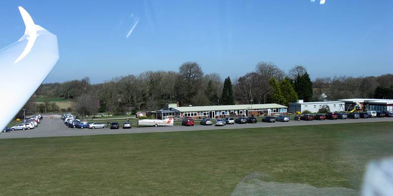
| Upwind severe 8/8 spreadout locally kills off the thermals. With no other thermals in range the end of the flight is nigh. | An aerotow passing beneath me North of the airfield as I glide gently back to earth. |
A few above cloudbase pictures taken after a cloudclimb to 5500 feet near Hurstbourne Tarrant.
 IMG_2926_2927_Panorama.jpg |
 IMG_2928.jpg |
 IMG_1610_1612_Panorama.jpg |
| iPhone pictures taken including some panoramas. | ||
 IMG_1613.jpg |
 IMG_1614.jpg |
 IMG_1616.jpg |
 IMG_1617.jpg |
 IMG_1619.jpg |
 IMG_1621.jpg |
| More pictures taken with the main Canon Powershot A650IS camera. | |||||
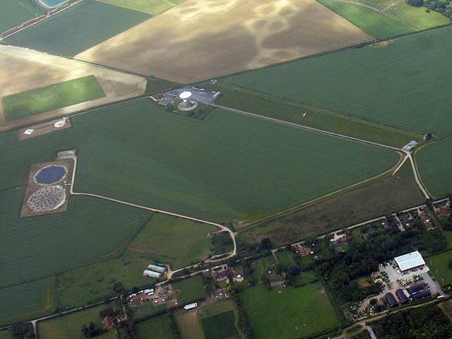
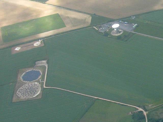
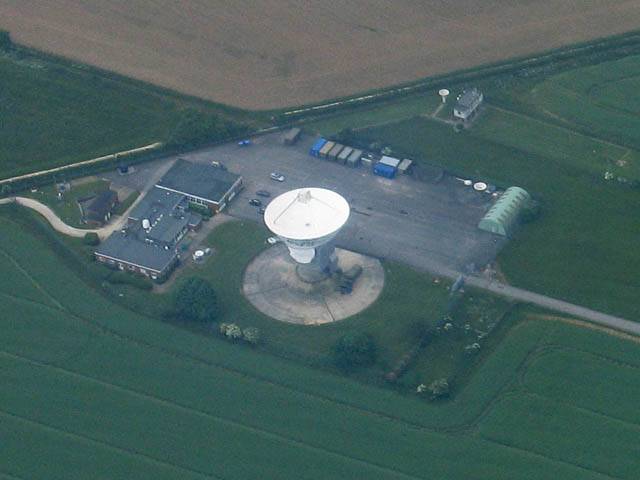
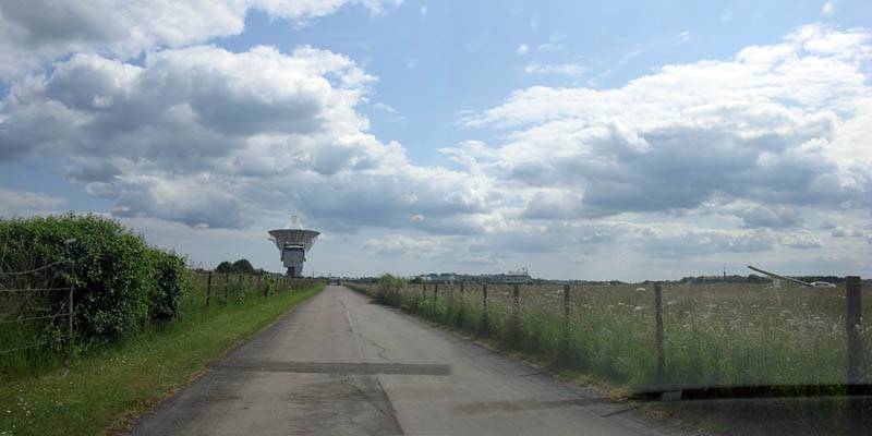
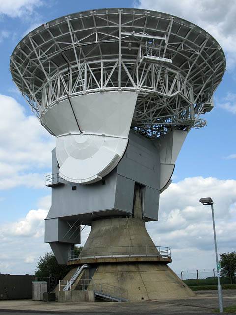
Spreadout was pretty severe again today. But this time I atleast managed a short cross country flight before it got too bad. It was an early start, launching at 10:37AM with cloudbase already almost 3000 feet above Lasham. I landed some time after 2PM. Then followed a trip to Chilbolton to retrieve a glider that had landed out. While we were there the kind staff offered us a tour inside the radio telescope. Cool! I've always wondered what CBN looks like from the ground. Getting to see inside was an even bigger bonus.
 IMG_2871.jpg |
 IMG_1399_1400_Panorama.jpg |
 IMG_1402.jpg |
 IMG_1407.jpg |
 IMG_1412.jpg |
| Towing SH4 out to the launch point, raring to go! | Lovely conditions early in the flight. | Early bad spreadout developing already in the Petersfield area. | Chilbolton air strip, just SW of the radio telescope (which is roughly underneath me). | |
 IMG_1414.jpg |
 IMG_1414_2.jpg |
 IMG_1417.jpg |
 IMG_1417_2.jpg |
 IMG_1417_3.jpg |
| Views of Chilbolton radio telescope, and of a glider landed on the old runway strip there. | ||||
 IMG_1419.jpg |
 IMG_1423_1424_Panorama.jpg |
 IMG_1426_1431_Panorama.jpg |
 IMG_1434.jpg |
| Smoke to the Northeast of Chilbolton Radio Telescope. | Views as the spreadout worsens, as I head back to Newbury. | ||
 IMG_1443.jpg |
 IMG_1446_1449_Panorama.jpg |
 IMG_1447.jpg |
 IMG_1450.jpg |
 IMG_1457.jpg |
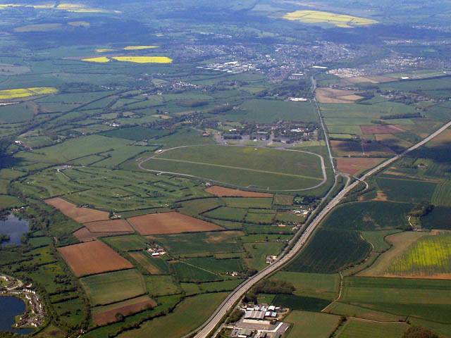
| Soaring over Greenham Common. | Experimental panorama above Newbury. | Newbury Racecourse. | Greenham Common looking East. | Returning to Basingstoke as the sky slowly closes in. |
 IMG_1460.jpg |
 IMG_1464.jpg |
 IMG_1468.jpg |
 IMG_1477_1480_MatrixPanorama.jpg |
| Soaring past low wisps of cloud to a higher cloudbase. | Getting above cloudbase. | Severe spreadout. | Still some nice thermals around. |
 IMG_1483_1486_Panorama.jpg |
 IMG_1487_1490_MatrixPanorama.jpg |
 IMG_1491_1493_Panorama.jpg |
| A dragon in the sky above Hampshire! | Killer spreadout starting to strangle the local thermals. | |
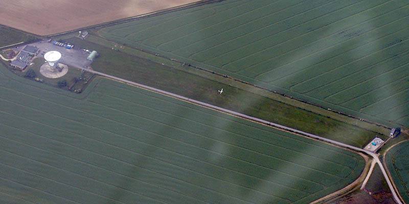
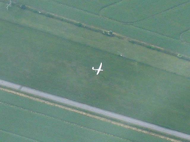
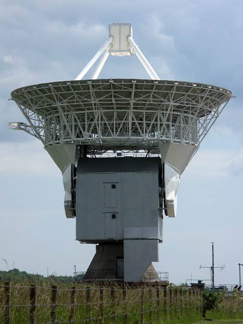
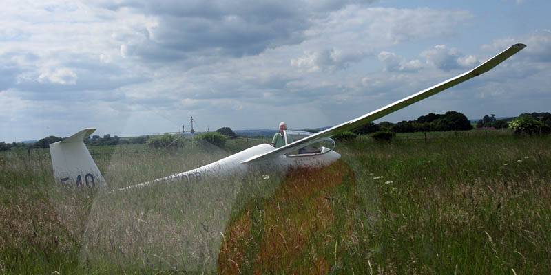
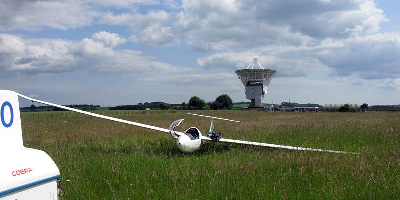
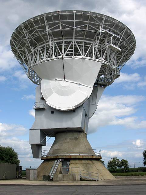
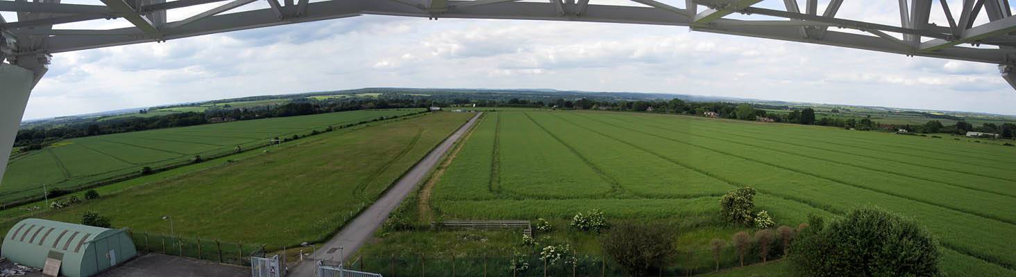
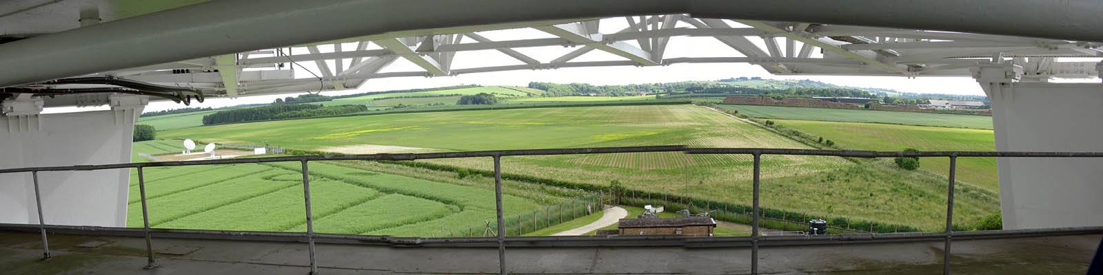
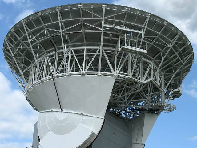
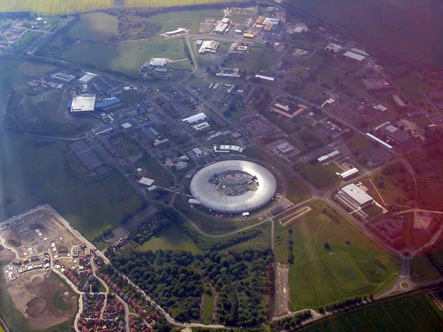
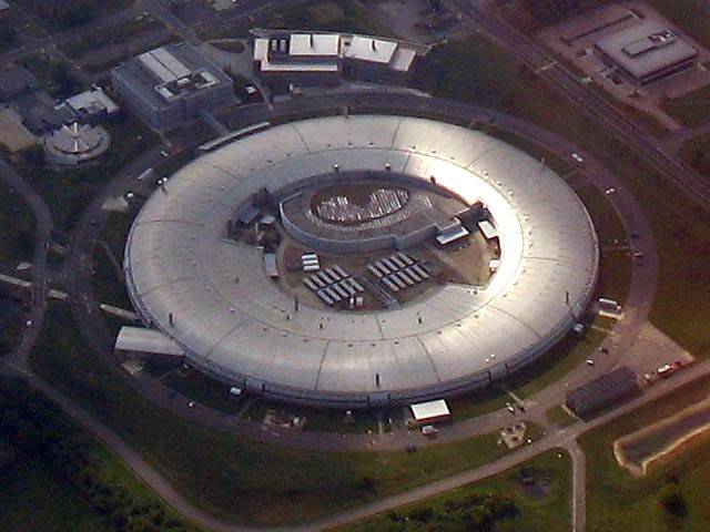
Pictures taken at Chilbolton Radio Telescope (CBN) while retrieving the landed glider spotted from above earlier on. It had landed on what used to be a runway at CBN, but now is a field containing meter high long grass. This was impossible to tell from the air, so just goes to show how tricky it can be to determine the exact nature of the surface of a potential landout field from high above.
 IMG_1495_1497_Panorama.jpg |
 IMG_1499.jpg |
 IMG_1503.jpg |
 IMG_1505.jpg |
 IMG_1506.jpg |
| Approaching CBN with the glider landout visible to the right. | CBN from the ground. | Discus 2 glider landed in meter high long grass next to CBN. | CBN from the ground, another angle. | |
 IMG_1508.jpg |
 IMG_1510.jpg |
 IMG_1511.jpg |
 IMG_1518.jpg |
 IMG_1515.jpg |
 IMG_1517.jpg |
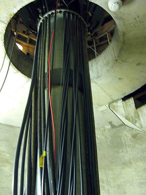
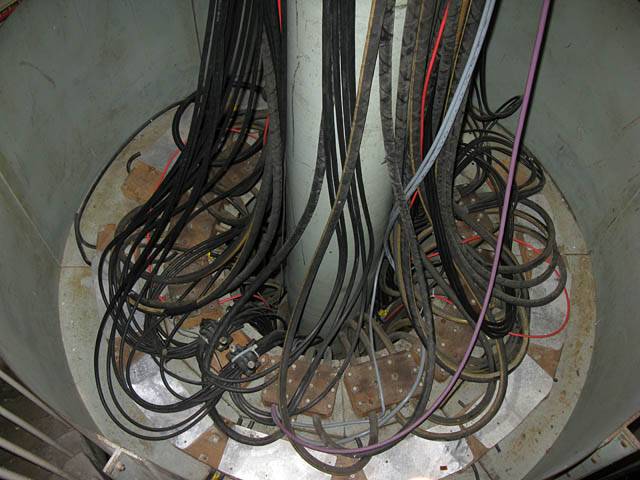
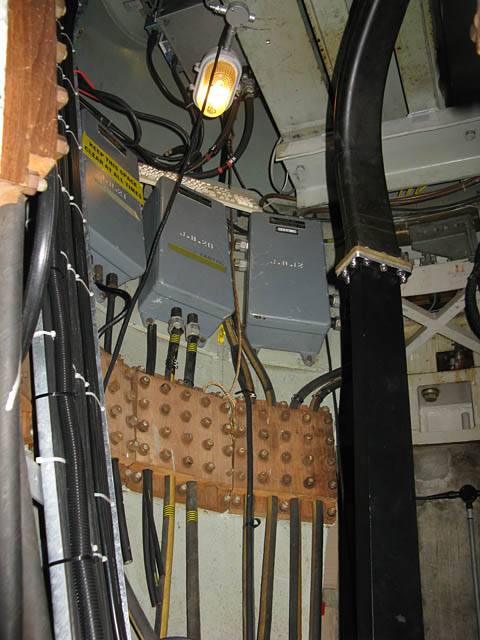
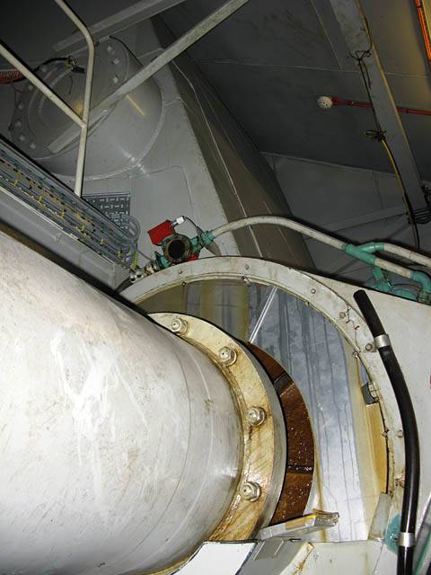
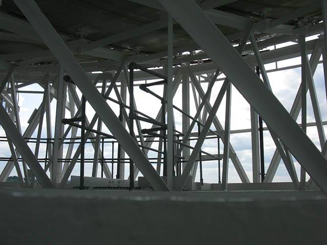
| Exploring inside the concrete base of CBN. | The cables with enough slack to allow the telescope to swivel almost all the way around without snapping them. | Other instruments and controls and other devices inside the core. | |||
 IMG_1520.jpg |
 IMG_1524.jpg |
 IMG_1527.jpg |
 IMG_1528.jpg |
 IMG_1530.jpg |
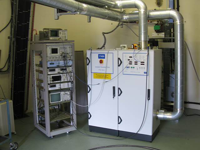
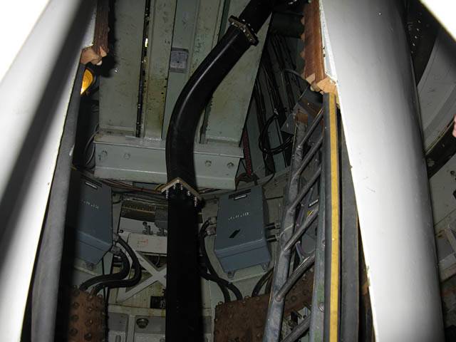
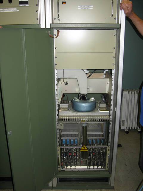
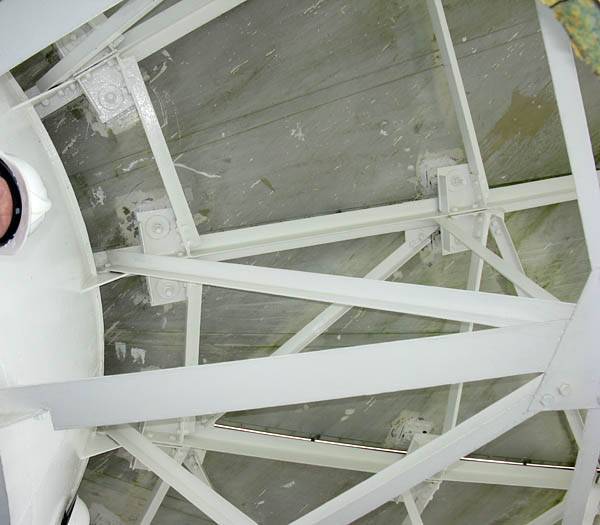
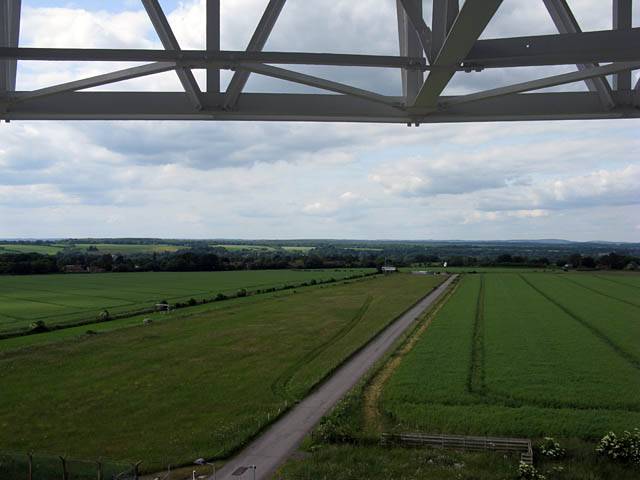
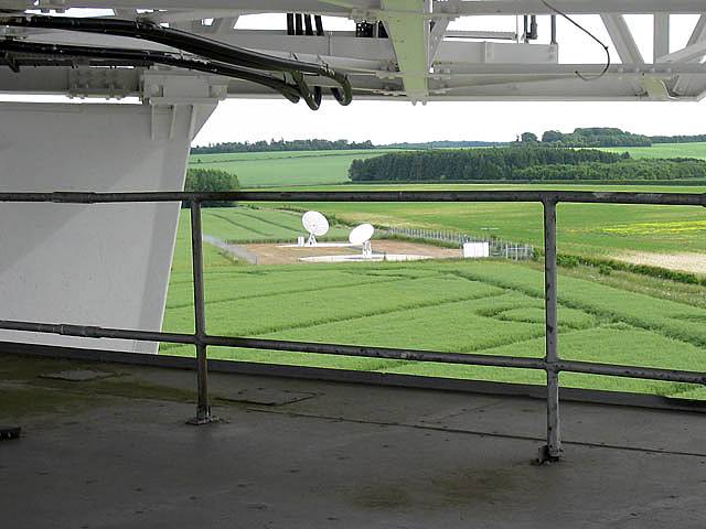
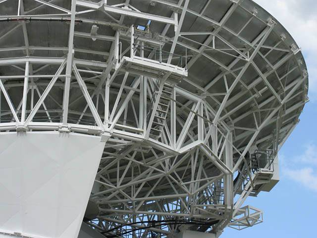
| A 700kW transmitter that powers the radio telescope. | This beam is the main horizontal axis. | Looking up through a hatch to the underside of the main dish. | Looking out across the landout field from under the dish of CBN. | Two other dishes nearby (2m and 6m). |
 IMG_1531_1533_Panorama.jpg |
 IMG_1534_1536_Panorama.jpg |
 IMG_1537.jpg |
| Two panoramas looking out each way from under the main dish of CBN. | Looking through the metal beam structure holding the radio telescope in position. | |
 IMG_1541.jpg |
 IMG_1542.jpg |
 IMG_1543.jpg |
| More views of CBN from another angle after we exit the structure. You can see the platforms that allow access to the top surface of the dish. | ||
Spreadout was pretty severe today. But I had fun local soaring. It's always good to get off the ground!
 IMG_1351_1352_Panorama.jpg |
 IMG_1360.jpg |
 IMG_1362_1367_Panorama.jpg |
| Having fun at cloudbase. | Peering through a gap in the clouds. | 180 degree panorama looking roughly Westwards. (The M3 to the left is roughly looking SSW.) |
 IMG_1371_1381_360Panorama.jpg |
| 360 degree panorama taken while circling somewhere between Basingstoke and Overton. Lasham to the Southeast is roughly centre. |
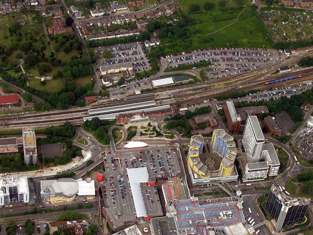 IMG_1383.jpg |
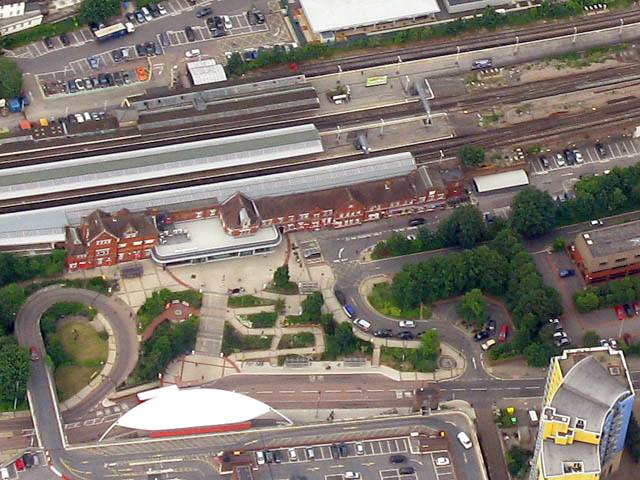 IMG_1383_2.jpg |
 IMG_1392_1394_Panorama.jpg |
| Views of Basingstoke train station from the South. | Looking Westwards into an increasingly dead sky. | |
Pictures taking during a group airex evening. I brought a bunch of colleagues from work to have flights in a glider. I still have a 100% record for colleagues landing with big grins on their faces!
 IMG_1222.jpg |
 IMG_1228.jpg |
 IMG_1229.jpg |
 IMG_1231.jpg |
 IMG_1235.jpg |
 IMG_1246.jpg |
 IMG_1247.jpg |
| Robin tug ready to tow. | Glider launching on aerotow on the medium runway. | Robin tug overflying as it lands. | Glider coming in to land. | |||
 IMG_1257.jpg |
 IMG_1263.jpg |
 IMG_1273.jpg |
 IMG_1274.jpg |
 IMG_1281.jpg |
 IMG_1283.jpg |
| Glider coming in to land. | Incoming Robin tug. | Glider coming in to land. | Another aerotow. | Incoming Robin tug. | |
 IMG_1287.jpg |
 IMG_1294.jpg |
 IMG_1297.jpg |
 IMG_1298.jpg |
 IMG_1299.jpg |
 IMG_1319.jpg |
| Cumulus backdrop to airborne glider. | Another aerotow. | A winch launch. | More shots of the Robin tug. | ||
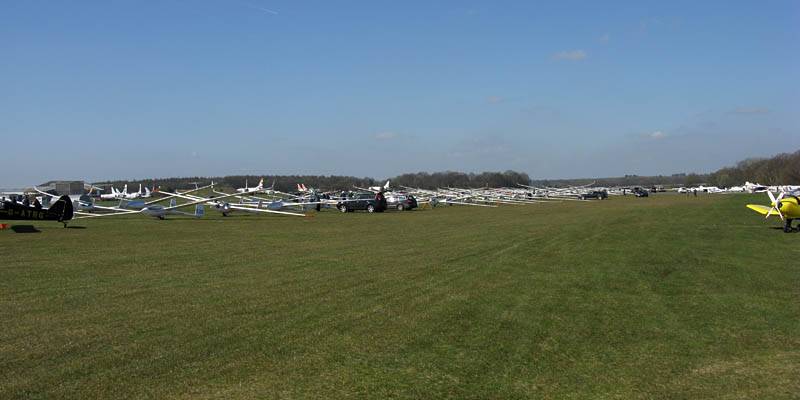
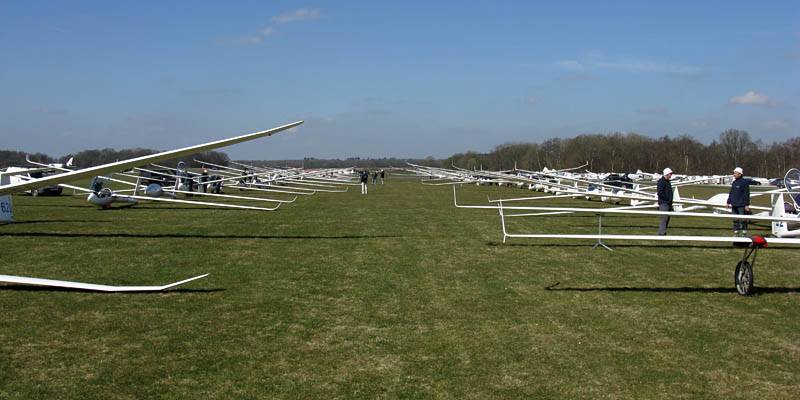
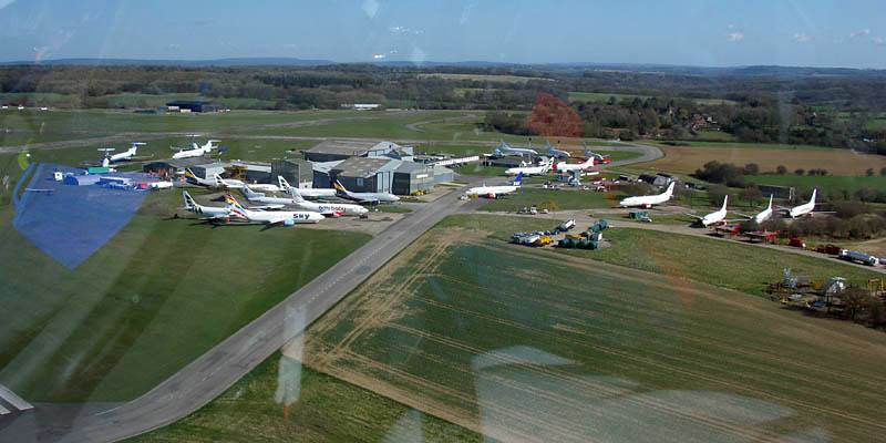
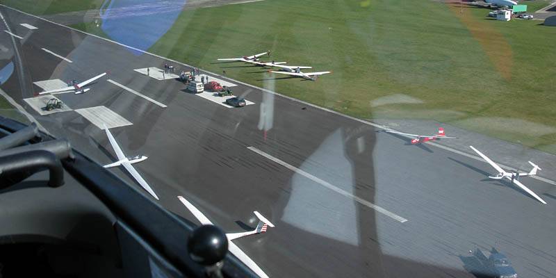
My first 300km flight of the year. It was the first day of the Lasham Regionals and there was a huge grid of 80 competition gliders. With another 50+ club gliders also joining in there were maybe 130 gliders in the grid. However with 8 tugs in action they made short work of all those gliders. I was in the 5th row of non comp gliders at the back of the grid. While the competition gliders were launching I took the opportunity to take some pictures of the tugs in action, including the unusual sight of 4 tugs towing in one frame.
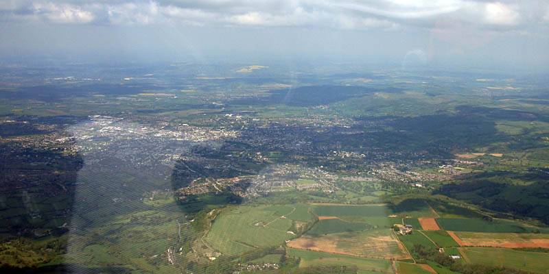
Then soon enough I was launched myself. Cloudbase had been low for a while so the delay suited me. It was a slow start but eventually I had a good run past Swindon, sneaking between the South Cerney parachute drop zone and the Fairford ATZ on the way. Then over the Cotswolds I struggled a bit, but eventually made it to Birdlip. The second leg to Northampton was stonking, with no more headwind, cloudbase up to 5500 feet and lines of energy along track making for an easy run, and my average speed recovering to above 70kph. Once round Northampton is was a straight forward dash back downwind home. I did pause at Didcot for pictures of the power station that has shut down, and also of Milton Park nest door where the Abingdon office of the company I now work for is located. At that point my speed was up to 77kph. Then after spending a while getting back up to height I resumed an easy run home to land after just over 4 hours airborne.
I had problems with poor visibility into sun during this flight, which affected the photography, especially later in the flight. Well done to Photoshop Elements where the lighting adjustment allowed me to cancel out much of the haze. Still nothing like a clear shot but great to rescue some otherwise unusuable shots. Also mind the unavoidable canopy reflections too.
 IMG_0011.jpg |
 IMG_0013_0016_Panorama.jpg |
 IMG_0022.jpg |
 IMG_0023.jpg |
 IMG_0026.jpg |
| 100 gliders in front of me on the grid, and another 30 or so behind me. Mind the dodgy seam in the panorama... | Gliders soaring to the Southwest of the airfield. | One of the Robin tugs on circuit, tow rope trailing. | ||
 IMG_0028.jpg |
 IMG_0029.jpg |
 IMG_0030.jpg |
 IMG_0031.jpg |
 IMG_0033.jpg |
 IMG_0034.jpg |
| I managed to photograph 6 of the 8 active tugs. The Lasham Cub, 3 Robins, a Pawnee, and a Cub on loan from another club. | |||||
 IMG_0037.jpg |
 IMG_0040.jpg |
 IMG_0043.jpg |
 IMG_0044.jpg |
 IMG_0049_0050_Panorama.jpg |
| Multiple aerotows ahead of me. Includes a rare view of 4 tows in one frame. | Before long I am launched by FoxFox. Cloudbase 3000 feet above Lasham. | Setting off Northwestwards, passing on the Southwest side each of Newbury and Membury. | ||
 IMG_0051_0052_Panorama.jpg |
 IMG_0055_0056_Panorama.jpg |
 IMG_0062.jpg |
 IMG_0063.jpg |
| Approaching Swindon. Looking North towards the Redlands drop zone. | Looking across Swindon. Now the old Lyneham airspace has gone I can fly right over Swindon and keep well away from the Redlands drop zone. | Sneaking Northwards between South Cerney and Fairford. | |
 IMG_0064.jpg |
 IMG_0065.jpg |
 IMG_0070.jpg |
 IMG_0071.jpg |
 IMG_0074.jpg |
 IMG_0076.jpg |
| Looking North to Cheltenham and Southwest to Gloucester from the Birdlip turning point. | Edgehill gliding club from the South. | Approaching from the West and passing Banbury to the North. | Silverstone in the distance to the South as I approach Northampton. | ||
 IMG_0081_0083_Panorama.jpg |
 IMG_0087.jpg |
 IMG_0095.jpg |
 IMG_0100.jpg |
 IMG_0102.jpg |
| Panorama of Northampton looming to the East, just before I turned and started to head home. | Passing Silverstone on the Eastern side. Into sun shots made photography a challenge. | Bicester town and gliding club. | ||
 IMG_0103.jpg |
 IMG_0108.jpg |
 IMG_0114.jpg |
 IMG_0124.jpg |
| I recognised Hell Coppice as I passed by. A butterflying spot where Brown Hairstreaks can be found later in the year. | Oxford from the East. | Approaching Didcot from the North. | Didcot Power station from the Western side. The coal pan now empty, with the power station having been shut down. |
 IMG_0146_0149_Panorama.jpg |
 IMG_0151_0153_Panorama.jpg |
 IMG_0159.jpg |
 IMG_0159_CroppedIn.jpg |
| Panoramic views of Didcot Power Station from the South, with Milton Park to the West and Didcot town to the East/Southeast. | Harwell nuclear research facility from the Northeast. (Yes I was well outside the restricted airspace that surrounds it.) | ||
After failing to get a single seater in the ballot I was kindly offered the back seat of a private Duo Discus Turbo. This gave me a rare opportunity to take pictures during landing and take off. With a mixture of blue conditions at Lasham, high based cumulus to the West and Northwest, and damper murkier air near Sherborne (sea air?) causing a big step down in cloudbase, it made for a varied and interesting pair of flights. The first flight was a short one as we fell down and an error starting the turbo meant we had to land. But for the second flight we got away and in the end had a good romp anticlockwise around the Salisbury Plain.
 IMG_9368.jpg |
 IMG_9373.jpg |
 IMG_9374.jpg |
 IMG_9375_9380_Panorama.jpg |
| Pictures of the biggest grid of the year so far. Maybe 60 gliders were present. | |||
 IMG_9381.jpg |
 IMG_9384.jpg |
 IMG_9386.jpg |
 IMG_9391.jpg |
 IMG_9394.jpg |
 IMG_9395.jpg |
| The glider in front about to launch. | Aerotow just after take off, banking in formation and just after release at 2000 feet. | Glider above releasing water ballast in early tricky conditions. | Take off take 2 after falling down, looking at the clubhouse as we pass by. | ||
 IMG_9396.jpg |
 IMG_9401.jpg |
 IMG_9408.jpg |
 IMG_9409.jpg |
 IMG_9411.jpg |
 IMG_9413.jpg |
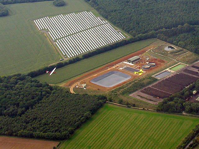
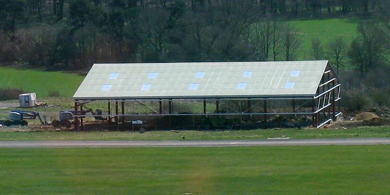
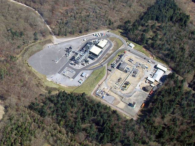
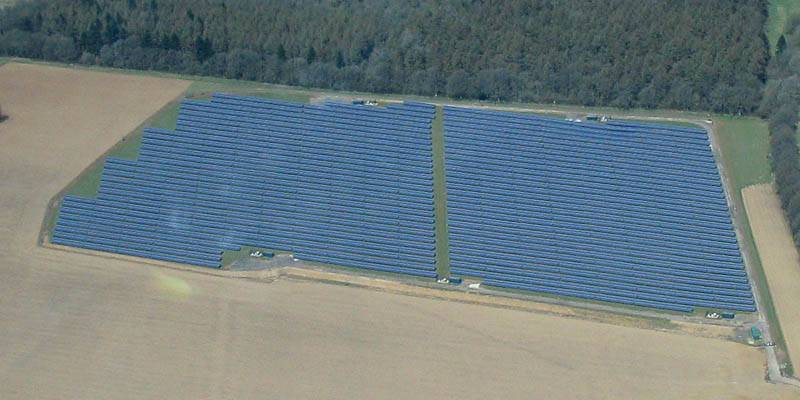
| The Gliding Heritage Centre Hangar on the South side taking shape. | Humbly Grove oil and gas plant from above. | Testing the turbo. | Another view of the solar panel field north of the airfield. | Sharing a thermal with other gliders. | A view of the airfield before we set off Northwestwards towards the cumulus. |
 IMG_9415.jpg |
 IMG_9423.jpg |
 IMG_9424.jpg |
 IMG_9427.jpg |
 IMG_9430.jpg |
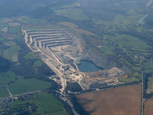
| Reaching the cumulus on the North side of Salisbury Plain after a plod across the blue. | Frome | Looking back past another glider at the bluer conditions behind. | A huge quarry to the West of Frome. | |
 IMG_9433.jpg |
 IMG_9444.jpg |
 IMG_9450.jpg |
 IMG_9456.jpg |
 IMG_9460.jpg |
 IMG_9463.jpg |
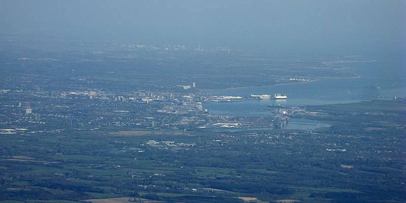
| Climbing up the side of a 1500 foot high sea breeze frontal cloud. Yeovil Reservoir visible in the background. | Climbing further up the 'wall'. | Climbing further up the 'wall'. | Flying past Salisbury on the way back. | Pretty cloudscape looking SSE towards Southampton from somewhere near Stockbridge. | |
 IMG_9475.jpg |
 IMG_9489.jpg |
 IMG_9493.jpg |
 IMG_9494.jpg |
 IMG_9504.jpg |
| A long range view of Southampton from the NNW. | Middle Wallop airfield from the South. | Chilbolton radio telescope from the Southwest. | Crossing the M3 South of Popham on final glide. | Returning to Lasham. |
 IMG_9512.jpg |
 IMG_9513.jpg |
 IMG_9516.jpg |
 IMG_9517.jpg |
 IMG_9518.jpg |
 IMG_2709.jpg |
| The touring caravan site and the launch point as seen from the circuit. | The A339 at the Avenue Road junction, ATC and the launch point as we come in to land. | The Duo Discus parked up after landing before it was put away. | |||
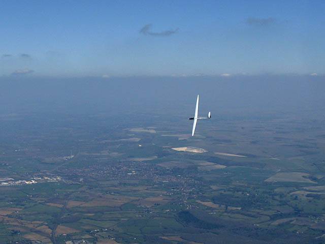
I unexpectedly had my first long soaring flight of the year today. A 3 hour soaring flight this early in the year is rather impressive for the UK, and very cold too! It was maybe -6/-7C at cloudbase, which topped out at 3700 feet. The flying wind was up to 33kph from the north. That made pushing upwind slow and difficult. But at times some long majestic streets formed. With the low sun angle, crystal clear air (60-70km visibility atleast) and the uniformity of the streets at times it made for rather pictoresque shadows. After 3 hours in the freezer I was more than happy to descend and defrost my feet again!
 IMG_9122.jpg |
 IMG_9127.jpg |
 IMG_9129_9130_Panorama.jpg |
 IMG_9132.jpg |
 IMG_9135.jpg |
 IMG_9145_9146_Panorama.jpg |
| Soaring just above cloudbase, slightly up the sides of the low bits, just South of the M3 near Basingstoke as I head NNW up a cloud street. | Panorama looking Northeast from just South of Basingstoke. | ||||
 IMG_9148.jpg |
 IMG_9153.jpg |
 IMG_9154.jpg |
 IMG_9156.jpg |
 IMG_9159.jpg |
 IMG_9161.jpg |
| Just north of the M3 I could see how soaked the ground is. | Cloud shadows. | Nice lighting as the sun shines through the clouds at different angles. | Looking East towards Odiham. | ||
 IMG_9163.jpg |
 IMG_9167.jpg |
 IMG_9168.jpg |
 IMG_9170.jpg |
 IMG_9173.jpg |
 IMG_9175.jpg |
| More lighting effects. | Flying along at cloudbase and slightly above some wisps. | Pileus forming above me above a larger cumulus tower. Almost obscured by the sun. | Looking into sun faint crepuscular rays are just visible. | The majestic cloud street that took me from Lasham to Basingstoke North, with well defined shadows below. | |
 IMG_9183.jpg |
 IMG_9184.jpg |
 IMG_9187_9188_Panorama.jpg |
 IMG_9192.jpg |
 IMG_9199.jpg |
 IMG_9221.jpg |
| Looking South toward Southampton, Portsmouth and the Isle of Wight. | Amazing shadows as I push North along the cloud street North of Basingstoke. | Lasham Airfield from the Northwest as I return to finish my flight. | |||
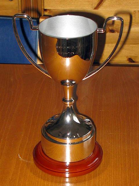
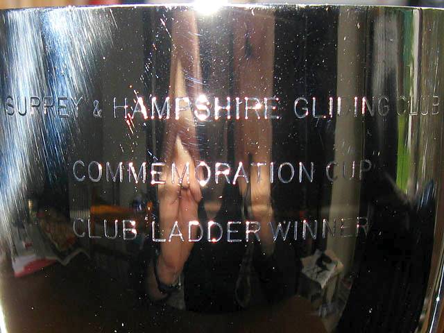
Pictures of the trophy that I won, including the engraving that I got organised for Lasham. I am the first winner of this new trophy remembering the days before S&H became integrated with Lasham rather than a separate club within a club.
 IMG_9031.jpg |
 IMG_9034.jpg |
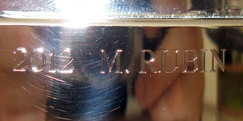 IMG_9.jpg |
| The Surrey & Hampshire Gliding Club Commemoration Cup Club Ladder Winner trophy. | The engraving for my 2012 win. The first on this new trophy. | |
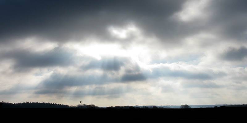
I took three winter winch launches in a Grob 102 to keep current on a cold winters' day. Snow had fallen the previous day but was melting away. Runway snow clearing by ATC had left blocks of ice strewn around the launch point and beyond. Early on wing icing was an issue, so it was necessary to get the scrapers out. The first launch was to 1300 feet, with scattered cloud at 800 feet. So I had a minute or so above cloudbase before I sunk rapidly below. Subsequent launches were limited by cloudbase, rising to 1100 feet with weak thermal activity. Everyone had flown by lunchtime, and everything was put away. But at 2pm the sky looked surprisingly soarable. Still, nothing too special and not worth busting a gut over. A pleasant winter's day none the less.
I also got to collect the trophy that was awarded to me in the December 2012 SGM for the best flight on the ladder in a Lasham single seater. Click here to see my winning flight on the ladder. I still can't believe such a slow 300km flight was the winner. I am sure there were others that flew further and/or faster. Shame they didn't put their flights up too.
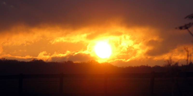 IMG_8867.jpg |
 IMG_8869_8870_Panorama.jpg |
 IMG_8873.jpg |
 IMG_8876.jpg |
| Sunrise at Lasham Airfield. | Flying just above cloudbase. | Moody cloudscape to the South back on the ground. | |
 IMG_8877_8878_Panorama.jpg |
 IMG_8879.jpg |
 IMG_2546_2550_Panorama.jpg |
 IMG_2552.jpg |
| Looking around the launch point as I prepare for another launch, with blocks of ice strewn across the runway ahead. | After lunch the sky over Lasham looked lovely with cloudstreets peppering the sky as I left to go home. | ||