
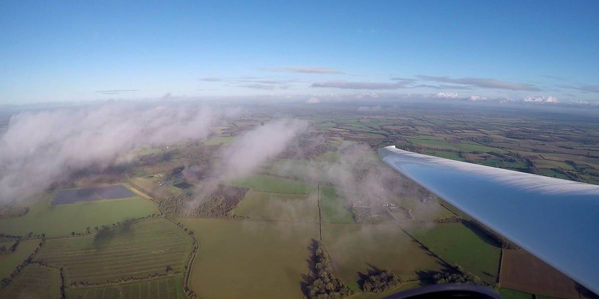
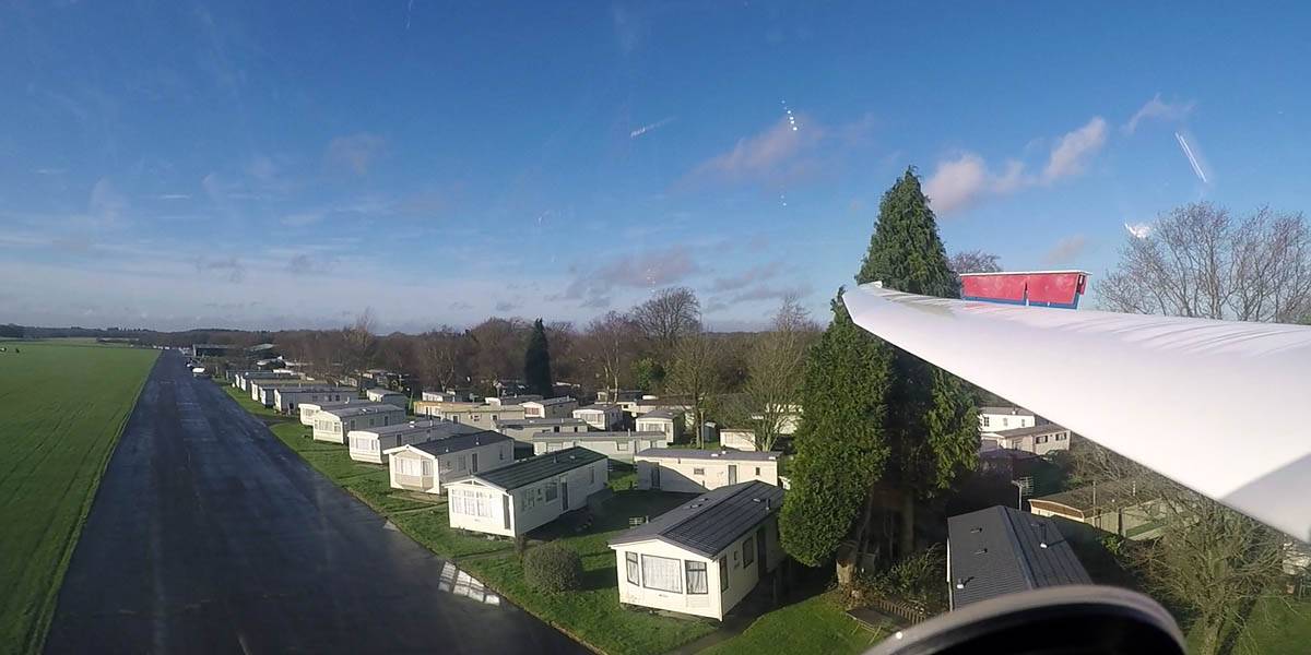
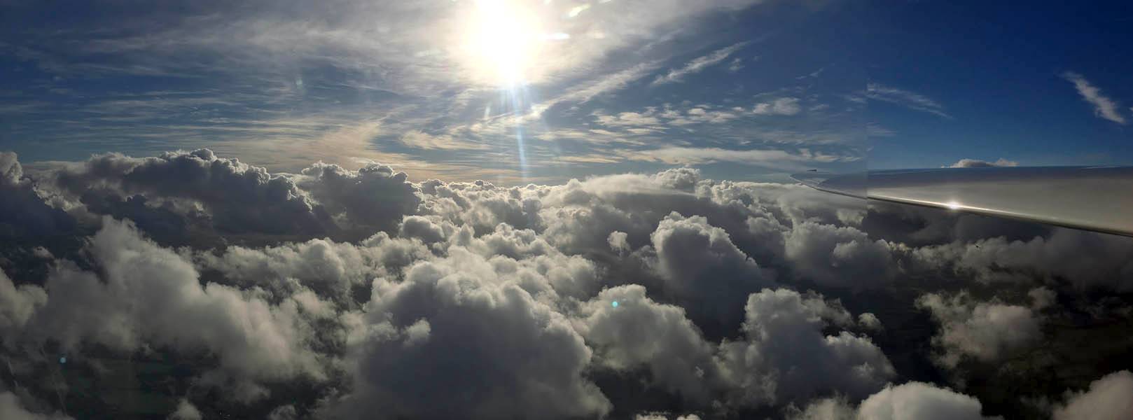
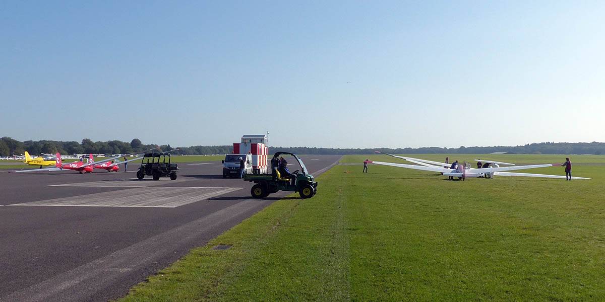
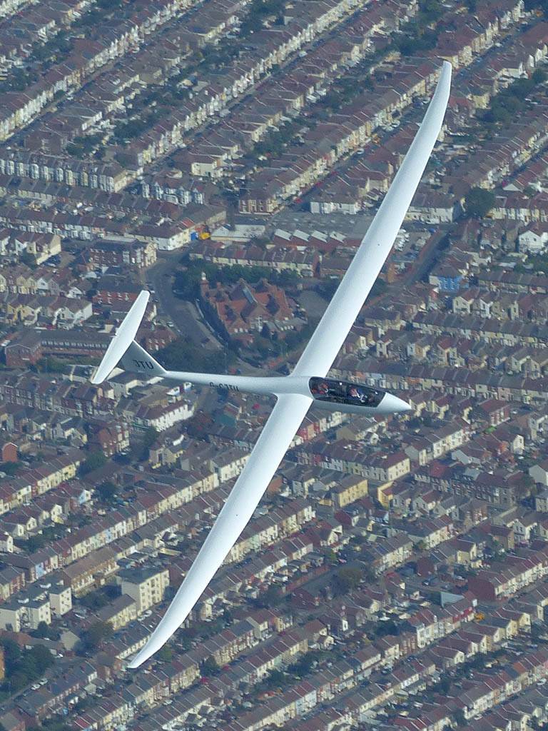
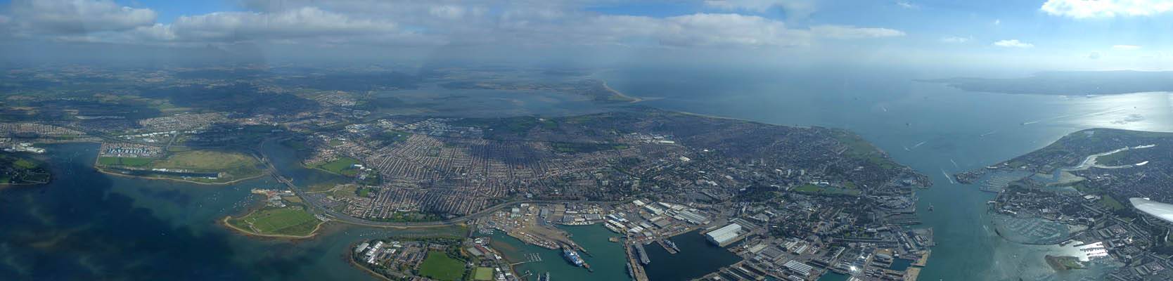
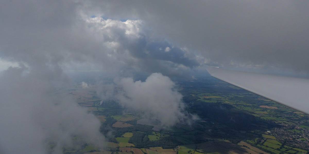
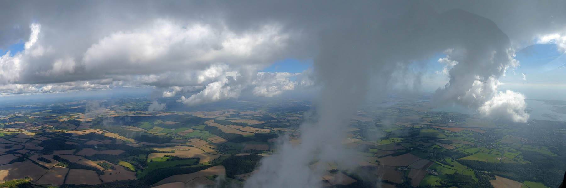
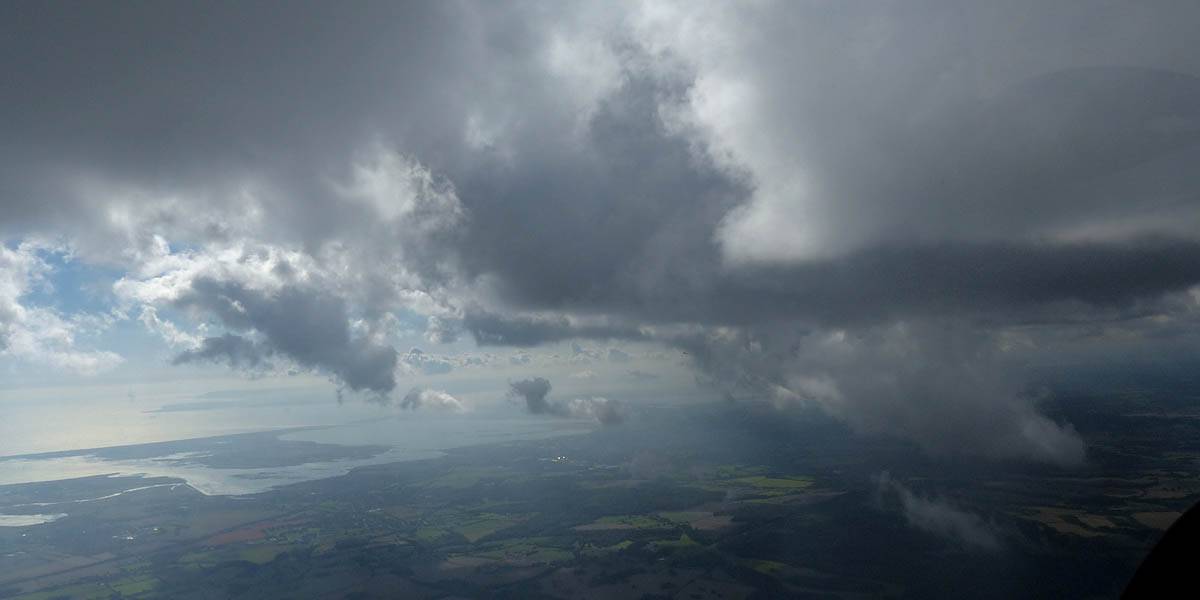
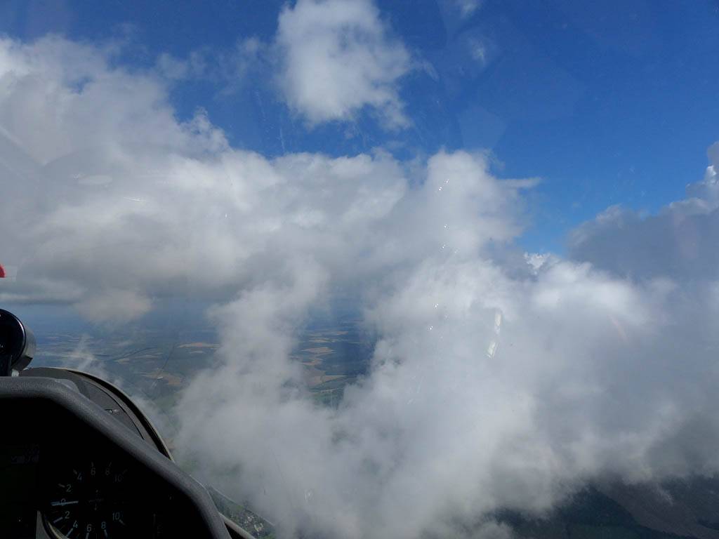
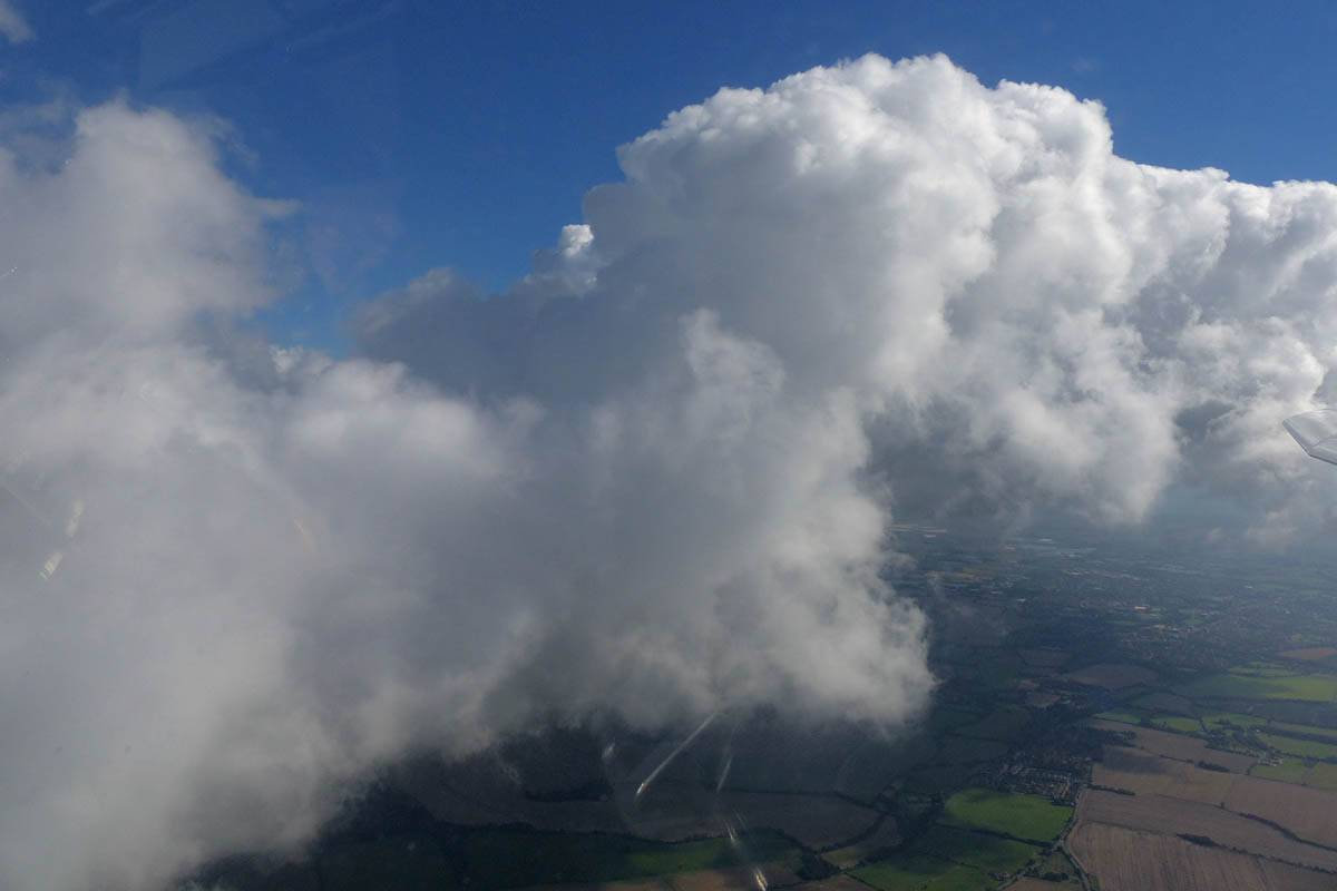
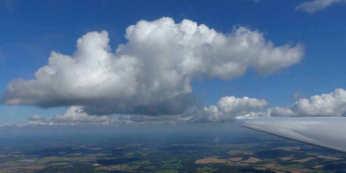
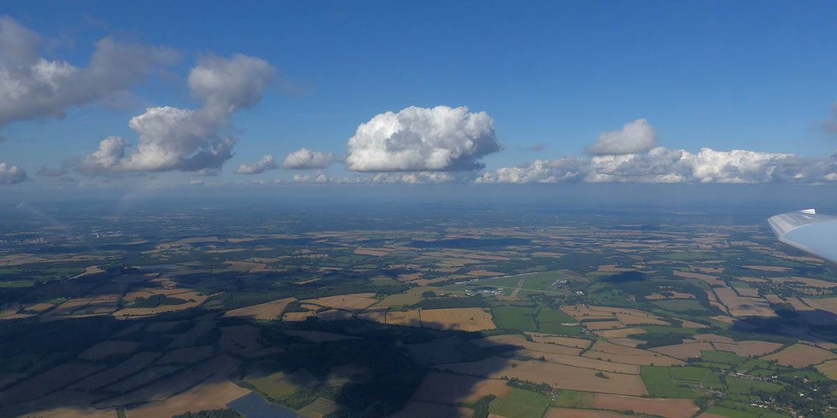
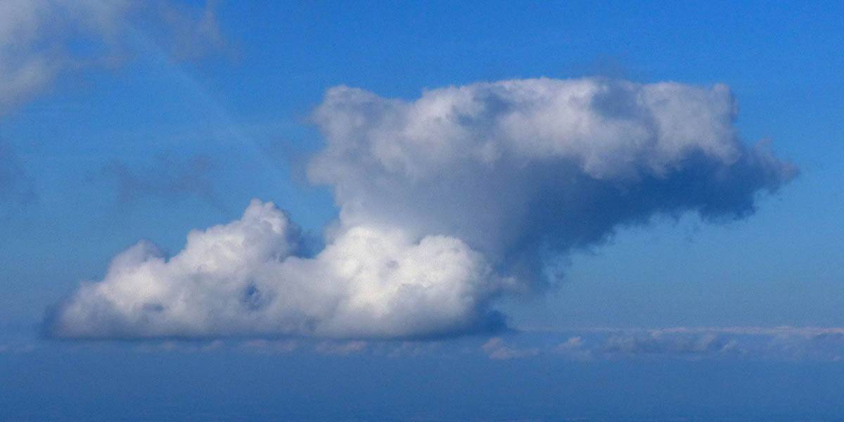
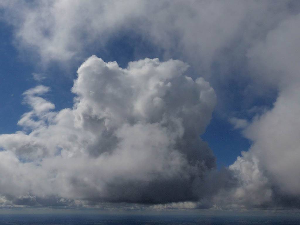
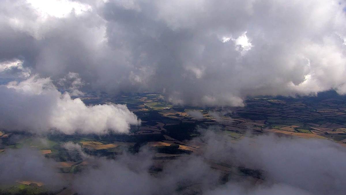
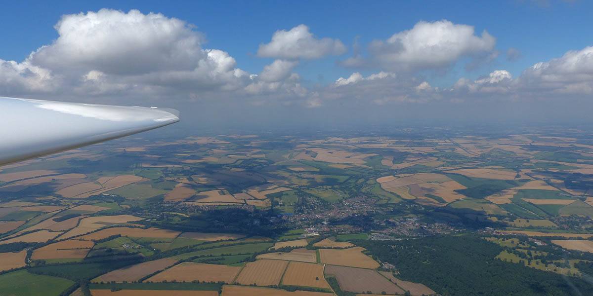
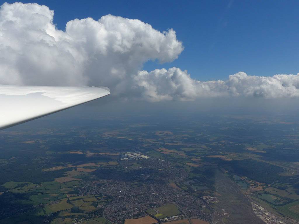
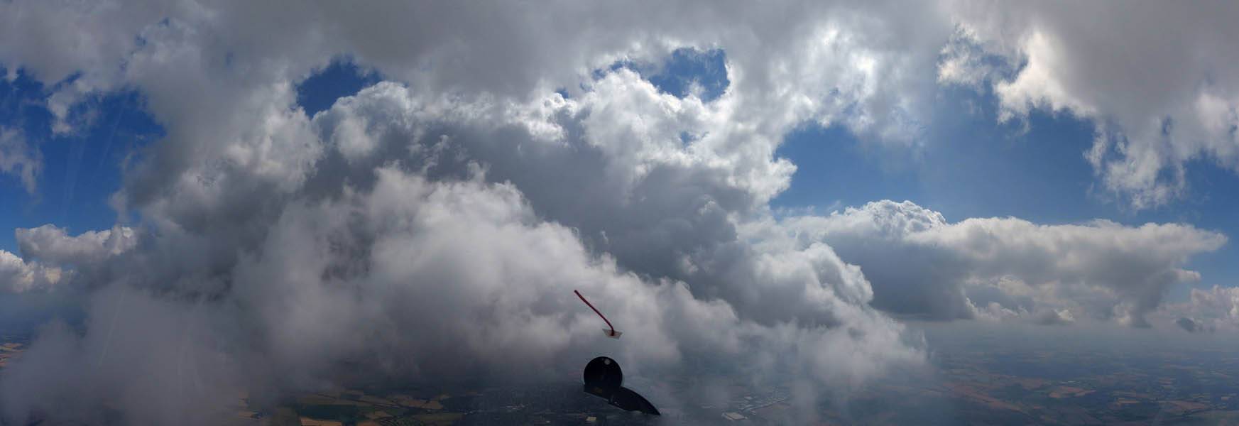
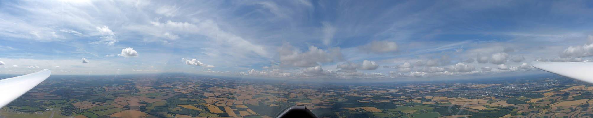
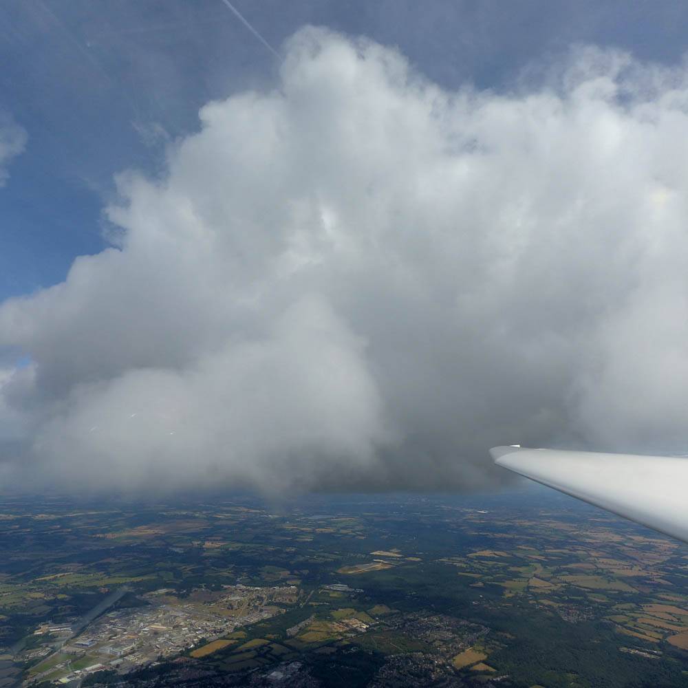
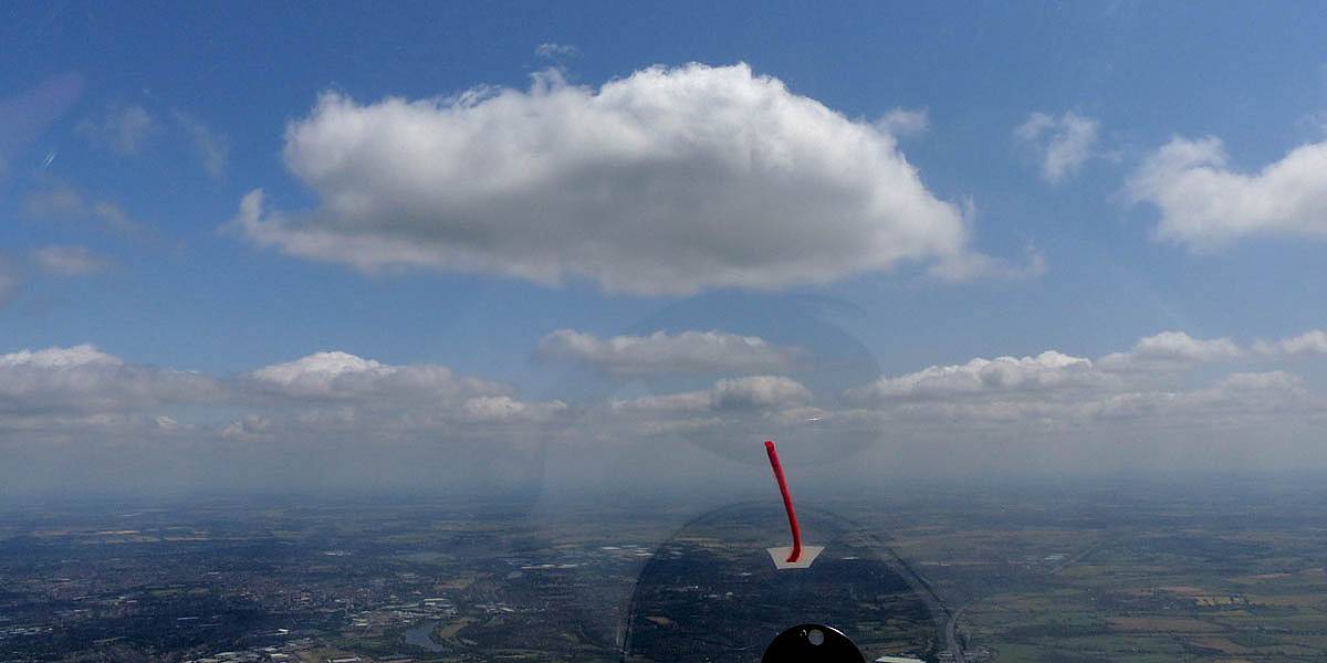
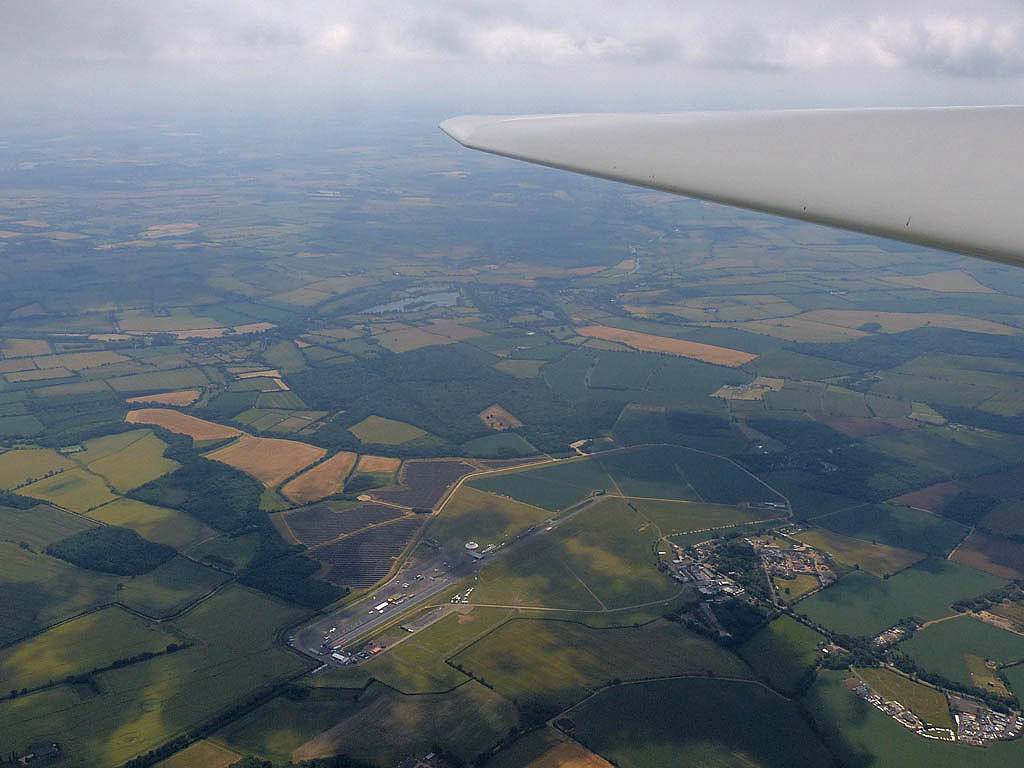
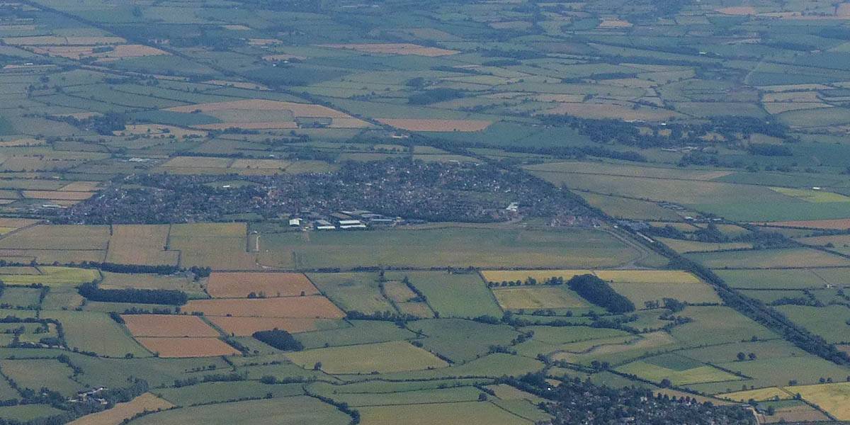
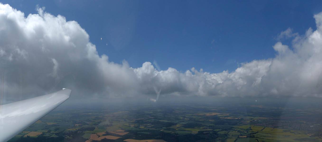
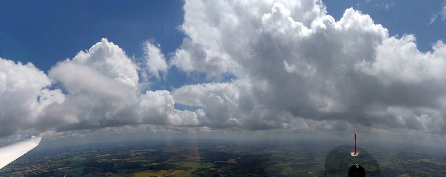
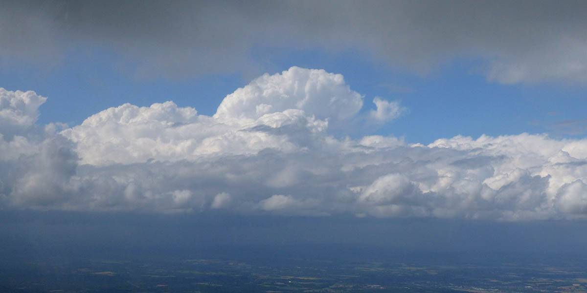
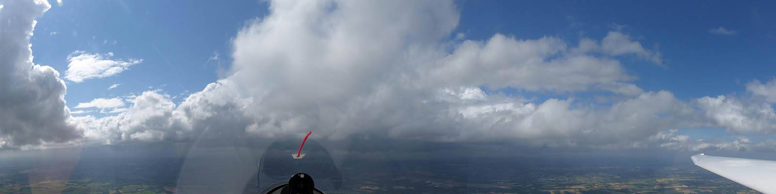
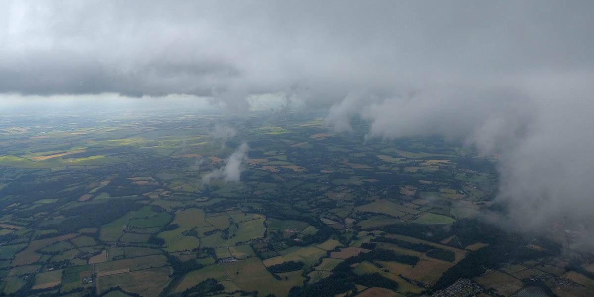
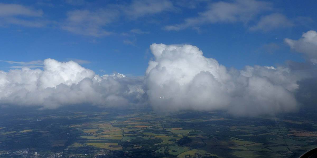
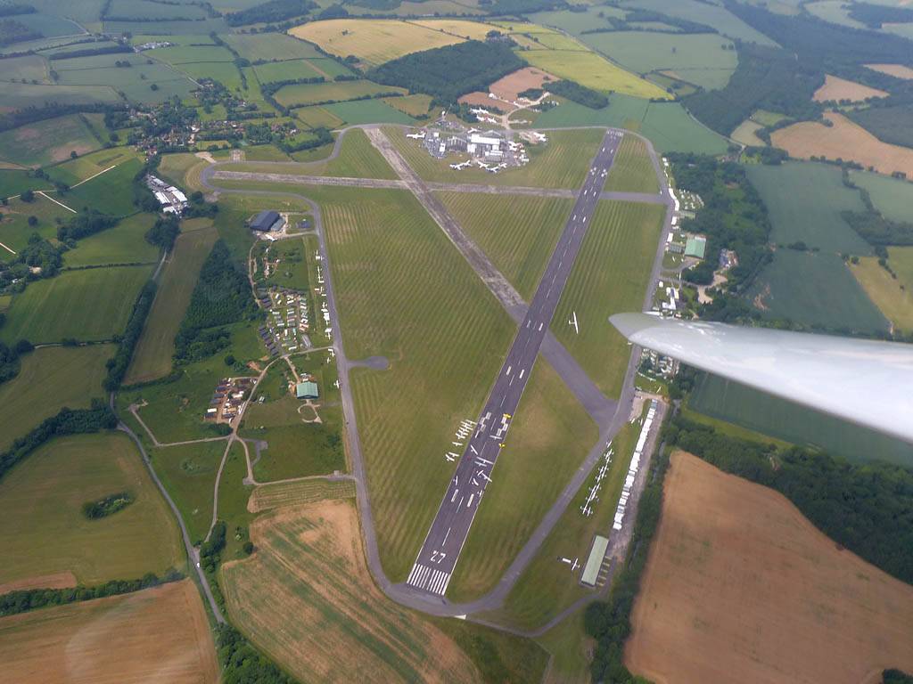
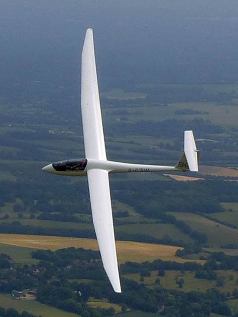
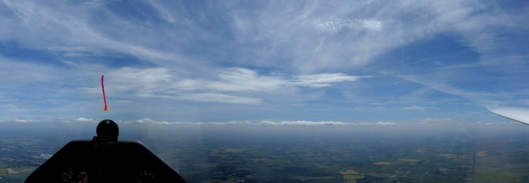
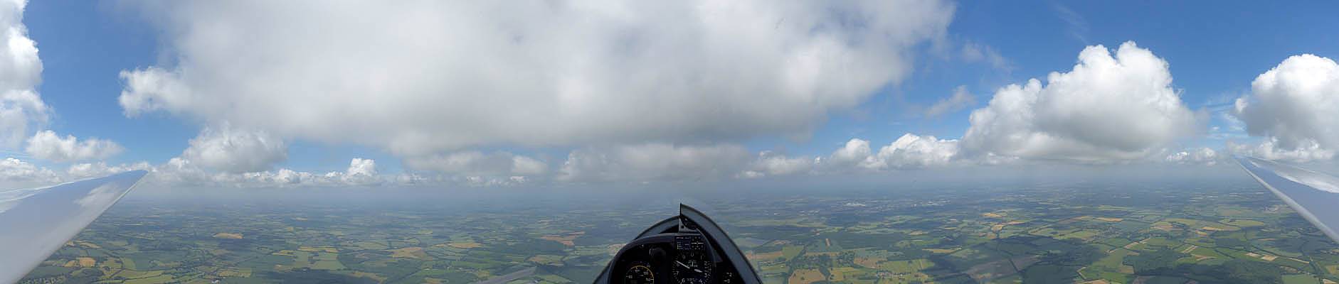
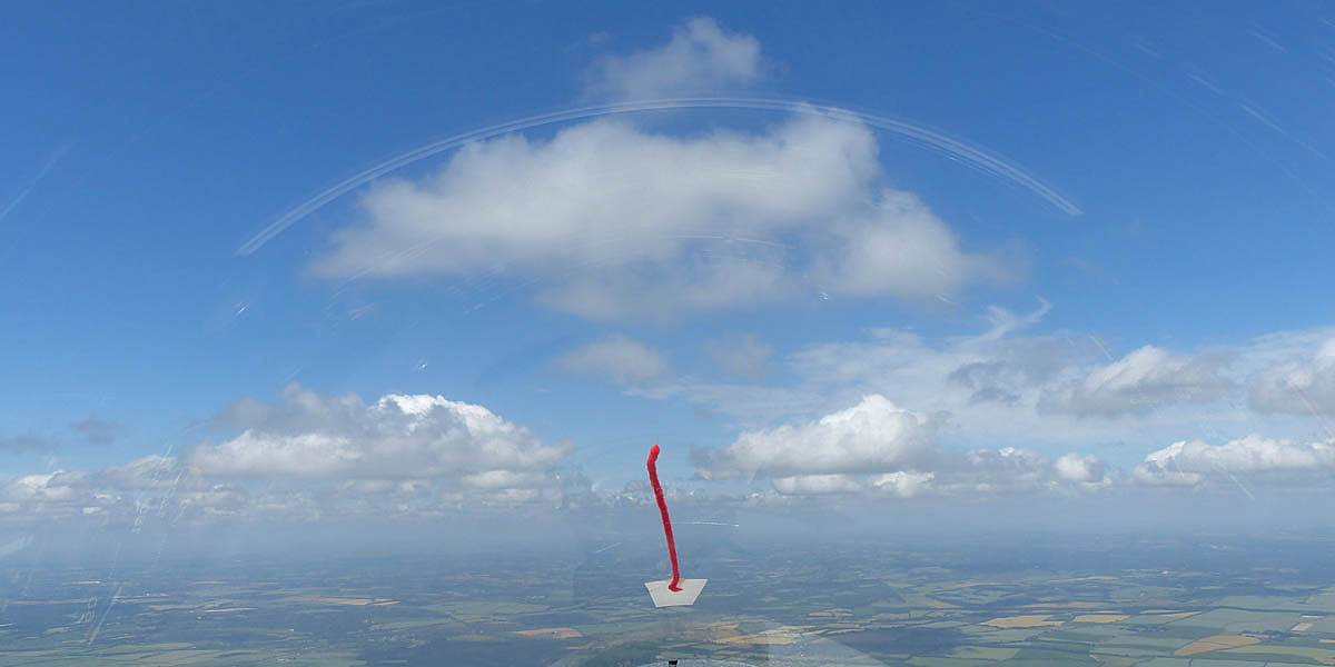
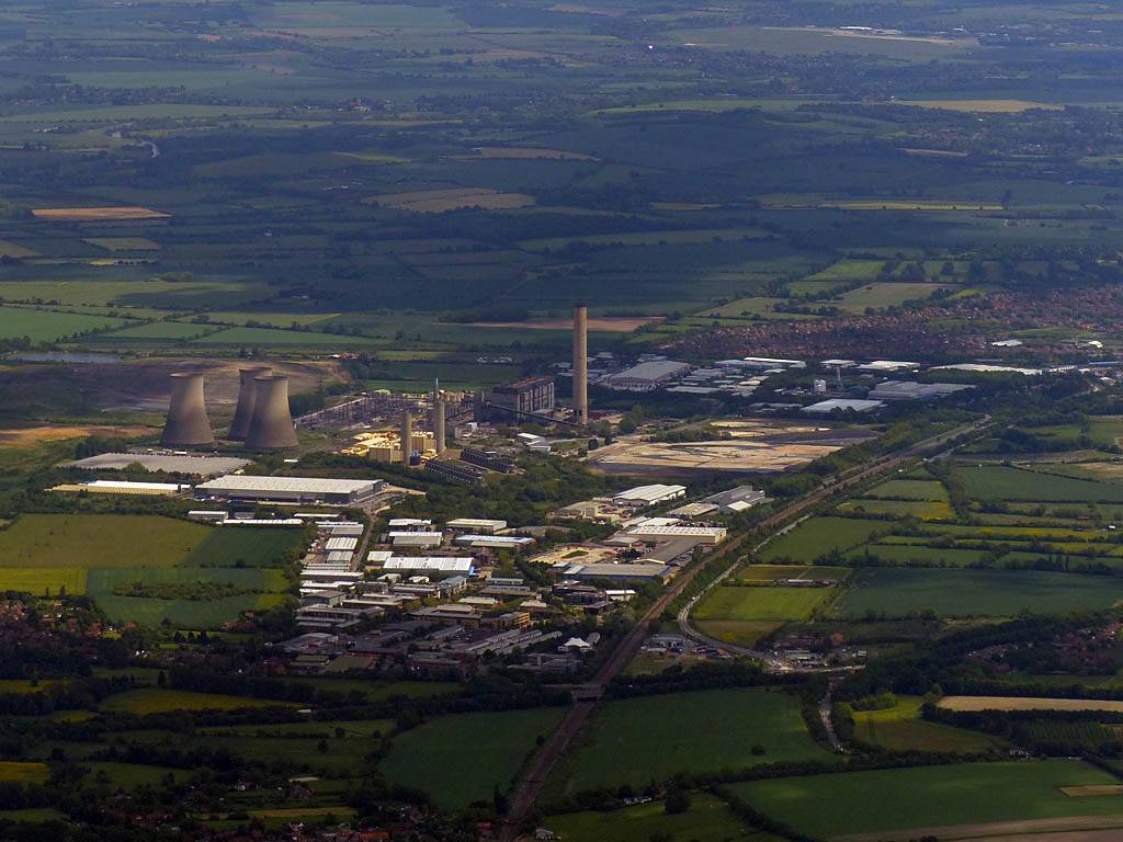
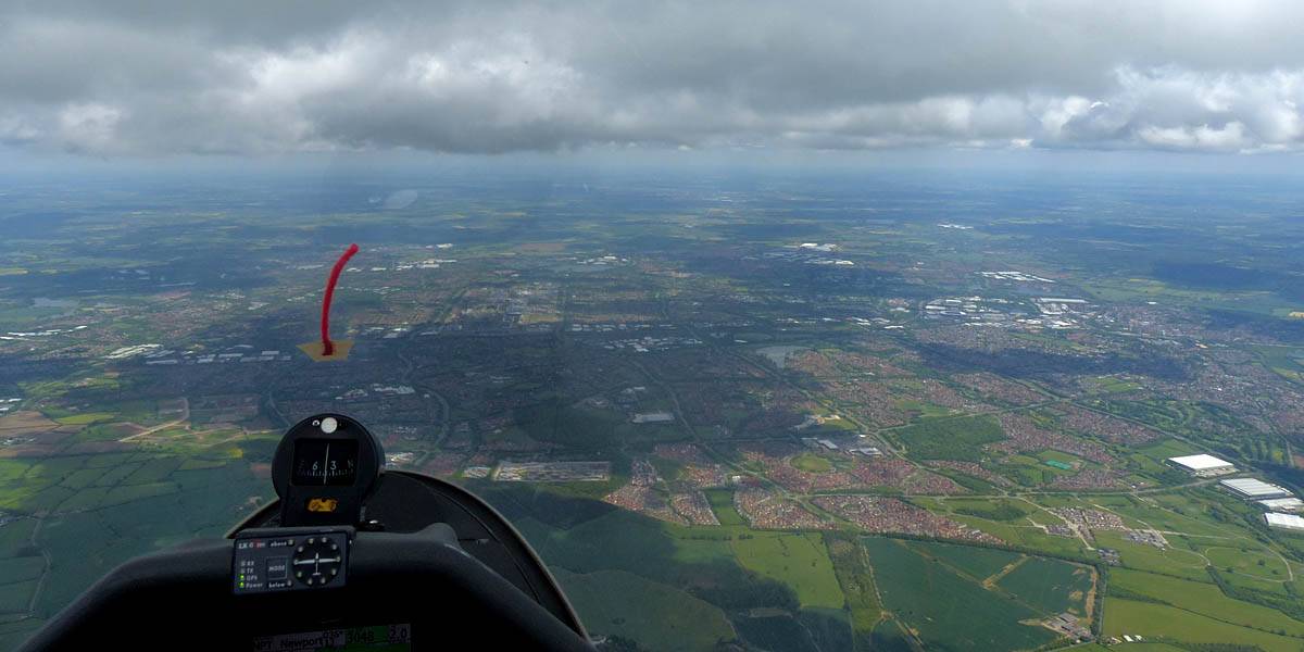
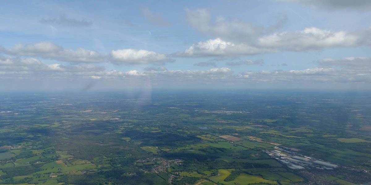
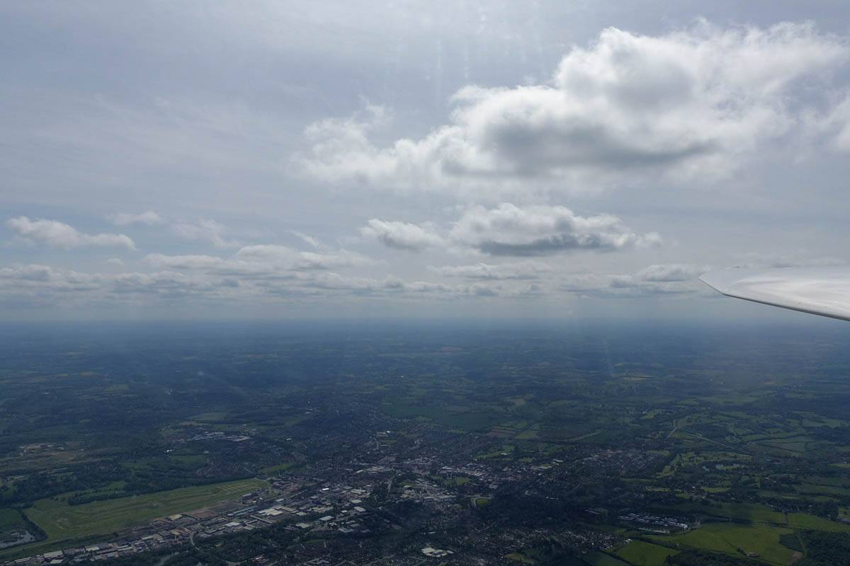
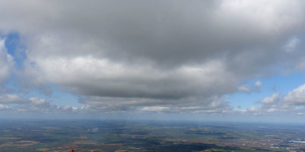
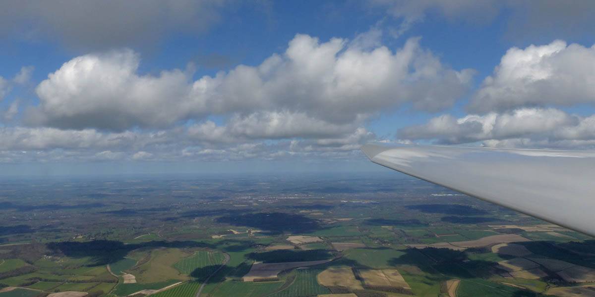
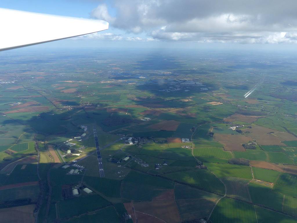
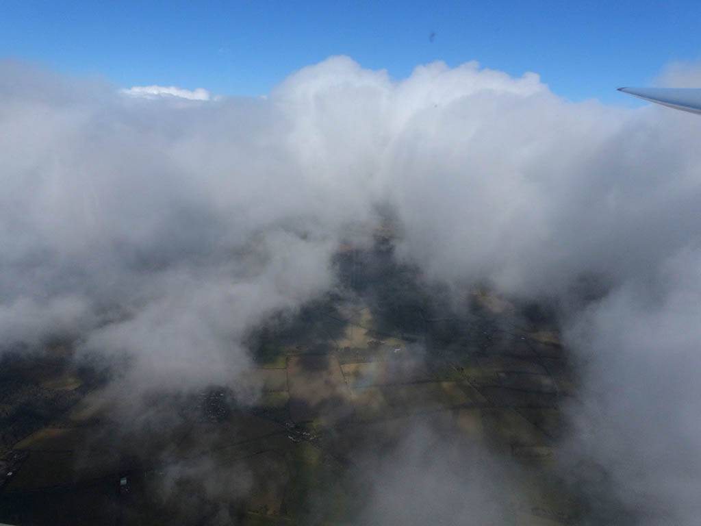
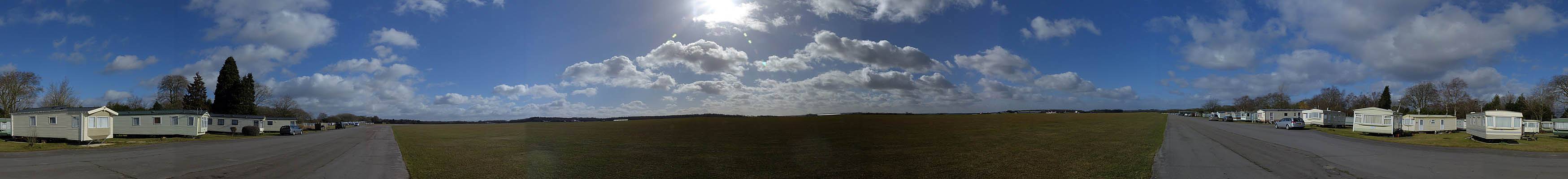
IMG_9444_9446_Panorama.jpg
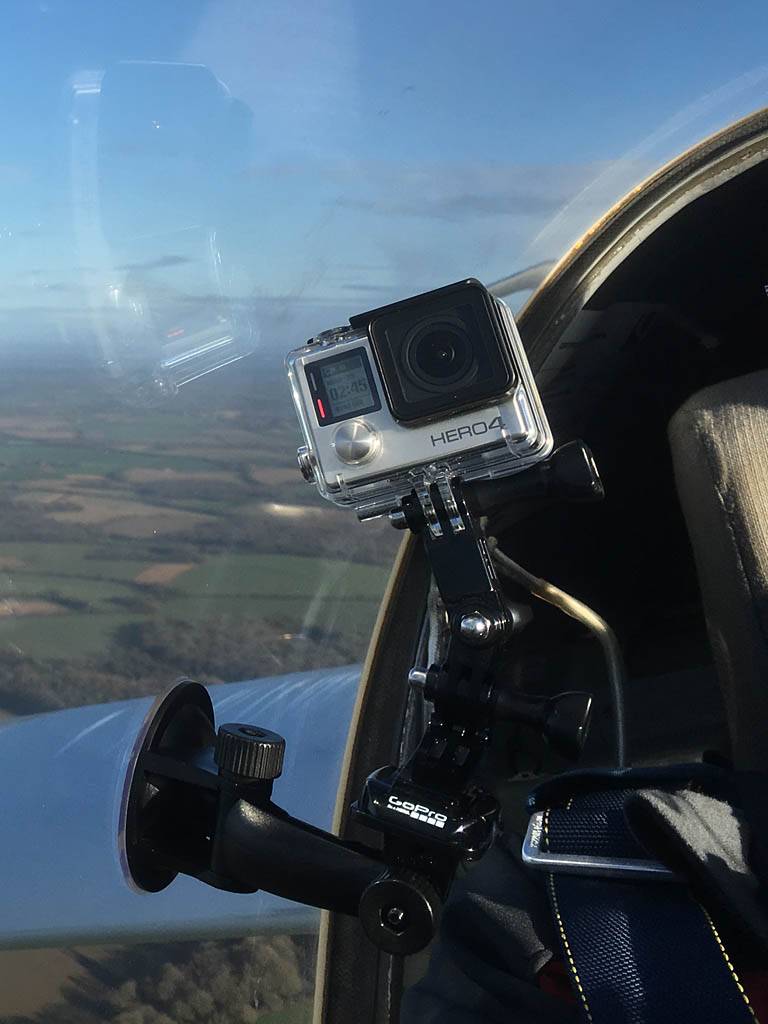
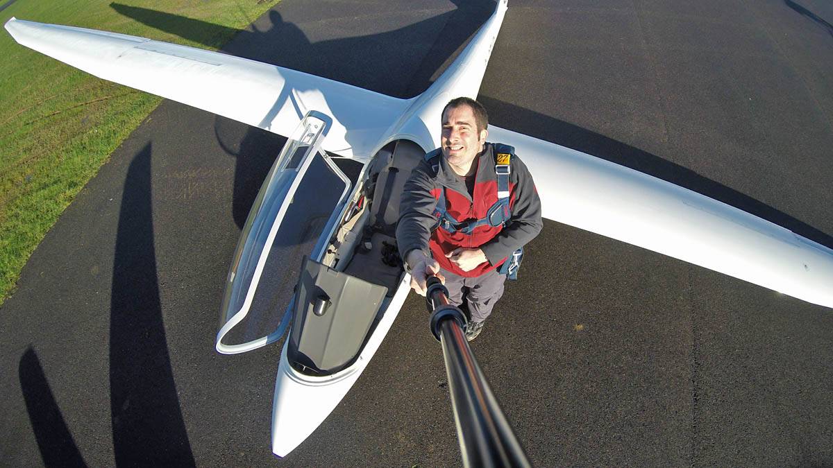
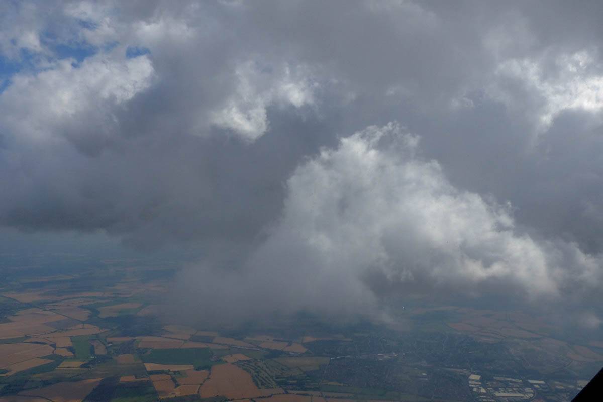
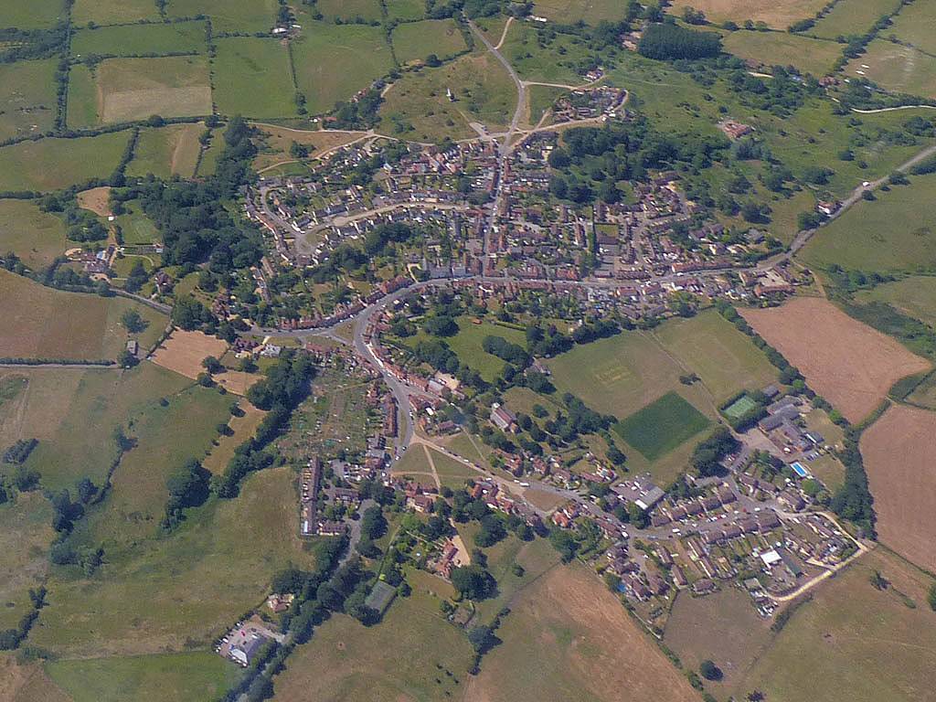
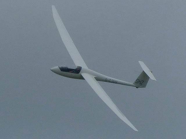
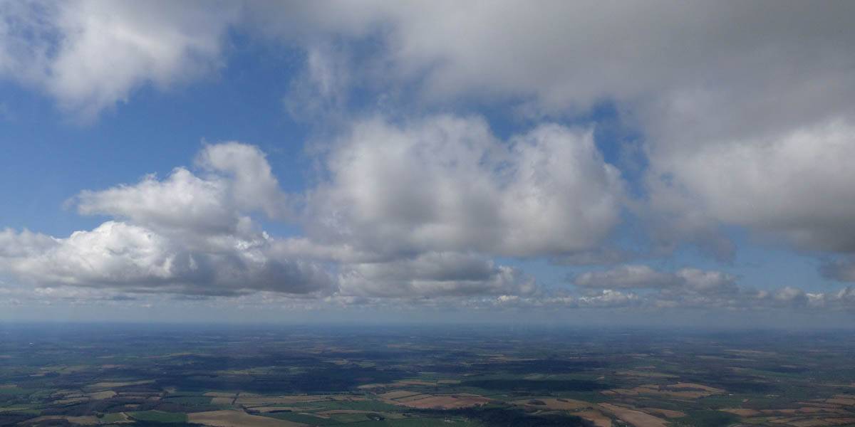
IMG_9454.jpg
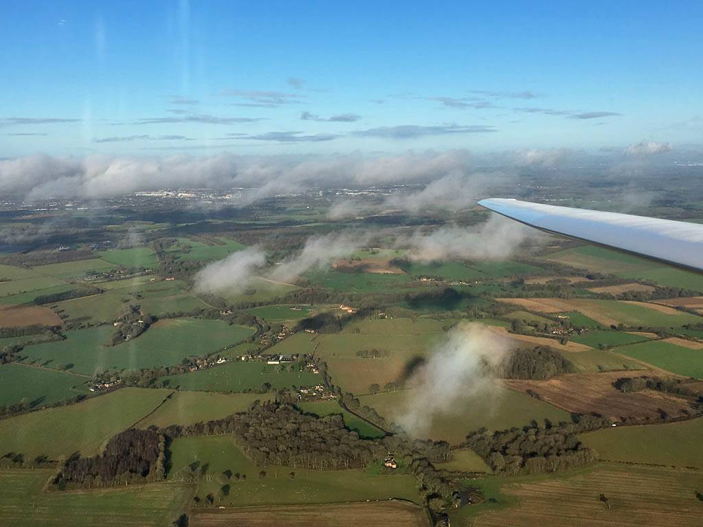
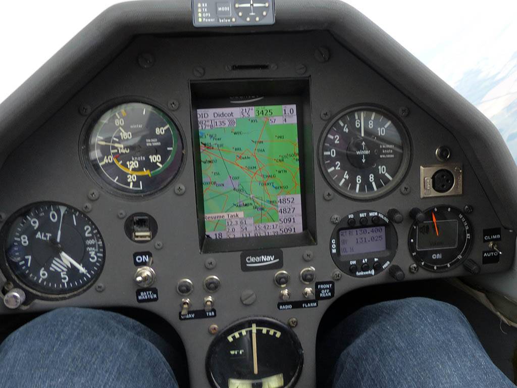
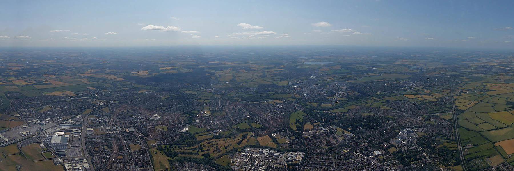
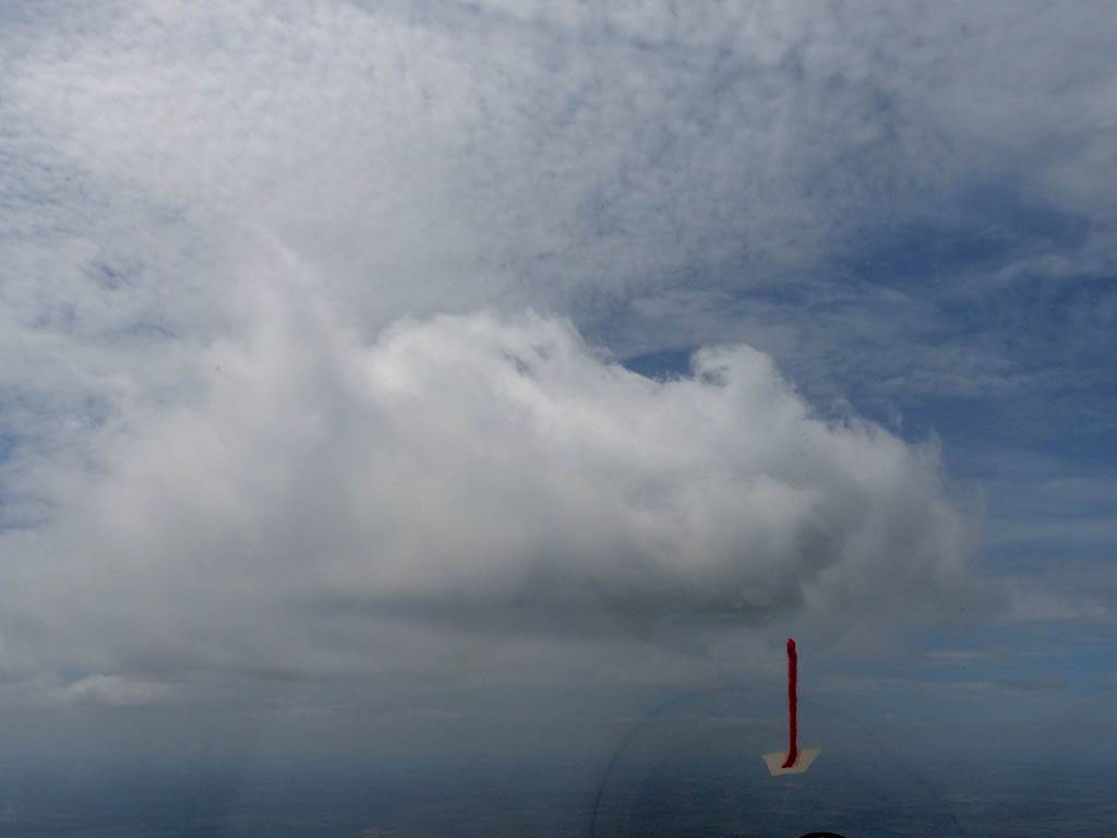
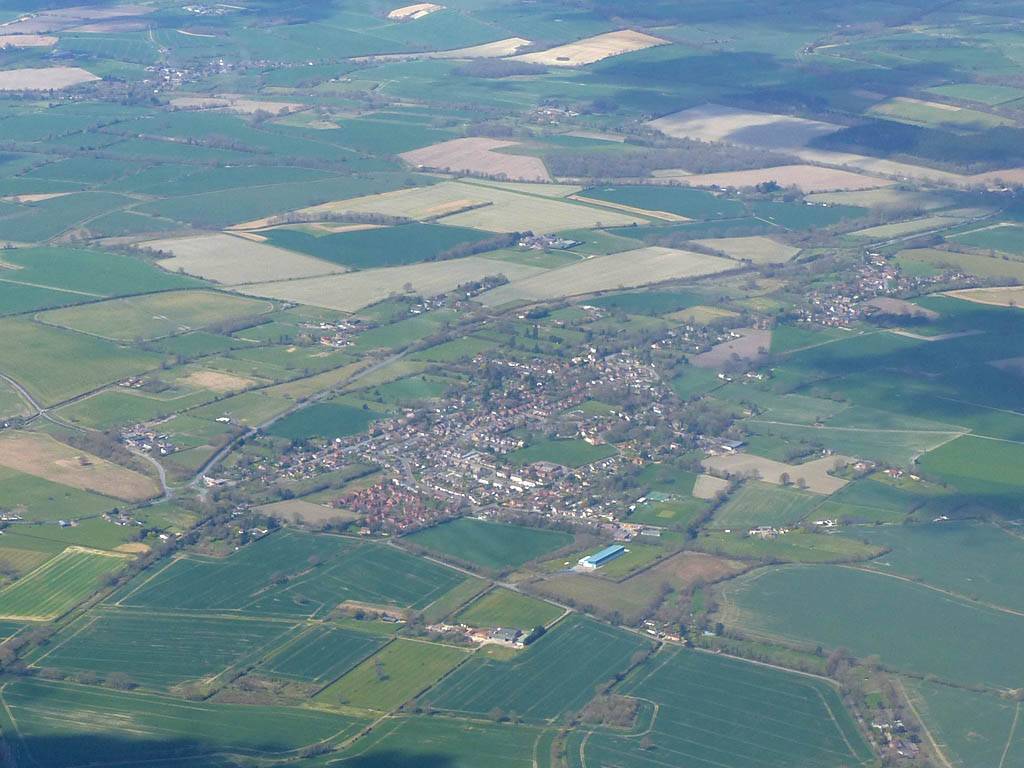
IMG_9455.jpg
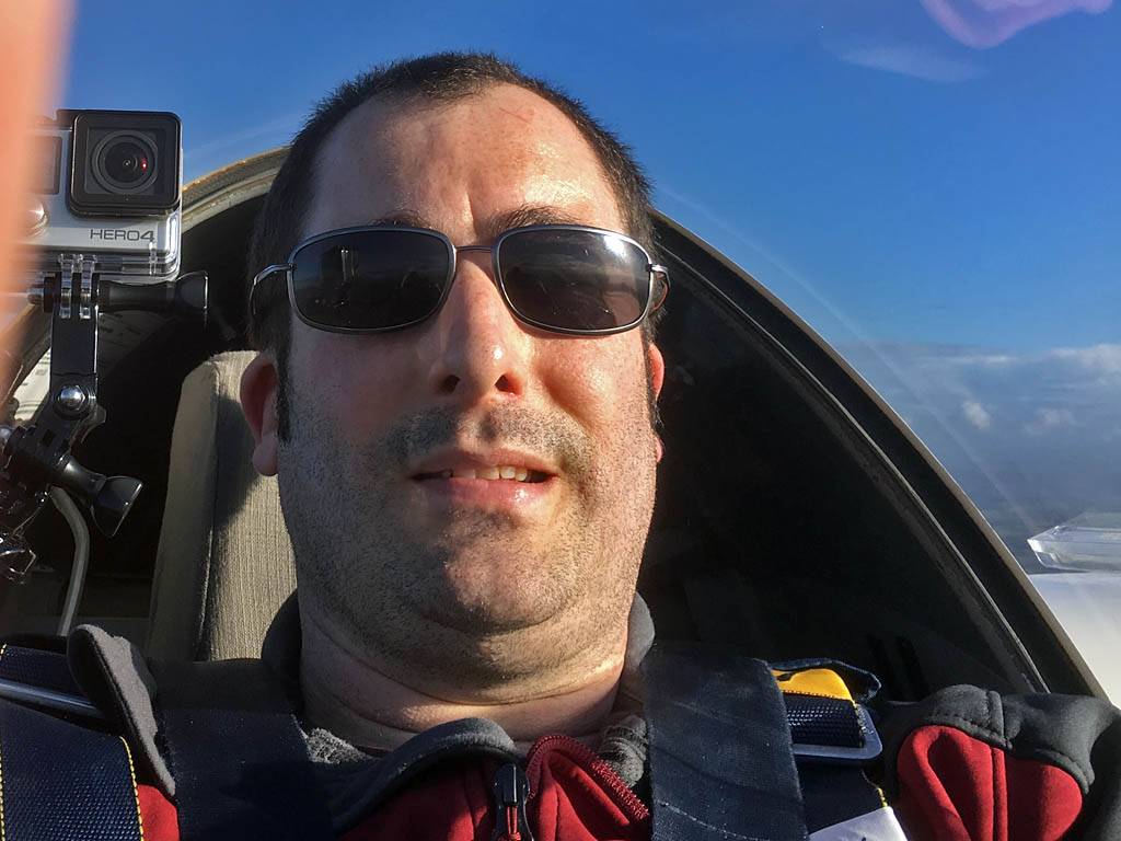
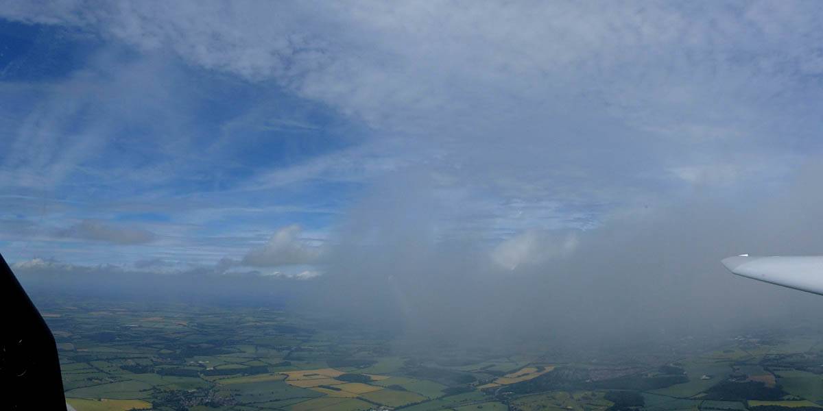
IMG_9457.jpg
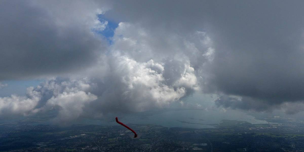
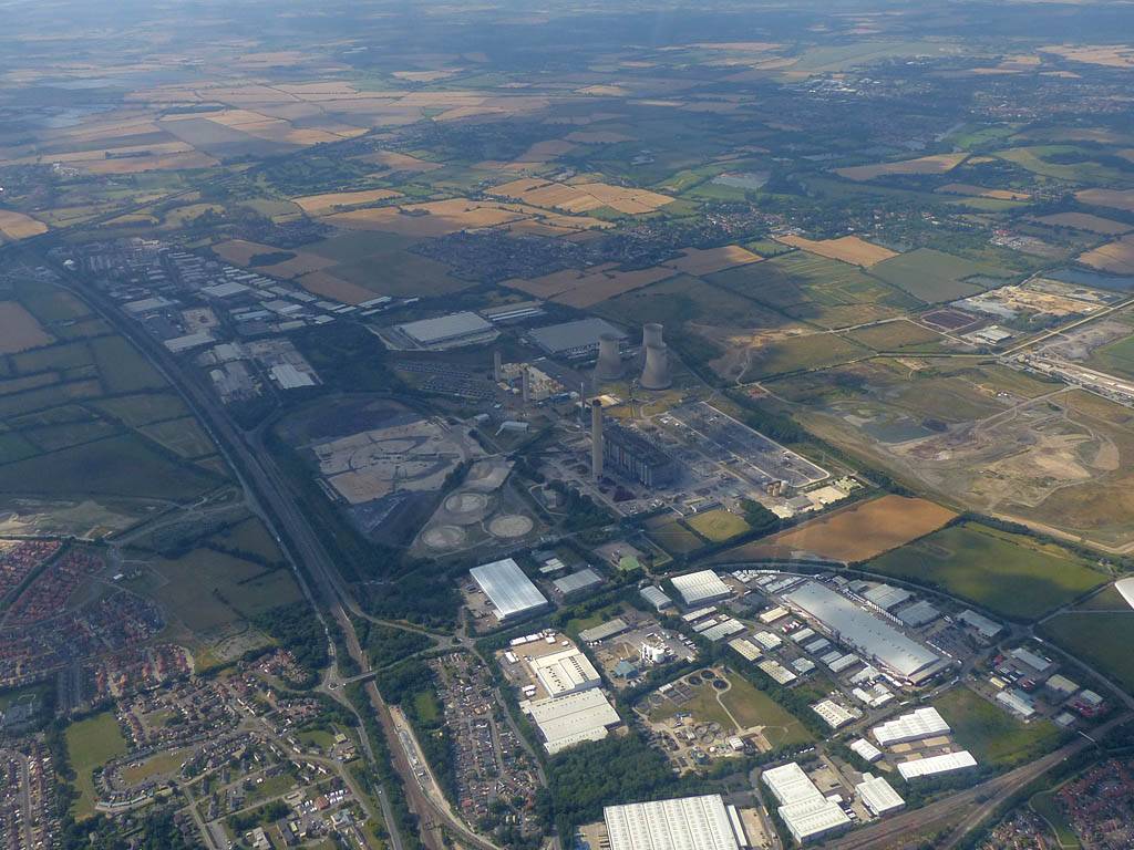
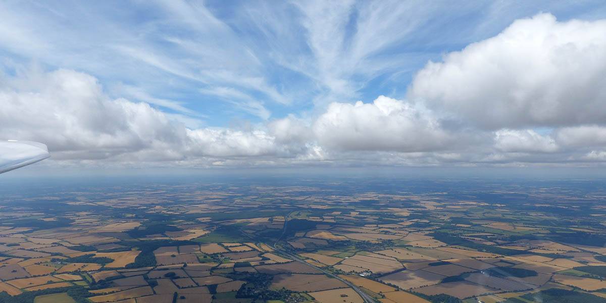
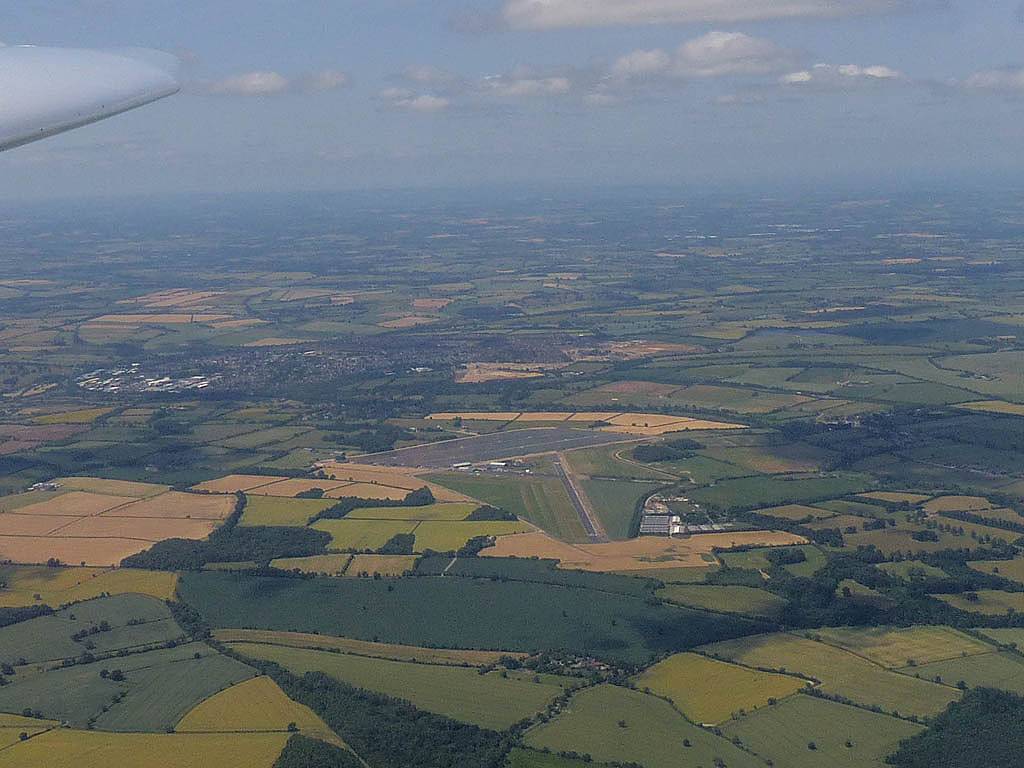
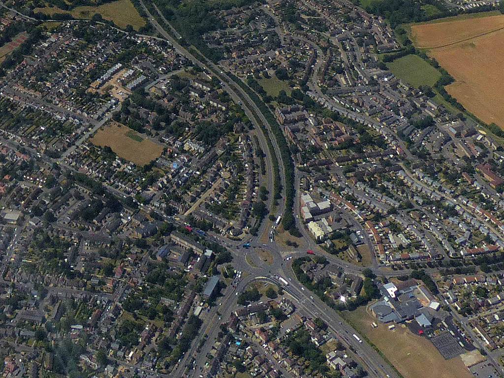
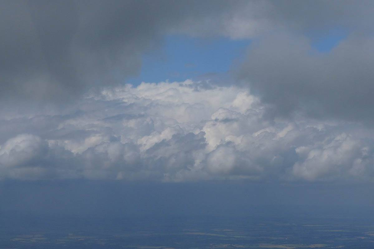
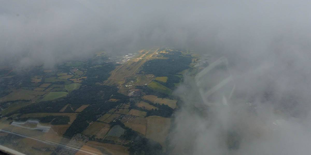
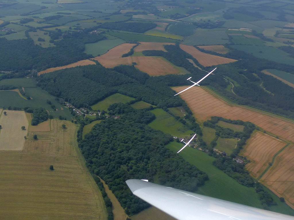
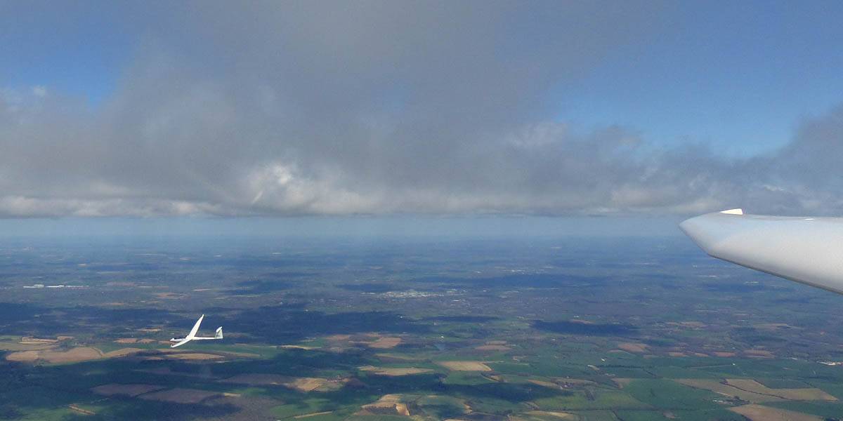
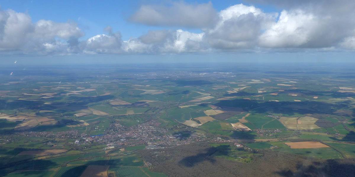
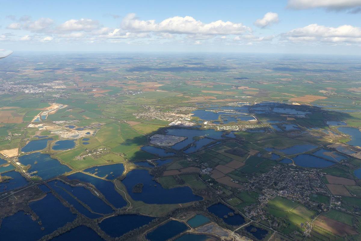
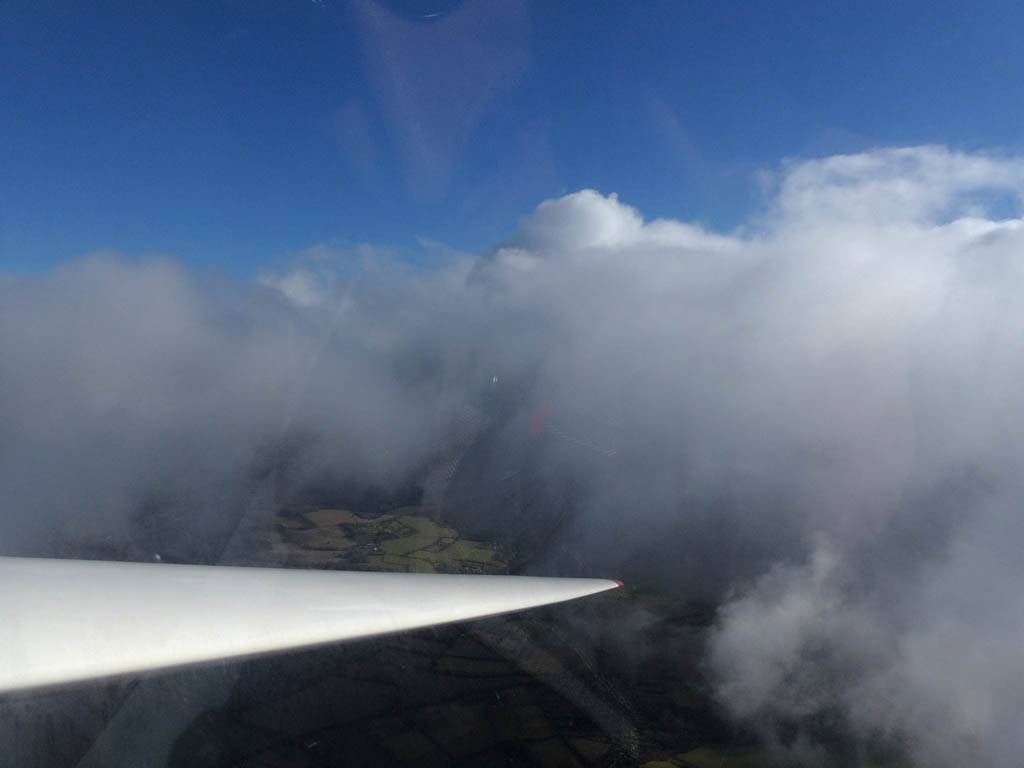
IMG_9462.jpg
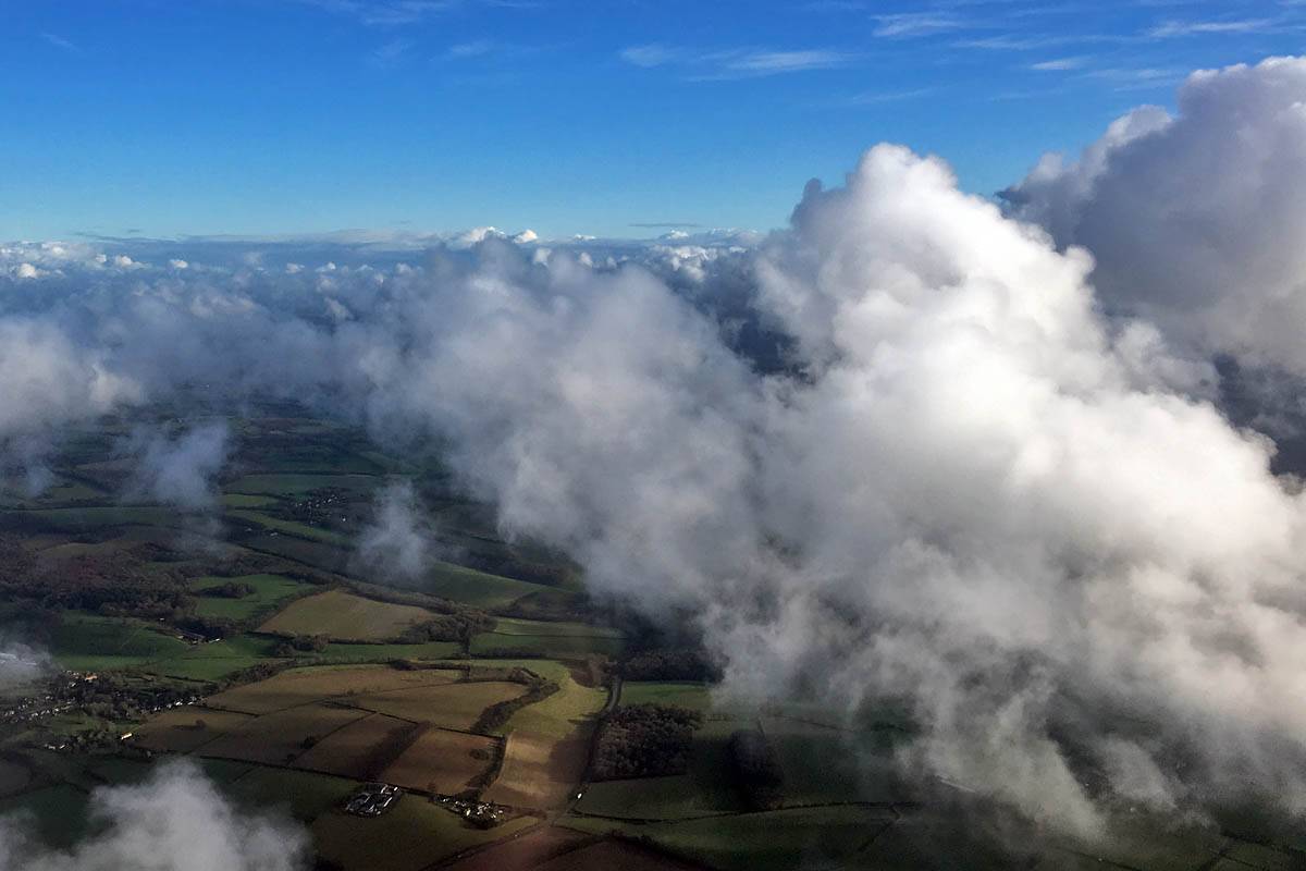
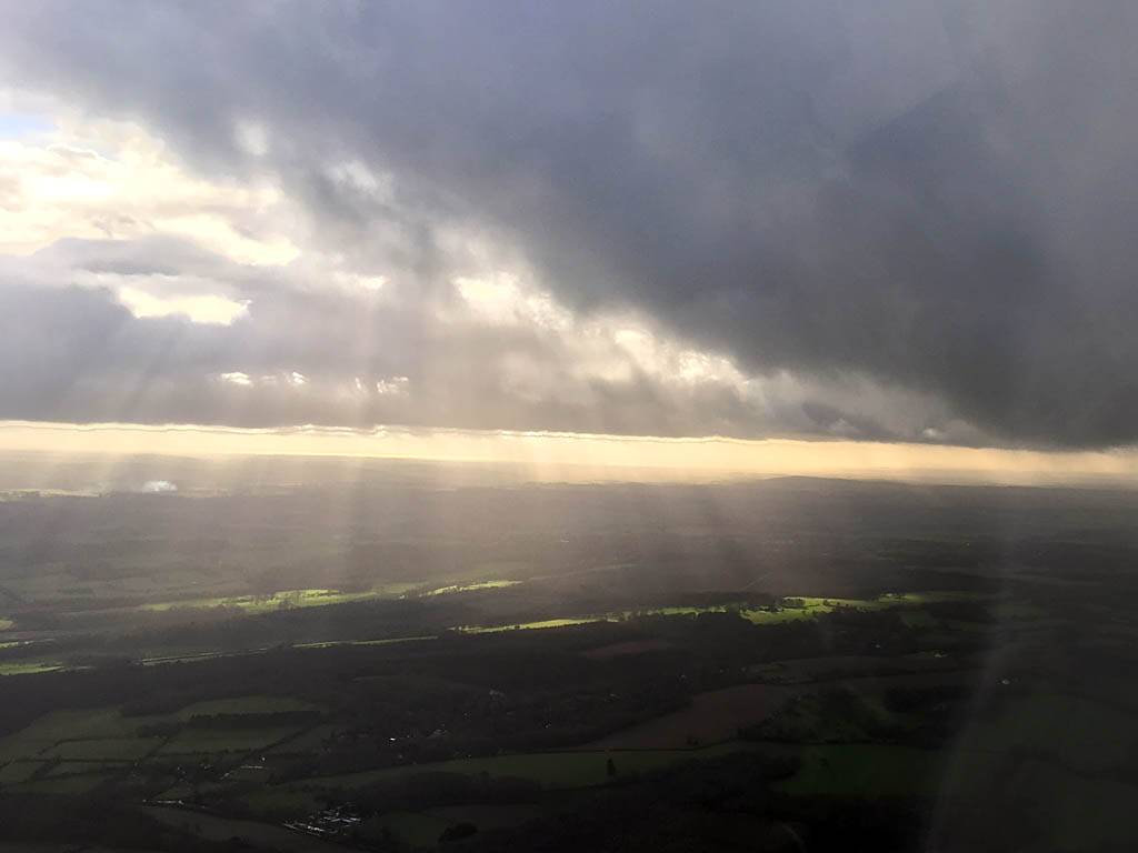
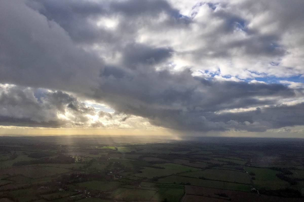
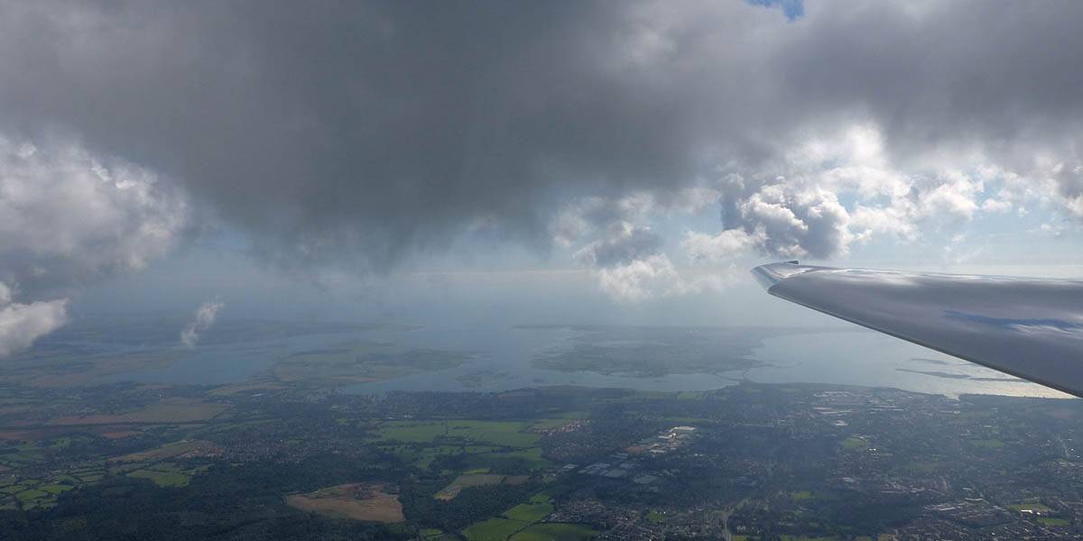
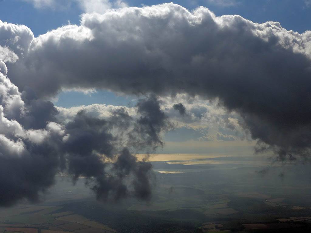
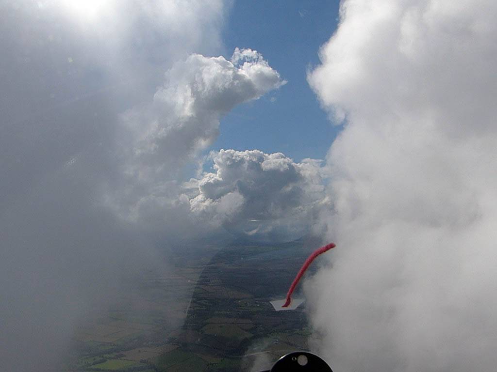
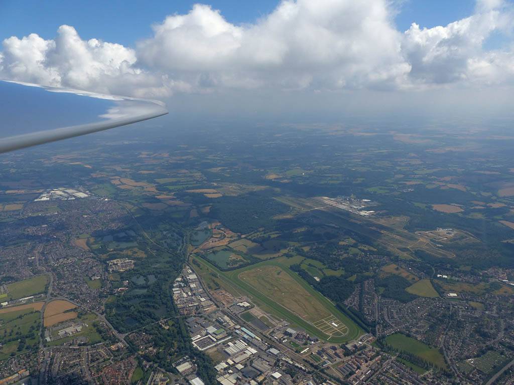
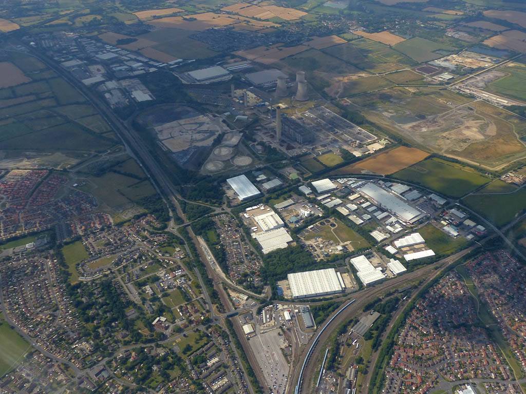
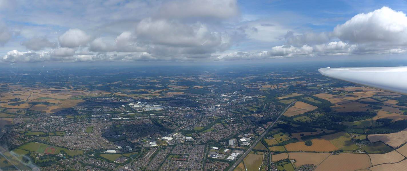
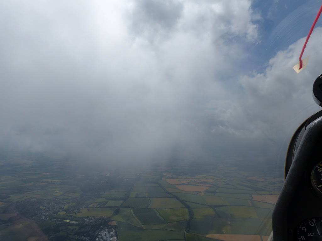
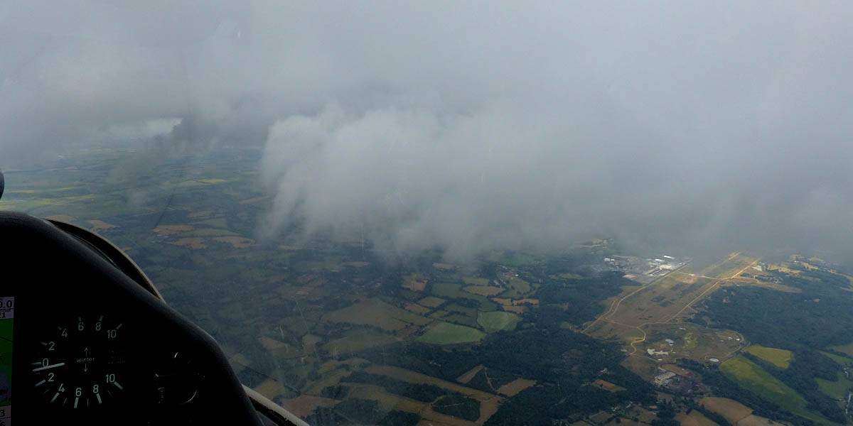
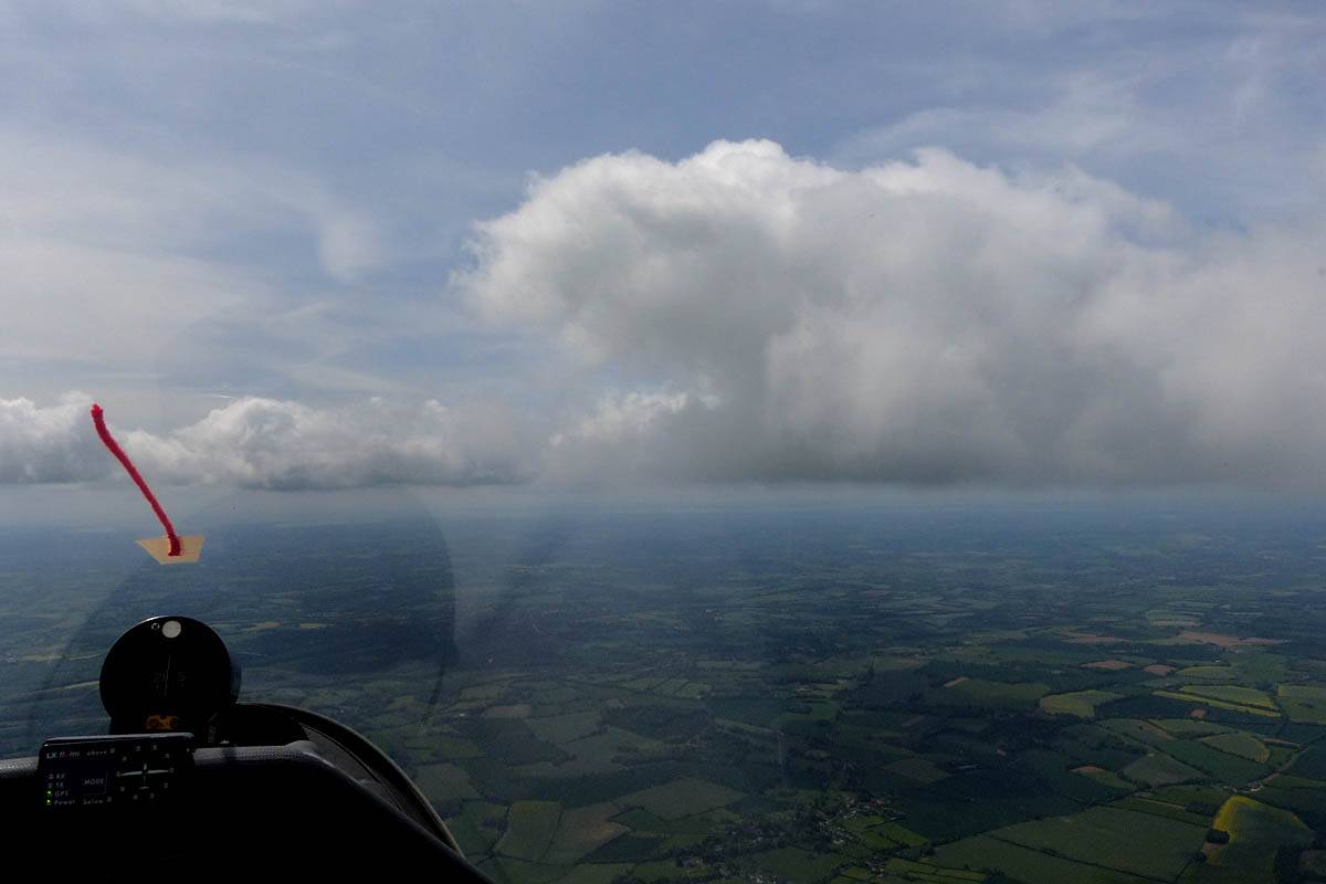
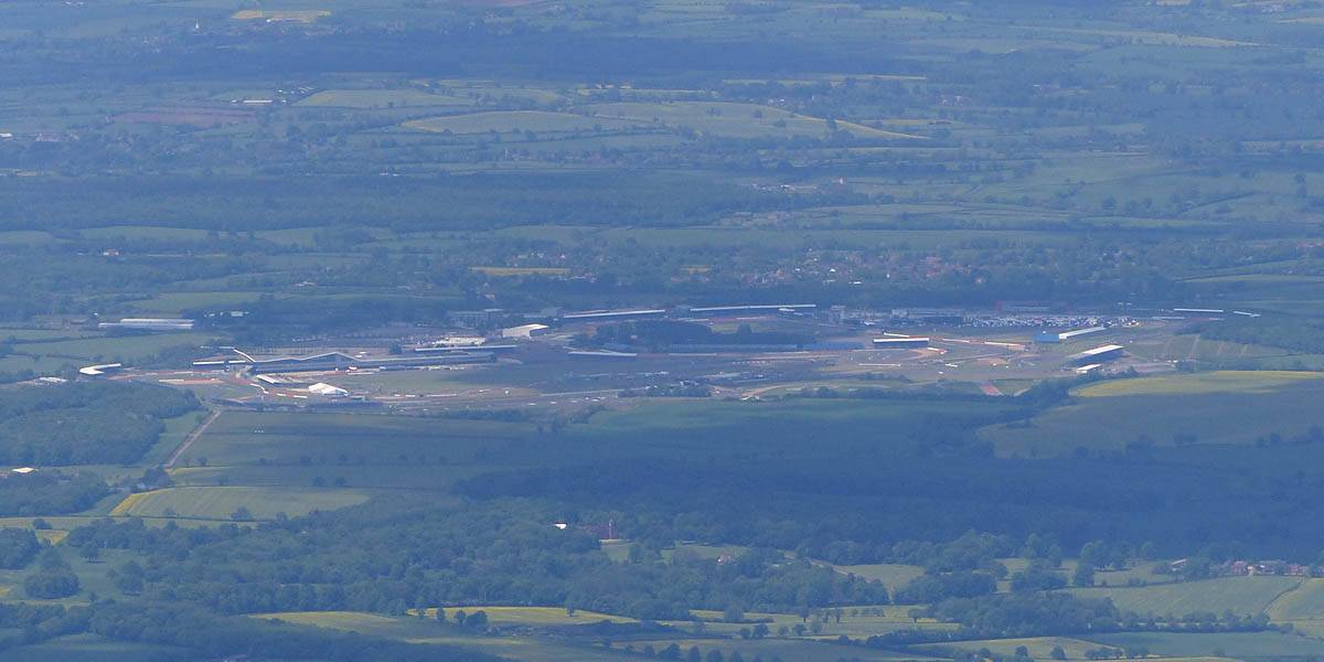
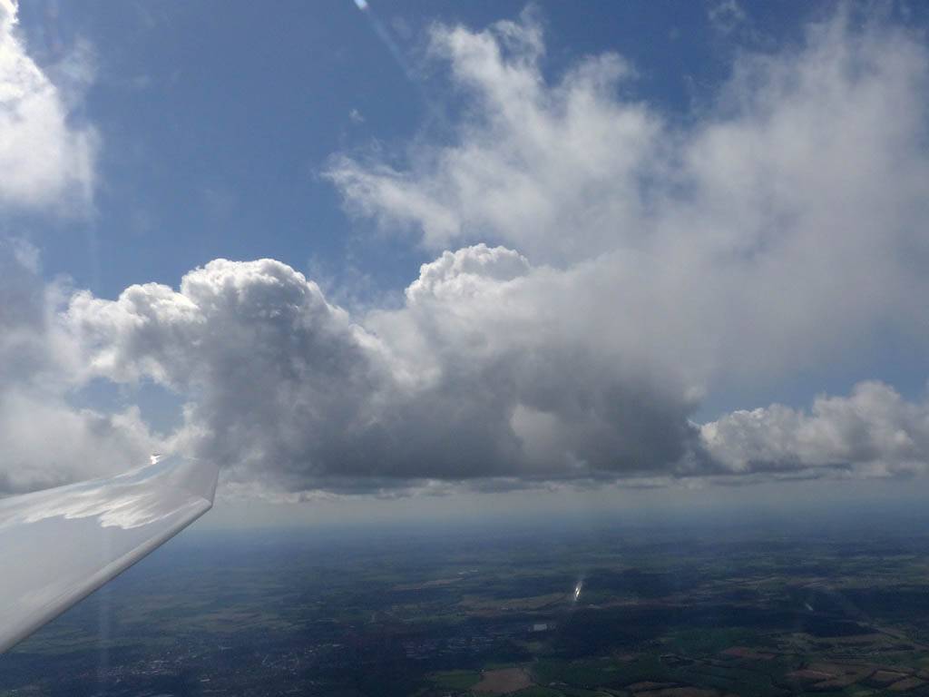
IMG_9464.jpg
Click here to return to the main Pictures index.
Click here to go to my 2015 diary.
Click here to go to the 2014 images.
Click here to go to the 2016 images.
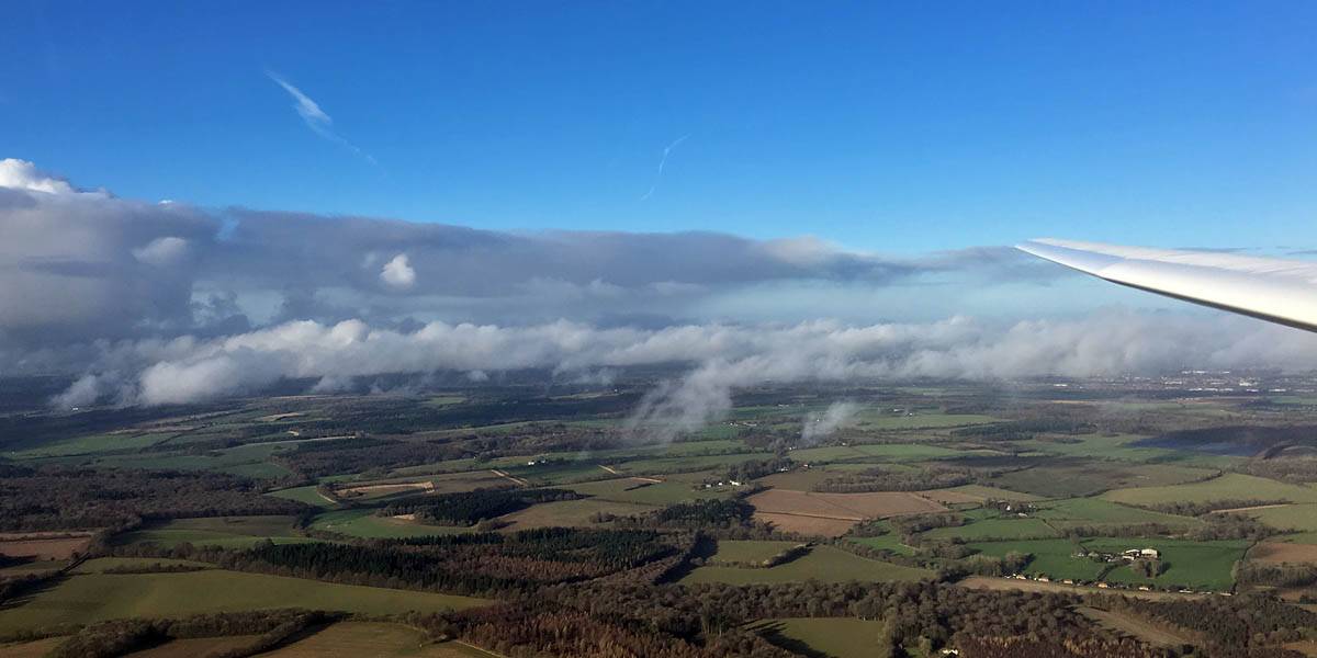
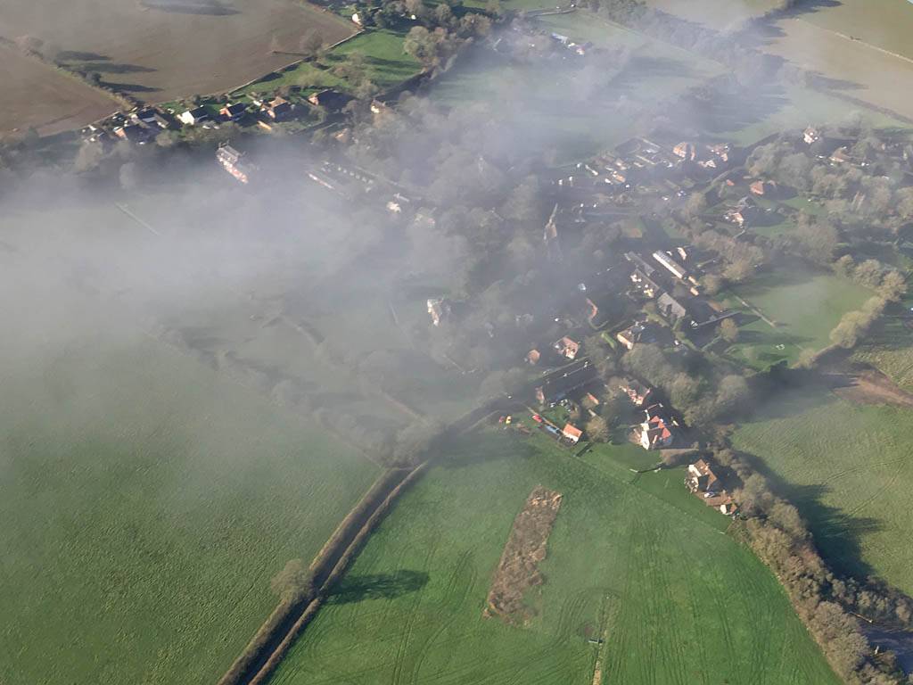
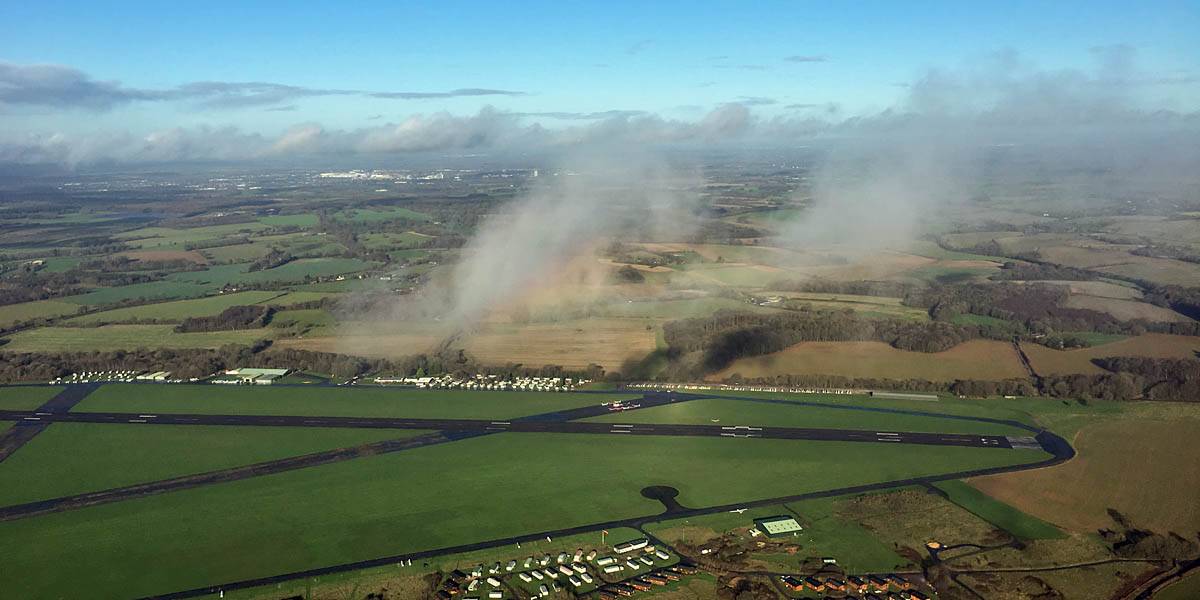
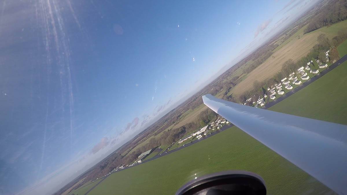
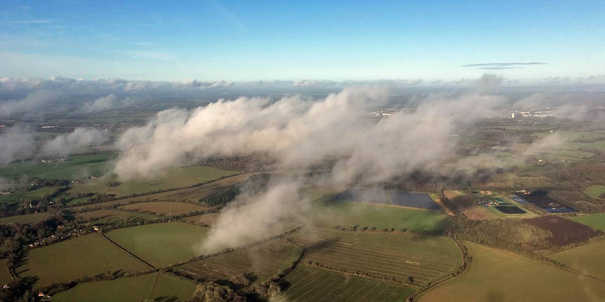
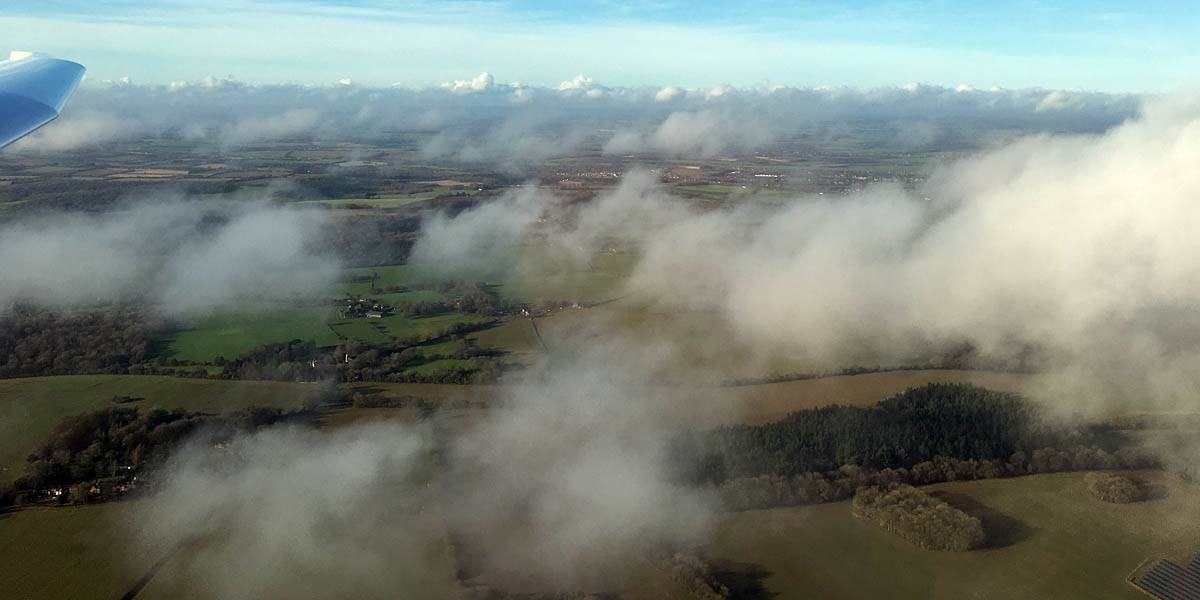
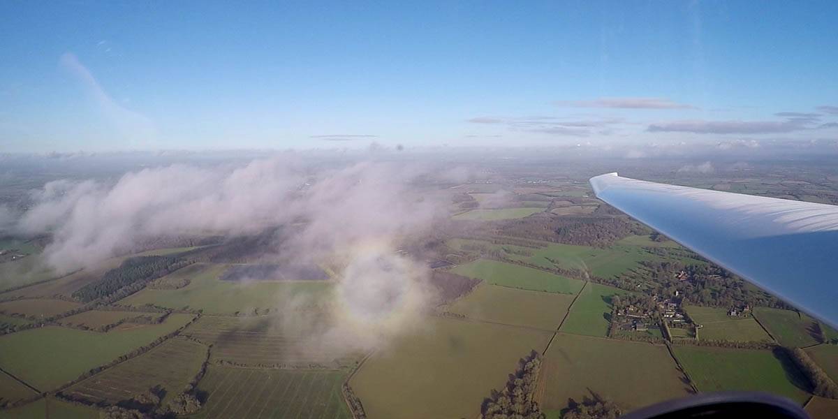
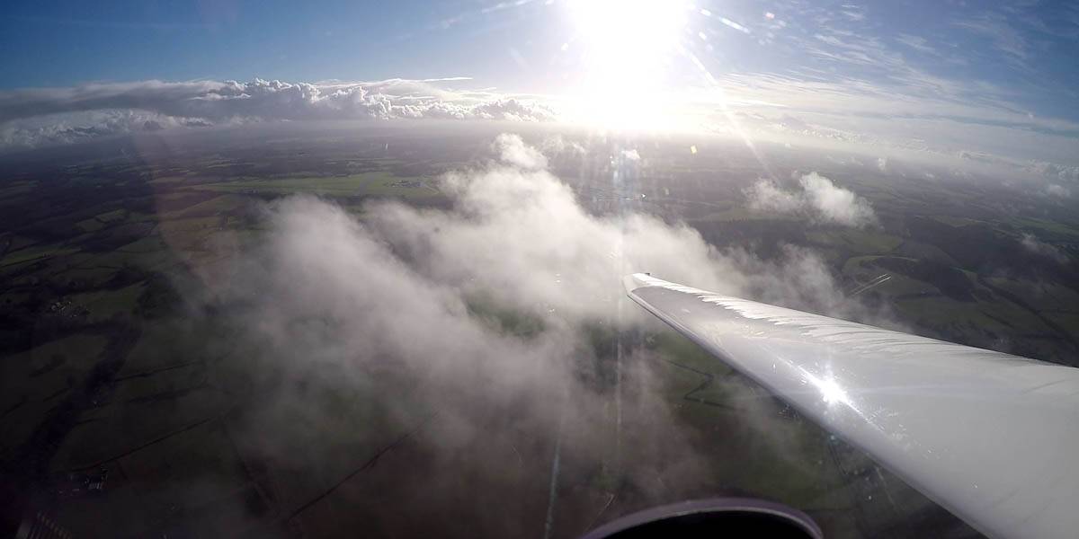
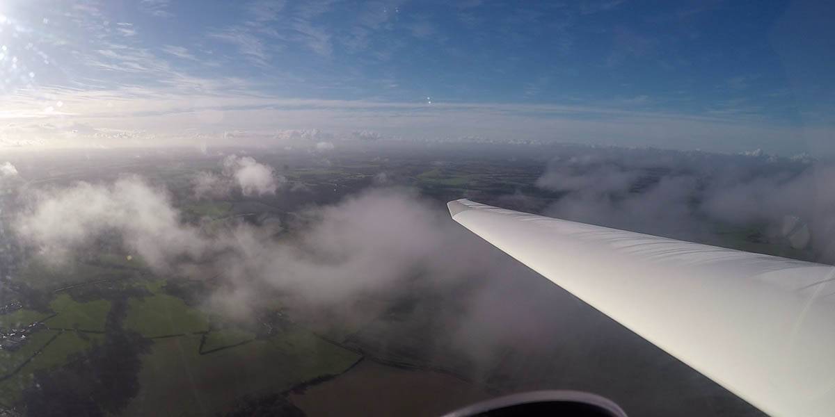
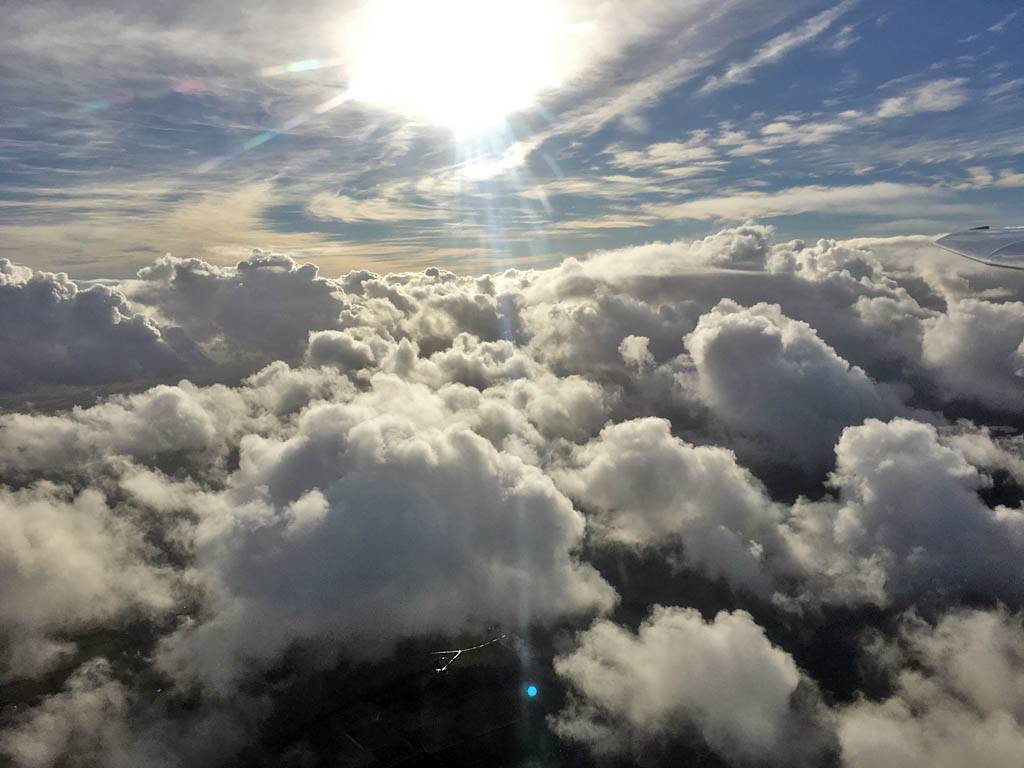
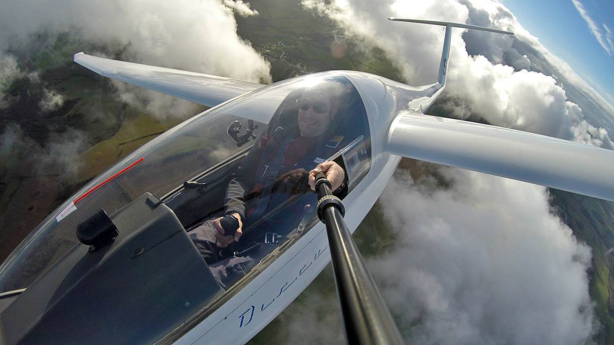
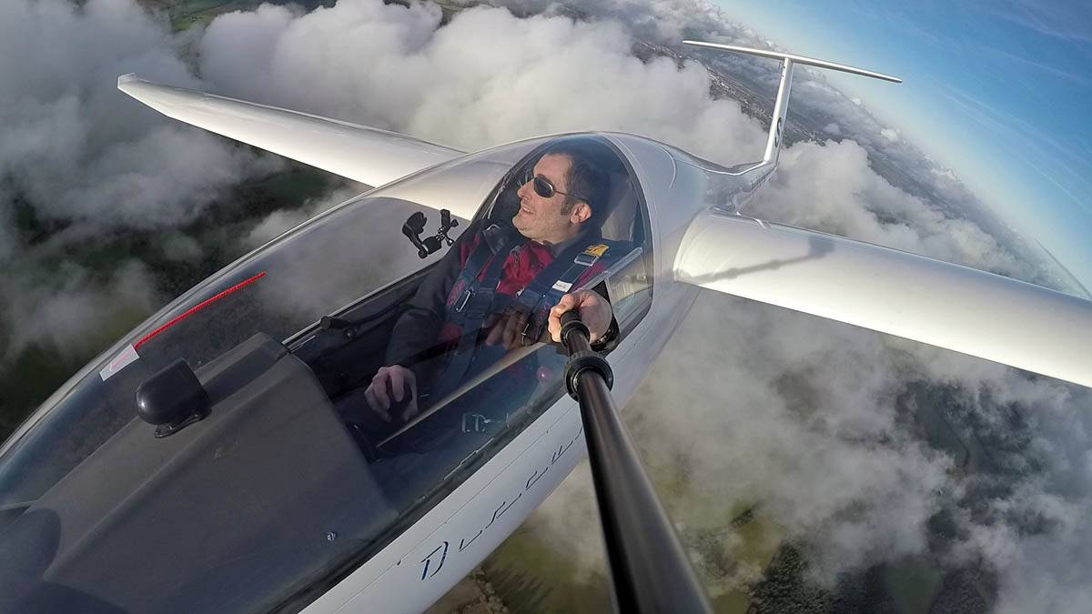
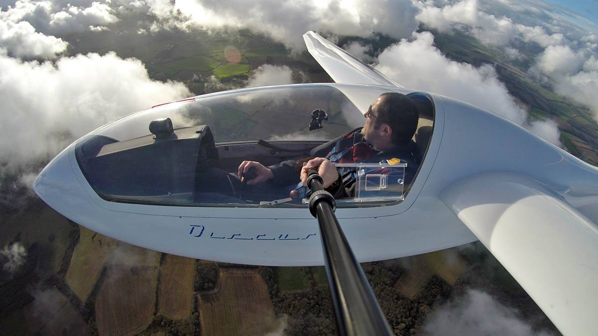
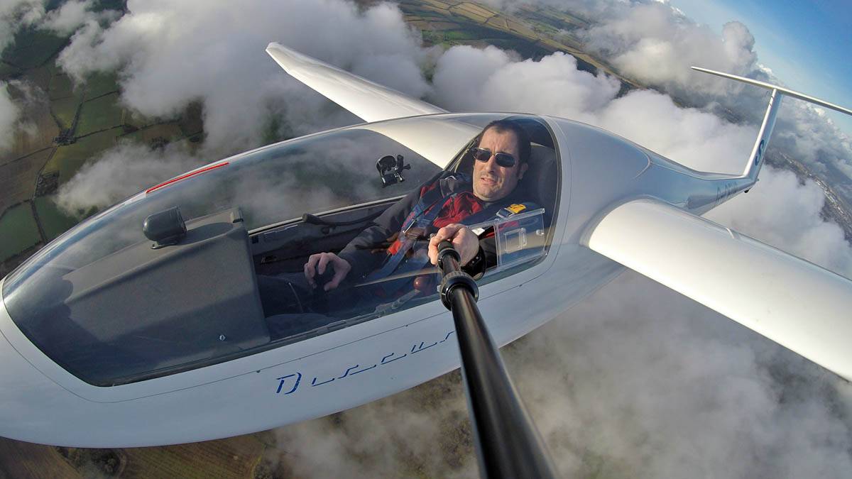
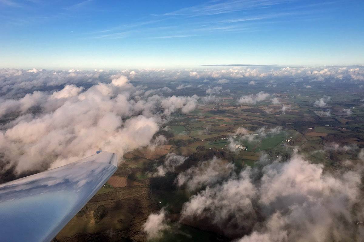
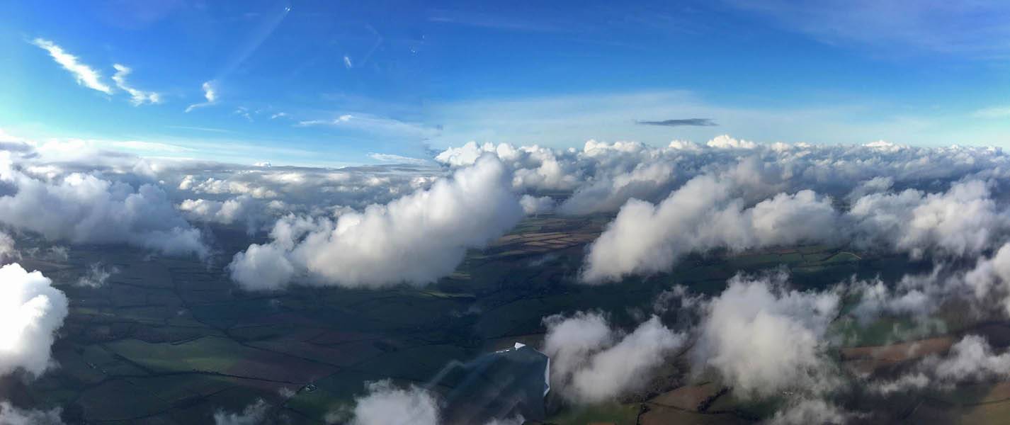
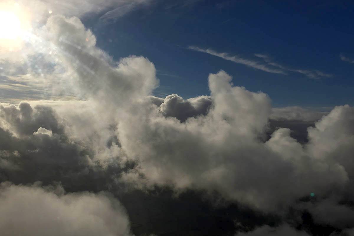
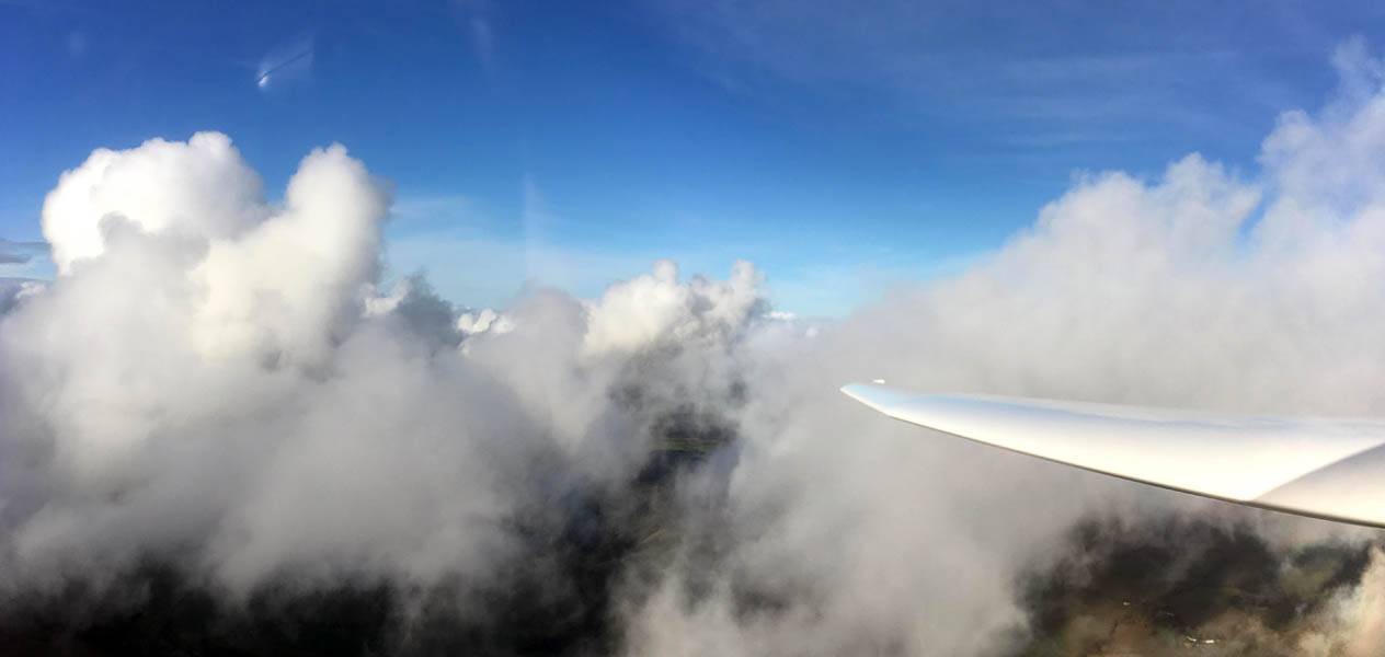
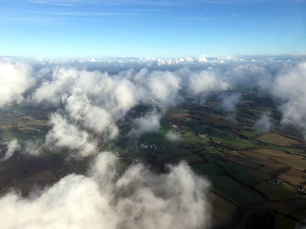
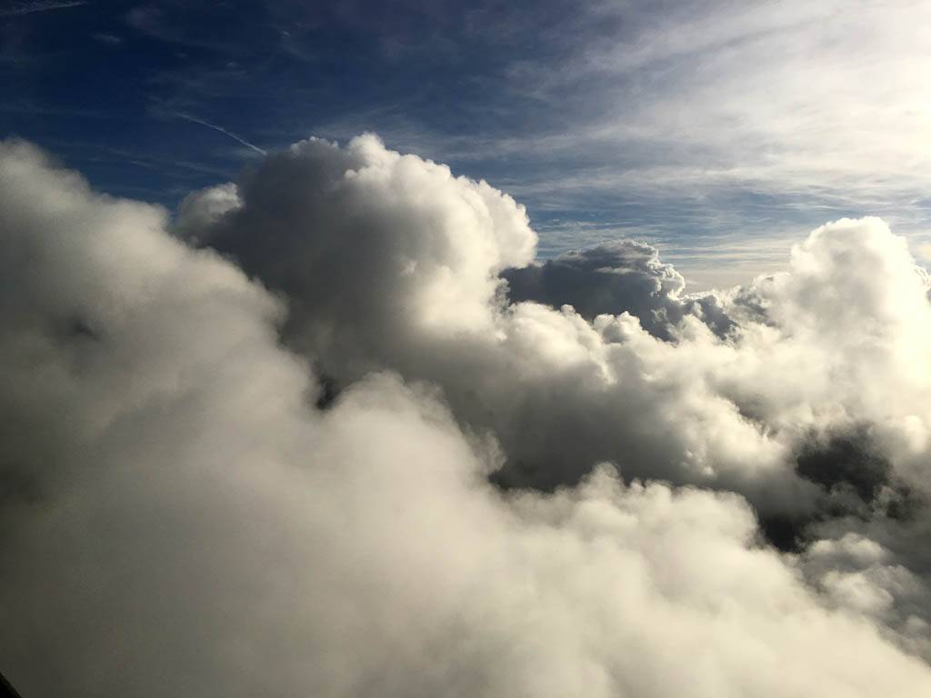
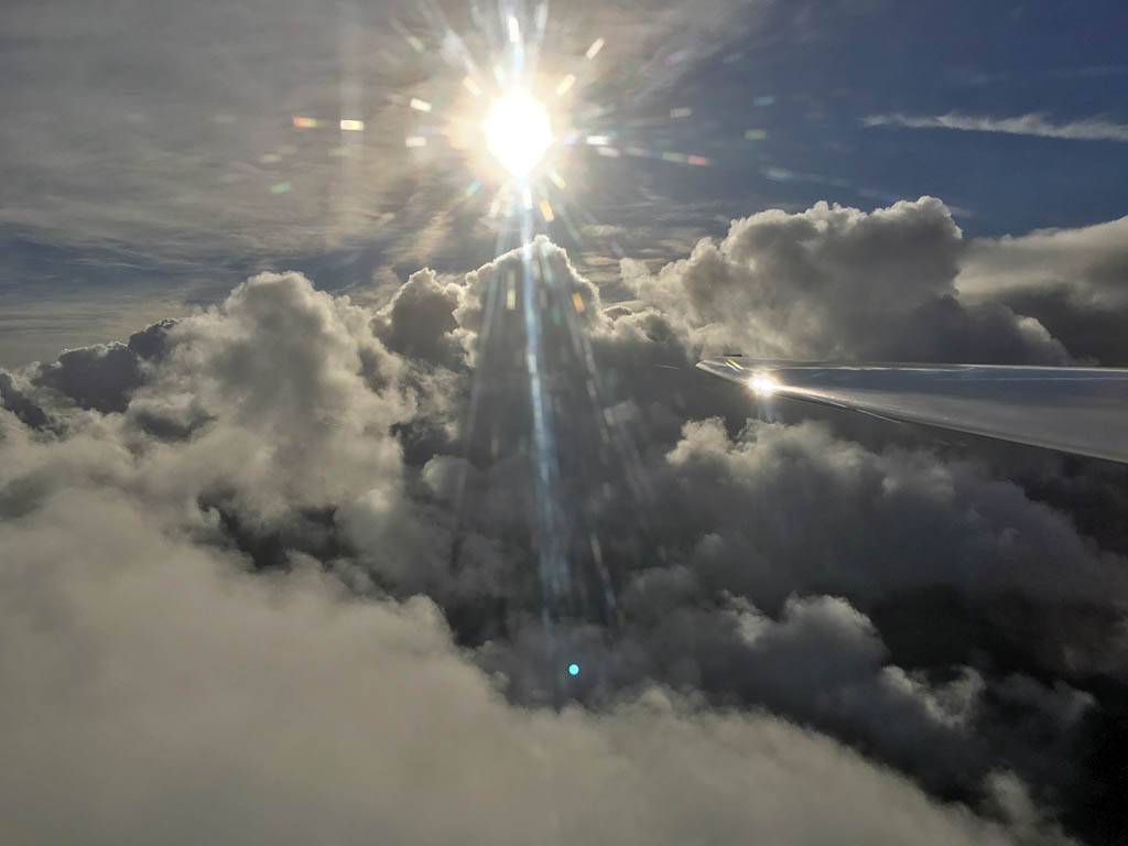
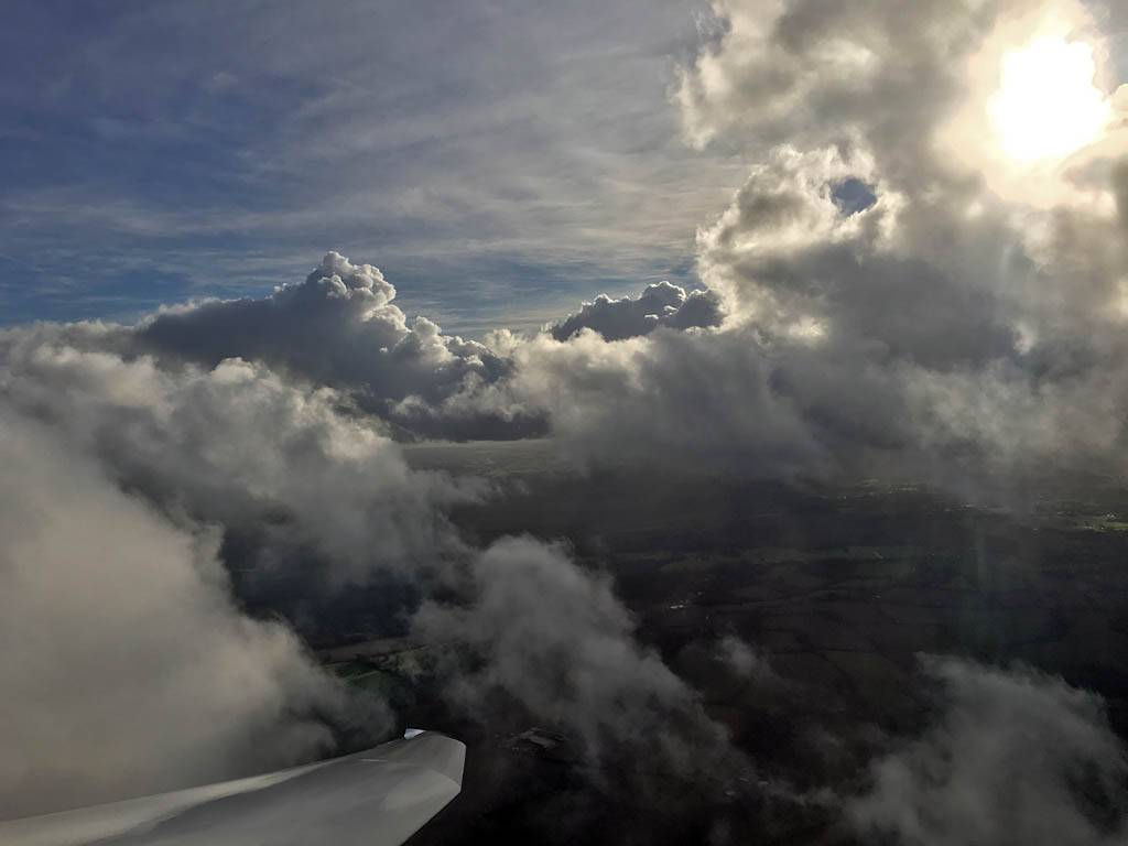
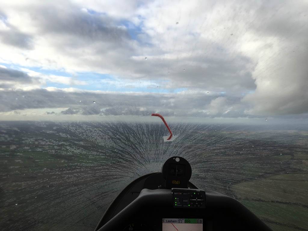
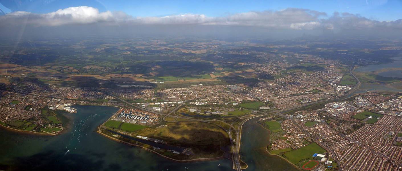
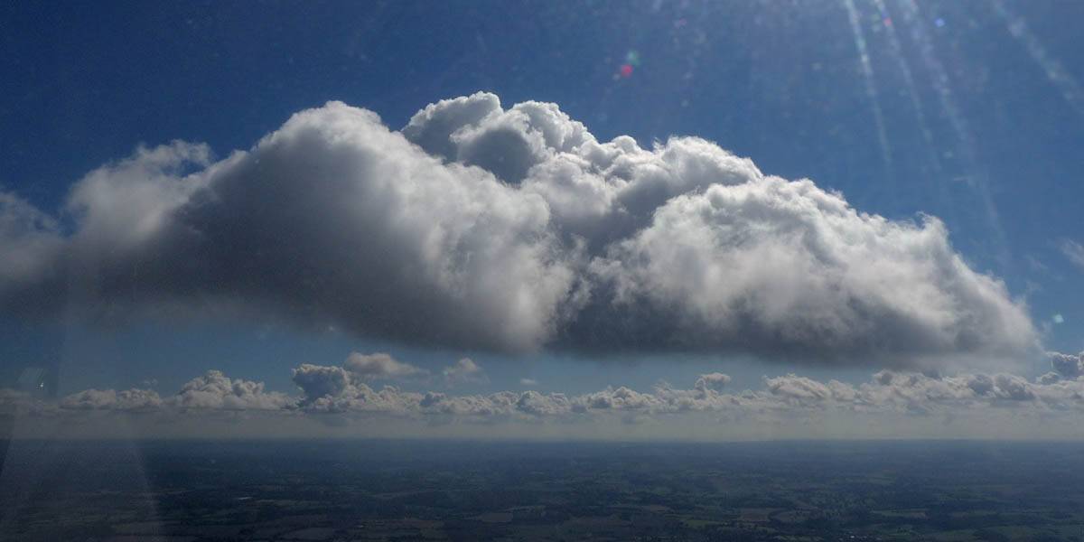
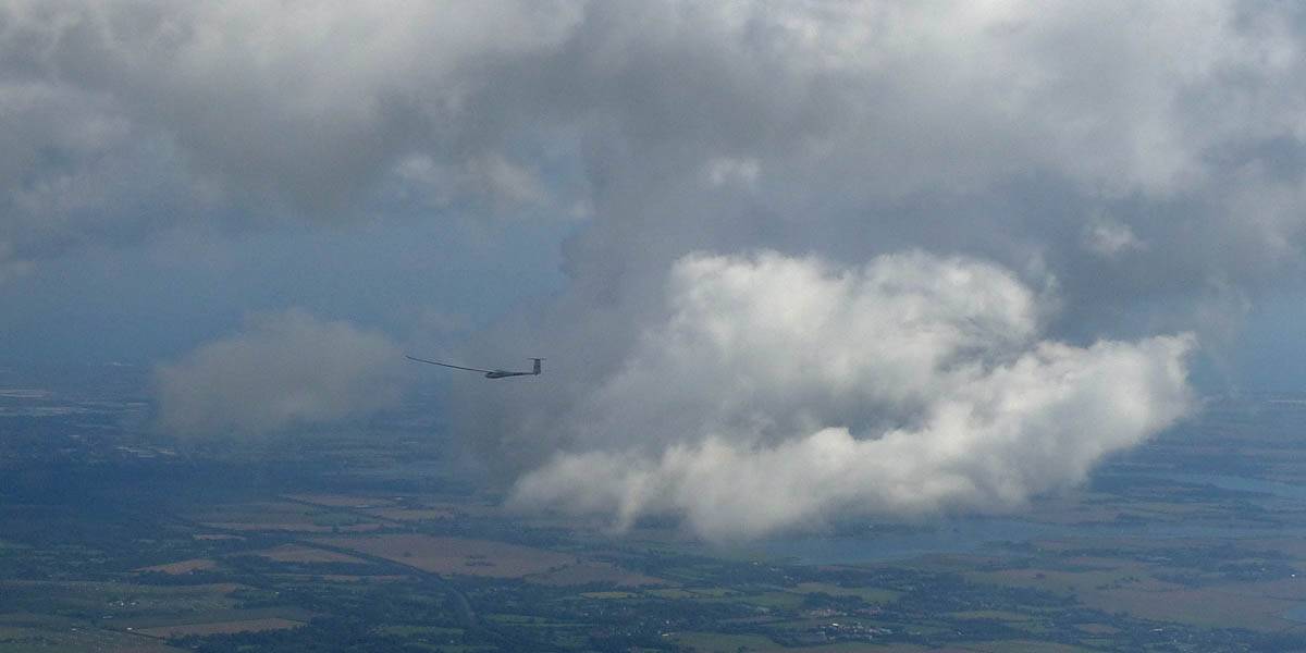
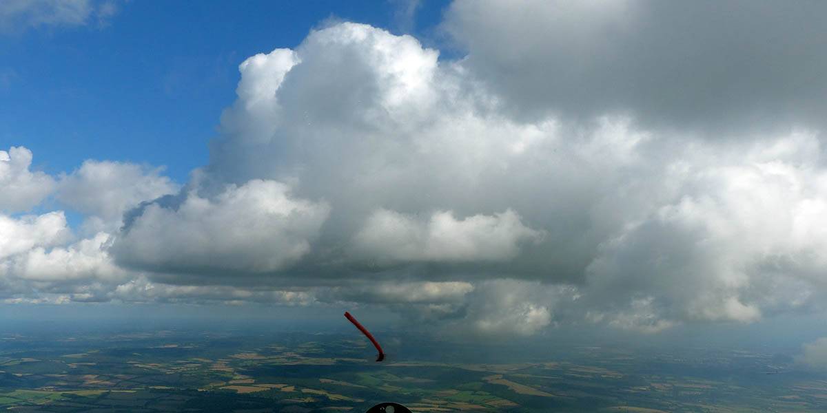
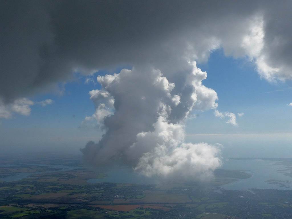
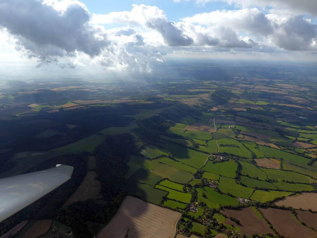
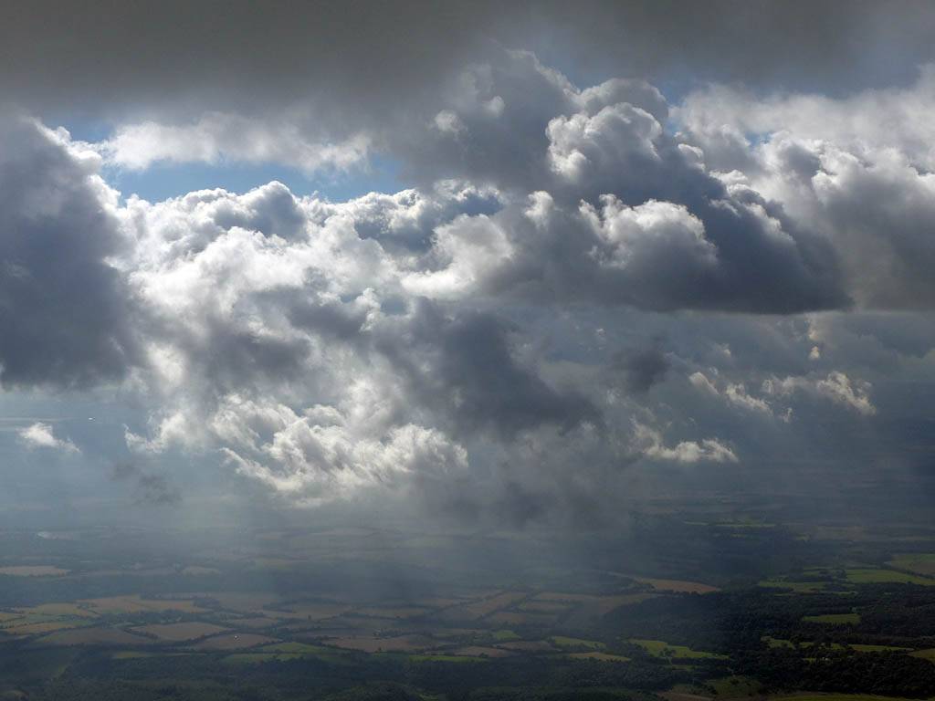
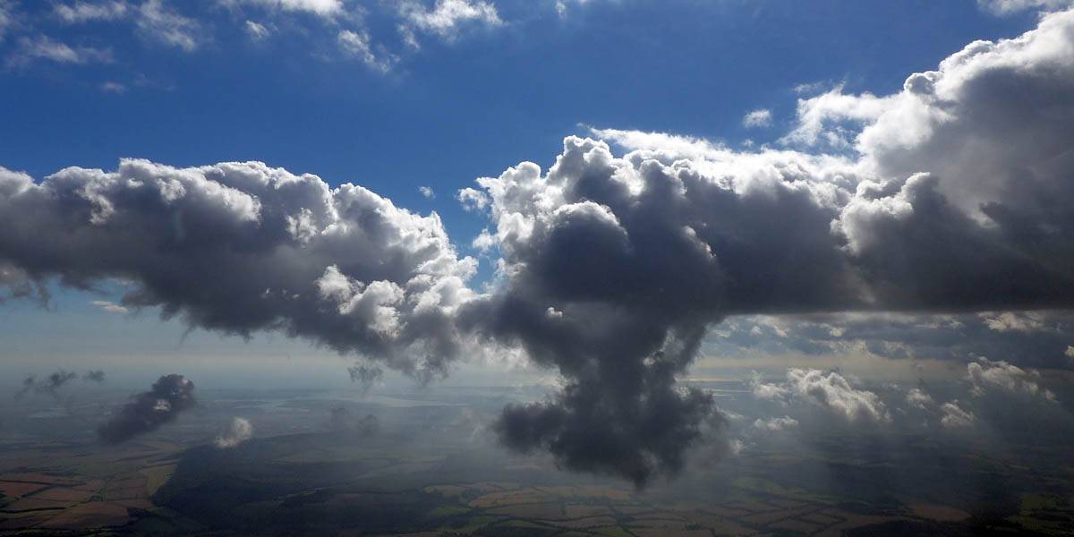
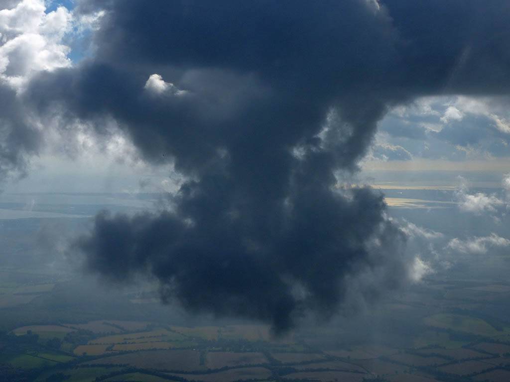
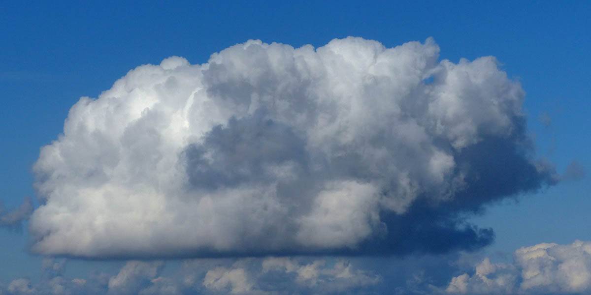
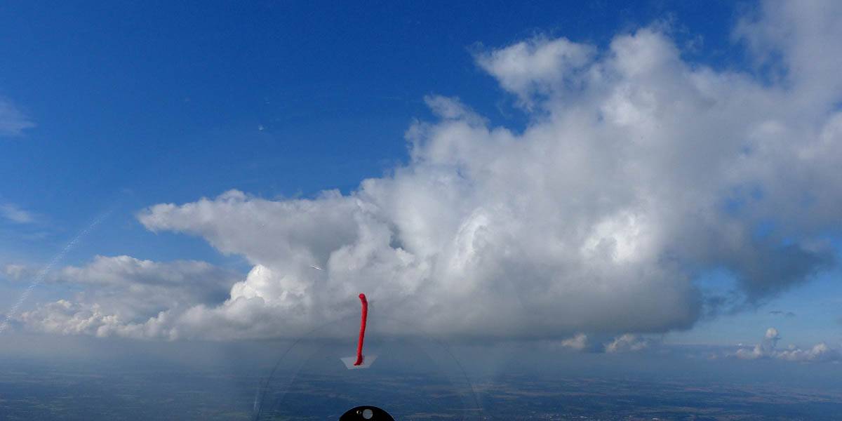
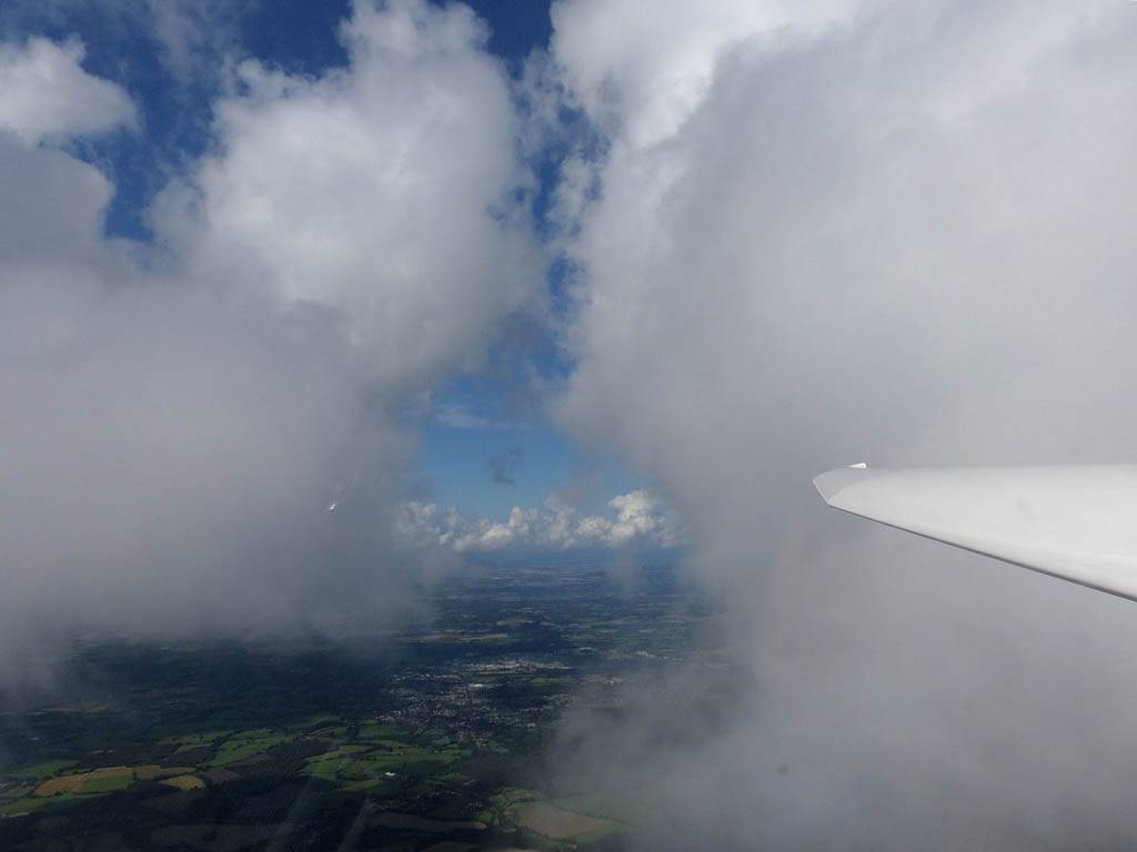
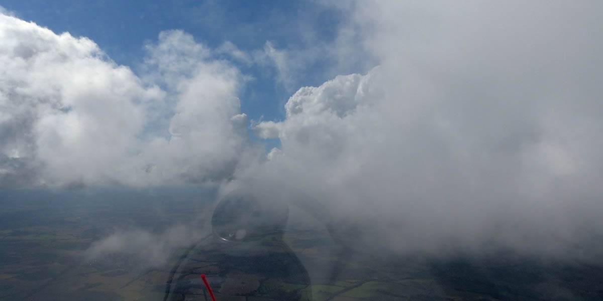
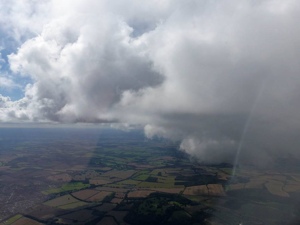
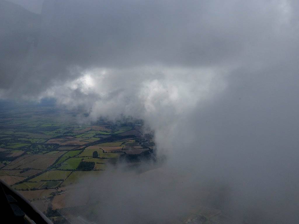
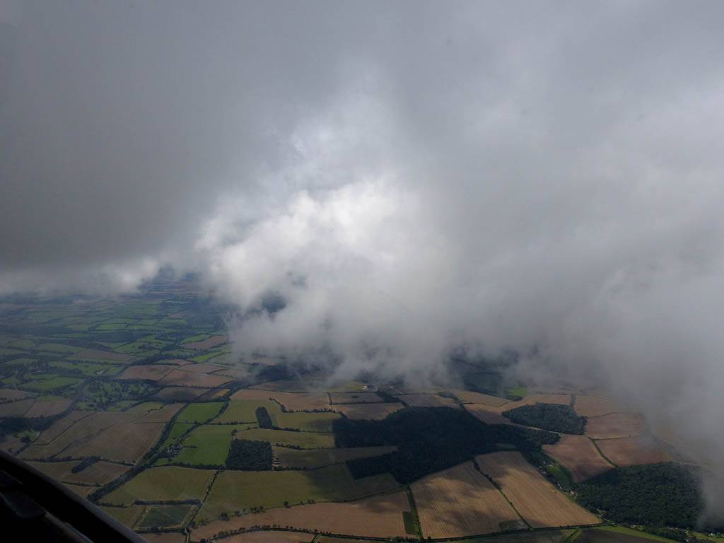
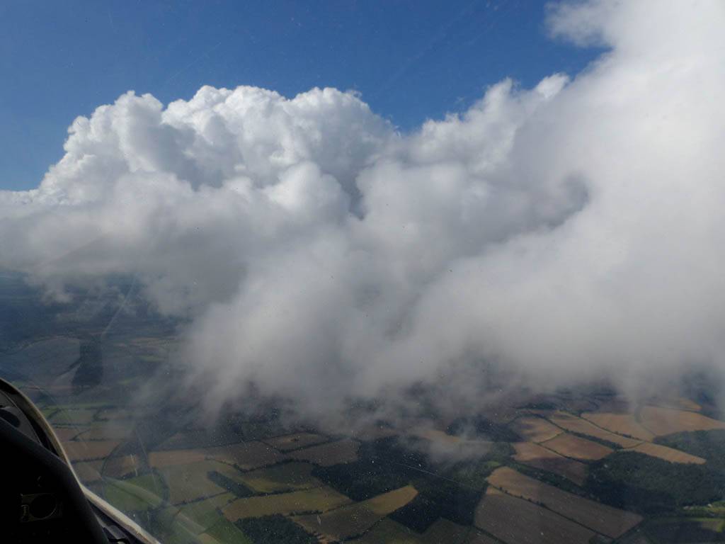
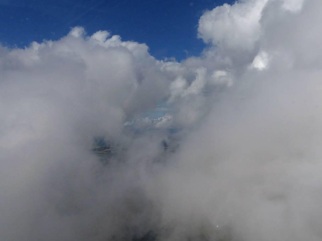
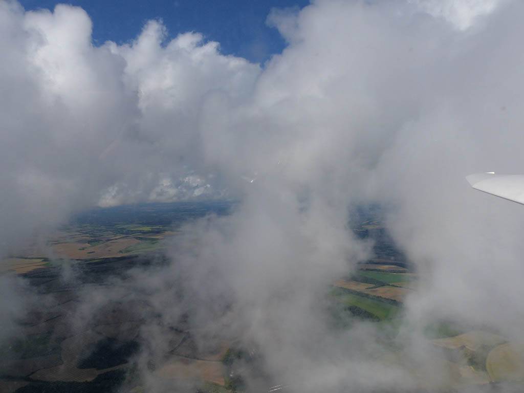
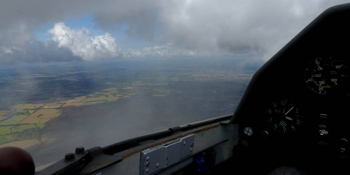
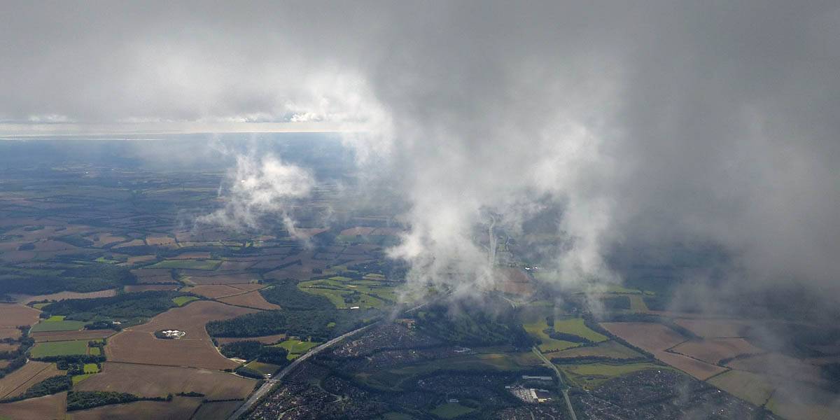
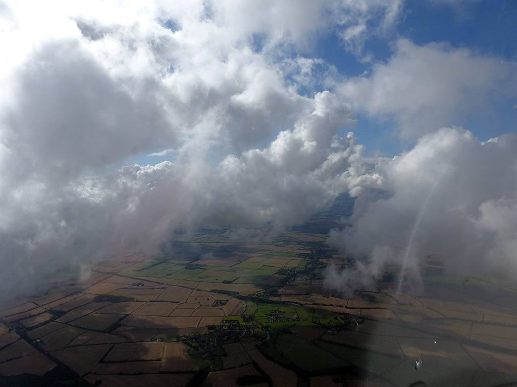
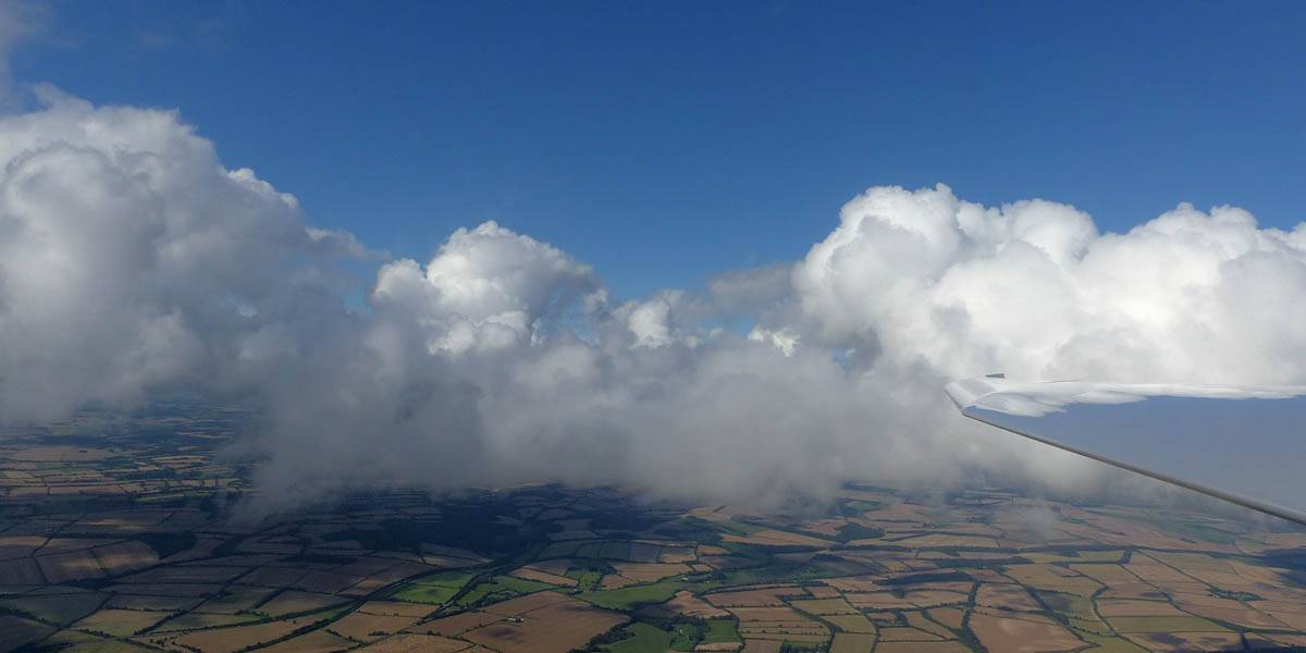
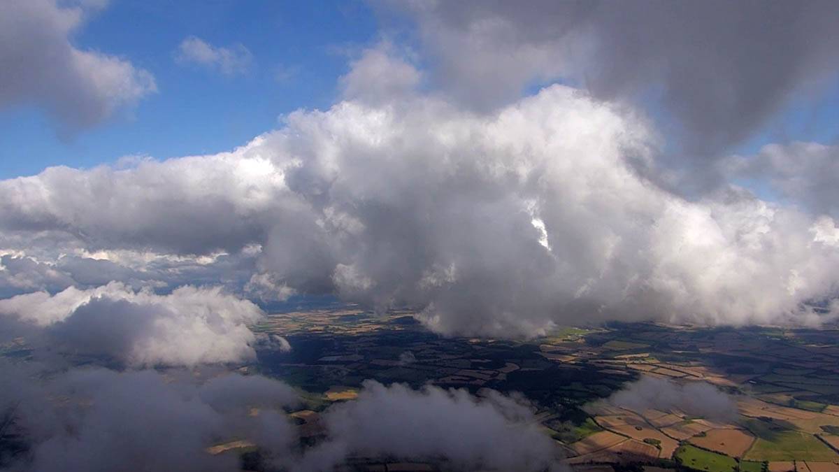
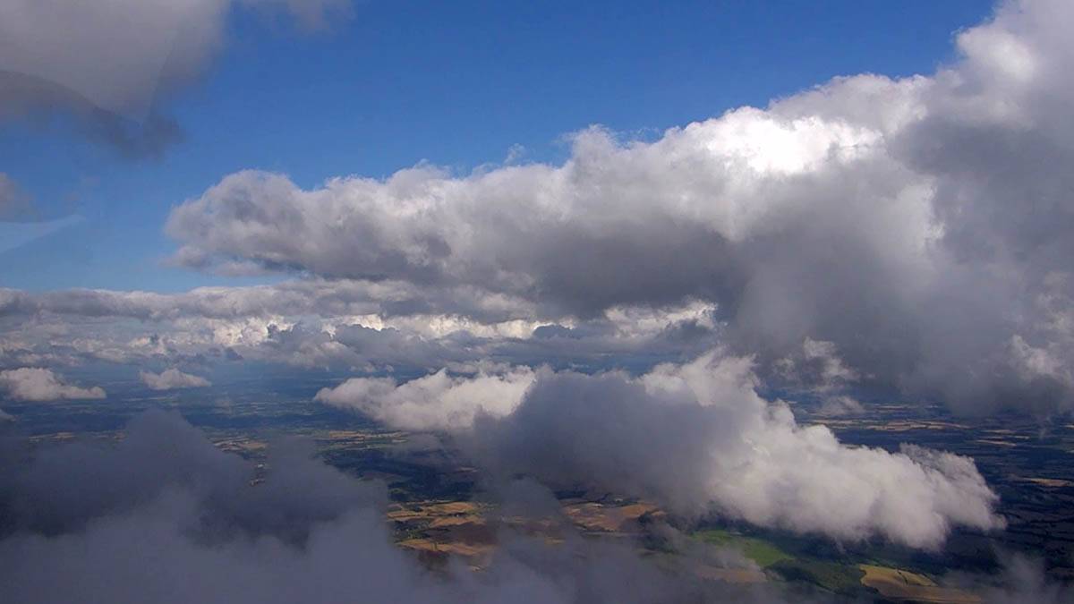
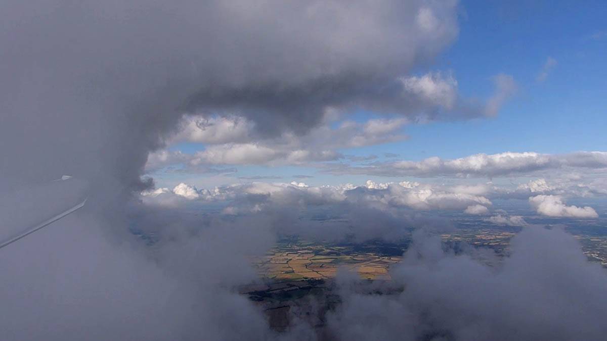
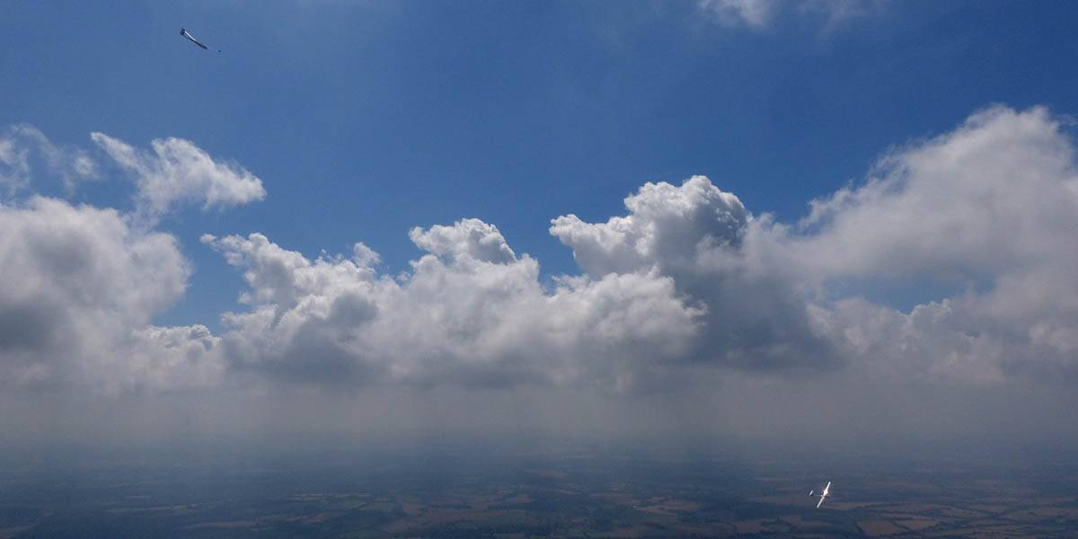
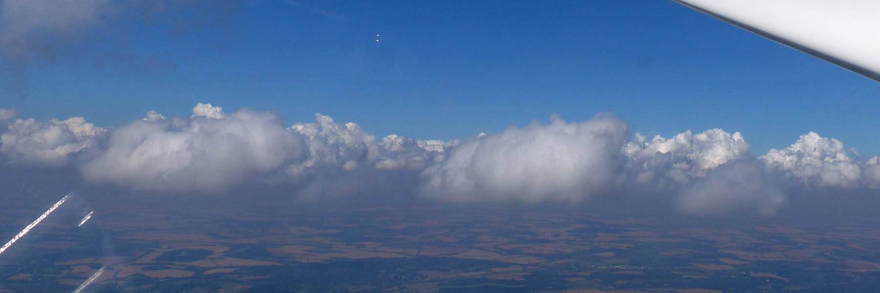
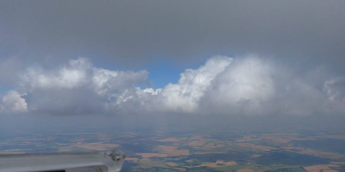
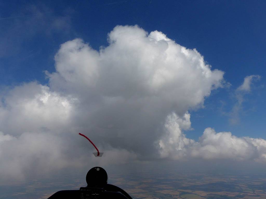
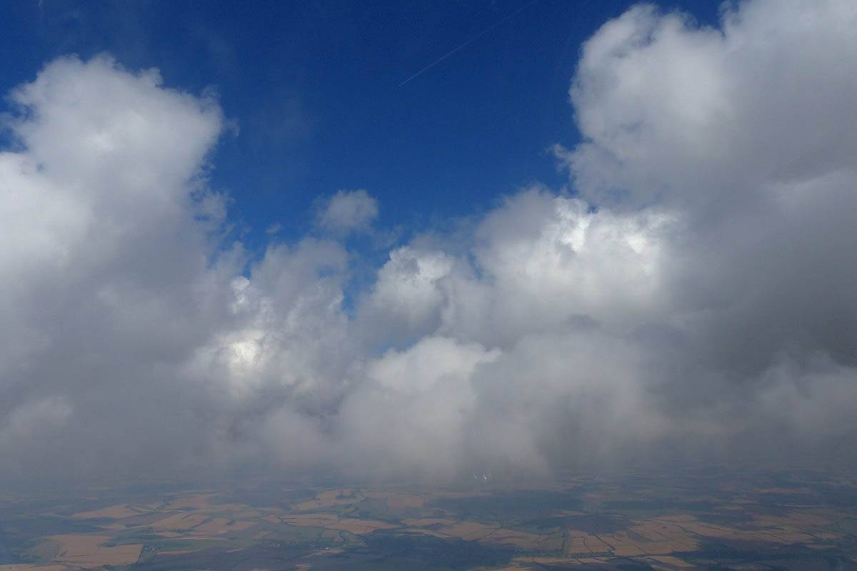
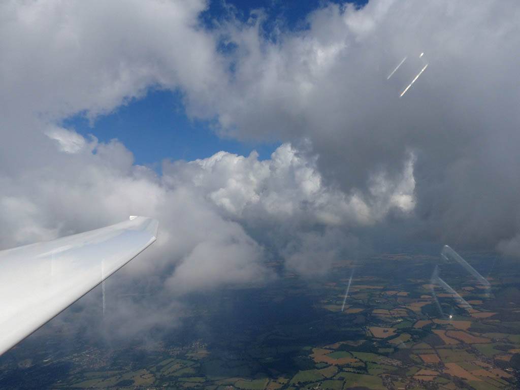
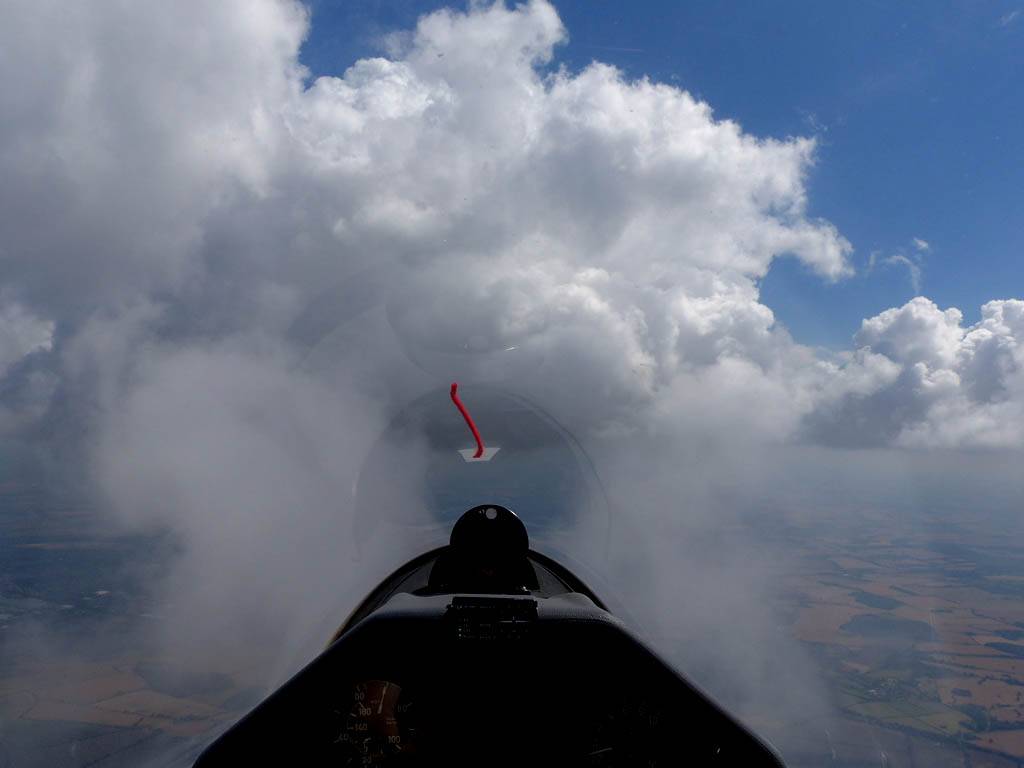
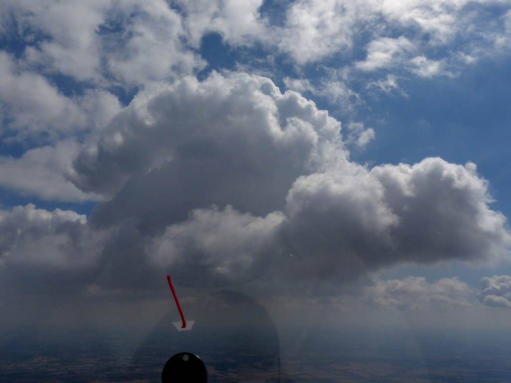
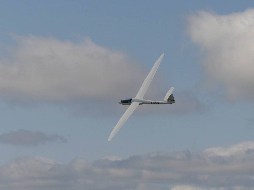
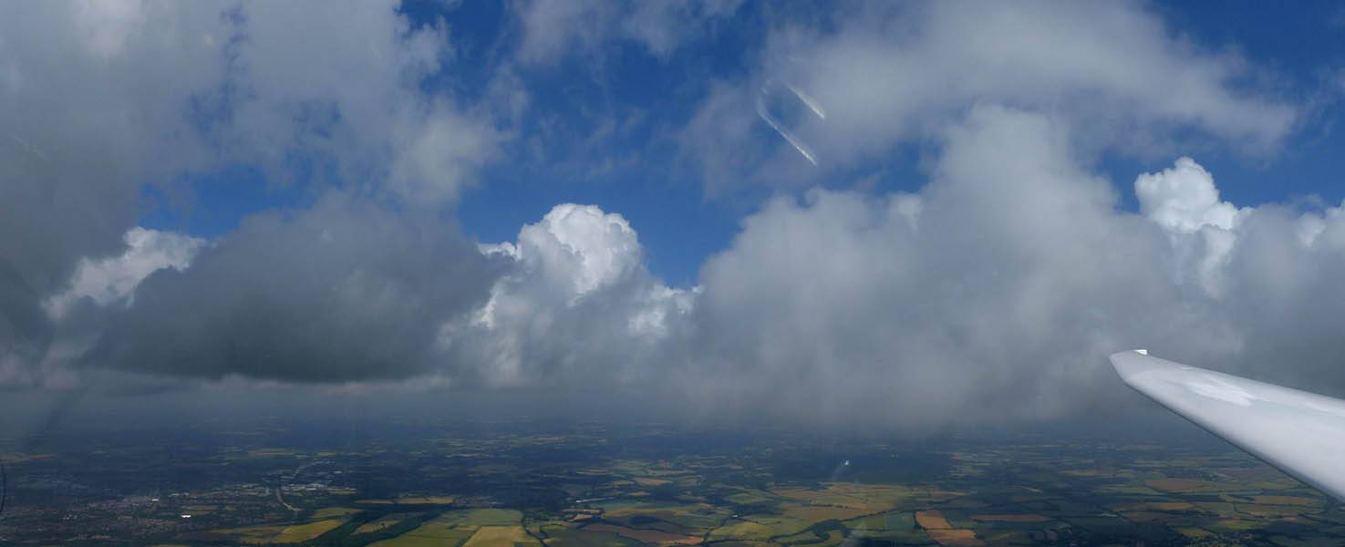
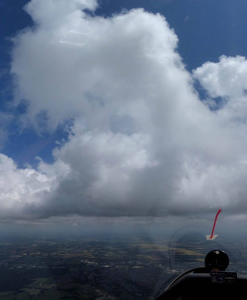
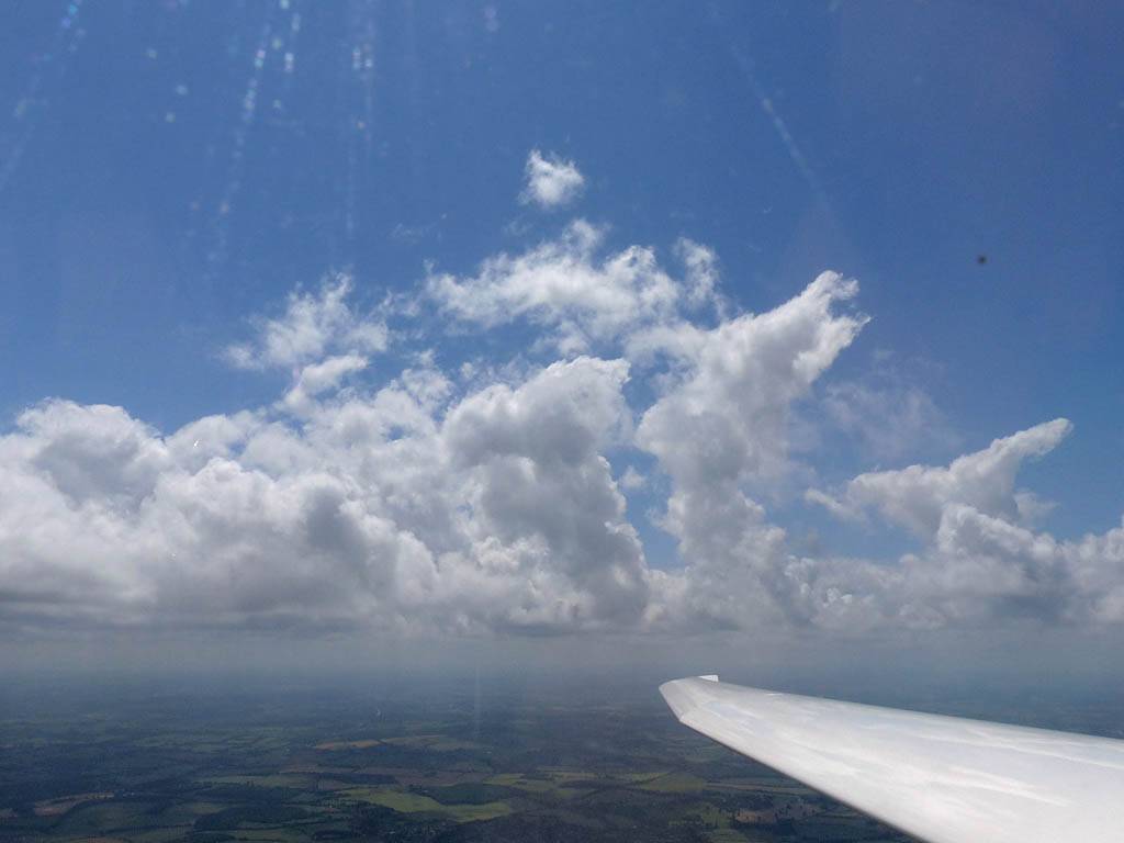
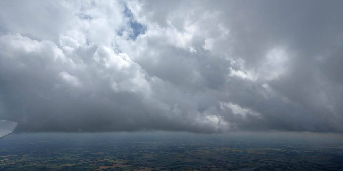
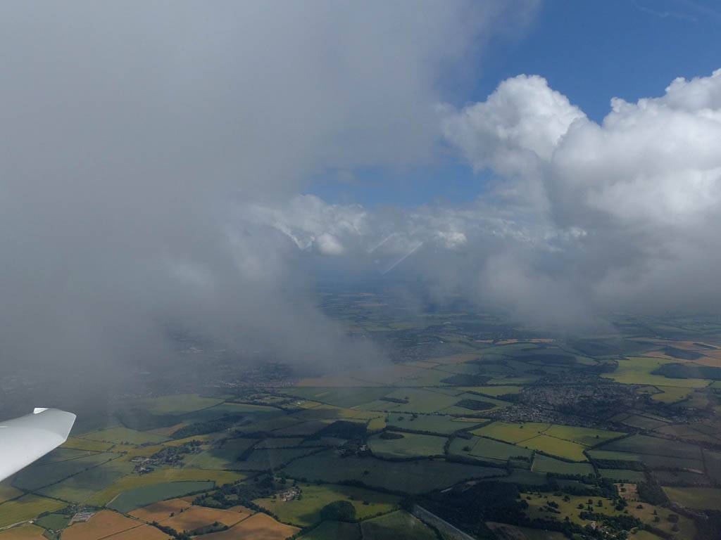
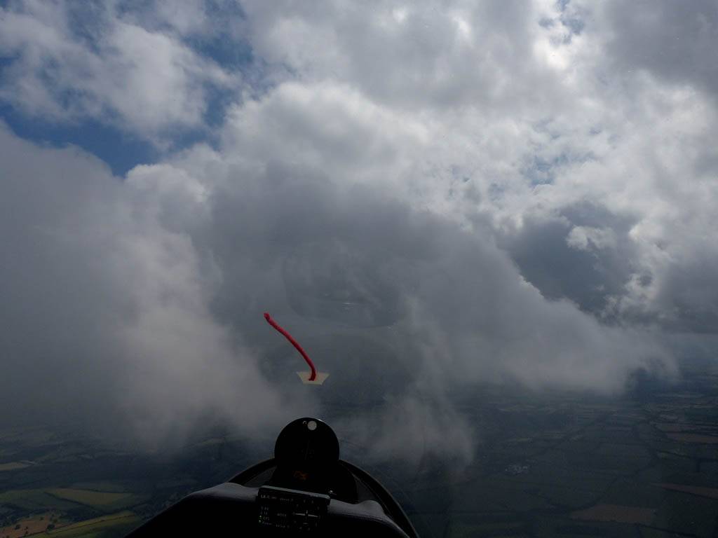
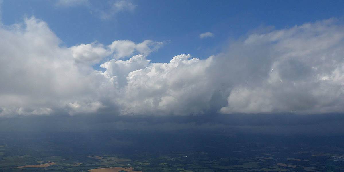
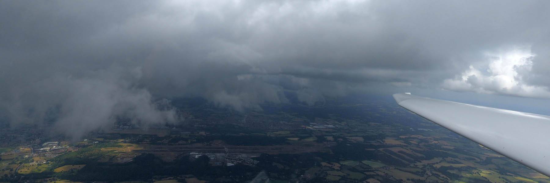
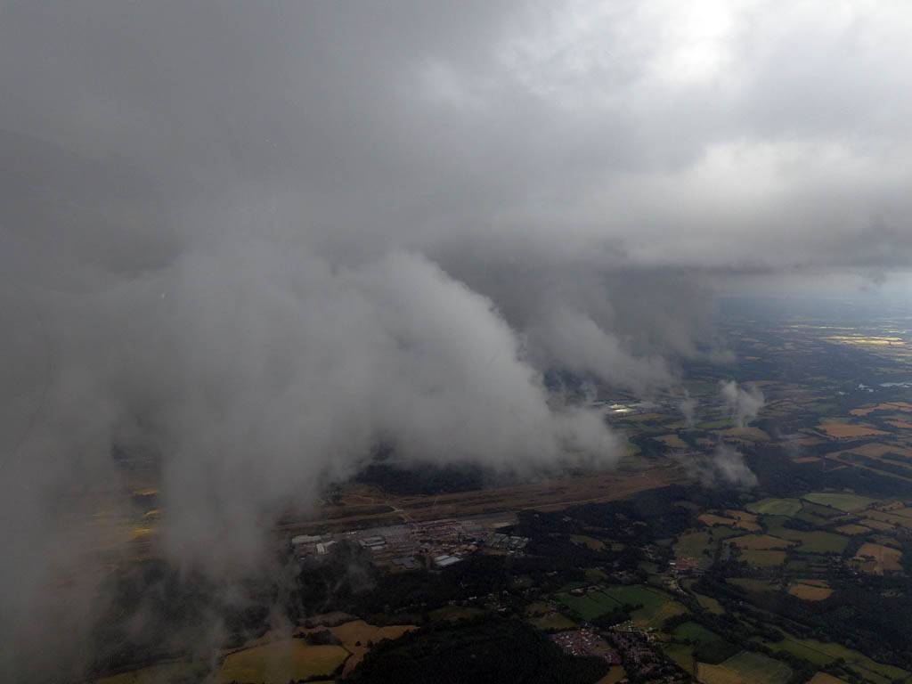
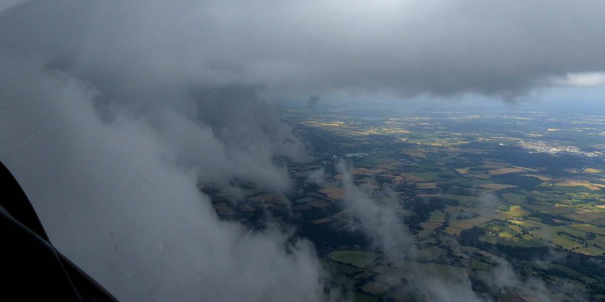
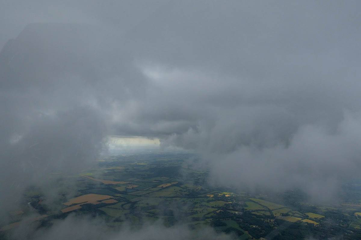
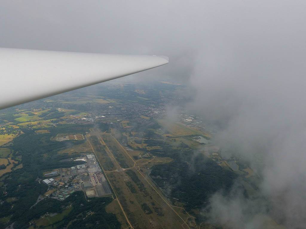
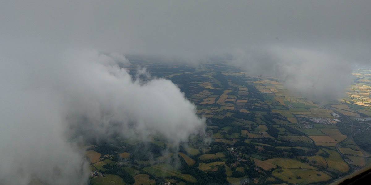
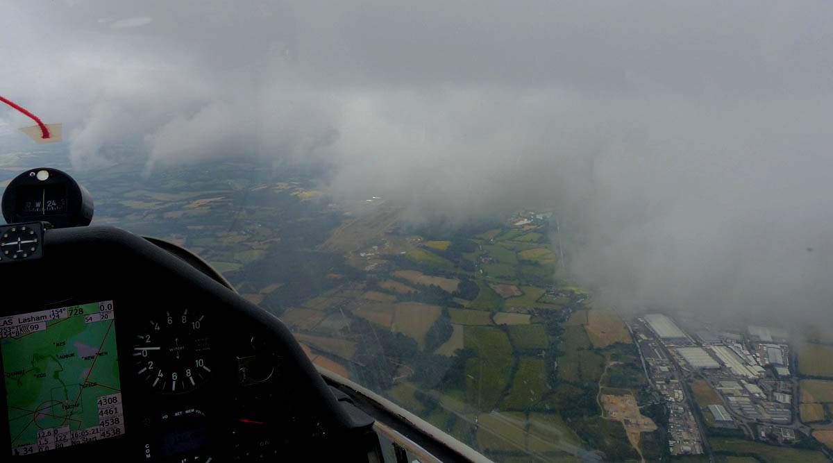
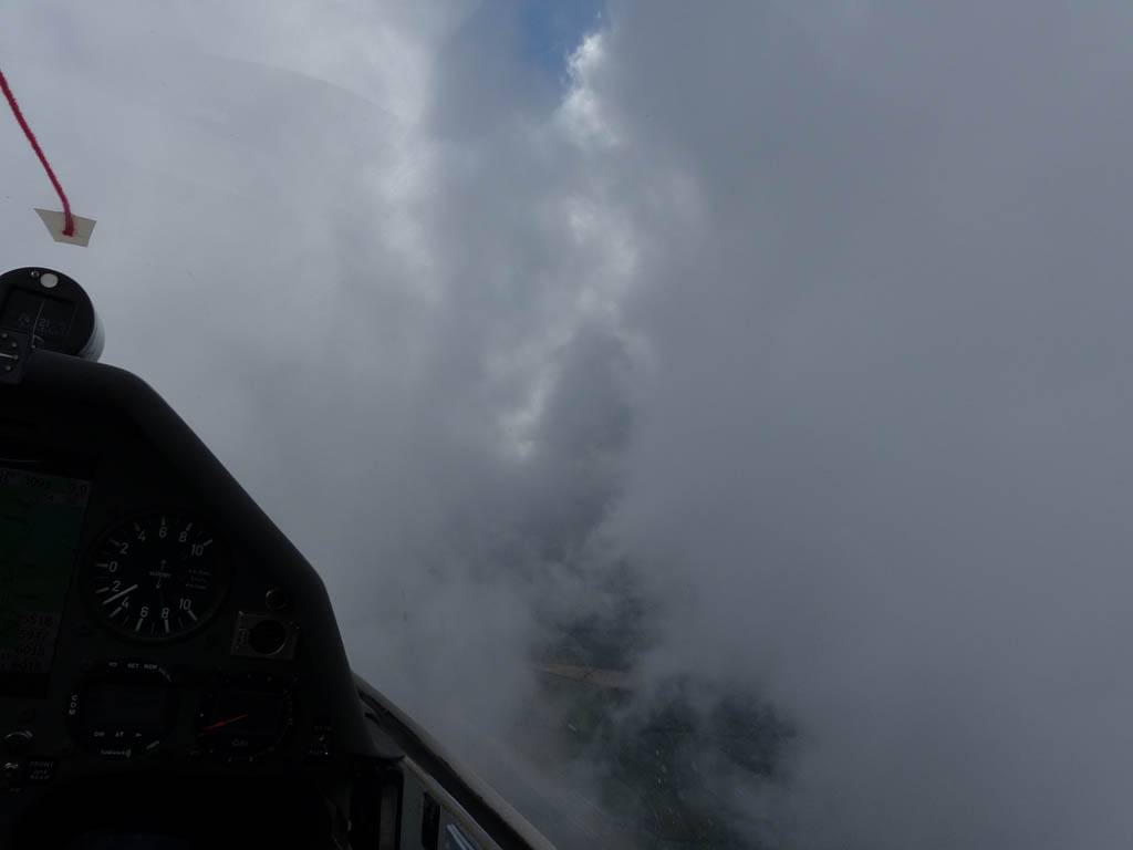
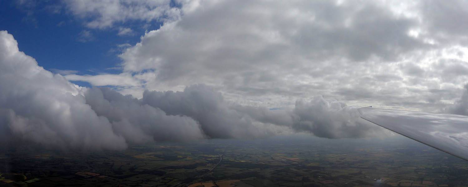
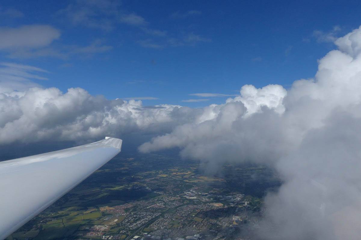
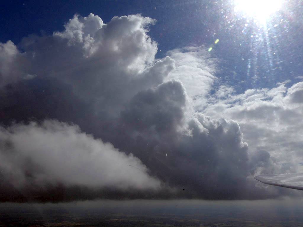
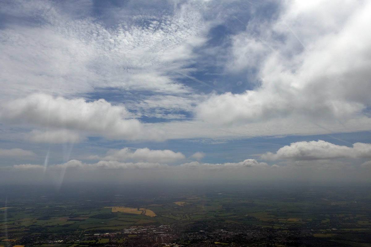
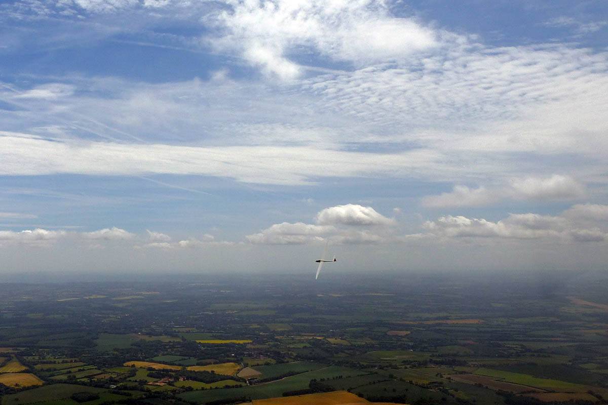
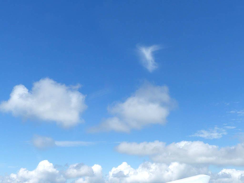
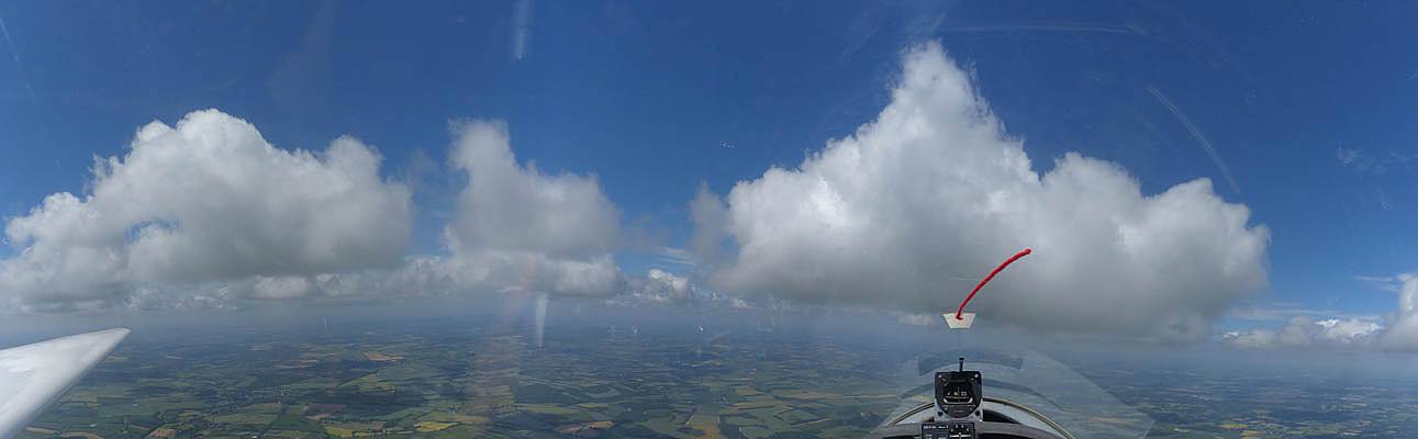
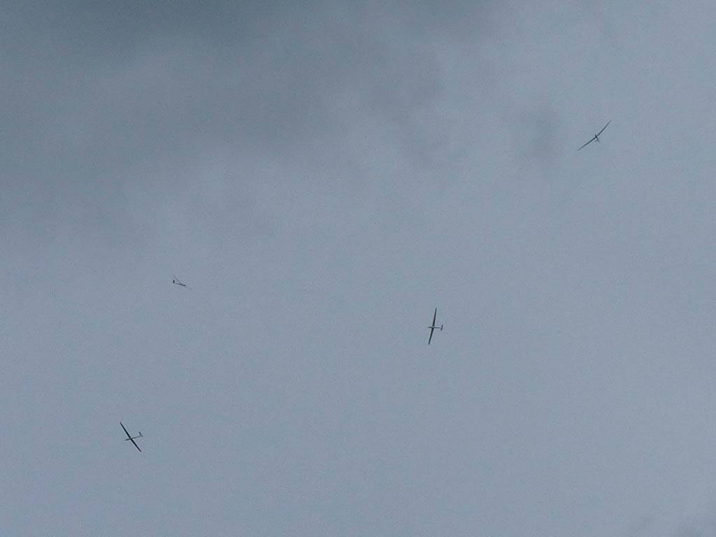
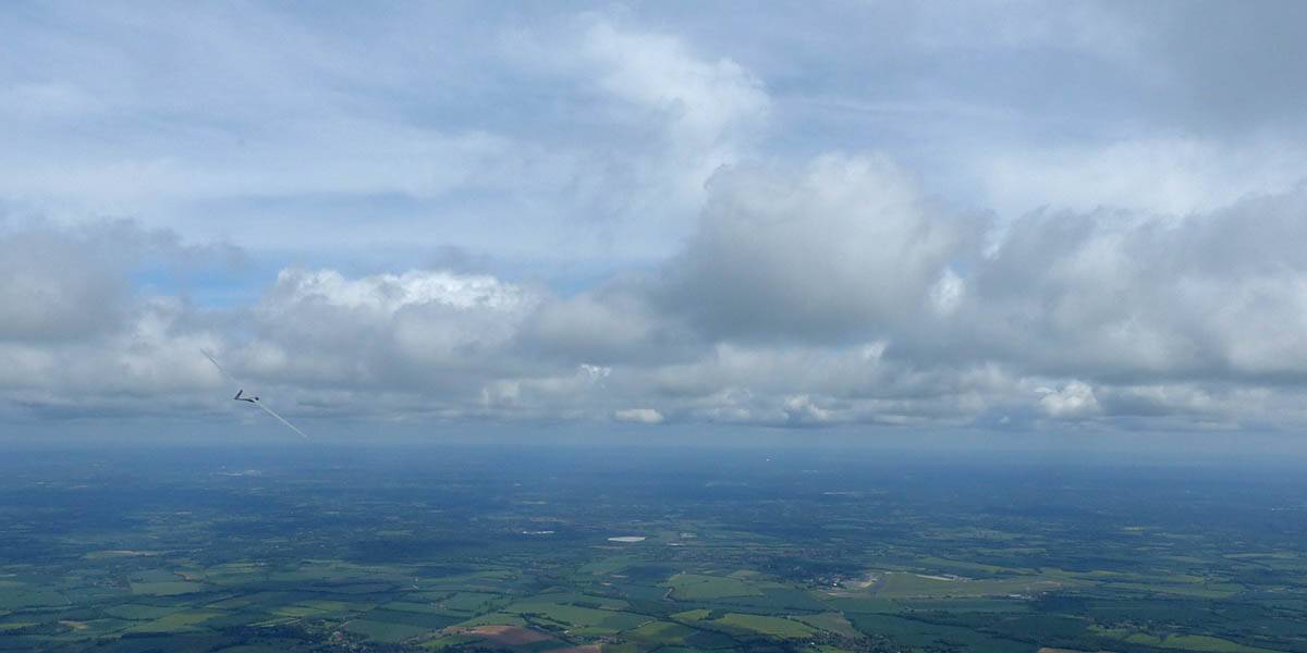
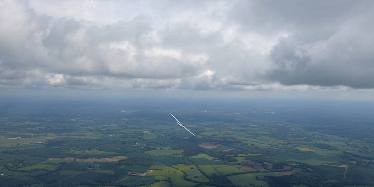
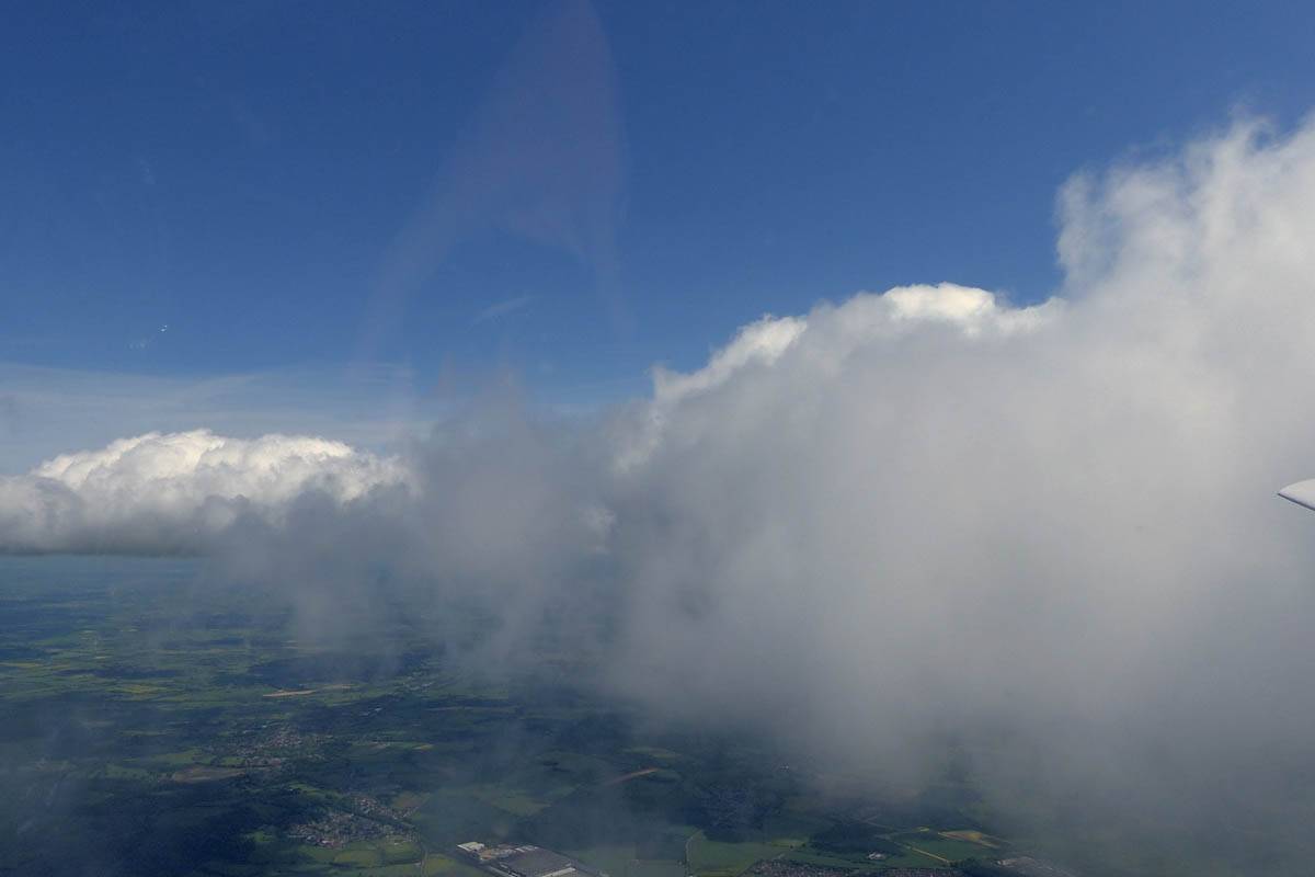
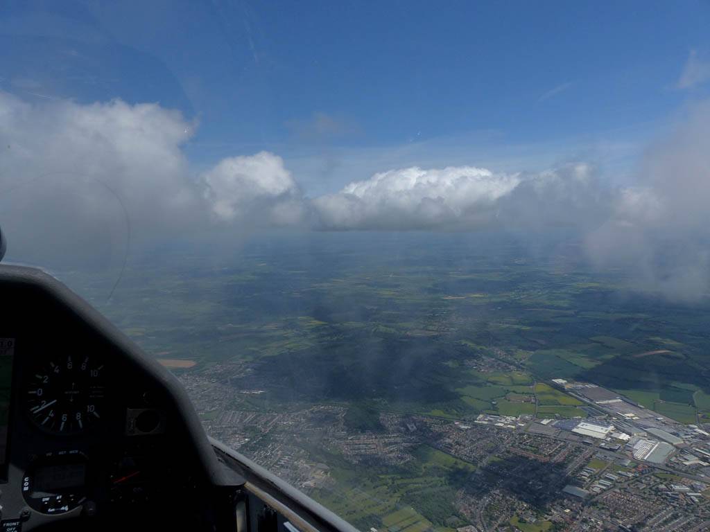
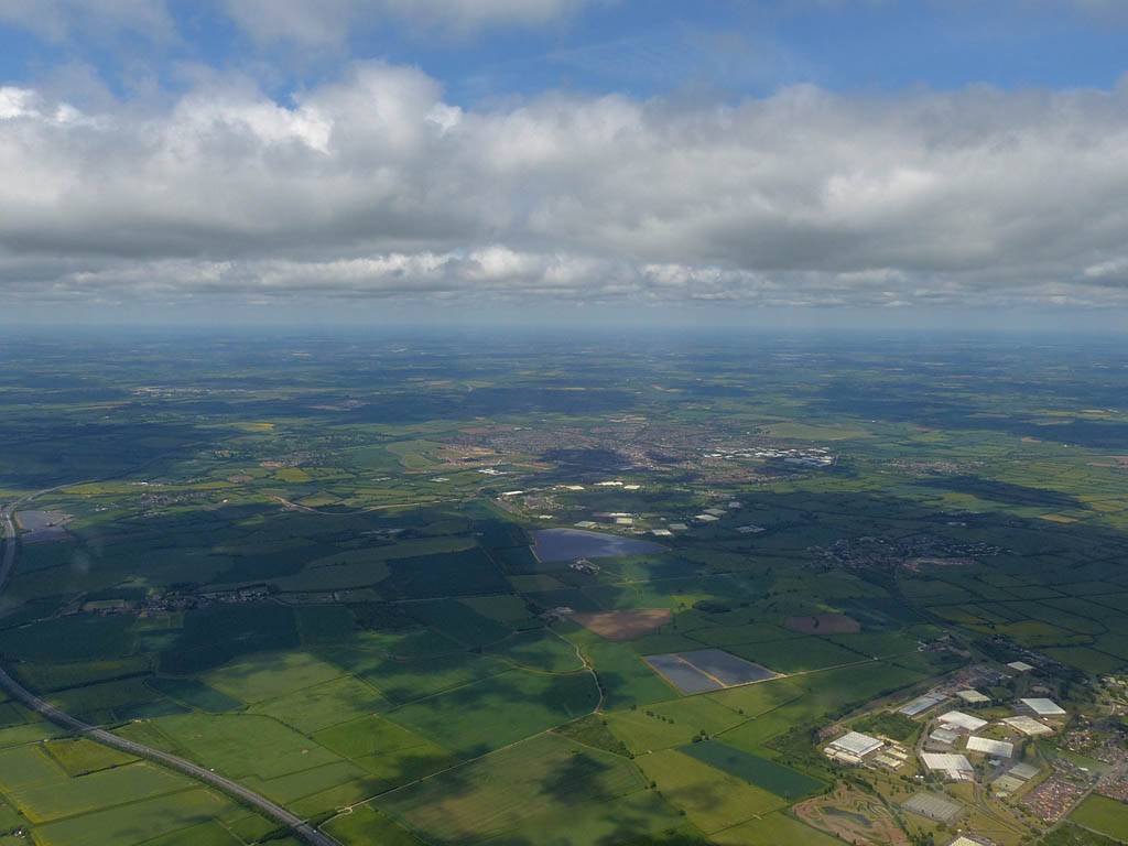
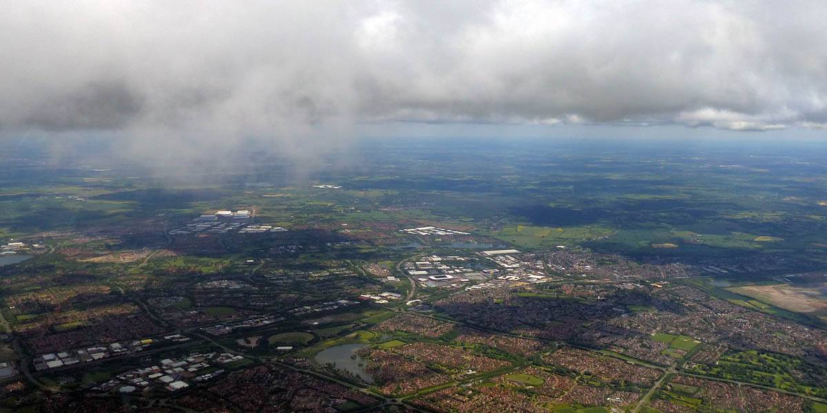
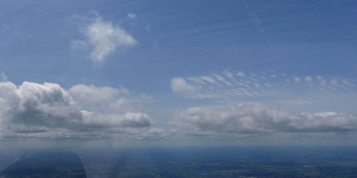
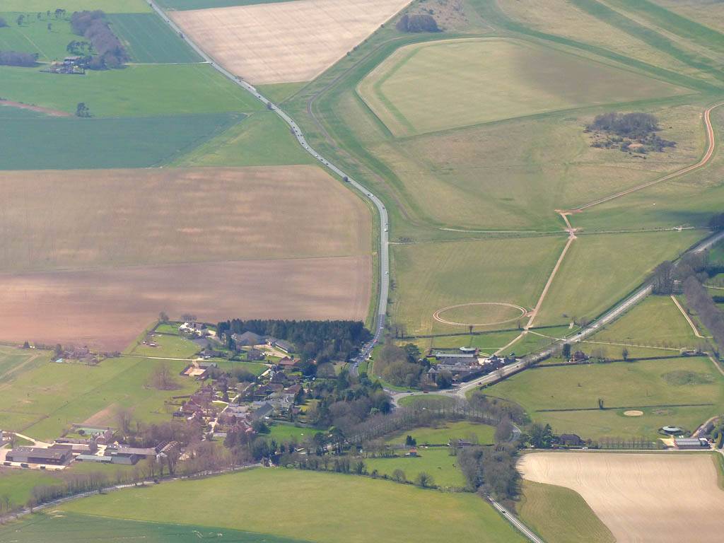
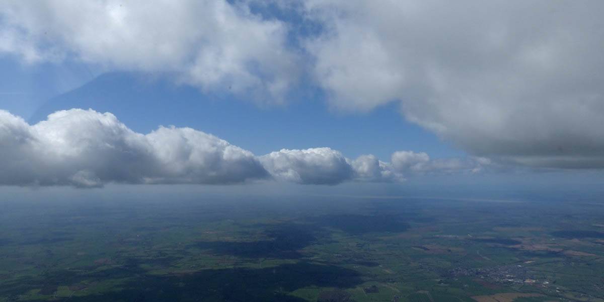
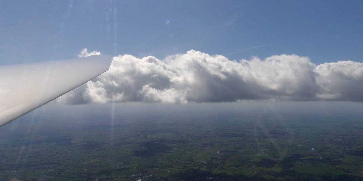
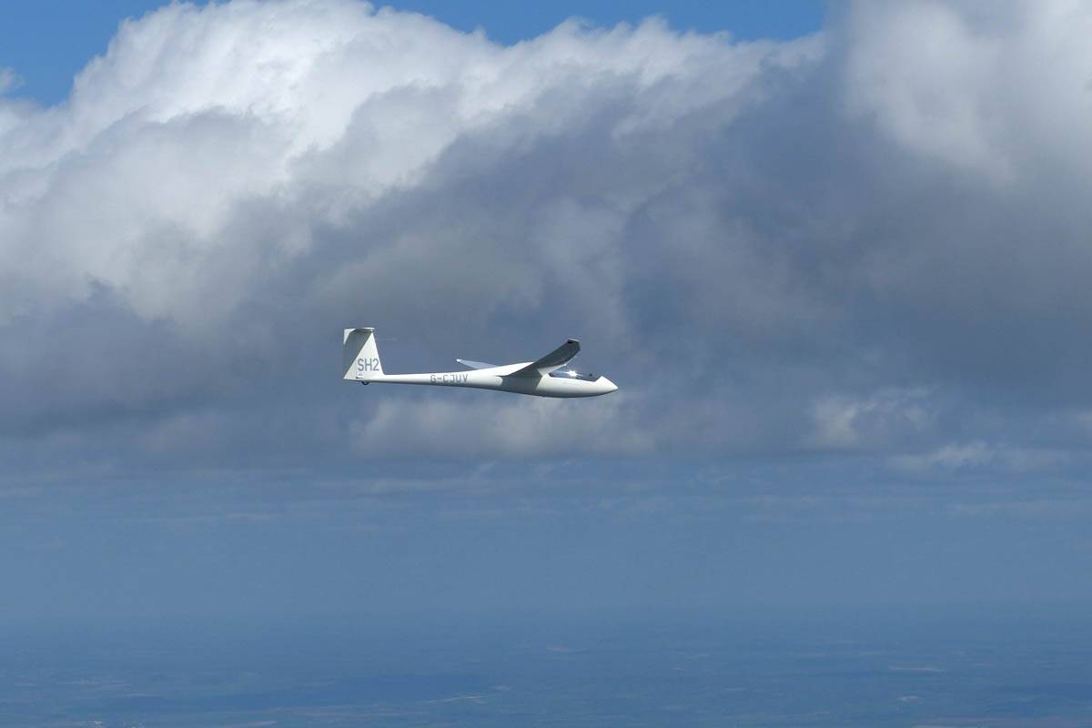
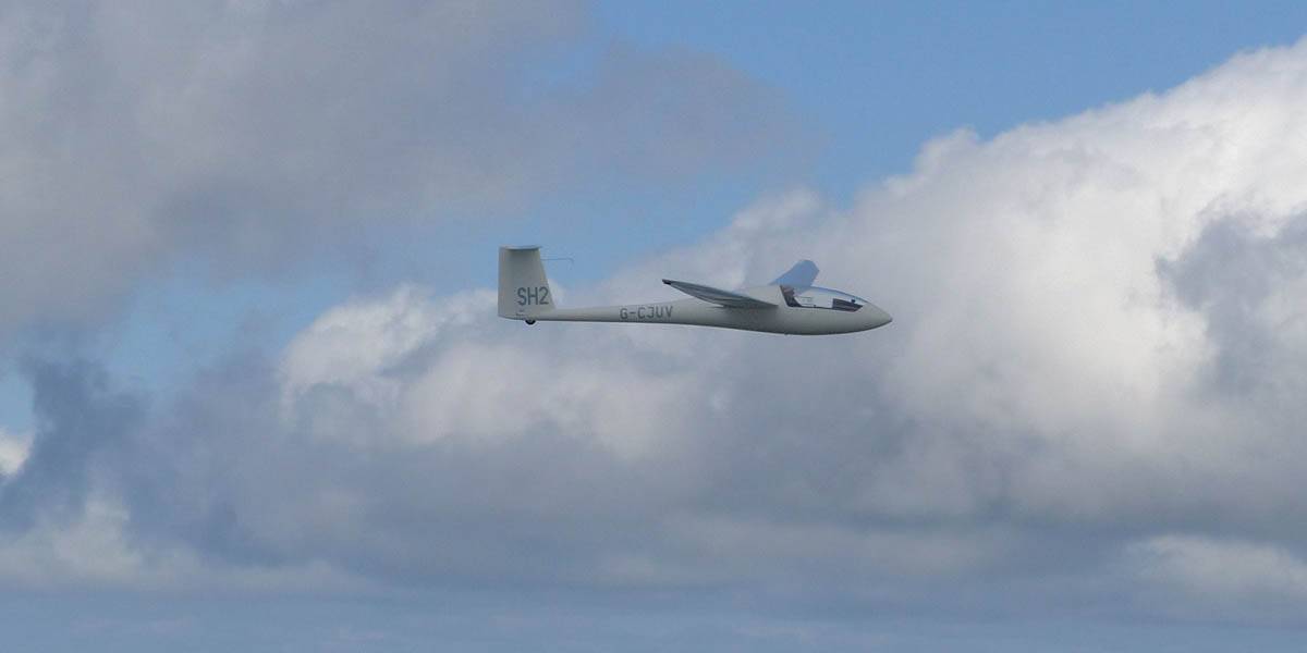
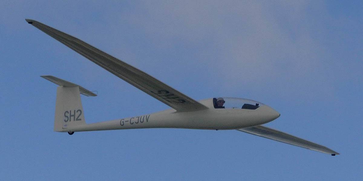
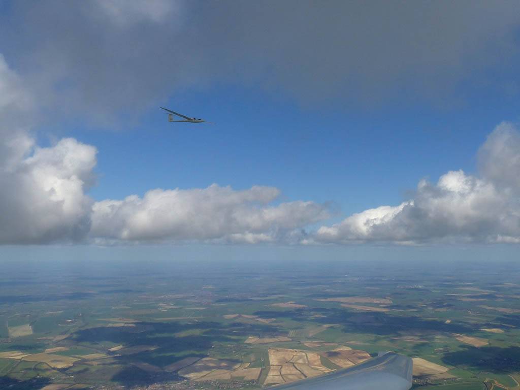
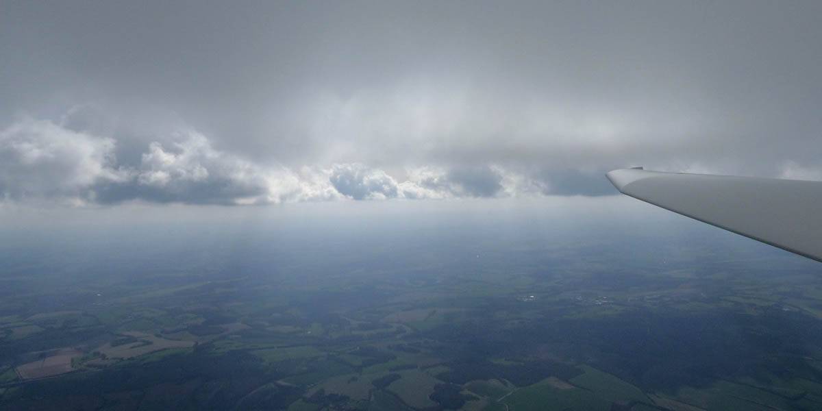
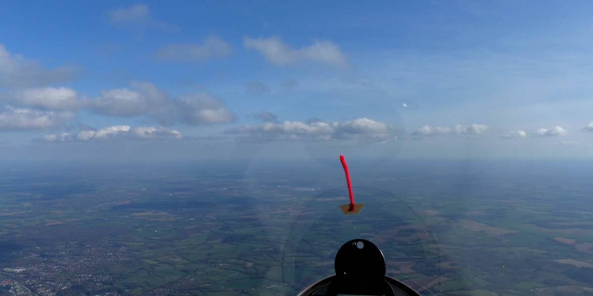
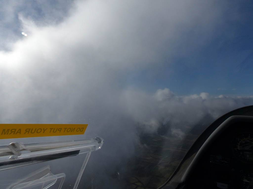
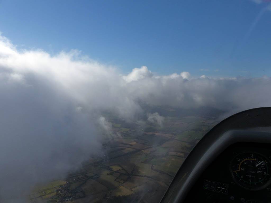
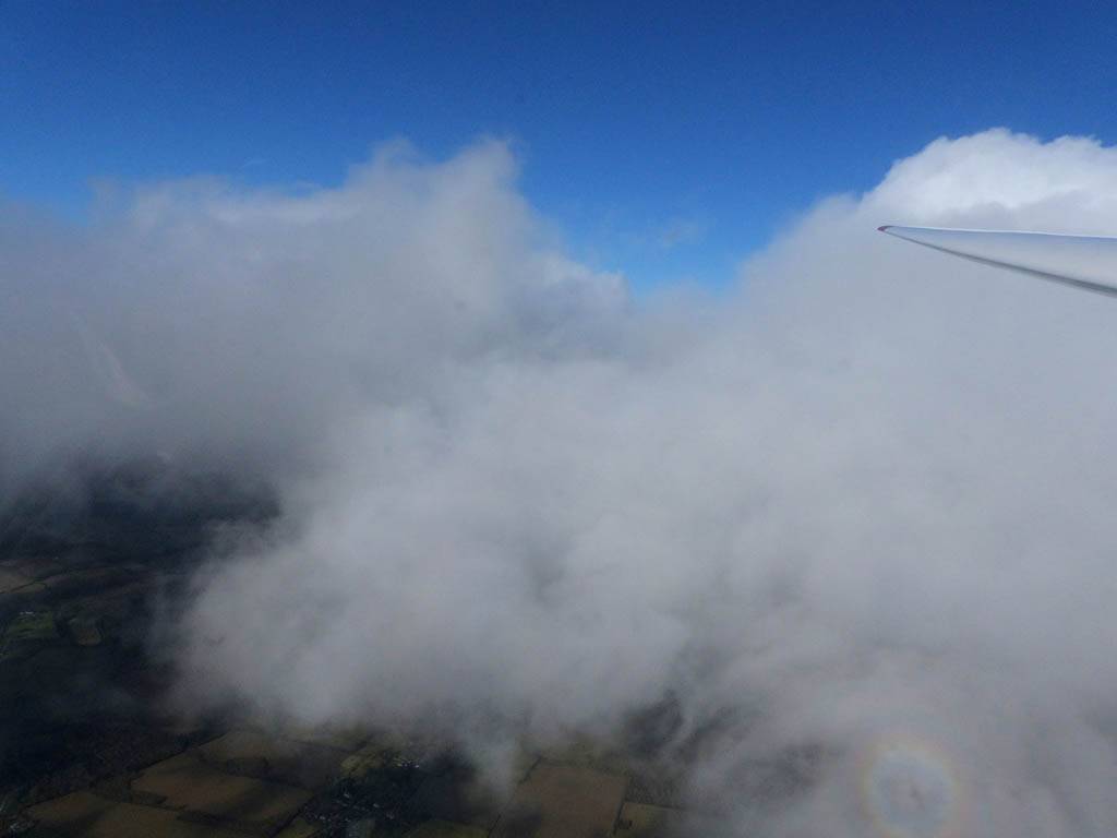
After a long grey and damp autumn and winter so far, I was keen to make use of this weather window. At first I thought it had gone wrong as showers hit the airfield early on. However the day brightened up and patchy cumulus formed quite low down. This made my winch launches rather more interesting than the usual winter hops. Then I decided to aerotow to 4000 feet with showers building upwind. The tuggy duely towed me upwind where the cloudscapes from up there were amazing! I thoroughly enjoyed that flight. As a bonus, on the way down, after having fun flying between the clouds, at cloudbase I found some thermals and was able to soar between 1700 and 1800 feet for 10 minutes before I got rained out of the sky. What a fantastic way to end the year. My best ever December flight.
There are two videos on YouTube. The Winch Launches were combined into a single video while The Aerotow was turned into my first ever edited gliding video. It incorporates the aerotow timelapse, selfie footage and cockpit footage as I flew over, through, around and below the clouds before getting rained out of the sky.
|
IMG_9444_9446_Panorama.jpg |
IMG_9454.jpg |
IMG_9455.jpg |
IMG_9457.jpg |
IMG_9462.jpg |
IMG_9464.jpg |
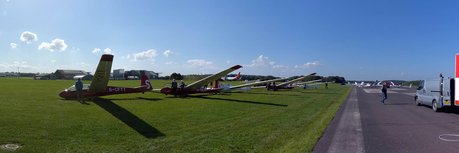
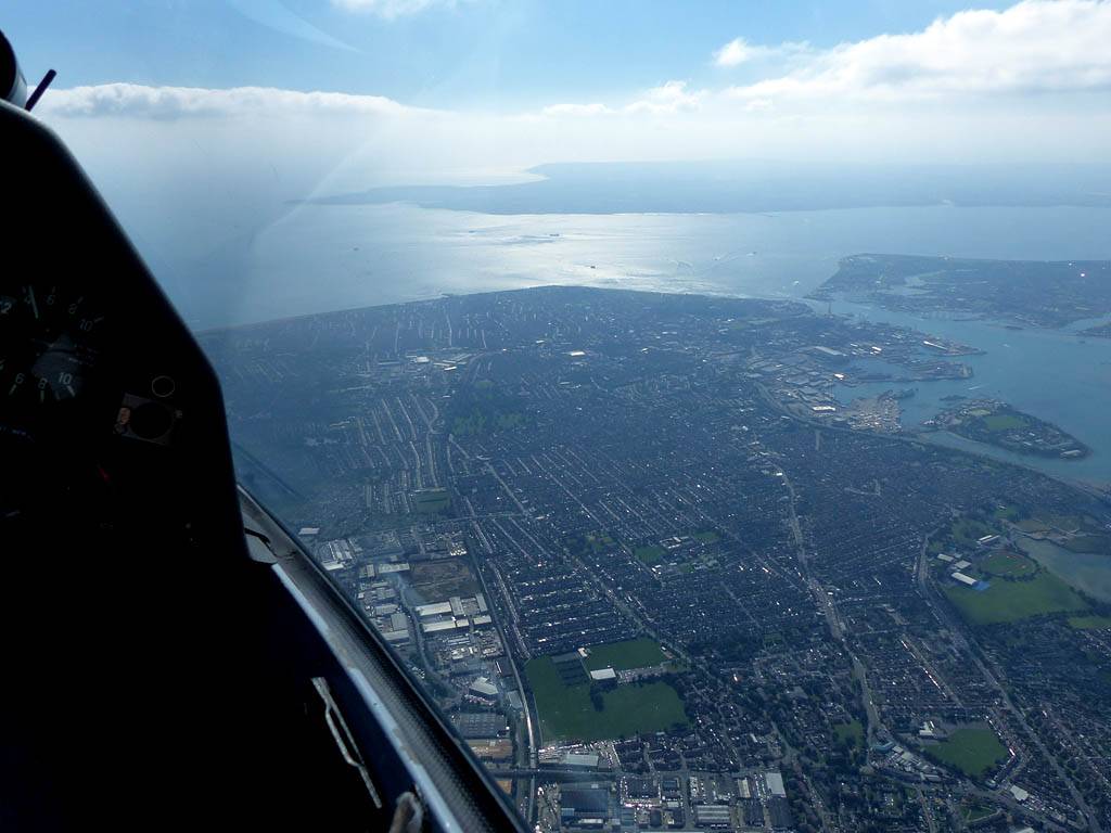
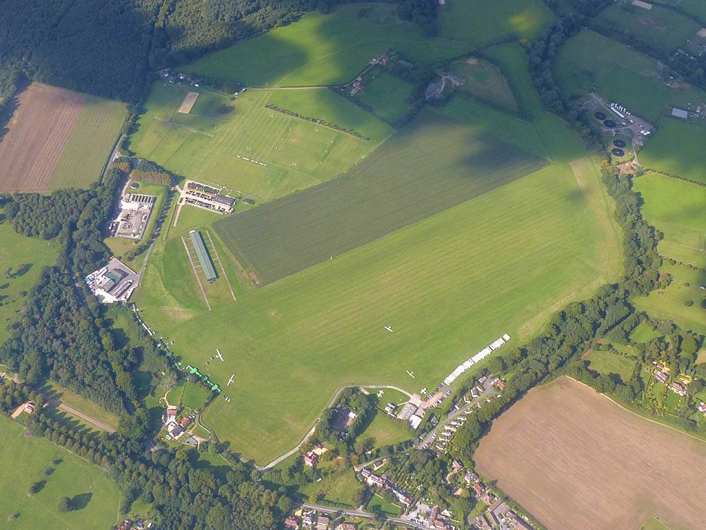
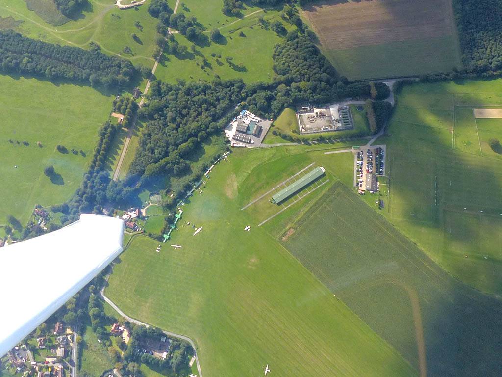
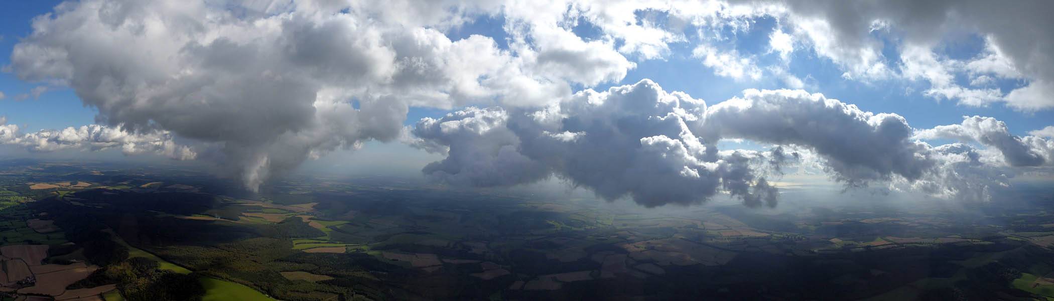
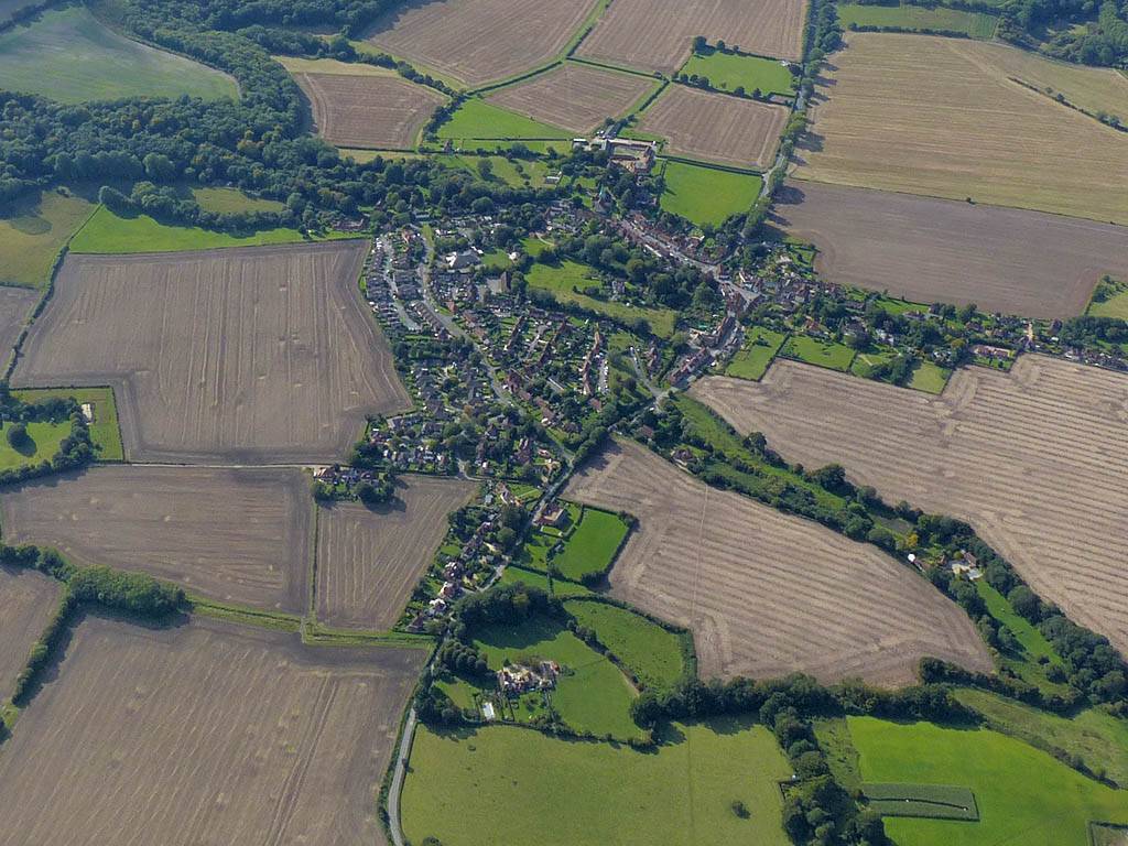
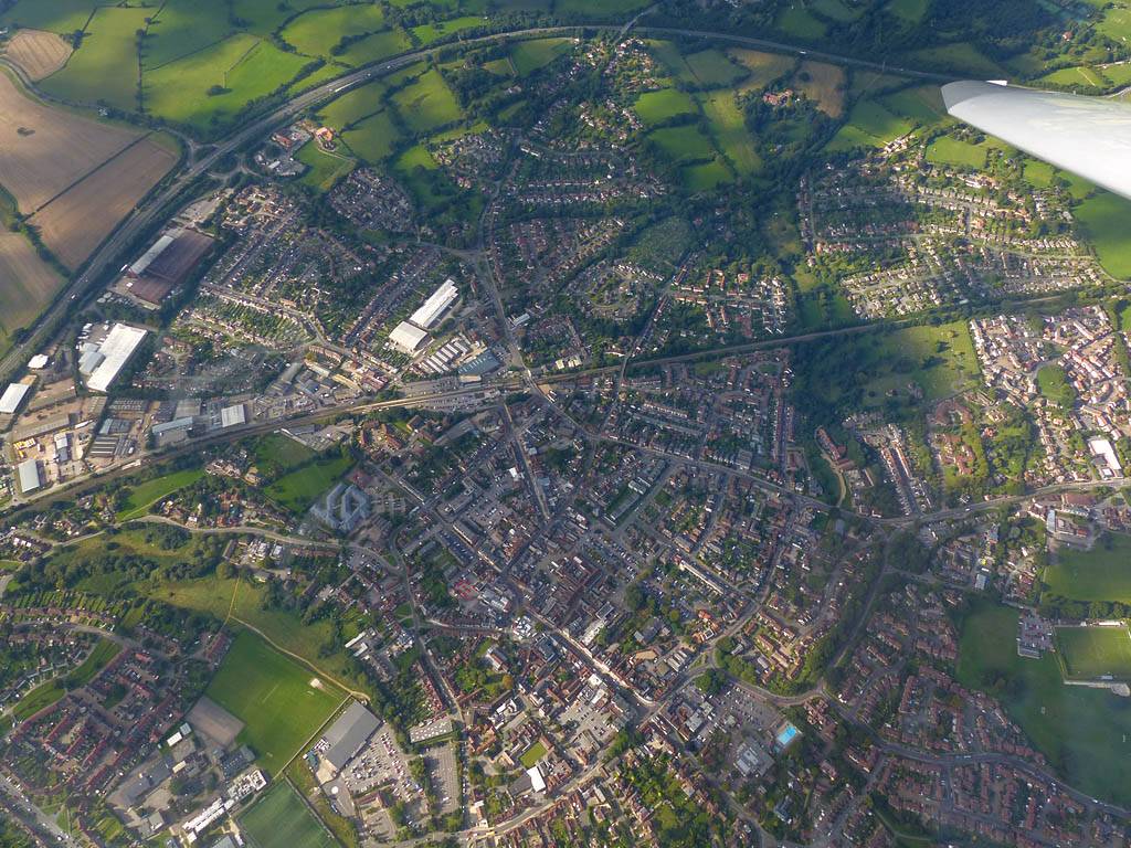
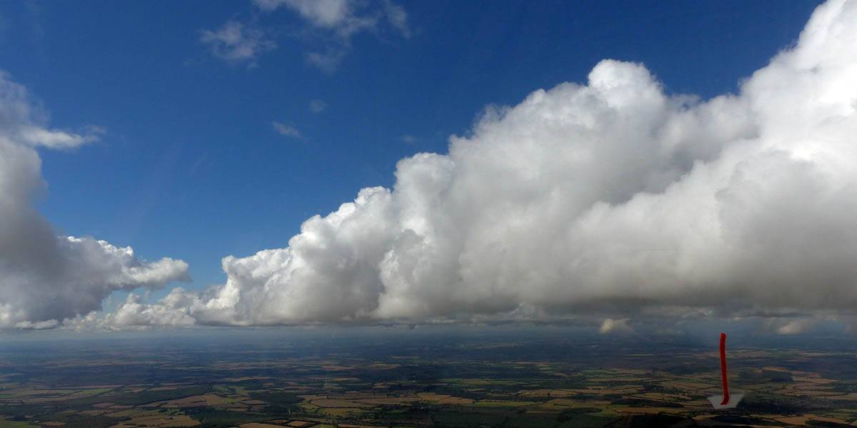
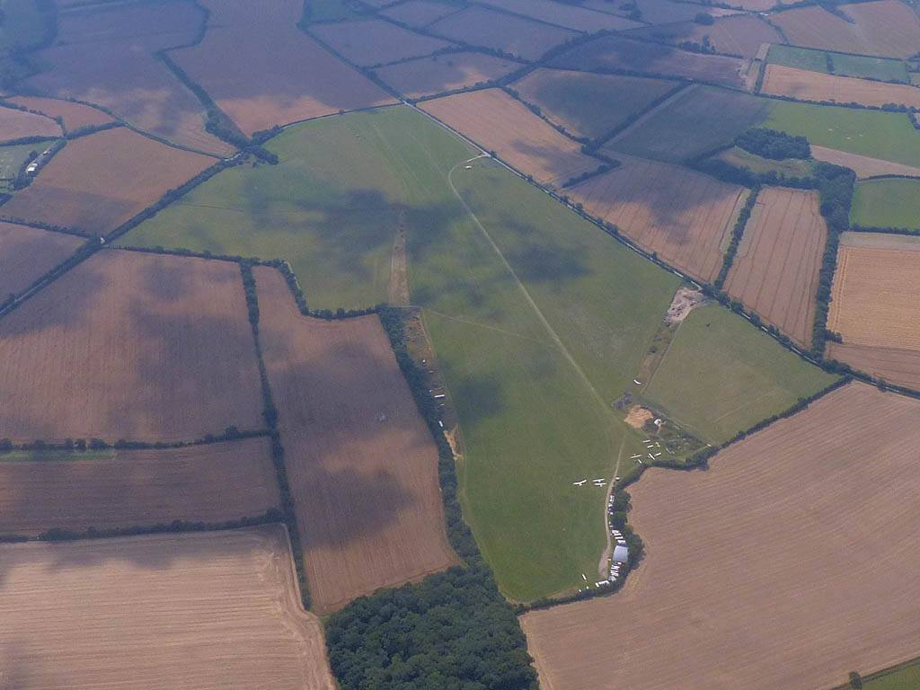
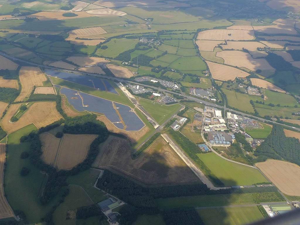
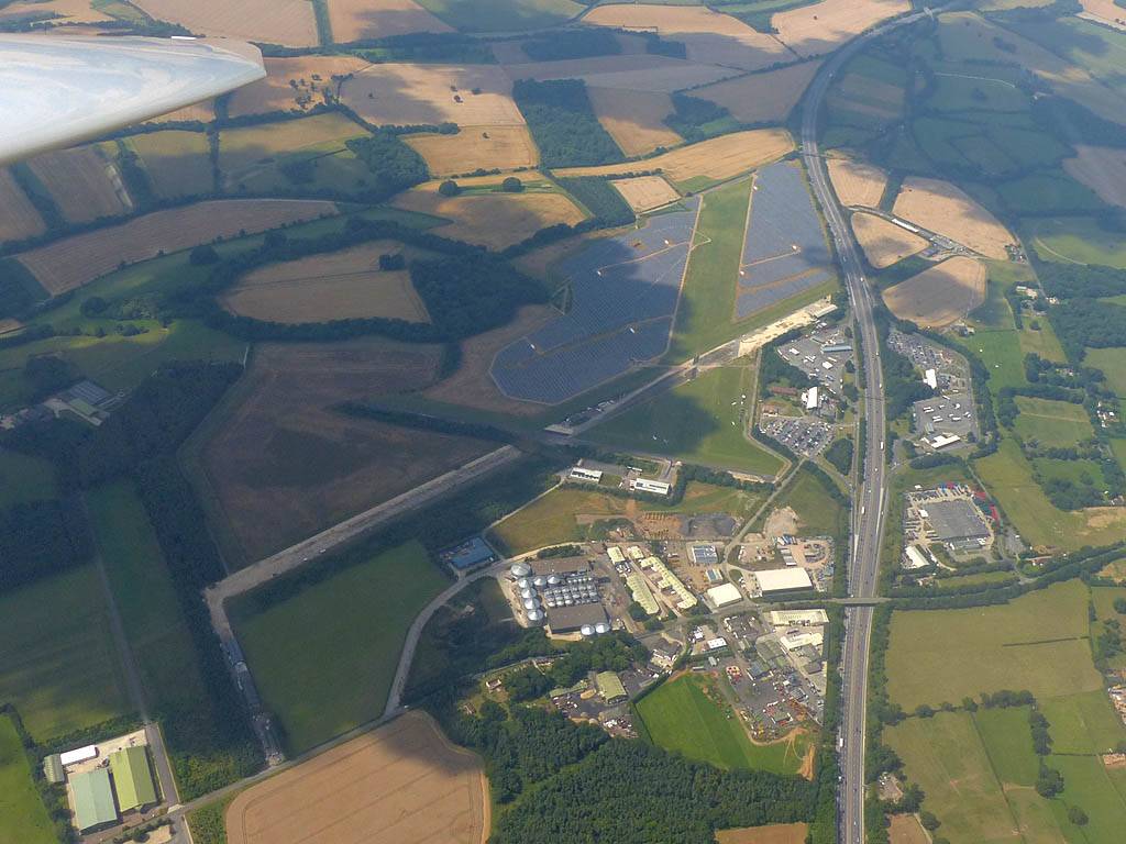
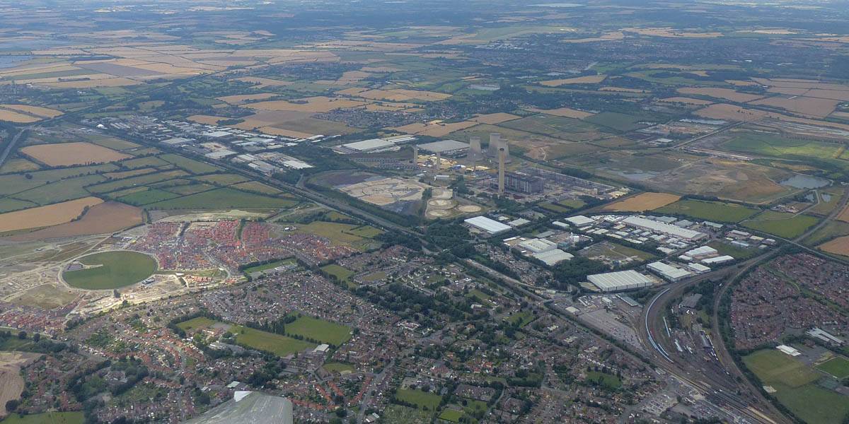
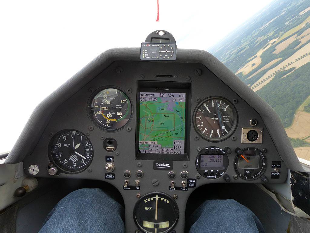
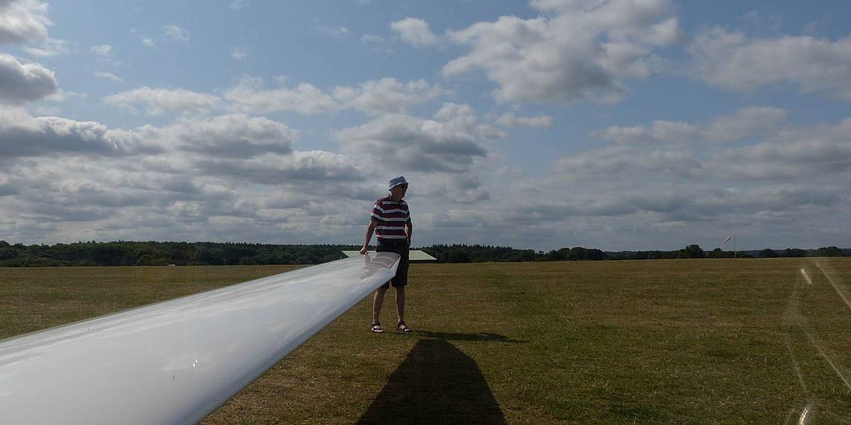
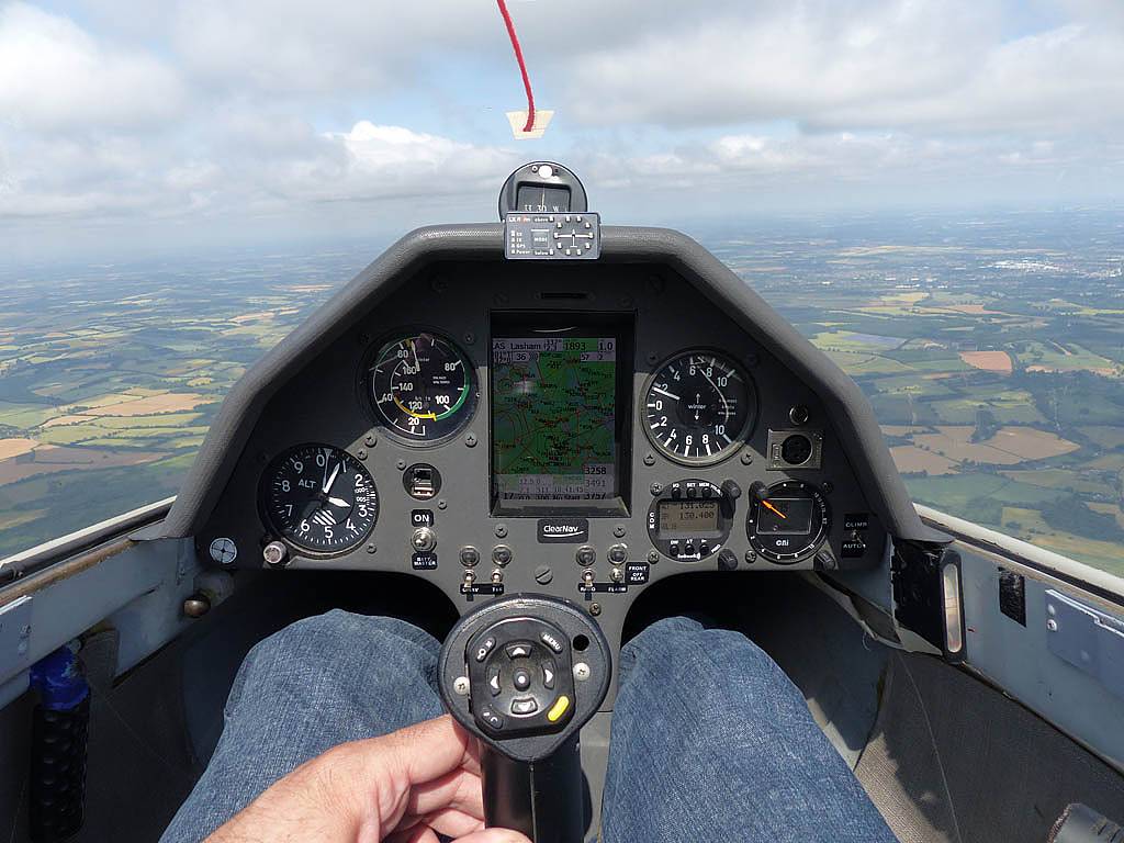
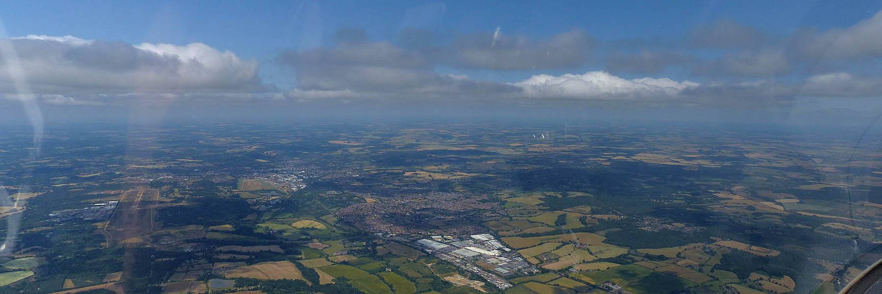
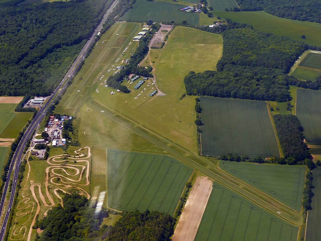
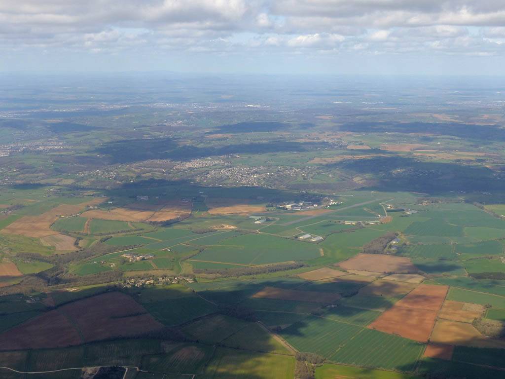
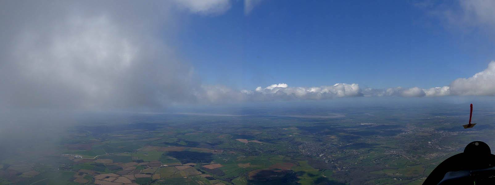
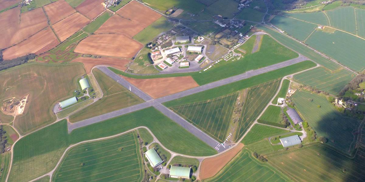
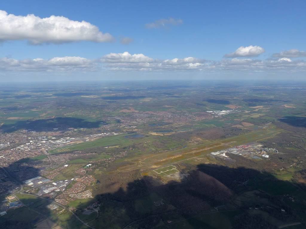
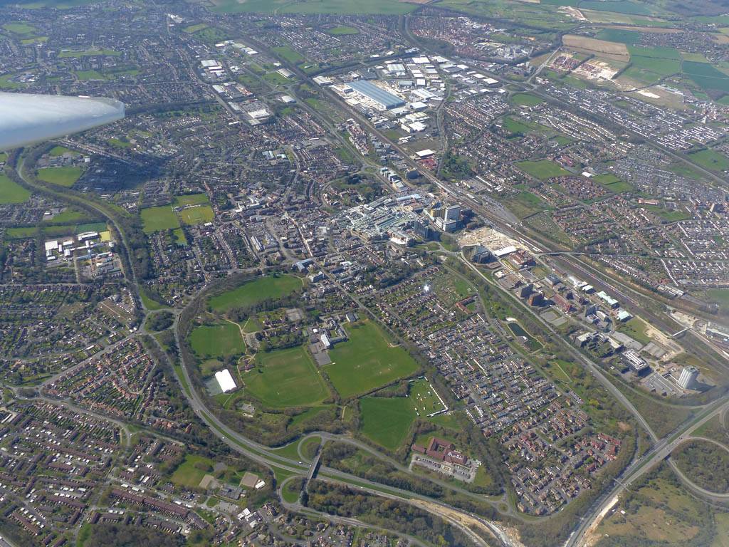
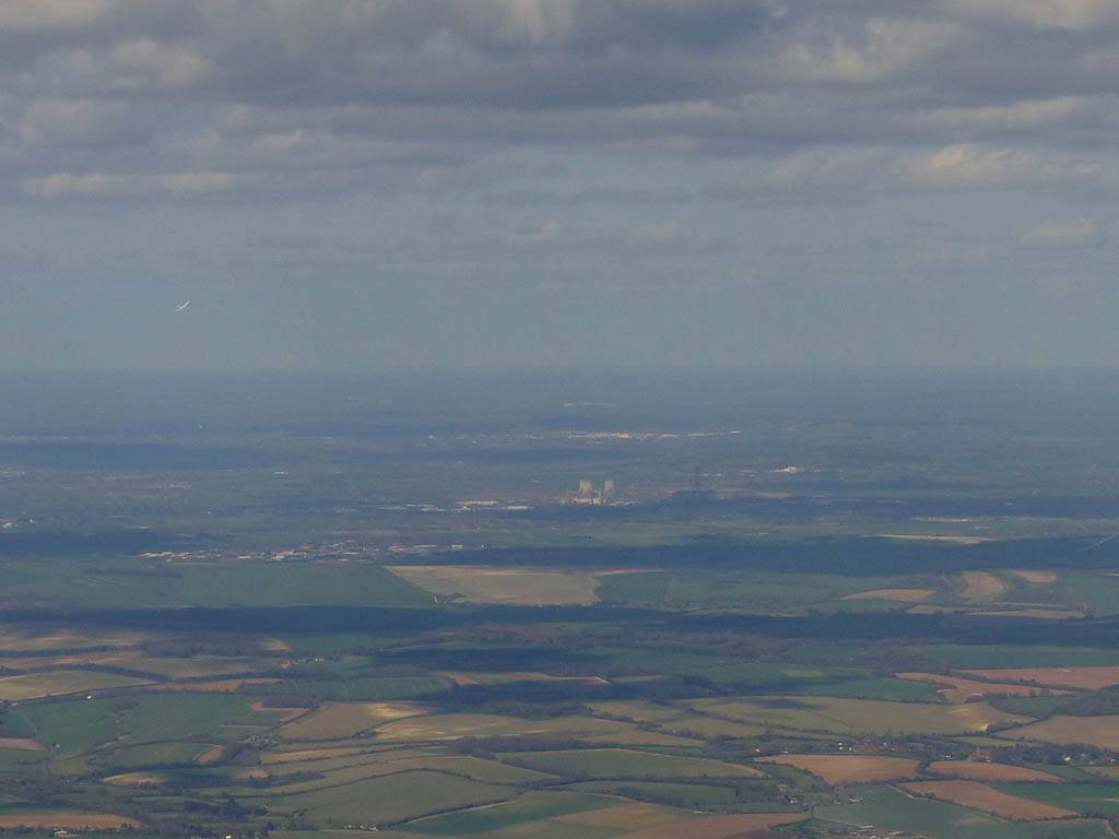
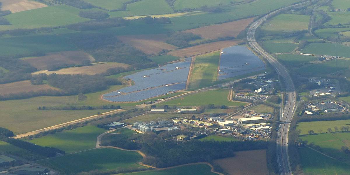
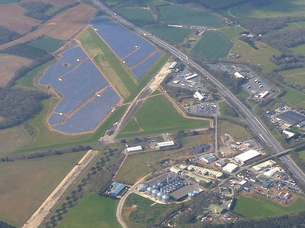
| Winch launch 1: Looking across the rolling Hampshire countryside towards some large towering cumulus clouds. | The new GoPro attached to the canopy and recording away. | Even small fluffy clouds make the short flight immensely more interesting. | Me and my GoPro in our first flight together. | Another view Westwards over the low cloud. Basingstoke under the wing. | Looking down through a cumulus at Lasham village. |
 IMG_9471.jpg |
 IMG_9475.jpg |
 IMG_9481.jpg |
 GOPR0175-1.jpg |
 IMG_9483.jpg |
 IMG_9492.jpg |
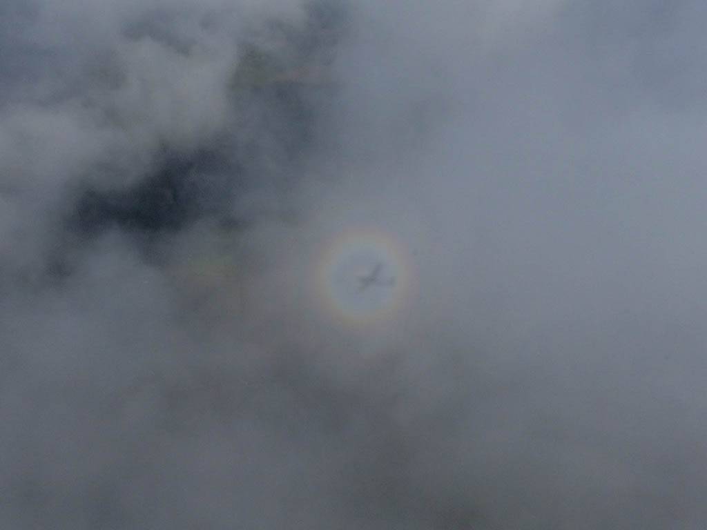
| Catching some irridescence in a cumulus cloud by the airfield as I briefly play in patchy lift next to it. | Back on the ground looking at showers forming to the South. | In the queue for winch launch 2. | The mounted GoPro makes pictures during winch launch possible! | Views over cumulus to the North of the airfield. | |
 GOPR0175-2.jpg |
 GOPR0175-3.jpg |
 GOPR0175-4.jpg |
 GOPR0175-5.jpg |
 GOPR0175-6.jpg |
 GOPR0175-7.jpg |
| The GoPro managed to capture a brief glory. | More views as I buzz the clouds before scampering back upwind to the airfield. | GoPro frames taken while landing on runway 23 Western side. | |||
 G0010177.jpg |
 IMG_9505.jpg |
Click here |
 IMG_9507.jpg |
 IMG_9510_9512_9514_Panorama.jpg |
 G0020190.jpg |
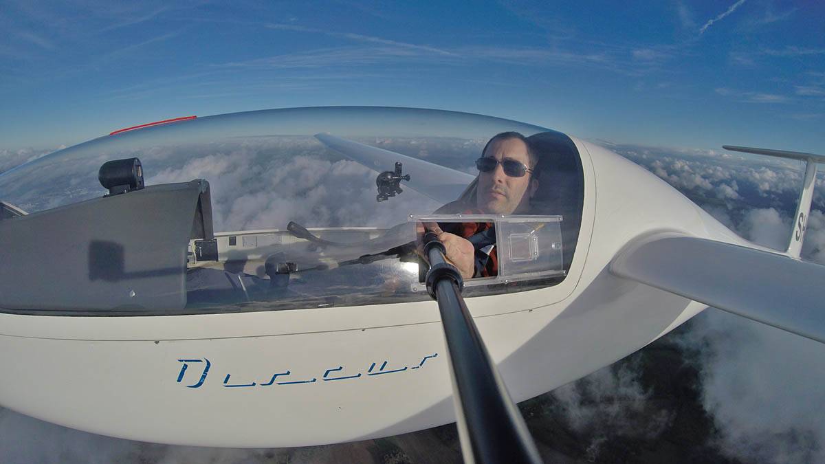
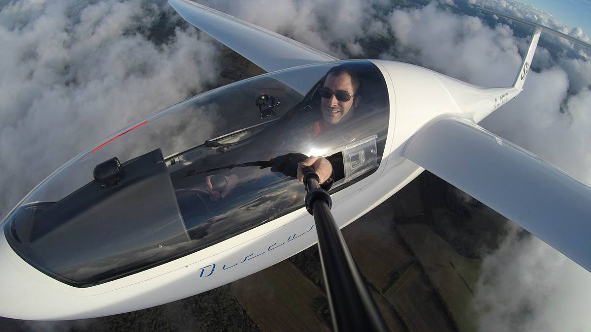
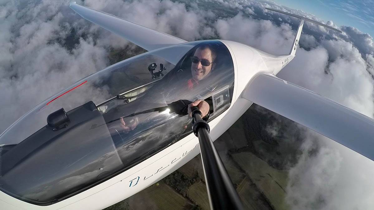
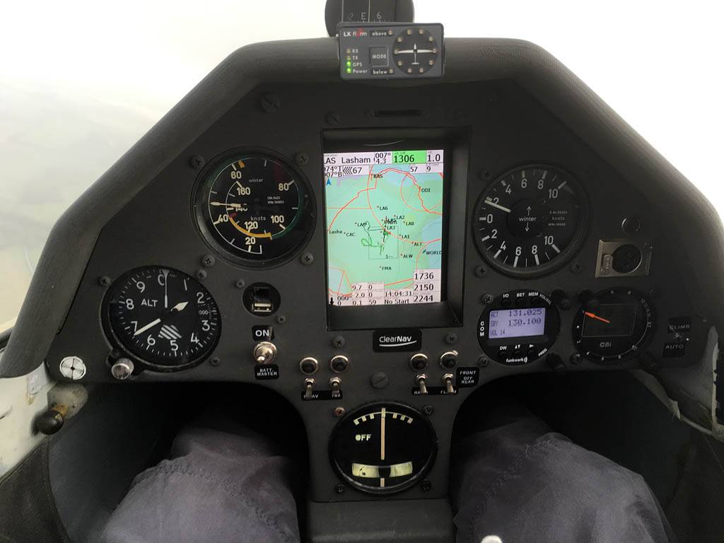
| Testing out the selfie pole while waiting in the aerotow queue. | An arty shot of Nigel Pocock. The cloud looks like steam rising off his head. | Heavenly views from 4000 feet soon after I released from tow. | Deploying the selfie pole with the GoPro on the end. Glider trimmed and flying itself safely at 50kts. | ||
 G0020191.jpg |
 GOPR0179-1.jpg |
 G0020193.jpg |
 GOPR0179-9.jpg |
 G0020195.jpg |
 G0020196.jpg |
| The best of the automatic photos taken by the GoPro. | However I think this video frame grab was even better. | More photos and video frame grabs as I turn the glider gently clockwise to stay in the same general area Southwest of Lasham. | |||
 GOPR0207_210_Panorama.jpg |
 IMG_9517.jpg |
 IMG_9520_9523_Panorama.jpg |
 IMG_9533.jpg |
| A quick GoPro panorama before I put it back on the suction mount. | Looking Northeast over small clouds to Lasham Airfield. | A more spectacular building cumulus cloudscape. | This cloud looks like a passing cloud seahorse. Or is it someone reclining in a hammock? |
 IMG_9534_9535_Panorama.jpg |
 IMG_9540.jpg |
 IMG_9542.jpg |
 IMG_9546.jpg |
 IMG_9550.jpg |
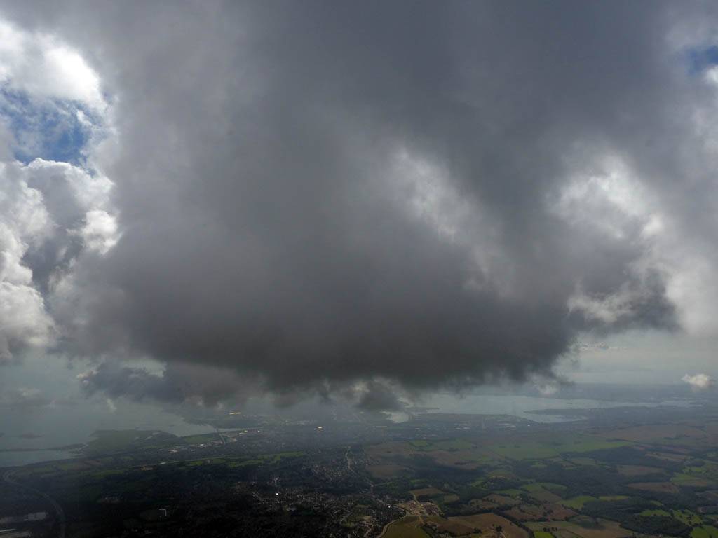
 IMG_9568.jpg |
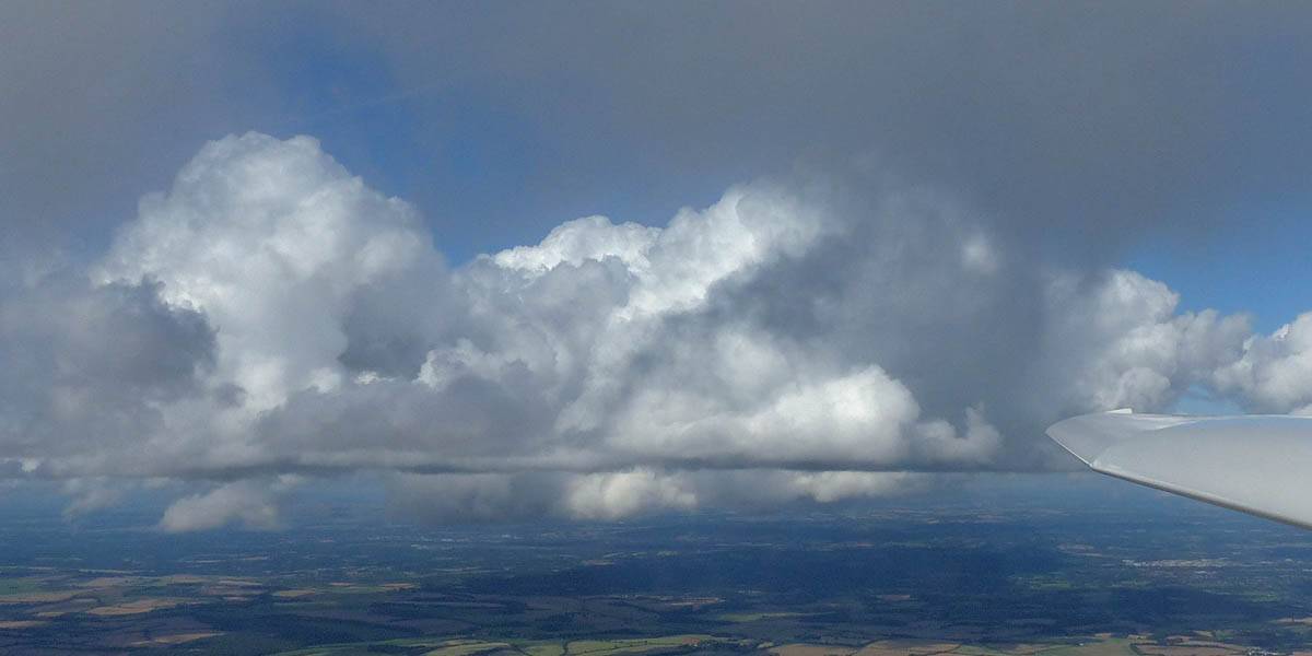
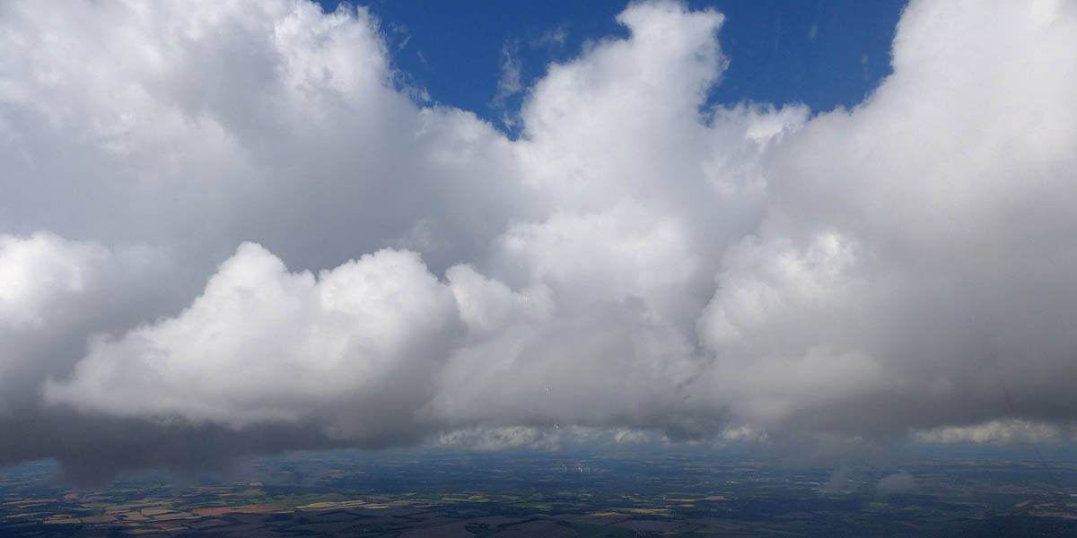
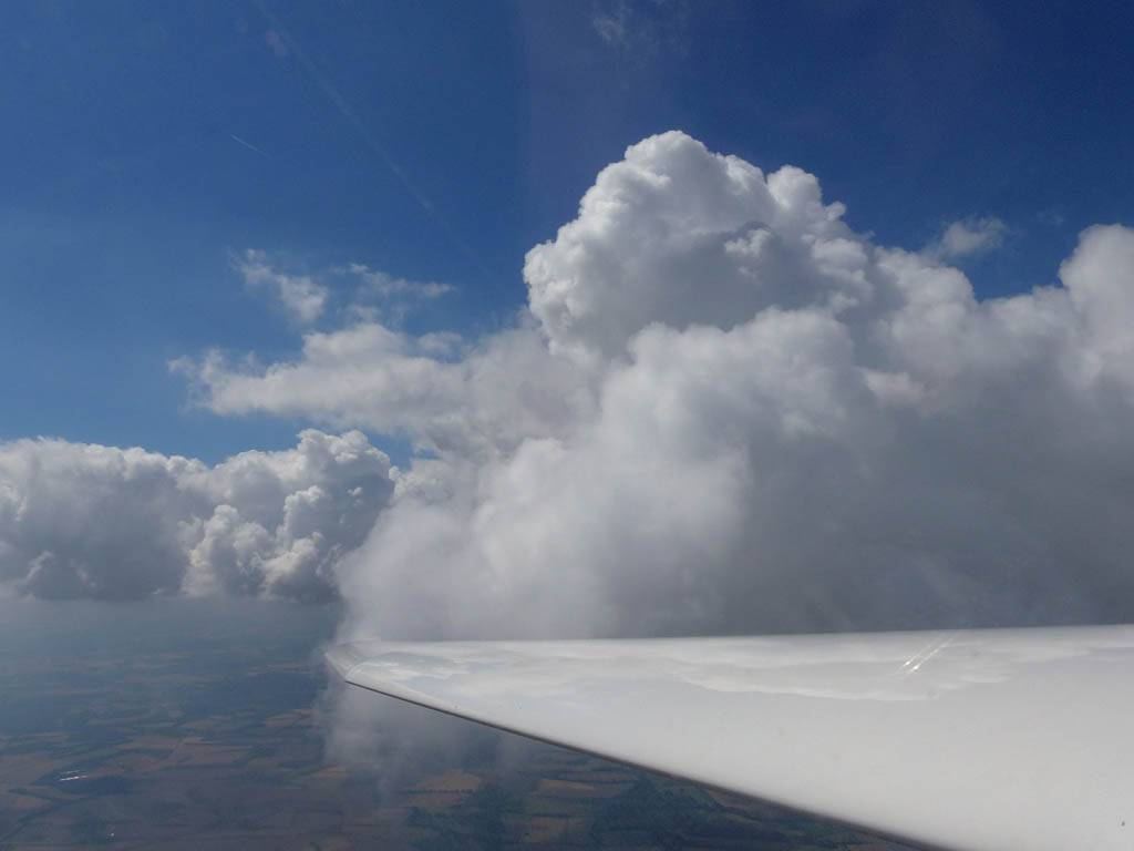
| A cloud jelly bear waving at me. | Another view as I descend past the cloud tops. | Clouds growing over Lasham airfield. | Upwind showers are building, providing more heavenly views. Photoshop Elements' highlights and shadows tweaking tool rescued these from very high contrast to bring them in line with what my own eyes saw. | ||
 IMG_9583.jpg |
 IMG_9597.jpg |
 IMG_9618.jpg |
 IMG_9622.jpg |
 IMG_9635.jpg |
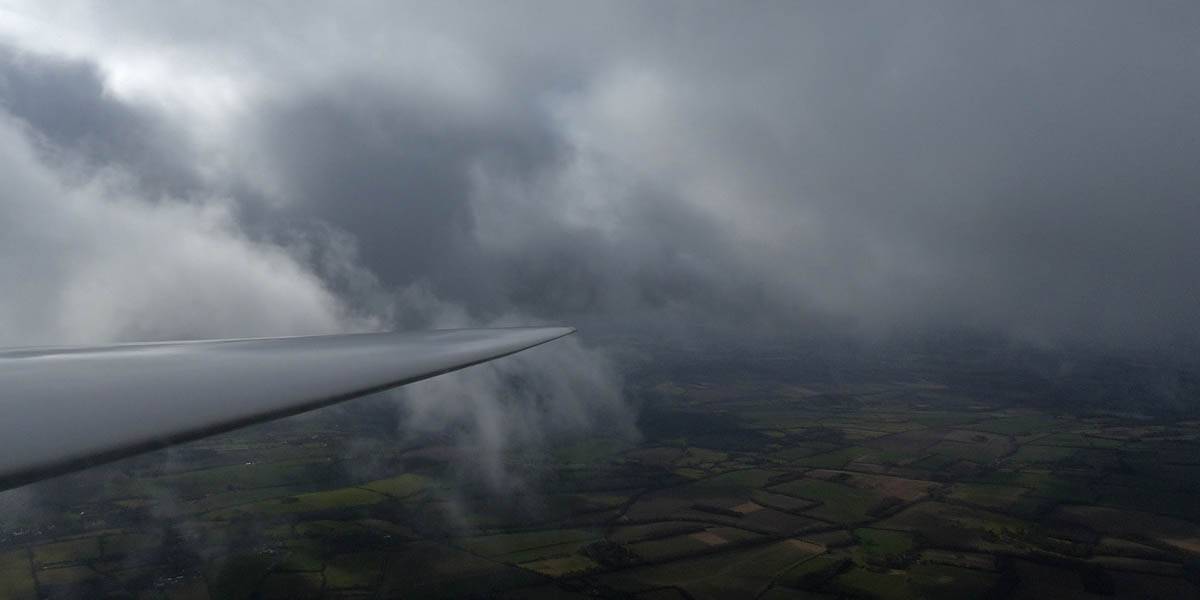
 IMG_9642.jpg |
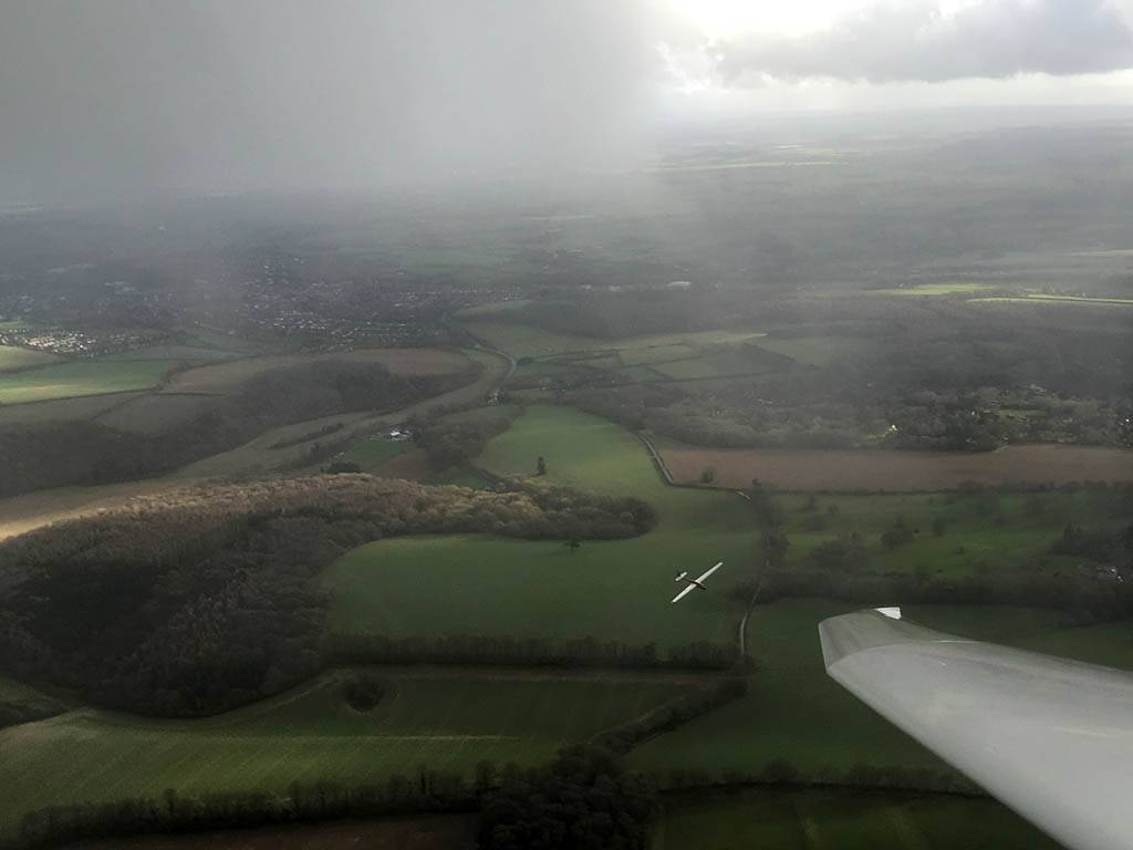
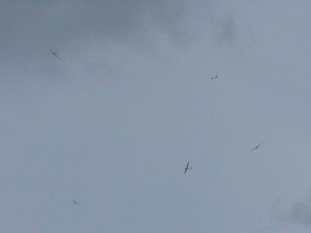
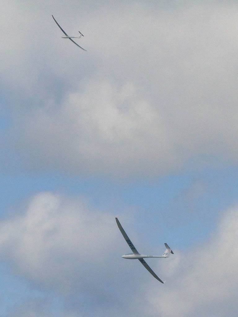
| December thermals! | Sharing a thermal with a Lasham K13. | Nice cloud street to the South. | Crepuscular rays as my cloud becomes very overdeveloped and showery. | I found the rain behind the area of lift. | With a large gap to the next thermal making it out of reach from 1500 feet above the ground, my December soaring has come to an end. |
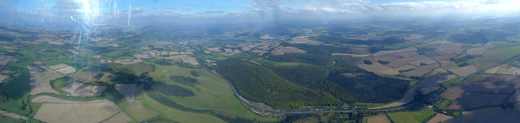
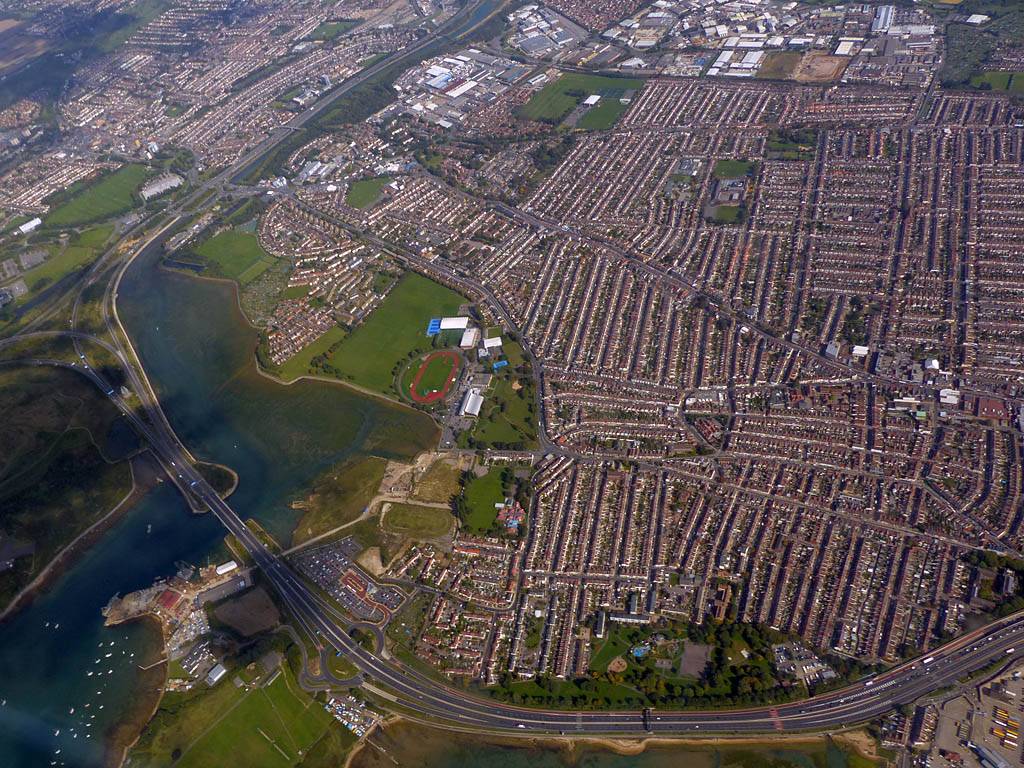
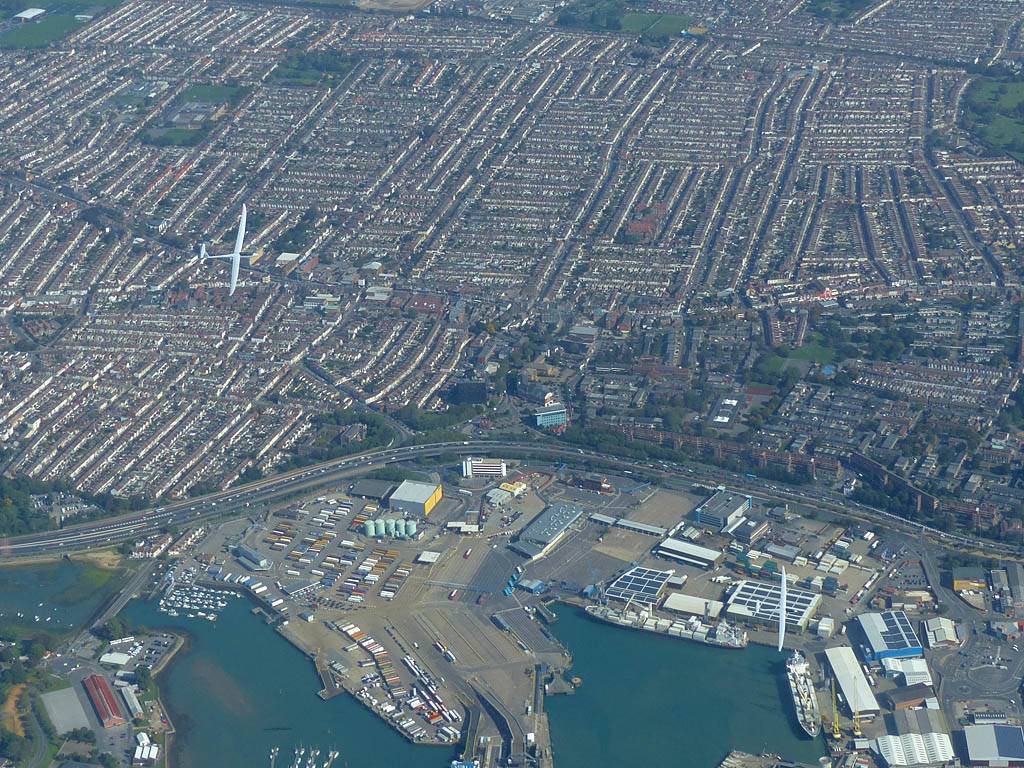
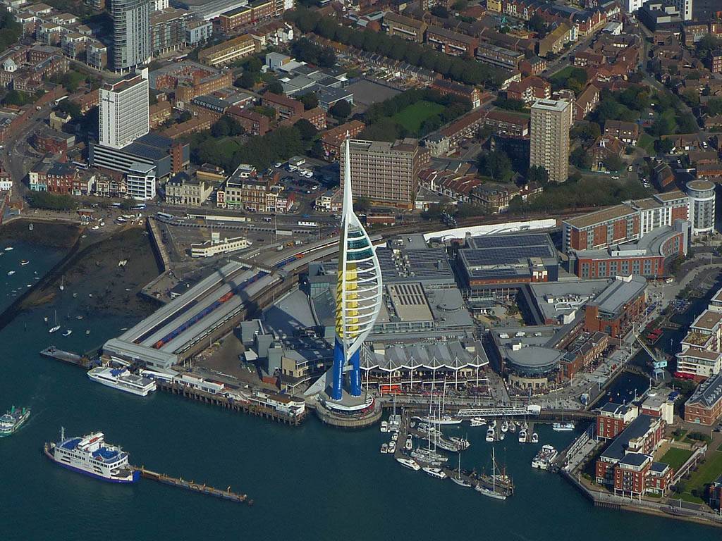
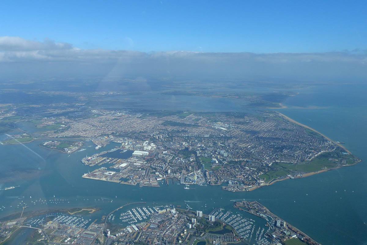
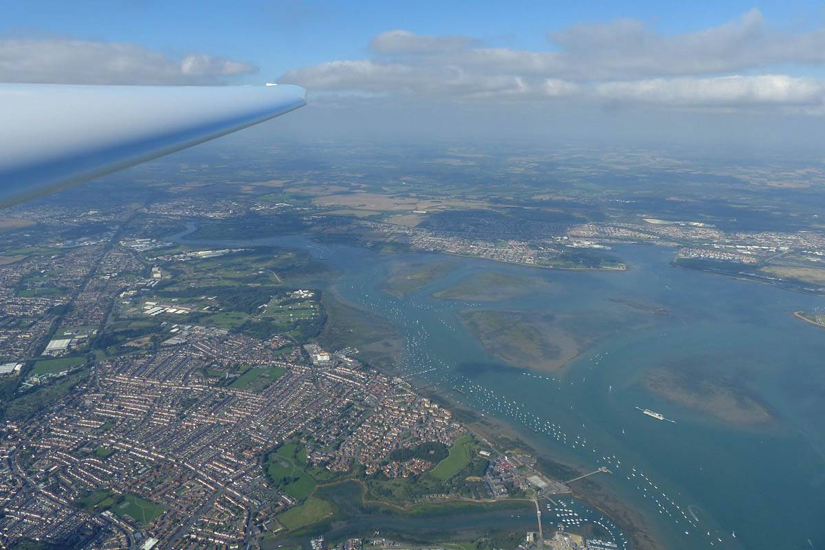
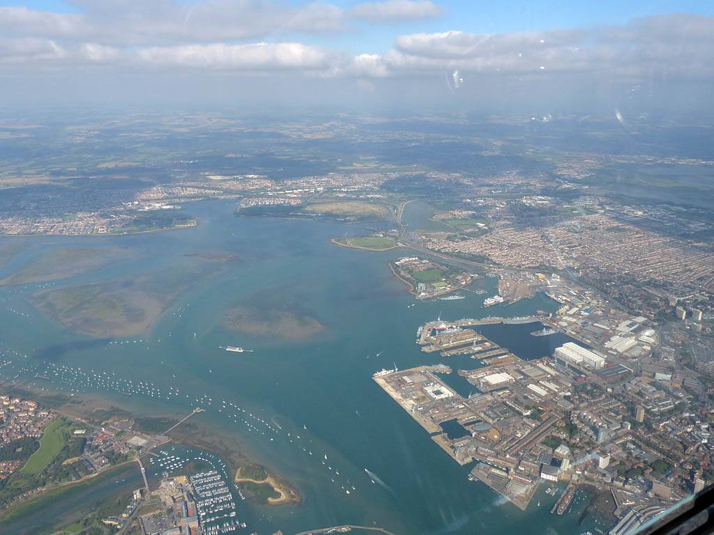
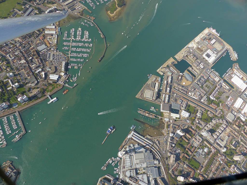
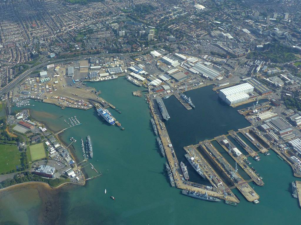
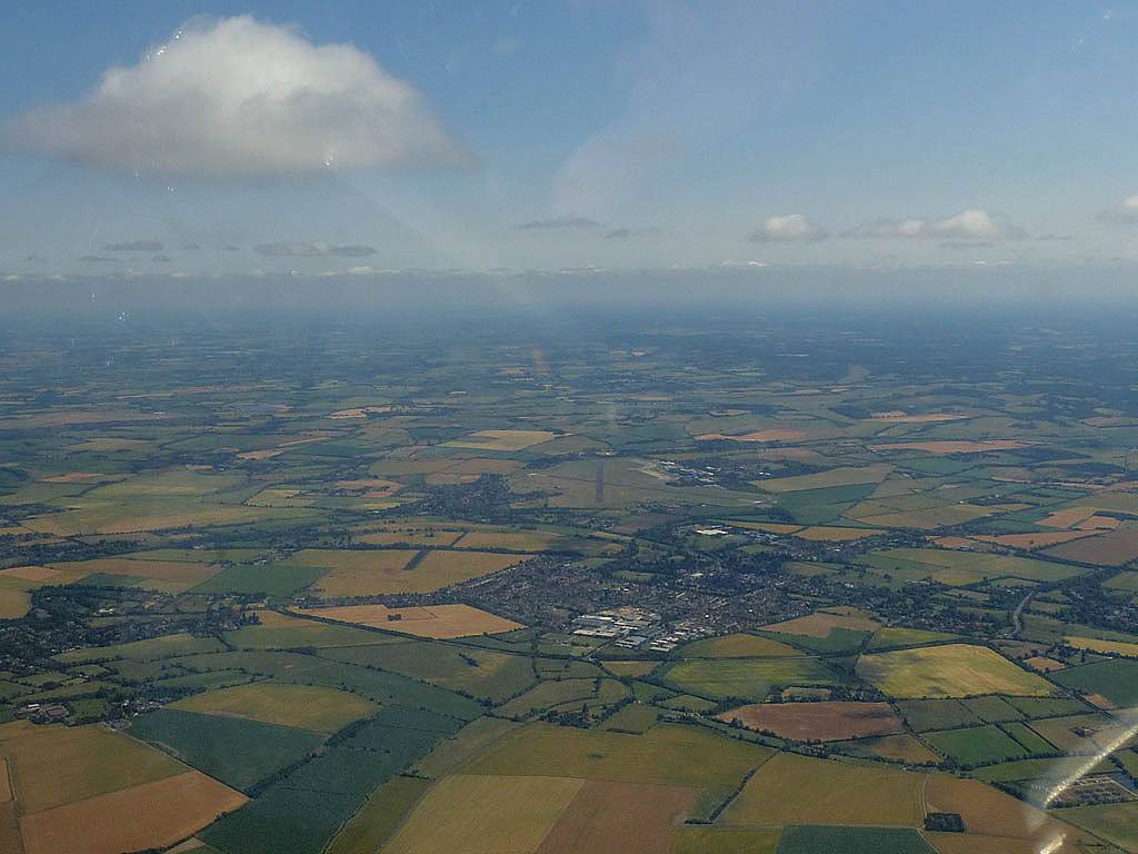
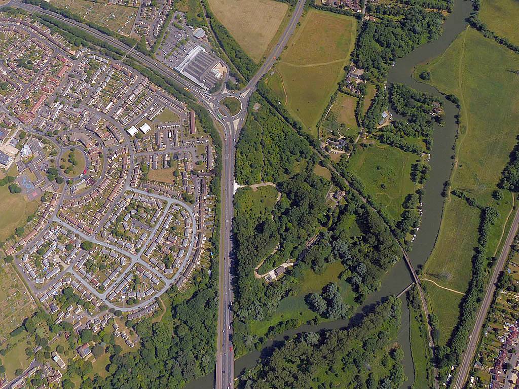
For the third Saturday in a row I got to go soaring. What a nice bonus! Once again South was best. I ended up over Portsmouth which was pure eye candy. I was eyeing the Isle of Wight, and indeed a group of other pilots did make it across and turned both St. Catherine's Point and the Needles. But I bottled out of it as cloudbase wasn't so high and a big blue hole was present over the Solent and the Northern half of the Isle. After floating around enjoying the views I turned the Spinnaker Tower and headed back inland. I went to Andover via Overton to complete 147km. This is the latest in the year that I have completed a cross country flight. So what a lovely way to end my 2015 soaring season.
 P1190095.jpg |
 P1190096.jpg |
 P1190098.jpg |
 P1190101.jpg |
 P1190106.jpg |
 P1190107_110_Panorama.jpg |
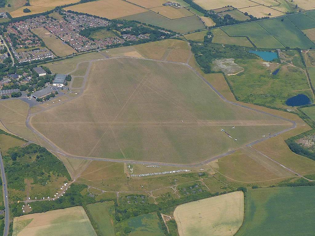
| Looking around the launch point before it gets soarable. Discus SH3 is my steed today. | Cumulus starting to pop to the Southeast forming interesting shapes. | A large grid ready to be thrown into the sky as soon as conditions are good enough. | The winch launch queue growing in length as conditions improve. | ||
 P1190117_120_Panorama.jpg |
 P1190126_127_Panorama.jpg |
 P1190133_138_Panorama.jpg |
 P1190140.jpg |
 P1190141.jpg |
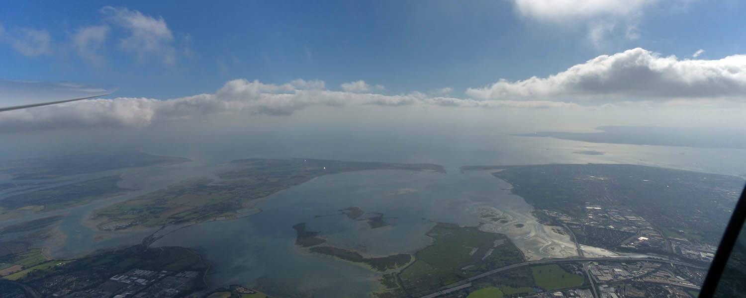
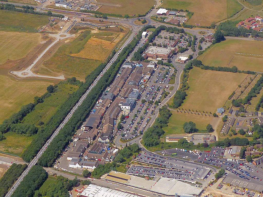
| Panorama of Butser Hill nd the A3 South of Petersfield as I fly Southwards after launch. | Panoramas of Hayling Island, Portsmouth, Gosport and the Isle of Wight beyond as I approach the A27. | Flying over to Portsmouth. | Looking down Eastwards at Portsmouth and the M275 motorway from over Portsmouth Harbour. | |
 P1190145_146_Panorama.jpg |
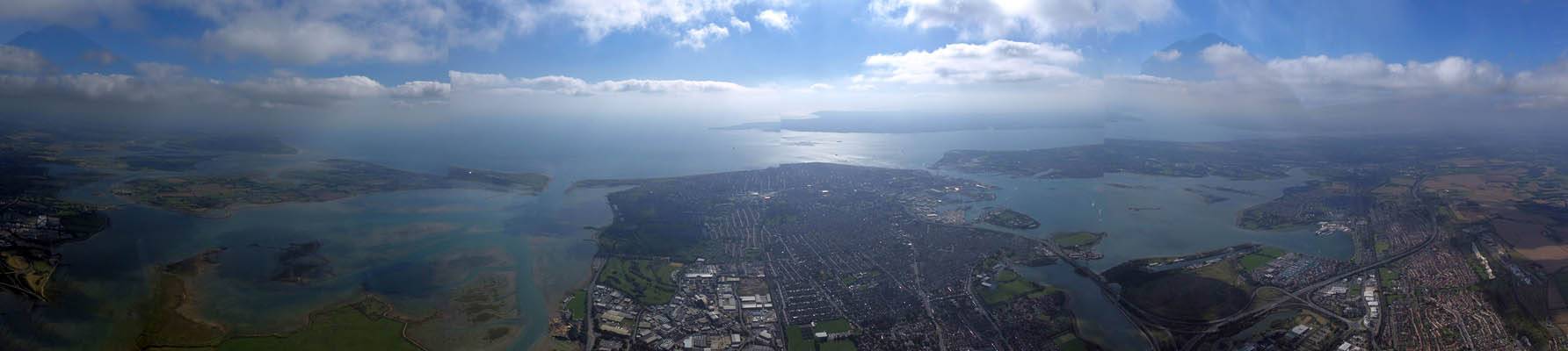
 P1190147_156_360Panorama.jpg |
 P1190159.jpg |
 P1190160_163_Panorama.jpg |
| Looking back Northeastwards inland from over the M275. | 360 degree panorama taken while soaring over Portsmouth Harbour. | Two other gliders joining me in the Portsmouth Harbour thermal. | Another Portsmouth / Gosport panorama as I take in the lovely views. |
 P1190165.jpg |
 P1190170.jpg |
 P1190171.jpg |
 P1190173.jpg |
 P1190176.jpg |
 P1190179.jpg |
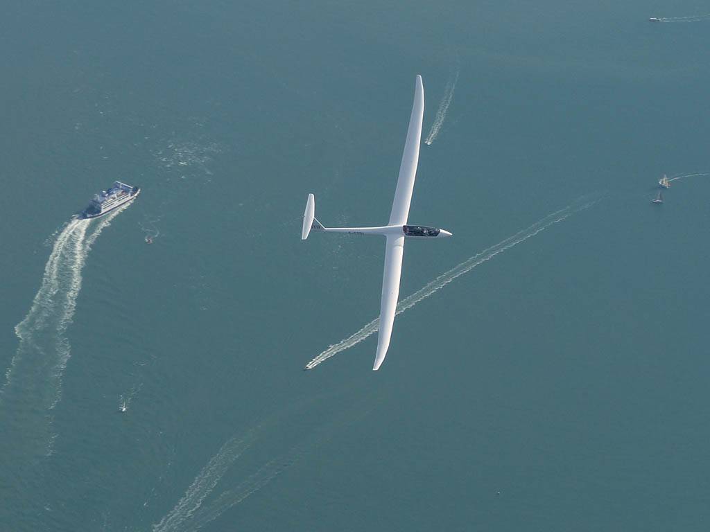
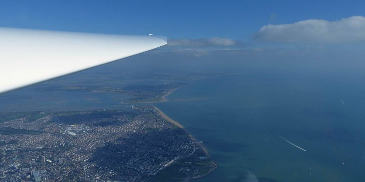
| Closeups of glider JTU as we soar together over Portsmouth Harbour. | Looking Eastwards from Gosport across Portsmouth and Hayling Island. | To the West the Solent heads into Southampton airspace. | The Spinnaker Tower, which is also the PTR turnpoint. | A wider view of Portsmouth, from the West over Eastern Gosport. | |
 P1190182.jpg |
 P1190184.jpg |
 P1190197.jpg |
 P1190198.jpg |
 P1190200.jpg |
 P1190200_Zoom.jpg |
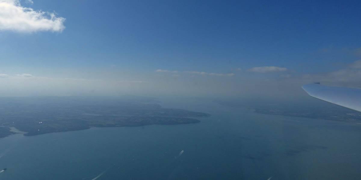
| To the West of me is Lee on Solent airfield and gliding club. | Cumulus over the Solent. I did go over to it but struggled to climb. With it being blue beyond I retreated back to Gosport. | Views of Portsmouth Harbour from the Southwest, over Gosport. | Turning PTR (Portsmouth Tower). It's hard to see from directly overhead but the Spinnaker Tower's shadow gives it away. View from the Southeast. | ||
 P1190203.jpg |
 P1190205_209_Panorama.jpg |
 P1190220.jpg |
 P1190221.jpg |
| Looking down at Portsmouth Naval Base and the main ferry port. | One more panorama from over Portsmouth Harbour as I retreat inland. | Andover Southeast (ANE) from the Northeast (A303/A3093 junction). | Andover from the East as I follow a street to the AND turnpoint on the far side before returning to Lasham. |
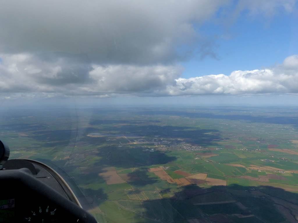
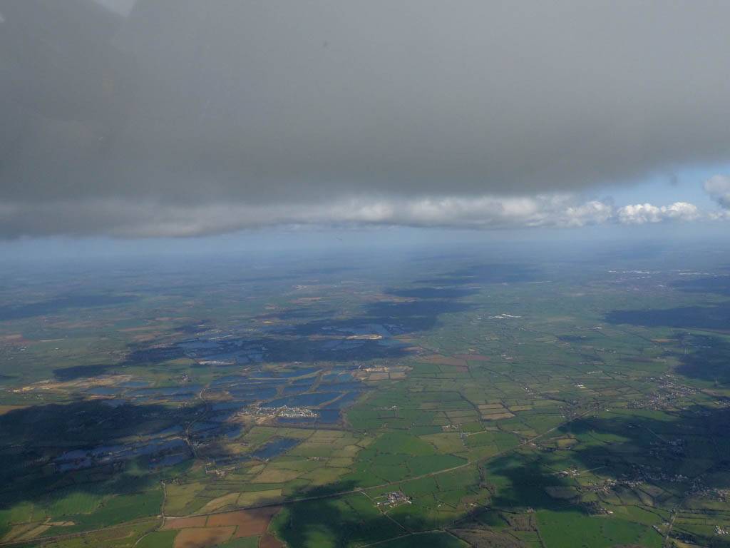
Today's highlight was exploring a sea breeze front along the South Coast. This was my first visit to the South this year, with all previous cross country flights having been to the North and West. There was a possibility of the Isle of Wight being on. But as I headed South I ran into a sea breeze front. With Portsmouth and beyond all unsoarable, I turned Havant just into the sea air before turning back under the low clouds and climbing back up land side. Then what followed was a lovely picturesque flight Eastwards to Parham along the sea breeze front. The return glide was harder but just as pretty. Then after turning Butser Hill I went inland as far as Newbury South before I started to run out of day (getting short this late in the year) and headed home. For the second Saturday in a row I was thankful of a potentially spectacular last soaring flight of the year.
 P1180902.jpg |
 P1180913.jpg |
 P1180917.jpg |
 P1180923.jpg |
 P1180925.jpg |
| A nice early cloud over Alton helped me get away to cloudbase. | Running into the sea breeze front as I head South towards Havant. | Views to the South as the A3 'disappears' under the sea breeze front. | ||
 P1180925_927_Panorama.jpg |
 P1180938.jpg |
 P1180939.jpg |
 P1180944.jpg |
 P1180945.jpg |
| More views of the sea breeze front as I fly through a gap in the sea breeze curtain to get to Havant. | The Havant HVT turnpoint from the Southwest. | More sea breeze views as I set off Eastwards. | ||
 P1180950.jpg |
 P1180951.jpg |
 P1180952.jpg |
 P1180954.jpg |
 P1180957_959_Panorama.jpg |
| Another glider surfing the sea breeze. | Looking South to Hayling Island. | Looking East the line of the Sea Breeze front is well marked. | Enjoying the views as low wispy clouds float around under me. | |
 P1180961.jpg |
 P1180963.jpg |
 P1180964.jpg |
 P1180971.jpg |
 P1180974.jpg |
| Looking back over my shoulder as I continue Eastwards. | Flying over and past low cloud towers. | To the North are more standard inland cumulus clouds with a bit of spreadout. | Looking back along the South Downs ridge from Parham that another glider is following. | |
 P1180976.jpg |
 P1180978.jpg |
 P1180981.jpg |
 P1180985.jpg |
 P1190003.jpg |
| The Parham Duo Discus landed out just West of the airfield just below the ridge. | Views of Parham Airfield from the Southeast and Northeast as I turn the PAR turnpoint. | Looking West along the ridge from the PAR turnpoint shows a better more marked angle. | ||
 P1190004_007_Panorama.jpg |
 P1190012.jpg |
 P1190021.jpg |
 P1190022.jpg |
 P1190025.jpg |
| More spectacular views of the sea breeze clouds in all their wonderful shapes and forms. | ||||
 P1190026.jpg |
 P1190034.jpg |
 P1190035.jpg |
 P1190038.jpg |
 P1190046.jpg |
 P1190047.jpg |
| South Harting from the East. The church spire on the far (Western) side is the HAR turnpoint. | Soaring over the centre of Petersfield, looking from the Southeast. PTW is the big roundabout near the top left of the picture. | Butser Hill (BUT) from above, looking North. The tower can barely be seen but it's shadow is obvious. | Looking back to Petersfield from the Southwest as I head back Northwards. | Flying back past Lasham on the Southwestern side. | Closeup of a pretty cumulus cloud in the distance. |
 P1190050.jpg |
 P1190058.jpg |
 P1190060.jpg |
 P1190064.jpg |
 P1190070.jpg |
 P1190077.jpg |
| A V tailed glider soaring above me. | Kingsclere mast (KGS) from the Southwest. | Another pretty looking distance cumulus cloud as the sky opens up. | A nice looking cloud street in front of me near Newbury South. | Newbury South (NES) from the West, is the bridge over the A34 at this junction. | One more contorted cloud shot as the day approaches the end and I head back to Lasham. |
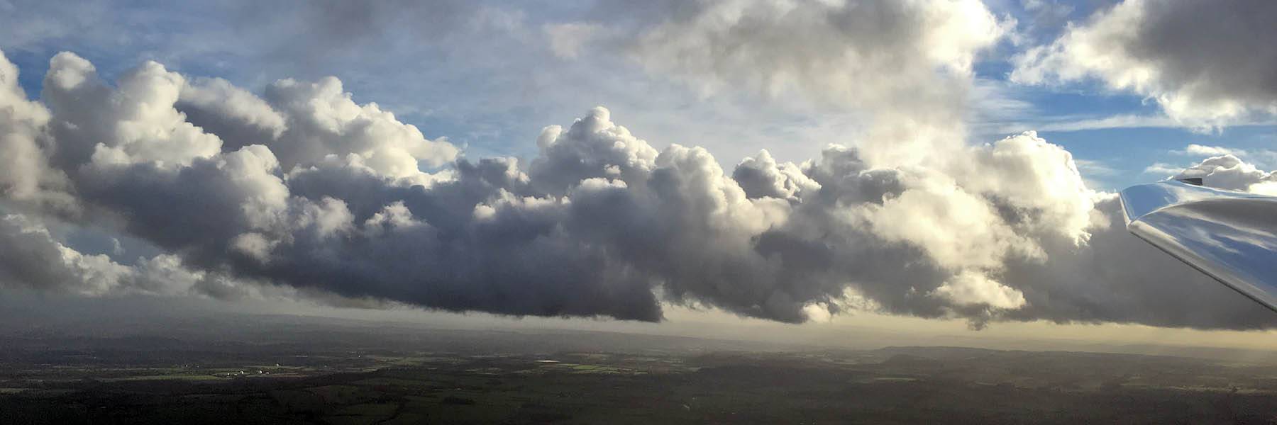
I took advantage of an afternoon weather window after an early cold front went through. With many clouds below 3000 feet above Lasham I didn'ty go far. We seemed to be sandwiched between lower cloud to the North and big gaps then sea air to the South. However the cloudscapes were spectacular and one cloud street in particular made for a spectacular playground blasting up and down it between Basingstoke and the Bullington area. This flight including 3 cloud climbs. The footage from the last two is combined into a single video. Some stills from the video are also included in the pictures. The last cloud climb was spectacular, up to 5000 feet just South of Popham, more than 2000 feet above the lowest clouds.
 P1180663.jpg |
 P1180668.jpg |
 P1180684.jpg |
 P1180702.jpg |
 P1180706_707_Panorama.jpg |
| Enjoying the big clouds and long streets soon after launch. | Exploring the fun street to the North where cloudbase drops almost like a sea breeze front. This was a spectacular convergeance. | North of the street consisted of lower clouds and big gaps. Aldermaston and Newbury clearly visible from Basingstoke. | ||
 P1180711_712_VPanorama.jpg |
 P1180735.jpg |
 P1180736.jpg |
 P1180745.jpg |
 P1180753.jpg |
 P1180758.jpg |
| Having fun above cloudbase. | More above cloudbase views as I soar my way Westwards along the convergeance alongside the lower cloud. I got up to 3500 feet under the upper cloudbase while the lower cloudbase was down at 2800 feet. | ||||
 P1180760_761_Panorama.jpg |
 P1180763.jpg |
 P1180764.jpg |
 P1180767.jpg |
 P1180775.jpg |
 P1180776.jpg |
| More views above cloudbase. | Bullington Cross (The BUL turnpoint is the bridge where the A303 goes over the A34) from the East. | Another view Northwards from the Bullington area. | |||
 P1180778.jpg |
 P1180781.jpg |
 P1180782.jpg |
 P1180784.jpg |
 P1180787.jpg |
 P1180805.jpg |
| Looking Southwards along the M3 towards the Coast from near Popham. | Basingstoke from the West, looming through the clouds. | Strong climbs were to be found under big clouds West of Basingstoke. | Continuing to play with the low wisps of cloud. | ||
 P1180815_819_Panorama.jpg |
 P1180820_821_Panorama.jpg |
 P1180824.jpg |
 P1180825.jpg |
| Continuing to play with the low wisps of cloud. | Views after a cloud climb. | ||
 P1180830_834_Panorama.jpg |
 P1180833.jpg |
 P1180845_849_Panorama.jpg |
 P1180847.jpg |
| Cloud art? | |||
 P1180866.jpg |
 P1180870.jpg |
 P1180898-1.jpg |
 P1180898-2.jpg |
 P1180898-3.jpg |
 P1180898-4.jpg |
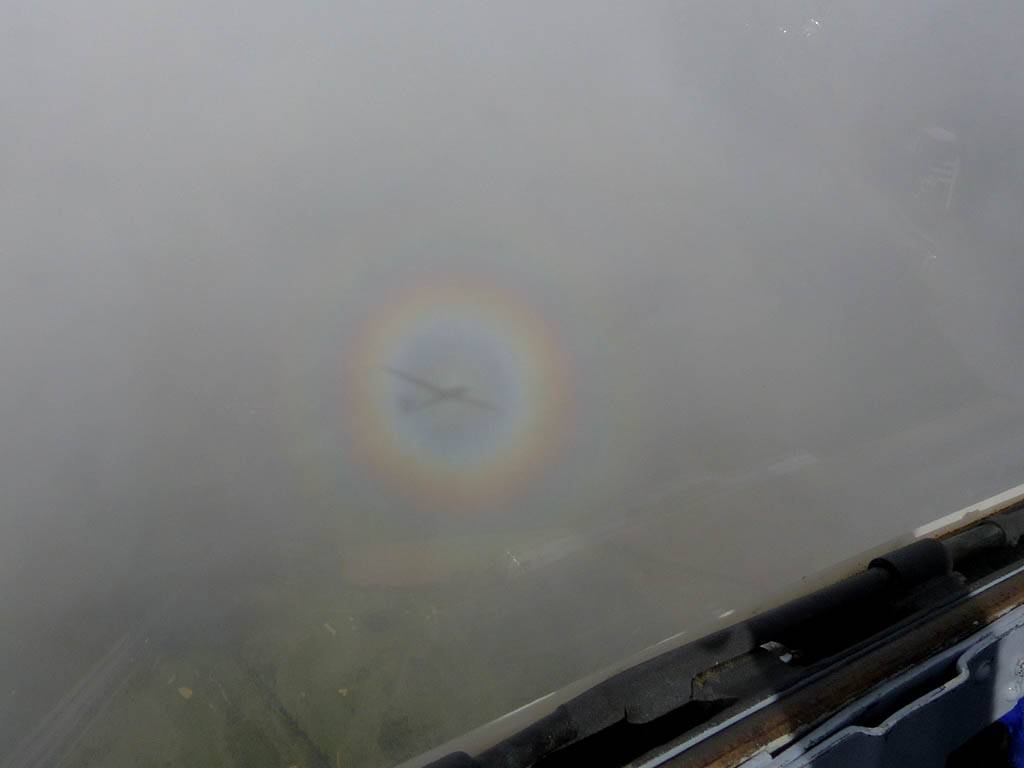
| A spectacular glory found round the side of one cloud on its sunny side after climbing up the side of it. | Spectacular views from high above cloudbase after the big 5000 foot cloud climb. | ||||
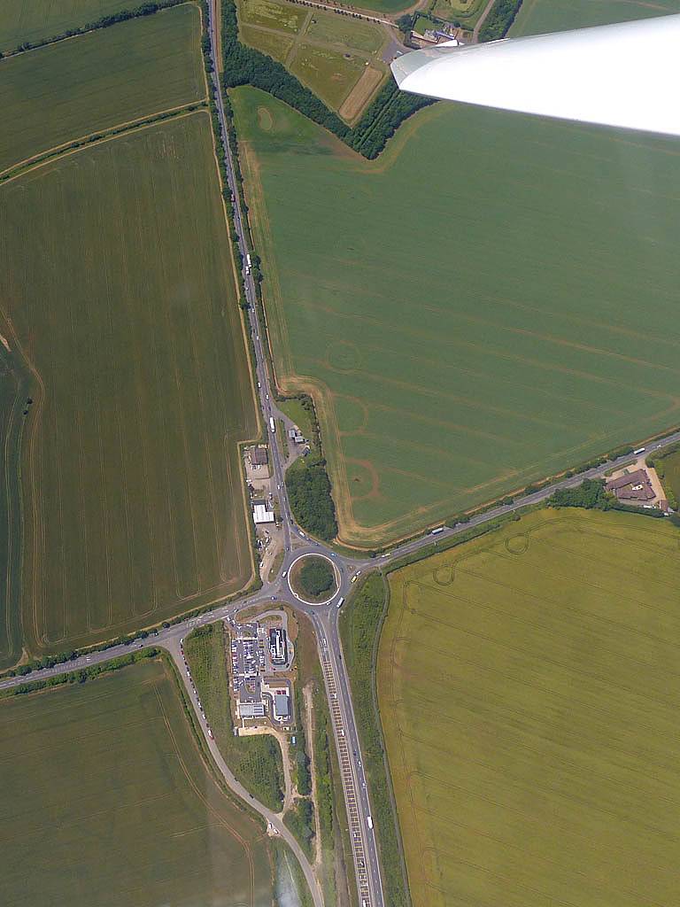
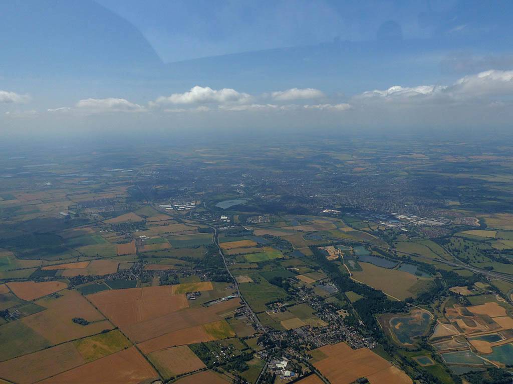
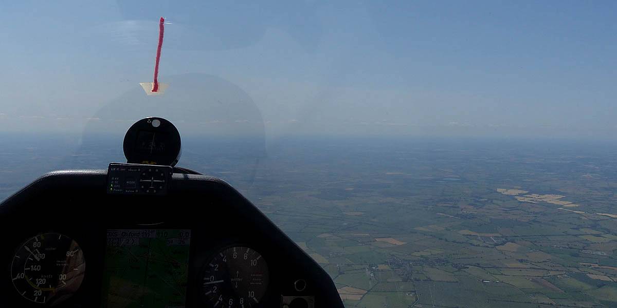
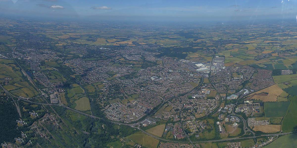
Another interesting cross country flight was to be had today. My first foray northwestwards was aborted as I was too early and cloudbase dropped to only 3000 feet above sea level North of the Newbury area. I headed to Pewsey instead where conditions were nice in this direction with cloudbase 1000 feet higher. Beyond was a gap so I turned PEW. Then I targeted Abingdon but soon ran into larger lower clouds again. I turned around at Woolley Down (WLY) to make use of nicer conditions further South. Beyond Fourmarks (FMA) was sea air so I turned back North where conditions had now improved a lot. I went as far as Oxford South (OXS) before going home. A took a couple of nice cloudclimbs in the Didcot area as later on there were tall clouds and strong climbs there. I wasn't feeling my best today so it was a nice bimble around before a migraine kicked in at the end and I decided to land, but not before more than 4 hours aloft.
 P1170773.jpg |
 P1170779.jpg |
 P1170786.jpg |
 P1170792.jpg |
 P1170796.jpg |
 P1170799.jpg |
| Soaring with other gliders. | To the North of Newbury cloudbase was noticeably lower. | Rivar Hill from the North-Northeast. | Burbage from the Southwest. The big roundabout is the BUB turnpoint. | Pewsey from the North-Northwest. The PEW turnpoint is the Eastern end of the train station platforms (near the footbridge) near the centre of the image. | Clench Common Airfield from the South. |
 P1170804.jpg |
 P1170808.jpg |
 P1170809.jpg |
 P1170810.jpg |
 P1170812.jpg |
 P1170815.jpg |
| Marlborough from the South. | Having fun at cloudbase as I fly Northeastwards from the Ramsbury area to Membury. | Membury Airfield and M4 services from the South-Southwest and East. | |||
 P1170817.jpg |
 P1170821.jpg |
 P1170825.jpg |
 P1170828.jpg |
 P1170832.jpg |
 P1170833.jpg |
| Woolley Down (WLY) from the North. The turnpoint is the road junction towards the bottom right of the picture. | Welford disused airfield from the Northeast. | Looking over Thatcham from the West-Northwest (Newbury just below the frame). | The view Southeastwards over Newbury. Thatcham, Newbury Racecourse, Greenham Common feature prominently. | Having fun at and just above cloudbase. | |
 P1170836.jpg |
 P1170840.jpg |
 P1170847.jpg |
 P1170853.jpg |
 P1170858.jpg |
 P1170859.jpg |
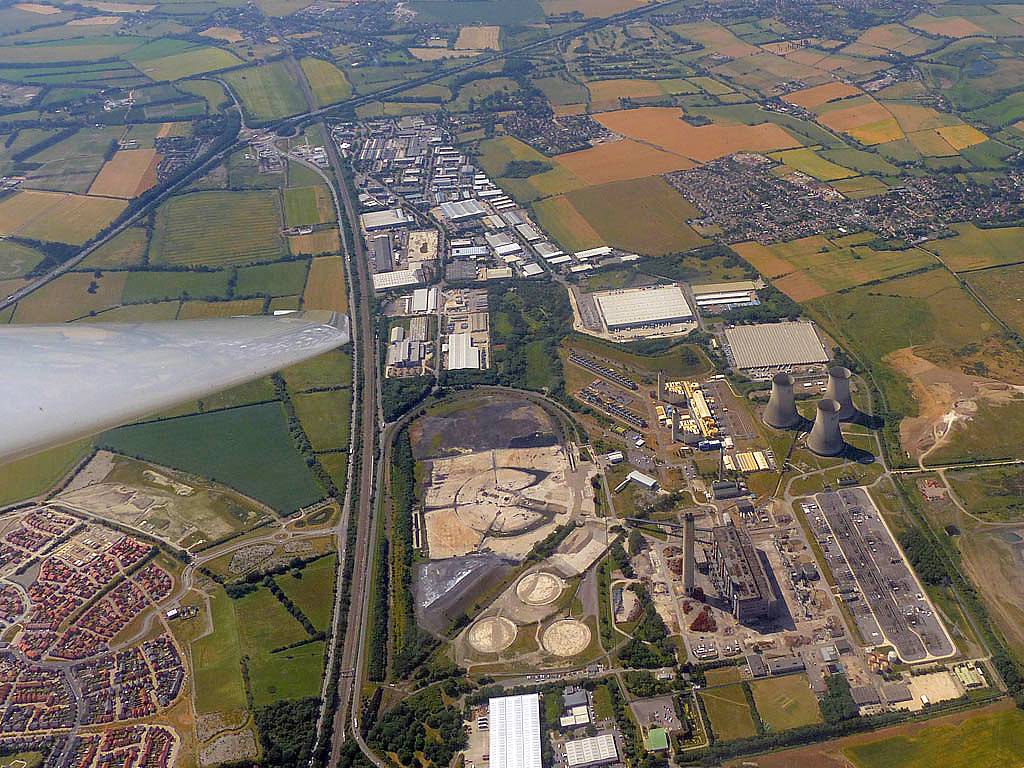
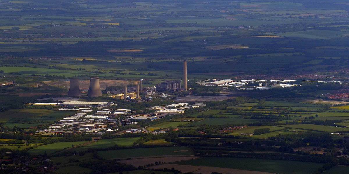
| Having fun at and just above cloudbase between Newbury and Basingstoke. | A view over Fourmarks, from the East-Southeast. The FMA turnpoint is a station on the Watercress Line at the very bottom edge of the picture. | Approaching Didcot Power Station from the Southeast. | Didcot Power Station and Milton Park from the Southwest. | ||
 P1170863.jpg |
 P1170867.jpg |
 P1170870_874_Panorama.jpg |
 P1170879.jpg |
 P1170882.jpg |
| Conditions just North of Didcot are really good now. | More fun at cloudbase in the Didcot / Abingdon area. | Didcot Power Station and Milton Park from the Northeast as I pass them again on the way home. | ||
Today was all about an epic struggle to avoid landing out as the sky clouded over to the North of Lasham. After a great start to the flight I got stuck low in weak conditions and almost ended up in a field. However a climb got me in range of Brimpton. Here several of us were soaring weak lift trying not to land at Brimpton. Eventually after an eternity I got high enough to reach some darker clouds to the Southwest. These were working and I was able to get back to cloudbase. Then after going round the back of Aldermaston I was finally in range of Lasham and relieved to make it home. On days like today it is a big buzz just to make it home under such challenging conditions.
 IMG_8093.jpg |
 P1170717_722_Panorama.jpg |
 P1170727.jpg |
 P1170728_729_Panorama.jpg |
| A grid forming during the morning. | Some glorious cloudscapes early in the flight close to Lasham. | ||
 P1170734.jpg |
 P1170745_746_VPanorama.jpg |
 P1170747.jpg |
 P1170750.jpg |
 P1170751.jpg |
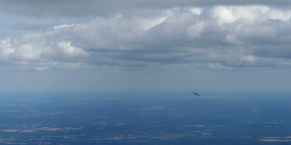
| Soaring with a buzzard. | Having fun at cloudbase near Aldermaston. | Looking Northeast from the Newbury area along the A4 and railway line towards Theal and Reading beyond. | Heading North towards Didcot the spreadout becomes severe. | |
 P1170755.jpg |
 P1170759.jpg |
 P1170761_765_Panorama.jpg |
 P1170770.jpg |
| This is as close as I got to Didcot Power Station before I turned tail and ran in the poor conditions. | After local soaring a field at under 2000 feet above sea level (1400 feet above Lasham) I was relieved to find a climb to get in range of Brimpton. | Panoramas of the severe spreadout as I local soar Brimpton. After an eternity I got away under some dark clouds and made it back to Lasham. Phew! | |
At last another cross country flight, and what an epic one it was. Conditions weren't always easy, so my average speed was quite leisurely. It took 5 and a half hours to go to Northampton West, Caxton Gibbet in Cambridgeshire, then back via Oxford South, much of the flight in semi blue to blue conditions. North and East of Bicester and Milton Keynes was where the best conditions were, and it was nice to see places like Graffham Water and Gransden Lodge gliding club again.
 P1160993_996_Panorama.jpg |
 P1160995.jpg |
 P1160998.jpg |
 P1170007_008_Panorama.jpg |
 P1170012.jpg |
 P1170014.jpg |
| Pictures taken as I am about to winch launch. | Getting up to height near Lasham. | Heading out past Newbury and Greenham Common. | The M4 near A34 and Chieveley services looked horrible. Glad I wasn't stuck in it. | Soaring with sister Discus SH3 between Chieveley and Didcot. | |
 P1170021_022_Panorama.jpg |
 P1170024.jpg |
 P1170027.jpg |
 P1170029.jpg |
 P1170033.jpg |
 P1170038.jpg |
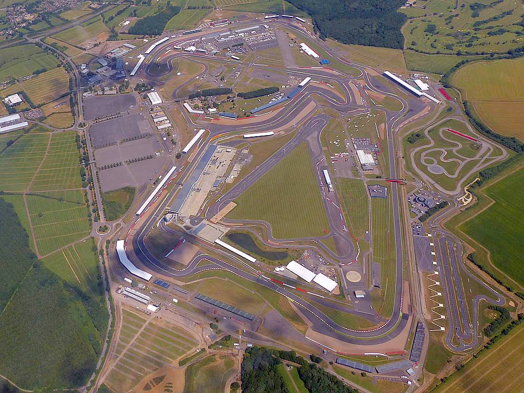
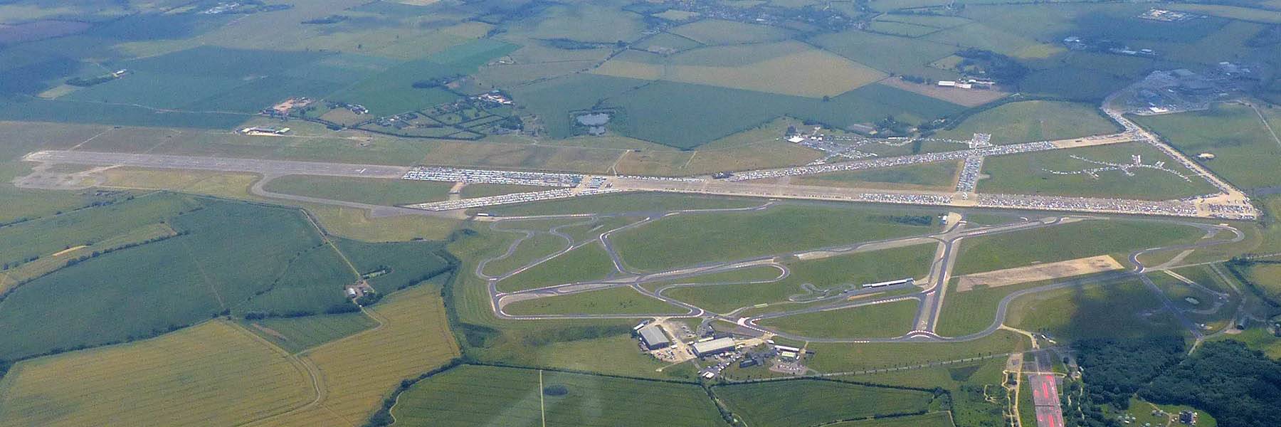
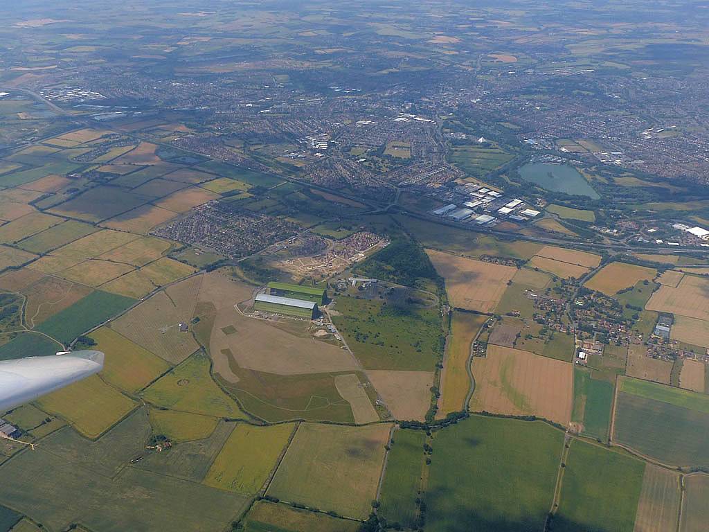
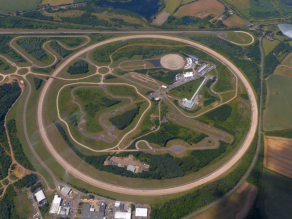
| Didcot from the Southeast, including the Power Station and Milton Park. | Benson Airfield from the Southwest. | Passing Bicester Village Designer Outlet after crossing a blue gap. | Bicester Airfield from the Southeast. | Turweston Airfield from the East. | Silverstone Race Track from the South-Southwest. |
 P1170046.jpg |
 P1170048.jpg |
 P1170051.jpg |
 P1170052_053_Panorama.jpg |
 P1170054_055_Panorama.jpg |
| Towcester from the Southwest, Northampton in the background. After the blue conditions near Bicester the better conditions North of Silverstone were very welcome. | M1J16, Northampton West (NOW) turn point, from the West-Northwest side. | Northampton from the West. The start of a lovely run East under lovely clouds. | Wellingborough from the South. | |
 P1170066.jpg |
 P1170070.jpg |
 P1170072.jpg |
 P1170080.jpg |
 P1170088.jpg |
 P1170089.jpg |
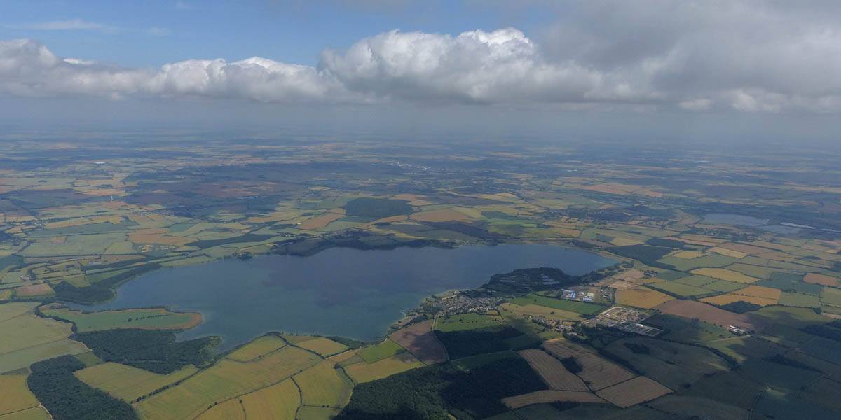
| Santa Pod drag strip from the North. | Bedford Autodrome from the Northwest and North. | Approaching Grafham Water, seen from the Southwest. | Little Staughton Airfield from the North. | ||
 P1170095_96_Panorama.jpg |
 P1170104.jpg |
 P1170106.jpg |
 P1170111.jpg |
 P1170115.jpg |
 P1170121.jpg |
| Panorama of Grafham Water from the South-Southwest. | Gransden Lodge Airfield (Cambridge Gliding Club) from the North. | Turning Caxton Gibbert (CAX) - Roundabout from the Eastern side. | Strong thermal in the CAX area. | Bedford from the East. | Soaring just Southeast of the D206 Cardington Danger Area (centered on the two airship hangars where Hybrid Air Vehicles and Cardington Studios are based), Bedford in the background. |
 P1170124.jpg |
 P1170126_134_360Panorama.jpg |
 P1170135.jpg |
 P1170136.jpg |
 P1170143.jpg |
| Millbrook from the SE. | Panorama of Milton Keynes from the Southeast as I leave the better air behind. Time to get as high as I can under the last cumulus cloud. | Bletchley from the Southeast. (Including the station and computer museum.) | The Eastern side of Milton Keynes from the South | A big blue hole looms ahead between Milton Keynes and Oxford where the next Cumulus wisps can be seen. |
 P1170144.jpg |
 P1170145.jpg |
 P1170151.jpg |
 P1170152.jpg |
 P1170155.jpg |
 P1170164_167_Panorama.jpg |
| Aylesbury from the North. | Thame Airfield and Haddenham behind it from the Northwest. | Brill from the Southeast. | Oxford from the Eastern side as I reach the wisps on the far side of the blue hole. | ||
 P1170168.jpg |
 P1170177.jpg |
 P1170182_183_Panorama.jpg |
 P1170187.jpg |
 P1170191.jpg |
 P1170192.jpg |
| A large roundabout at Headington, seen from the SE, is the Oxford East (OXF) turnpoint.. | Oxford South (OXS) from the Northwest as I turn it. The turnpoint is actually the bridge over the river at the bottom of the picture. | Looking back over Oxford from the South. | Heading Southwards, now on the last leg following the wisps of cumulus. Didcot over the nose. | Cumulus over Didcot, seen from the North as I approach it. | Milton Park from the Northeast. |
 P1170193.jpg |
 P1170200.jpg |
 P1170204.jpg |
 P1170205_206_Panorama.jpg |
 P1170209_210_VPanorama.jpg |
| Views of Didcot Power Station and Milton Park from the Northeast and East as I top up my height under the cumulus. | Harwell from the Northeast as I skirt past the restricted airspace. | Aldermaston from the East as I final glide my way home. | ||
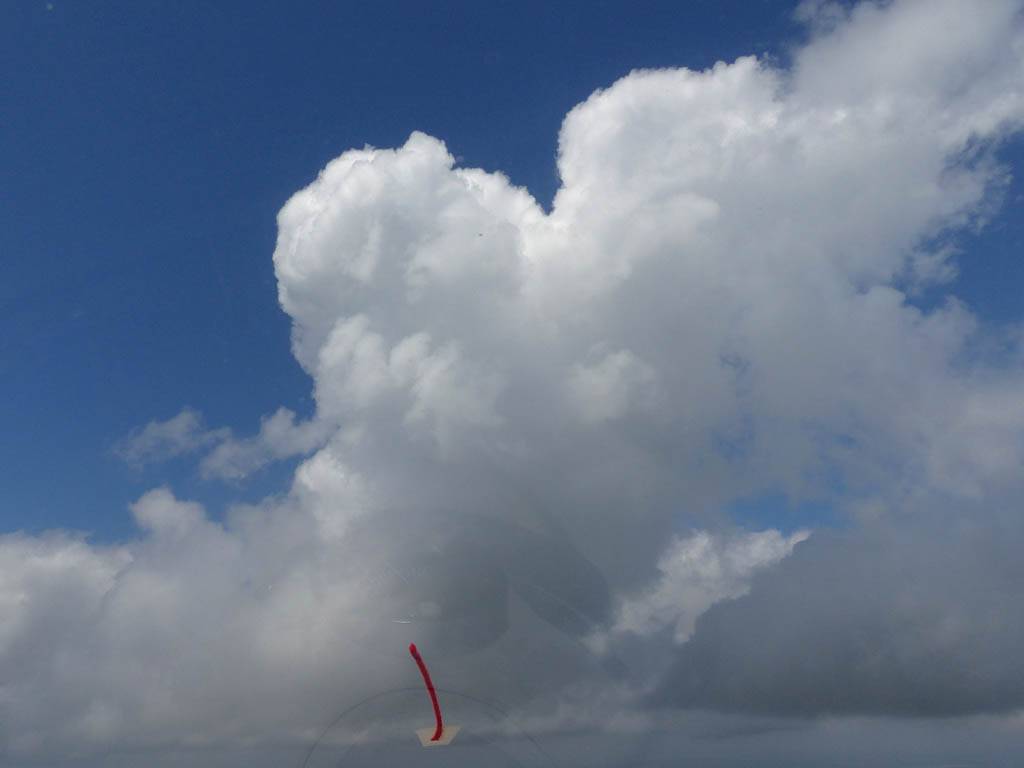
This was another local soaring flight in the same Discus as on 29th June. Conditions were difficult early on and I struggled to stay up. But the middle third of the flight was characterised by more relaxed fun at cloudbase. Meanwhile a shower was brewing to the Northwest which I couldn't resist going to explore for the last third of the flight. Then followed a spectacular run along a 'frilly skirt' of low cloud. The finale though was a climb into cloud in a 6 knot thermal. I climbed 2000 feet until I reached the airspace ceiling at FL65 (6500 feet). Then after a long glide out inside the cloud tower I emerged to spectacular views which I captured on video. This was local soaring at its best as it was nice and varied and had some spectacular eye candy in the views from around and above cloud.
 IMG_7919.jpg |
 P1160802.jpg |
 P1160804_805_Panorama.jpg |
 P1160806_807_Panorama.jpg |
 P1160812_813_Panorama.jpg |
 P1160817_818_Panorama.jpg |
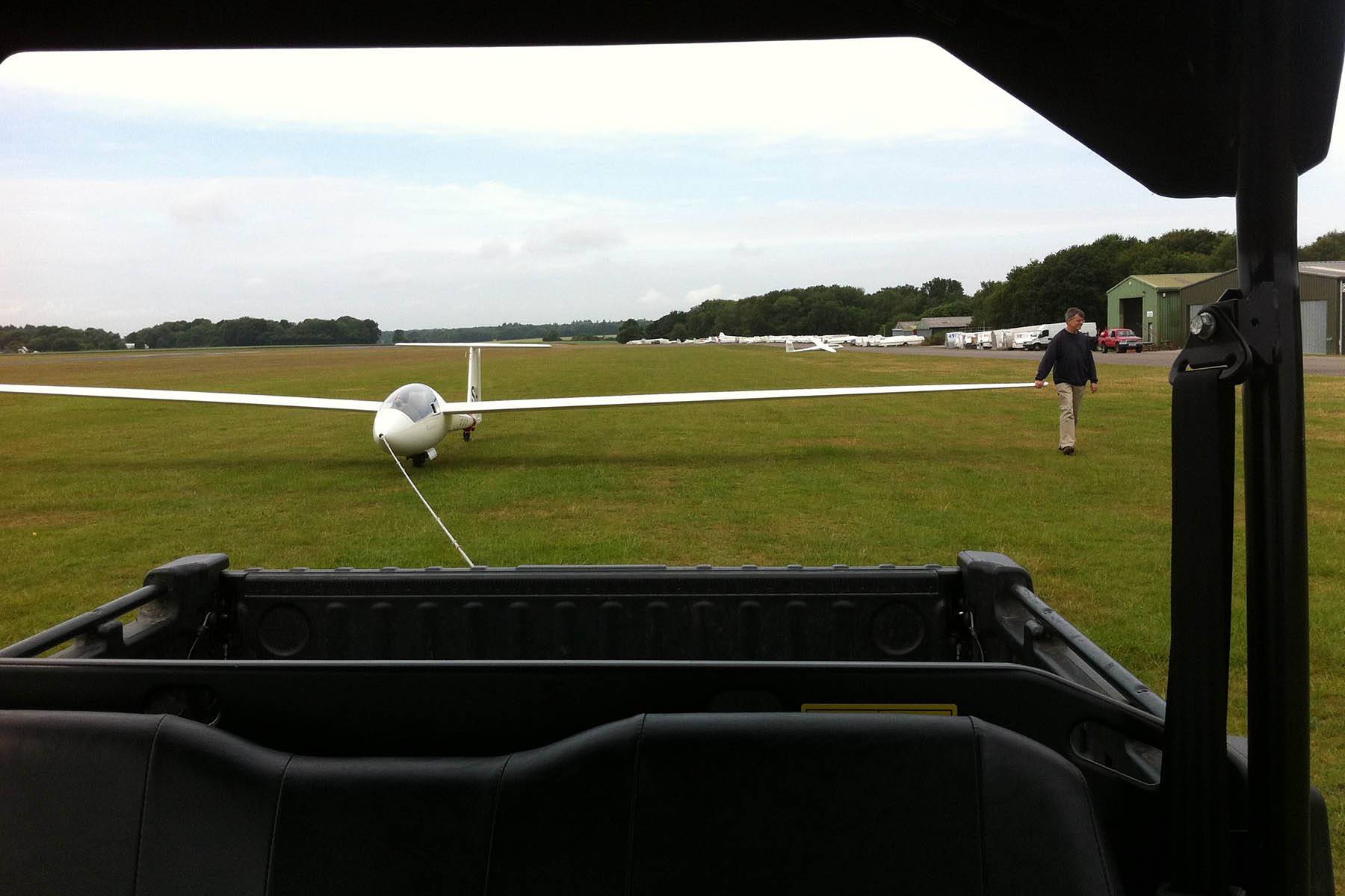
| Towing the glider out using a Lasham buggy. | Views at cloudbase once I get established and local soar in the Basingstoke area. | ||||
 P1160821.jpg |
 P1160836_838_Panorama.jpg |
 P1160841_842_Panorama.jpg |
 P1160848.jpg |
 P1160860.jpg |
 P1160864.jpg |
| More nice clouds. | Increasing overdevelopment. | Fun at cloudbase. | A shower brewing to the Northwest near Newbury. | ||
 P1160865.jpg |
 P1160869.jpg |
 P1160881.jpg |
 P1160884_887_Panorama.jpg |
 P1160891_892_Panorama.jpg |
 P1160891_895_Panorama.jpg |
| More views from just above cloudbase. | Closing in on the shower cloud as I find a way across a gap in front. | Arriving at the shower cloud I find it has a frilly skirt. | |||
 P1160898_900_Panorama.jpg |
 P1160901.jpg |
 P1160905.jpg |
 P1160912.jpg |
 P1160917.jpg |
 P1160919.jpg |
| Along the edge of the skirt of low cloud is strong lift taking me to the upper cloudbase. Greenham Common disappearing under the cloud as I beat up and down the side of the low bits. | |||||
 P1160923.jpg |
 P1160926.jpg |
 P1160928.jpg |
 P1160929.jpg |
 P1160939.jpg |
|
| More views as I continue to have great fun exploring the wall of low cloud. | A fleeting view along a 'crevice' between two cloud towers after cloud climbing to FL65 (6500 feet). | . | |||
| Click here to see a video taken after emerging from the cloud. |
 P1160941.jpg |
 P1160942_943_Panorama.jpg |
 P1160948.jpg |
 P1160956.jpg |
| Views from above cloud as I fly back towards Lasham while slowly sinking down from the cloud climb. | ||||
A weekday flight in a Discus as I was on holiday. But as cloudbase was low and not rising quickly I stayed local to Lasham again. As always it's still fun even when staying local, watching the world go by far below me.
 P1160413.jpg |
 P1160434.jpg |
 P1160436.jpg |
 P1160441.jpg |
 P1160442.jpg |
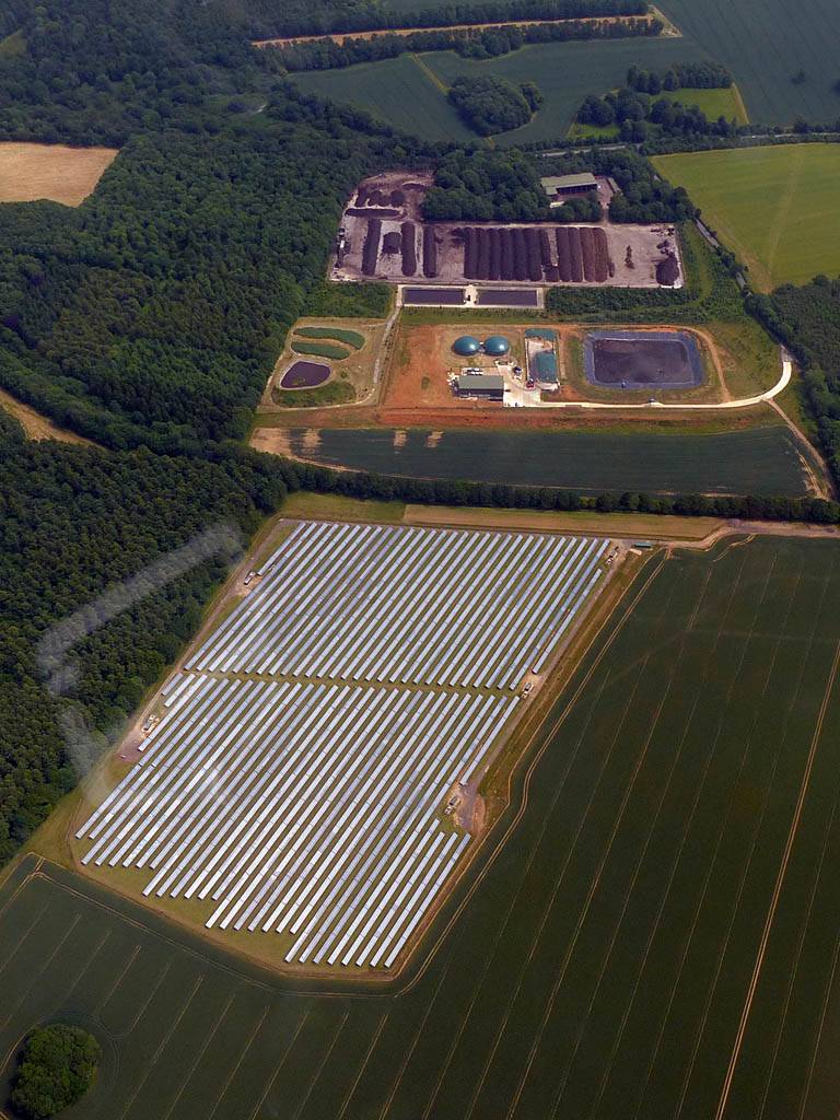
| Lasham on a weekday. Starting my 2 week holiday as intended. | Soaring with others. | Solar panels and a composting plant just North of Lasham. | ||
 P1160443.jpg |
 P1160445.jpg |
 P1160446.jpg |
 P1160447.jpg |
 P1160450.jpg |
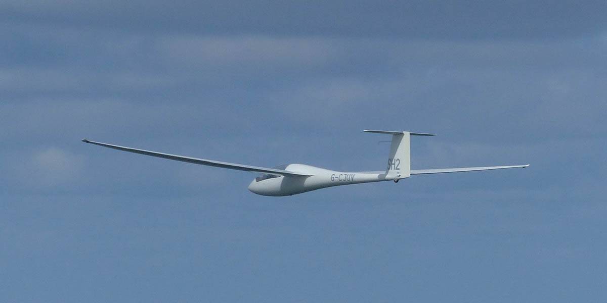
| Nice cloudscapes as top cover moves in. | Soaring with sister Discus SH2 (I was in SH4). | |||
 P1160452.jpg |
 P1160456_457_Panorama.jpg |
 P1160474_476_Panorama.jpg |
| Despite the top cover thermals are still working fine and I get slightly above cloudbase. | Panorama as the cumulus thins and heads towards blue later in the flight. I'm just North of Basingstoke. | |
Pictures taken during a local soaring flight in a Grob 102. I had tried to push Northwestwards but conditions were not easy and other gliders on task were bailing and returning to Lasham. Still a nice fun local soaring flight.
 P1160332_336_Panorama.jpg |
 P1160342.jpg |
 P1160345.jpg |
 P1160346.jpg |
 P1160353.jpg |
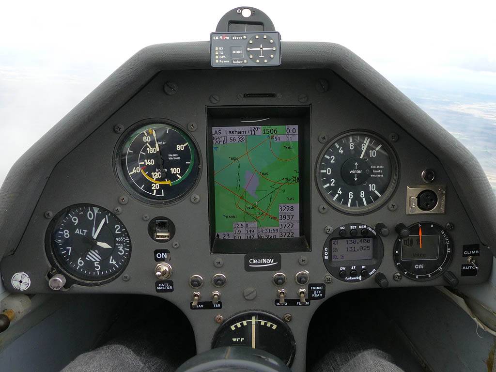
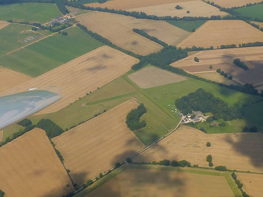
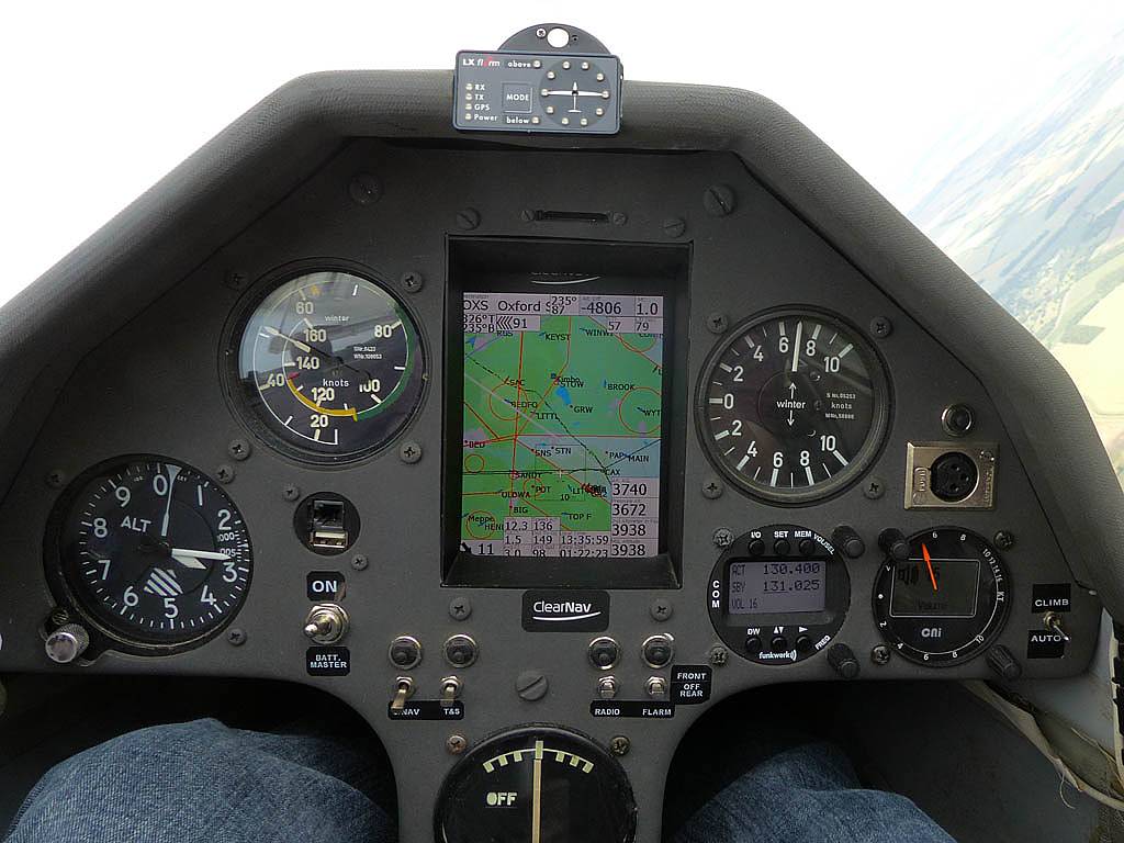
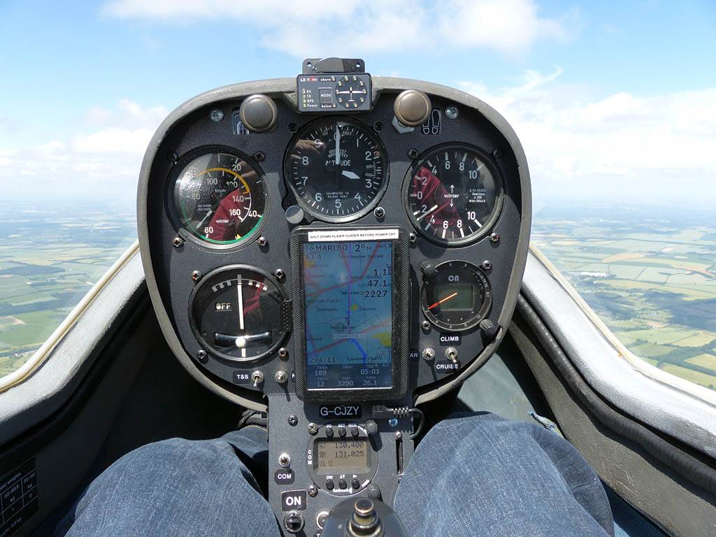
| 180 degree cloudbase panorama. | Popham Airfield from the Southwest. | Another view of the local cumulus clouds. | The Grob 102 cockpit looks a lot different to the Discus cockpit. The glider guider is nowhere near as good as the ClearNav but still a very useful addition to the instrumentation. | A pretty virga cloud way above me. |
 P1160360.jpg |
 P1160367.jpg |
 P1160368.jpg |
 P1160379_382_Panorama.jpg |
 P1160387.jpg |
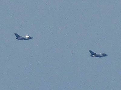
| Fighter jets roaring past me in the distance to the South. | Another virga cloud sitting there alone way above the cumulus clouds. | Another cloudbase panorama as it gets to about 3800 feet above the airfield (4400 feet QNH). | Sharing a thermal with a vintage V tailed glider. | |
Pictures taken while flying Lasham - Liss - Marlborough - Newport Pagnall - Wantage - Lasham for 312km. Early top cover thinned and dissipated more than expected making it another lovely day in the skies above Southern England.
 P1150813.jpg |
 P1150814.jpg |
 P1150816_818_Panorama.jpg |
 P1150819.jpg |
 P1150821.jpg |
 P1150827.jpg |
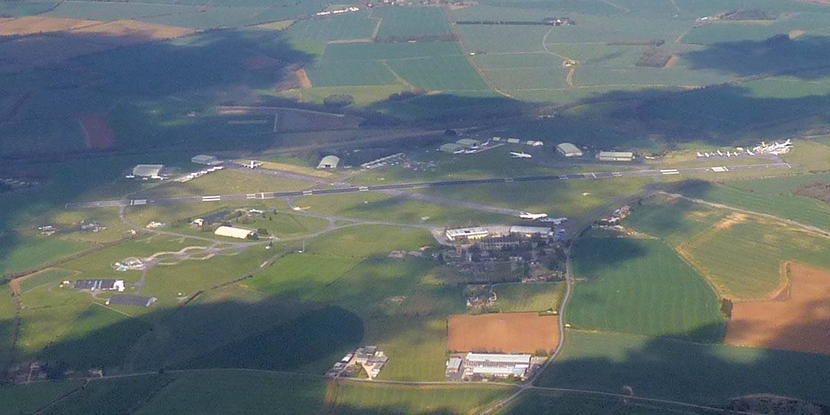
| A gaggle of gliders soaring aloft. | Being hooked on at the winch launch. | Joining another glider in a thermal. | Lasham Airfield from the Northwest. | ||
 P1150831_835_Panorama.jpg |
 P1150836.jpg |
 P1150837_839_Panorama.jpg |
 P1150849.jpg |
 P1150855.jpg |
| Setting off Southwards from Lasham towards Liss. Alton visible from the Northwest. | Heading back Northwest to bigger and better clouds. | Alton from the South. | Marlborough from the Southeast. | Turning MAR, Marlborough (Northeast is up). The turnpoint is the road bridge (A345 Pewsey Road over River Kennet) near the bottom of the picture. |
 P1150859.jpg |
 P1150864.jpg |
 P1150865.jpg |
 P1150868.jpg |
 P1150872.jpg |
 P1150890.jpg |
| Views of Didcot and Milton Park from the West as I fly Northeast past the Wantage area. | Getting above cloudbase near Oxford. | Bicester from the South as I cross the M40. | Approaching Milton Keynes from the Southwest. Newport Pagnall in sight on the far side. | ||
 P1150895.jpg |
 P1150898.jpg |
 P1150903.jpg |
 P1150909.jpg |
 P1150911.jpg |
 P1150915.jpg |
| Having fun at cloudbase over Milton Keynes. | Turning NPT, Newport Pagnall Services. (Up is Southwest.) | Some exhilerating strong thermals over Milton Keynes. | Long range view of Silverstone from the South. | Interesting top cover ripples above the cumulus. | Bicester from the East-Southeast, with RAF Upper Heyford in the background. |
 P1150918.jpg |
 P1150931.jpg |
 P1150934.jpg |
| A closer look at Bicester from the East. | Looking Southeast towards Lasham and South-Southwestwards from just North of Newbury as the clouds get shallower and top cover thickens again late in the day. Time to head home. | |
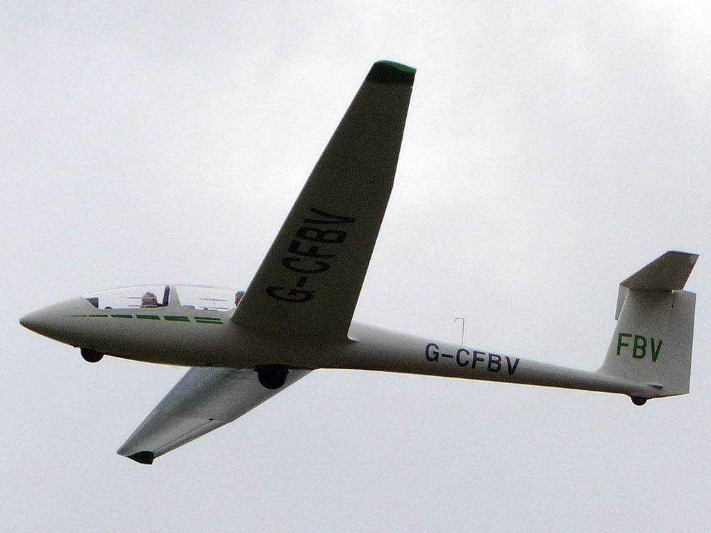
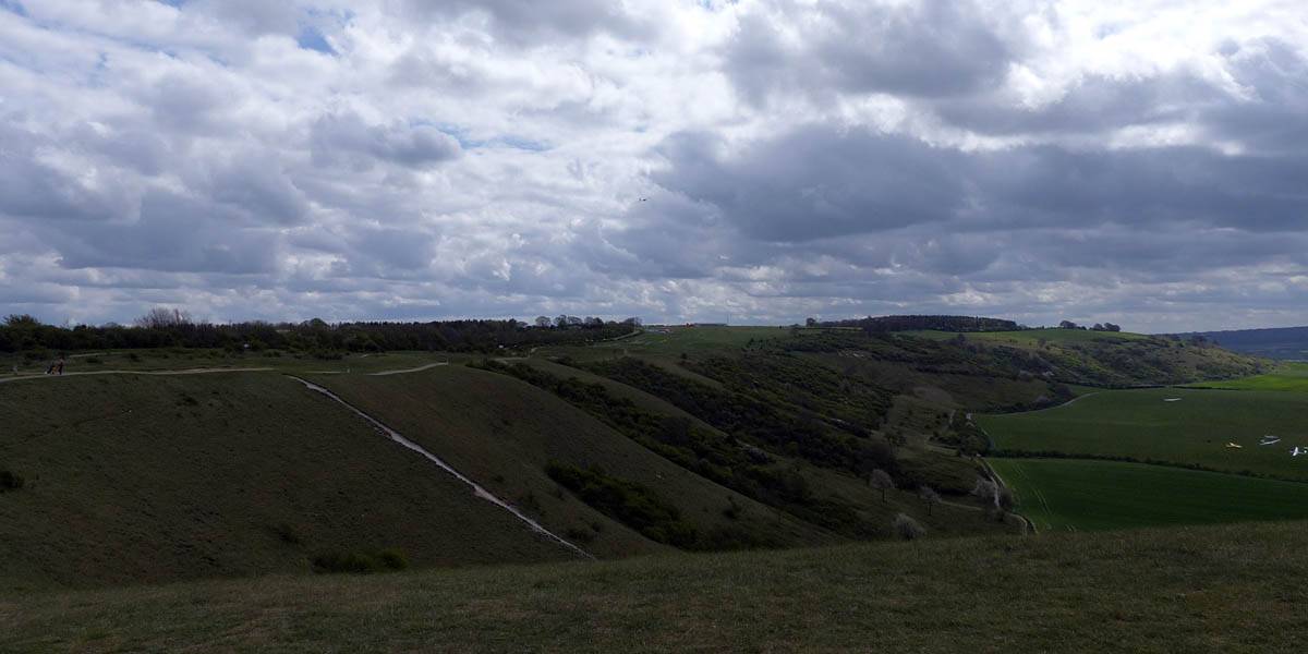
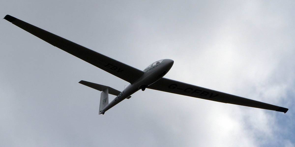
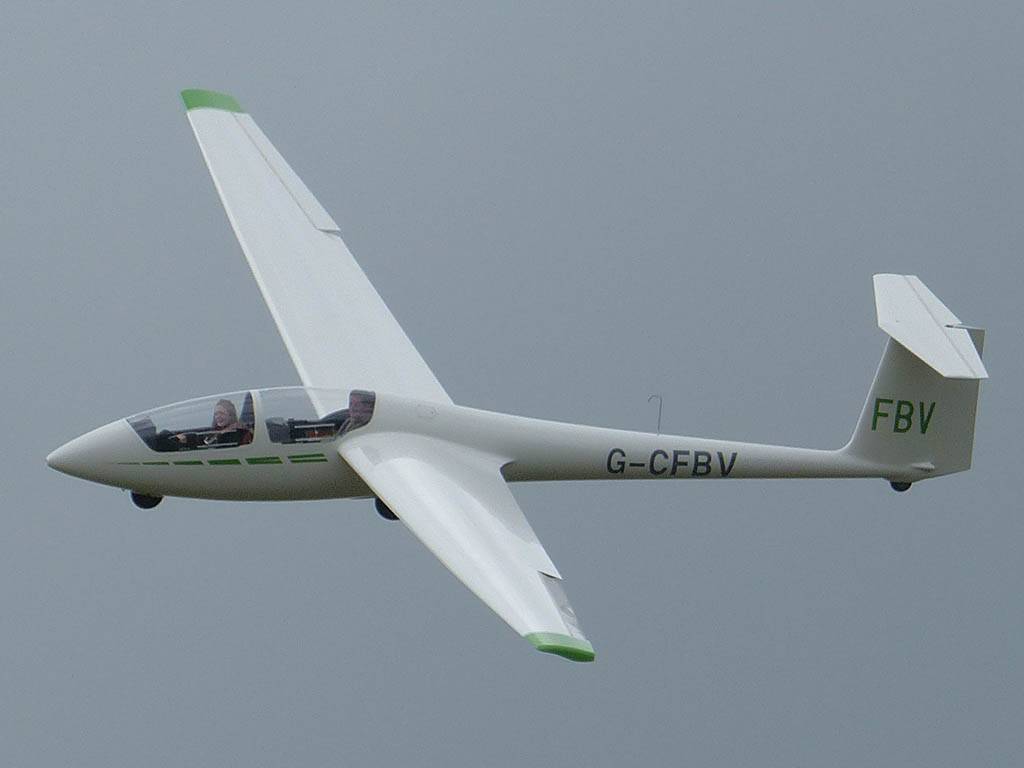
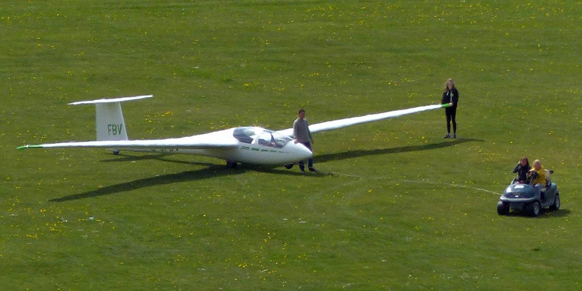
Gliders from London Gliding Club spotted while walking along the top of the Dunstable Downs. Of particular note was glider FBV, the glider I had my first ever glider flight in.
 P1130398.jpg |
 P1130400.jpg |
 P1130402.jpg |
 P1130409.jpg |
 P1130412.jpg |
 P1130415.jpg |
 P1130425.jpg |
| Gliders at the launch point. | Soaring above. | Glider FBV ridge soaring above Pascombe Pit. | Looking South along the downs from above Pascombe Pit. | Glider FBV beating up the ridge some more. | Glider FBV back on the ground. | |
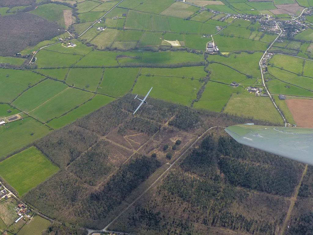
My first cross country flight of the year. It was a brisk Westerly wind and a monster cloud street had formed. After launch I followed this street upwind. It was slow going into a 35kph headwind but there were miles of straight flying with the occasional turn in 8+kt cores. Eventually I found myself over Lyneham airfield. It was a novelty being here as it used to be inside retricted airspace before RAF Lyneham closed down. After jumping North to a 2nd spectacular cloud street I carried on West past Kemble and turned Aston Down. Out West cloudbase was up at 5800 feet and it was a chilly -5C. There was a good view of the Severn Estuary from here too. I then returned along the 2nd street that took me past Swindon. Here I found another Lasham Discus and managed to fly alongside him for a bit. Downwind was so much quicker with that tail wind. After a while I found myself turning Basingstoke, and decided to head upwind again as I wasn't ready to land yet. This time the clouds were shallower and not streeting as well, and I struggled a bit, getting low in the Newbury area for a while. Cloudbase was slowly dropping to below 5000 feet too. After I got away I pushed out past Membury to Ashbury before returning as the clouds got shallower. I landed after 4 hours 18 minutes and a leisurely 297km. It took a while for my feet to defrost after that flight!
 P1130045.jpg |
 P1130046.jpg |
 P1130047_051_Panorama.jpg |
 P1130053.jpg |
 P1130054.jpg |
| From a distance this looked like a single plane with 2 tails. The photo betrays that it is 2 fuselages though. | Getting ready to tow out as early rain clears and it brightens up rapidly. | Before long, as the launch point, the sky looks gorgeous. | Setting off Westwards along the monster cloud street once I thermal away to cloudbase off a winch launch. | Gorgeous sky to the North of the Lasham area too. |
 P1130060.jpg |
 P1130063.jpg |
 P1130072_074_Panorama.jpg |
 P1130075.jpg |
 P1130088.jpg |
| Flying alongside glider KRO for a while under the cloud street. | Cloud street panorama. | Looking North to Newbury and beyond. | A nice cumulus to the South, in the Andover area. | |
 P1130095.jpg |
 P1130096.jpg |
 P1130106.jpg |
 P1130108.jpg |
 P1130111.jpg |
 P1130116_117_Panorama.jpg |
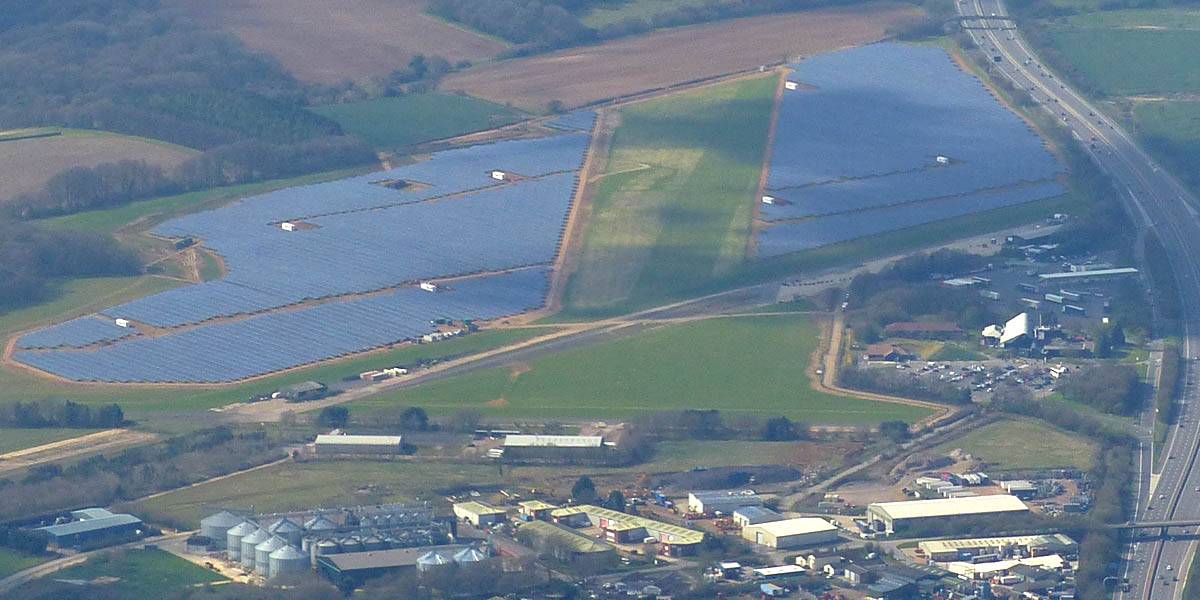
| Burbage from the Southeast. | Marlborough from the South with Swindon in the background. | Beckhampton from the Northeast (near Avebury). | Soaring with other gliders. | And the street keeps on going. Approaching Lyneham. | Lyneham panorama from the North-Northwest. That's a lot of solar panels! |
 P1130119_122_Panorama.jpg |
 P1130123.jpg |
 P1130128.jpg |
 P1130131.jpg |
 P1130132.jpg |
| Flying to the 2nd cloud street to the North. | Soaring over Milbourne Common Wood. The Common is to the South of us at the top right of the picture. | The other Lasham Discus SH2 was also on his way to Aston Down and back. | Kemble airfield from the South. | The Severn Estuary comes into view. |
 P1130134.jpg |
 P1130136.jpg |
 P1130143.jpg |
 P1130148_149_Panorama.jpg |
 P1130150_152_Panorama.jpg |
| Looking back East-Southeastwards from Kemble, the shadows showing the long line of the 2nd cloud street. | Approaching Aston Down gliding club from the Southeast. | Gazing westwards towards the Severn Estuary as I approach Aston Down. | ||
 P1130157_158_Panorama.jpg |
 P1130172.jpg |
 P1130174.jpg |
 P1130186.jpg |
 P1130188.jpg |
| Gazing westwards towards the Severn Estuary as I approach Aston Down. | Aston Down from the Southeast. | Looking back along the 2nd cloud street again from West of Kemble. | Passing the lakes Southwest of South Cerney. | Getting up to cloudbase on the West side of Swindon. |
 P1130191.jpg |
 P1130197.jpg |
 P1130202.jpg |
 P1130204.jpg |
 P1130205.jpg |
 P1130212.jpg |
| Swindon from the Western side. | Flying alongside SH2 near Swindon. That was fun. | Newbury and Greenham Common from the Southwest. | |||
 P1130223.jpg |
 P1130231.jpg |
 P1130236.jpg |
 P1130237.jpg |
 P1130242.jpg |
| Turning Basingstoke, looking Northwest. | Didcot was visible far to the North. | Membury airfield from the East and East-Southeast. It too has sprouted lots of solar panels! | ||
 P1130247.jpg |
 P1130253.jpg |
| One last view near cloudbase as I head back to Lasham. | Slowly blueing out on final glide back to Lasham (passing Aldermaston to the left of me). There are still plenty of good thermals about though. |
I spent this period at Aerodromo Santa Cilia near Jaca in Northern Spain. These pictures are on their own page. Click here to see the Jaca pictures.
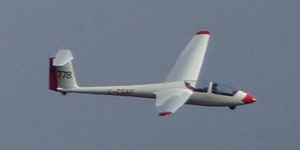
Today was a windy day. It made for an entertaining aerotow in the morning in a K21 with an instructor which took us above the clouds to some gorgeous eye candy. The tow was very rough which made for great practice for a trip to Jaca later in the month. Then I helped out on the ground for a while before having a couple of solo winch launches later in the day.
 IMG_6407.jpg |
 IMG_6408_6413_Panorama.jpg |
 IMG_6414.jpg |
 IMG_6415_6418_Panorama.jpg |
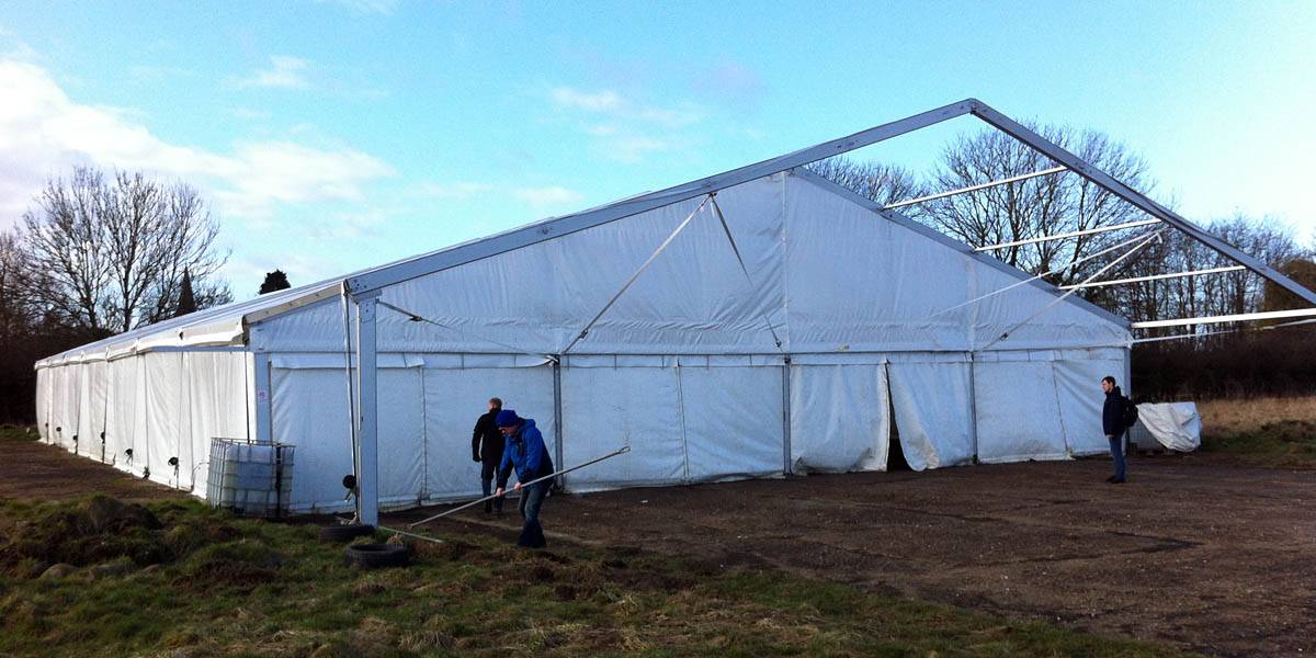
| Visiting the temporary hangar on the South side to get the K21's out. (It's too windy for the K13's.) | Towing the K21's out. | ||
 P1110456_458_Panorama.jpg |
 P1110459.jpg |
 P1110460.jpg |
 P1110463.jpg |
 P1110468.jpg |
| K21's parked up on the runway ready to fly. | Up at 4000 feet the views are grand. (Cloudbase is below 3000 feet.) | |||
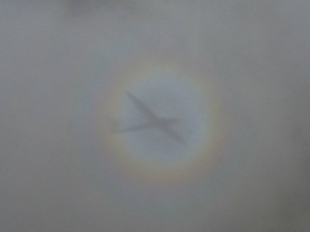
 P1110470.jpg |
 P1110470_CroppinIn.jpg |
 P1110472.jpg |
 P1110480.jpg |
 P1110487.jpg |
 P1110496.jpg |
| A K21 glory below us. | More nice views as we descend past the clouds. | 778 in the air with the next pilots after I land. | |||
 P1110498_507_360Panorama.jpg |
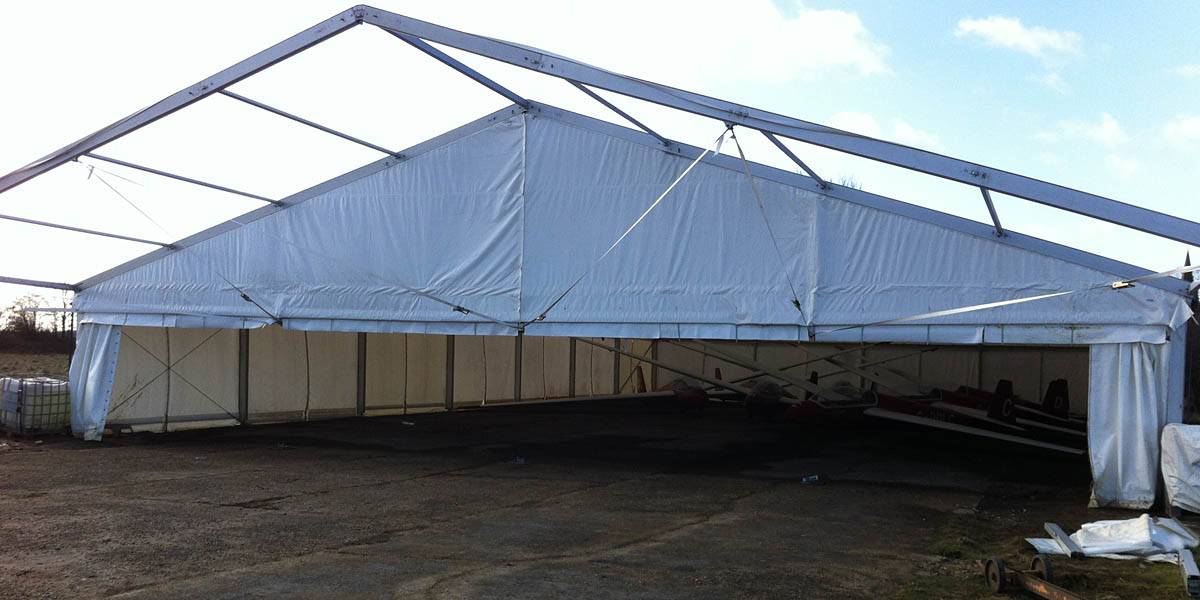
 P1110510.jpg |
 P1110511_514_Panorama.jpg |
| 360 degree panorama from the peri track on the way back to the clubhouse. | The new hangar is almost complete. Doors only just attached. | Back at the launch point, another nice cloudscape to the South. |